Tucked away in the northwest corner of the park, the Black Rock Campground is one of the closest Joshua Tree campgrounds to the towns outside the National Park, but because it’s sort of off in its own satellite location the region doesn’t tend to get the same amount of attention as the ‘main attractions’ along Park Boulevard and Pinto Basin Road. I had explored Joshua Tree National Park for years before I even set foot in Black Rock Canyon.
This hike begins near the small visitor center building inside the campground, where there are some parking spots reserved for day-use. There is also a water fountain and a flush toilet, so make sure to use these before you hit the trail.

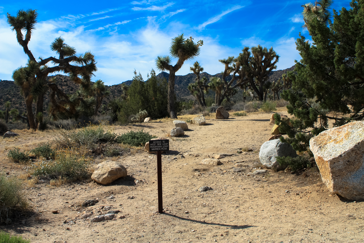
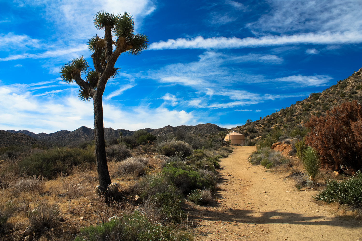
From the visitor center, follow the paved campground road directly behind the building southward. There are a few roads that parallel in this direction but they’ll all meet up about 0.15 mile south of the visitor center. From here, a trail departs the pavement and continues southwest toward a prominent water tank. Look for the sign pointing toward the West Side Loop, Panorama Loop, and Warren Peak.


At the tank, the trail meets up with a dirt access road. Make a short descent to the southeast and follow the sign for the West Side Loop at 0.35 mile. Follow this trail through the broad, low, mostly flat plain for 0.4 mile to a four-way junction at 0.7 mile. If you continue straight, the West Side Loop becomes the Burnt Hill Trail. Take a hard right here to head toward Warren Peak on the Black Rock Canyon Trail.

The trails here are well-signed … but it’s the desert and things don’t always last long out here, so don’t expect the signs to always point the way.
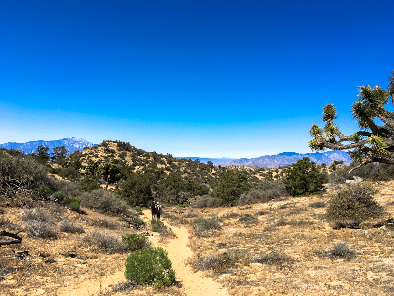
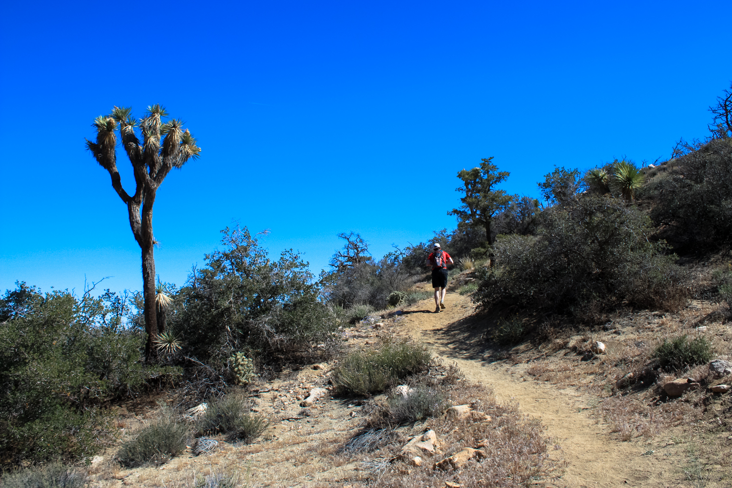
The next mile of the trail makes a gradual incline as it heads toward the southwest following the wash of Black Rock Canyon. At first, the trail sort of vaguely follows the wash, but as the canyon narrows you’ll enter the proper wash itself. Expect some sandy trails here that might make hiking a little slower than you’re used to on more solid surfaces. You’ll start to enter a more traditionally “canyon” landscape around 1.3 miles — and don’t be surprised if you hear the buzz of bees nearby — Black Rock Spring sits at the 1.5 mile mark and has a reliable (if often sluggish) water output, which the desert’s bees (and many other animals) love.
At 1.7 miles, you’ll reach the loop junction. A wooden stake in the ground near a wizened old cholla marks two directions “WP” (Warren Peak) and “PL” (Panorama Loop). It doesn’t necessarily matter which way you go here. If you proceed clockwise you’ll have a slightly steeper climb up but you’ll get the panoramic vista point as your reward. If you go counterclockwise it’s a more gradual climb but the vistas southward don’t have quite the same dramatic reveal.
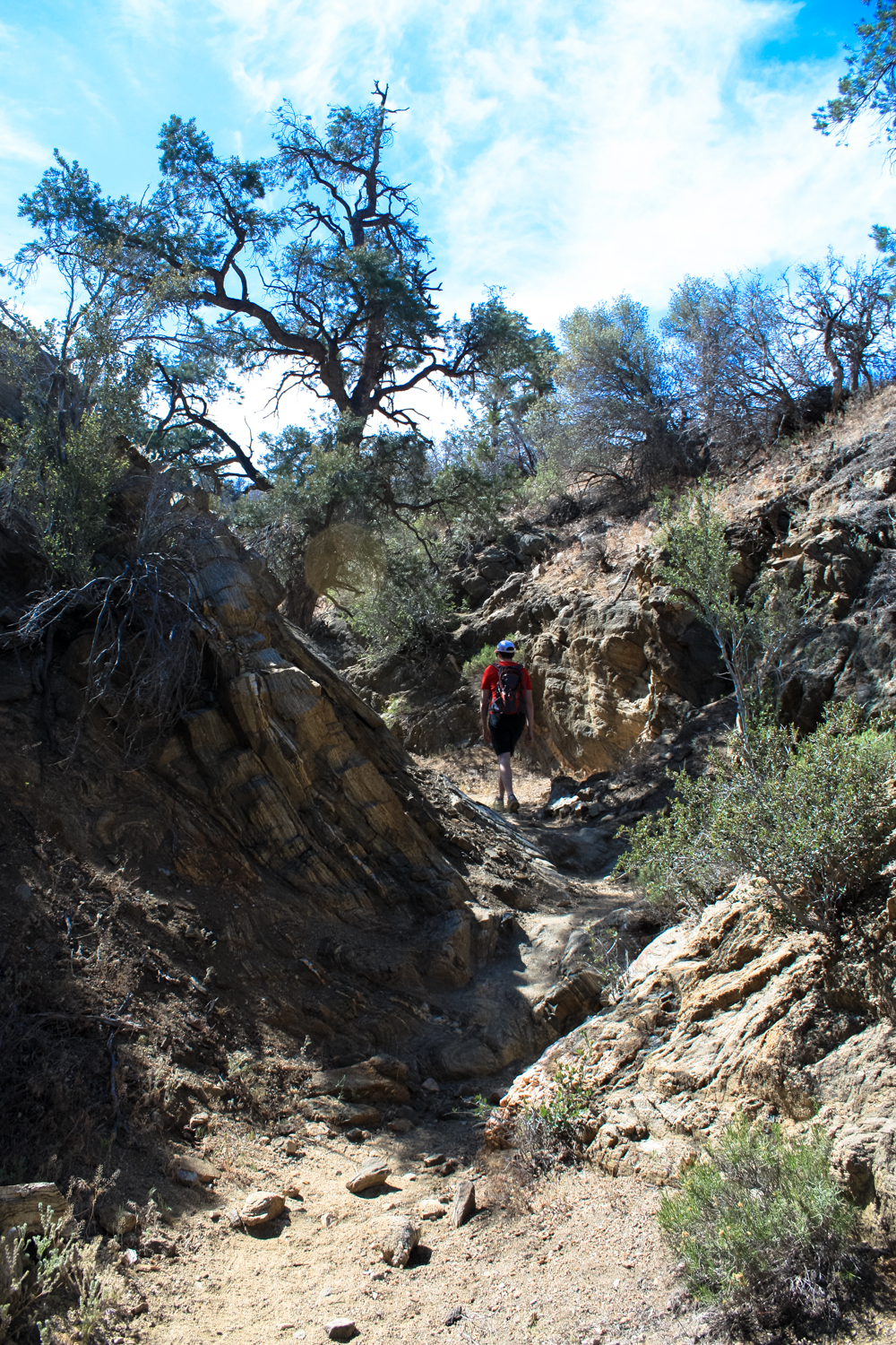
For this route as described, I went at the loop clockwise, keeping to the left at the junction. Here, the trail begins its climb up a rocky, narrow canyon.


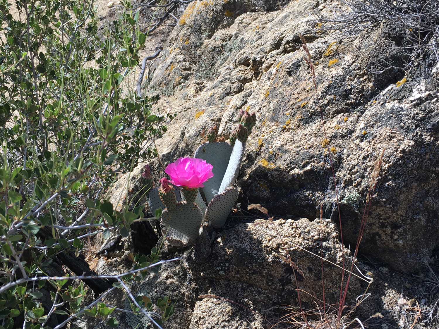
If your hiking timing is good, you may get to spot some eye-catching bright purple and pink cactus blooms on the canyon walls along the way.

Potentially an endangered foxtail cactus. Any desert botanists who can confirm?

gotta love a good beavertail cactus in bloom, right?
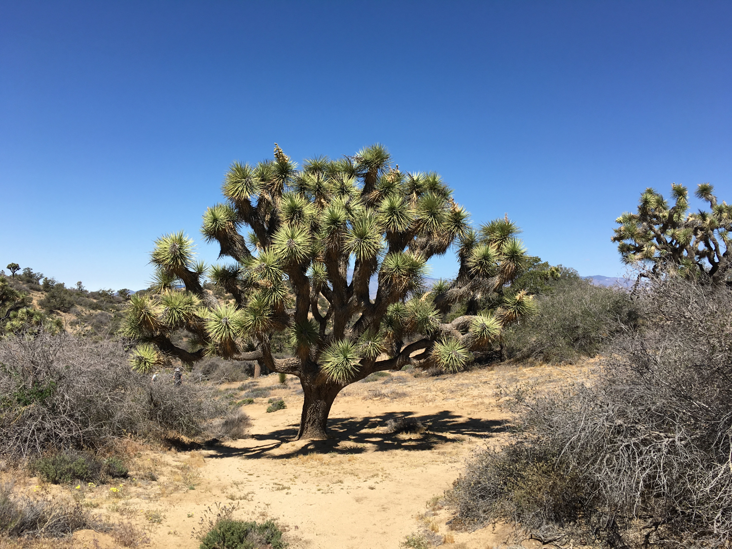
As you continue hiking and climbing, you might start to notice something a little different about your surroundings. Gone are the seemingly nonstop Joshua trees from the area near the trailhead — here the iconic yuccas are accompanied by juniper, piñon pine, and even oak trees.
This area of the park is one of its highest in elevation, and these trees have found good toeholds here in the cooler canyons. This area also tends to get a bit more snow and rain in the winter, which helps support the surprisingly dense vegetation that grows here. You’re not really going to find this plant community or this landscape in any other part of Joshua Tree National Park.

At 2.6 miles, the trail reaches a steep set of switchbacks along a narrow, rocky ridge. This is definitely the most intense climb of the route, but by this point in the trip you’ll also start to soak in some incredible views of the broad valley to the northeast. As you continue climbing the San Bernardinos (hopefully snow-capped) reveal themselves to your west.


San Gorgonio Mountain in the distance, with a tiny bit of snow
By 2.8 miles, you’ll hit a long east-west ridge that provides some absolutely incredible views in all directions (hence the name, “Panorama Loop,” I suppose!). You’ll be able to make out the Coachella Valley and Mount San Jacinto, San Gorgonio Mountain, and then get views north back toward Yucca Valley and north toward Landers.

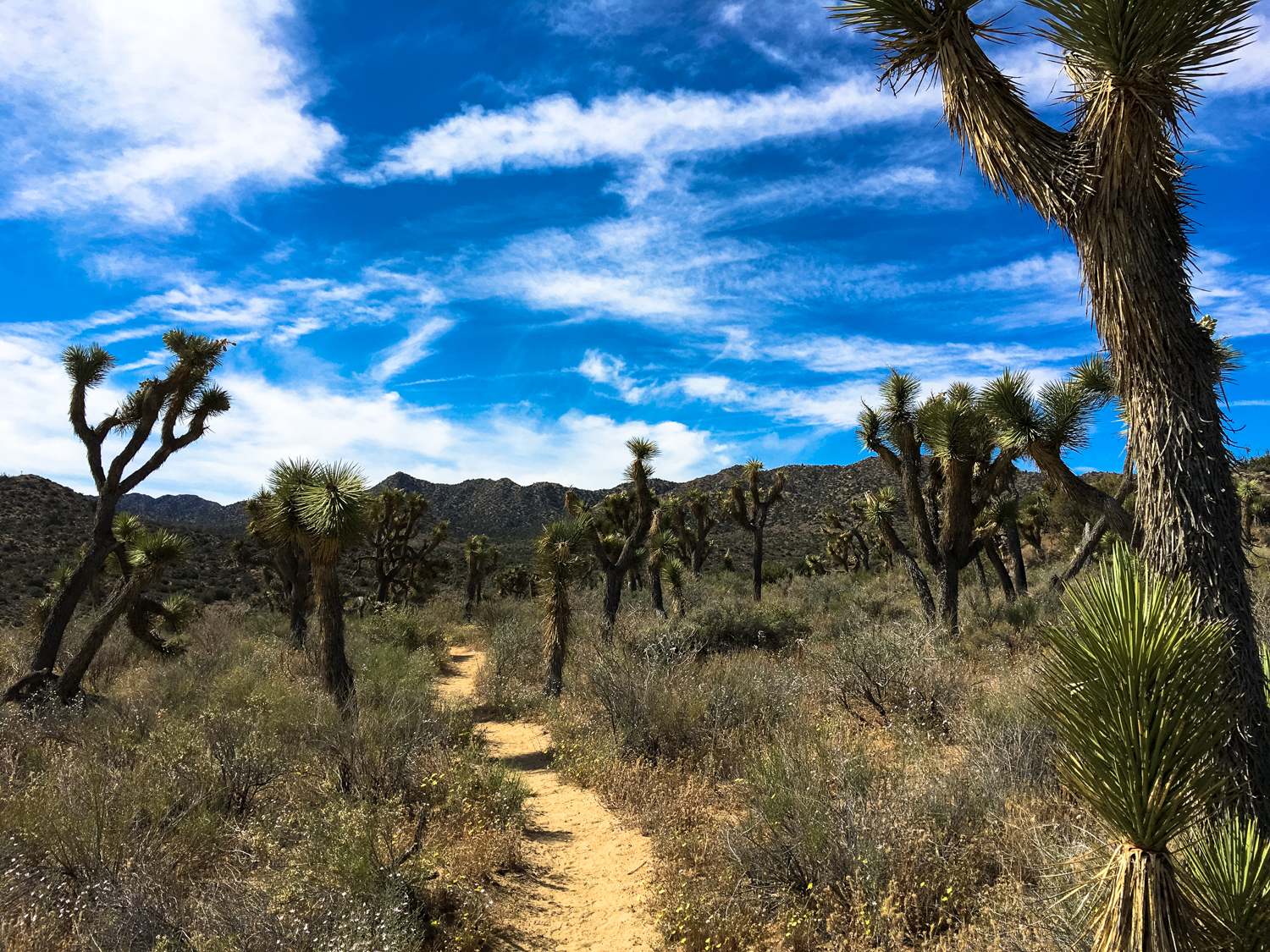
Follow the trail west along the ridge and enter a broad wash at 3.7 miles, where some truly majestic Joshua tree specimens re-enter the terrain. Keep right at the junction with the Warren Peak trail at 4.3 miles and you’ll close the loop at 4.7 miles. Return back the way you came.


For an optional side trip, you can tackle Warren Peak, which will add 1.4 miles roundtrip from the junction at the 4.3 mile mark.
Tags: black rock canyon, Joshua Tree National Park, panorama point, Yucca Valley