UPDATE: Corrected permit information on 11/16/2017
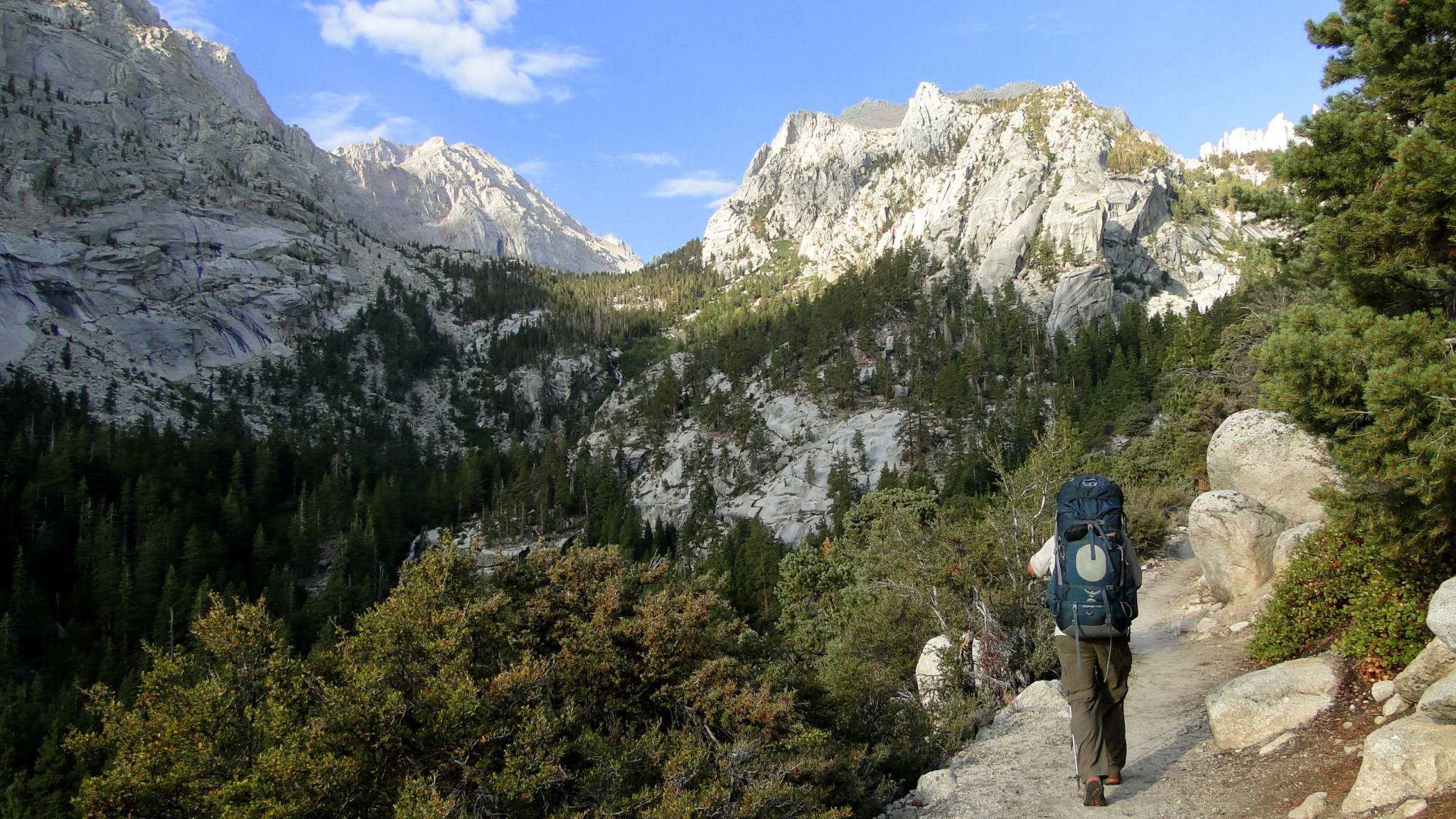
Many visitors considering Mt. Whitney think about it in terms of a brutal dayhike from Whitney Portal that often has them starting at midnight and ending when their legs fall off. Somewhat more fortunate hikers will take a few days to approach the summit while camping at Trail Camp or Outpost Camp. For those who really enjoy long walks to tall bumps, this epic route from Onion Valley gets you to the summit while also allowing you to sample some of the best high country in both Sequoia and Kings Canyon National Park.

Of course, as with any visit to Mt. Whitney, you will have to contend with a severely restricted quota system for the Whitney Portal departure. A separate quota for permits exiting Trail Crest applies to hikers who start elsewhere and finish at Mt. Whitney. The way this works is that when using recreation.gov to choose your permit dates, you select the option for the Mt. Whitney exit permit. After selecting this permit option, you then get the option to select your starting trailhead, which in this case will be Onion Valley. The bad news is that there are only 25 exit permits (15 reservable, ten walk-up) available per day. The good news is that these permits are not subject to the same lottery than entry permits are subjected too, so you will likely have an easier time getting the permits – provided you are flexible with your planning.

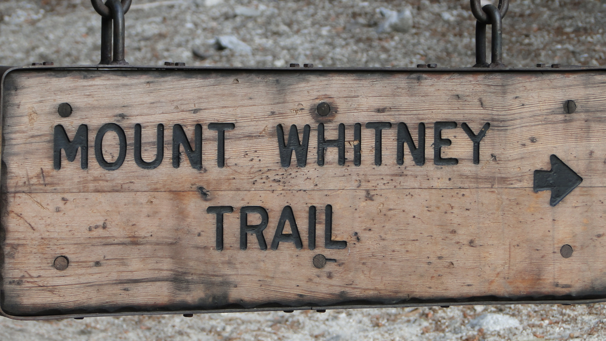
The Mt. Whitney Trail
A quick synopsis reveals a simple route: access Kings Canyon and the Pacific Crest Trail via Kearsarge Pass, and head south along the Pacific Crest Trail until Crabtree Meadows. Turn left again, and climb Whitney. Exit out of Whitney Portal. Despite the simplicity of the routing instructions, there are a number of highlights to experience along the way that makes this route worthy of consideration even if you took Whitney completely out of the equation.

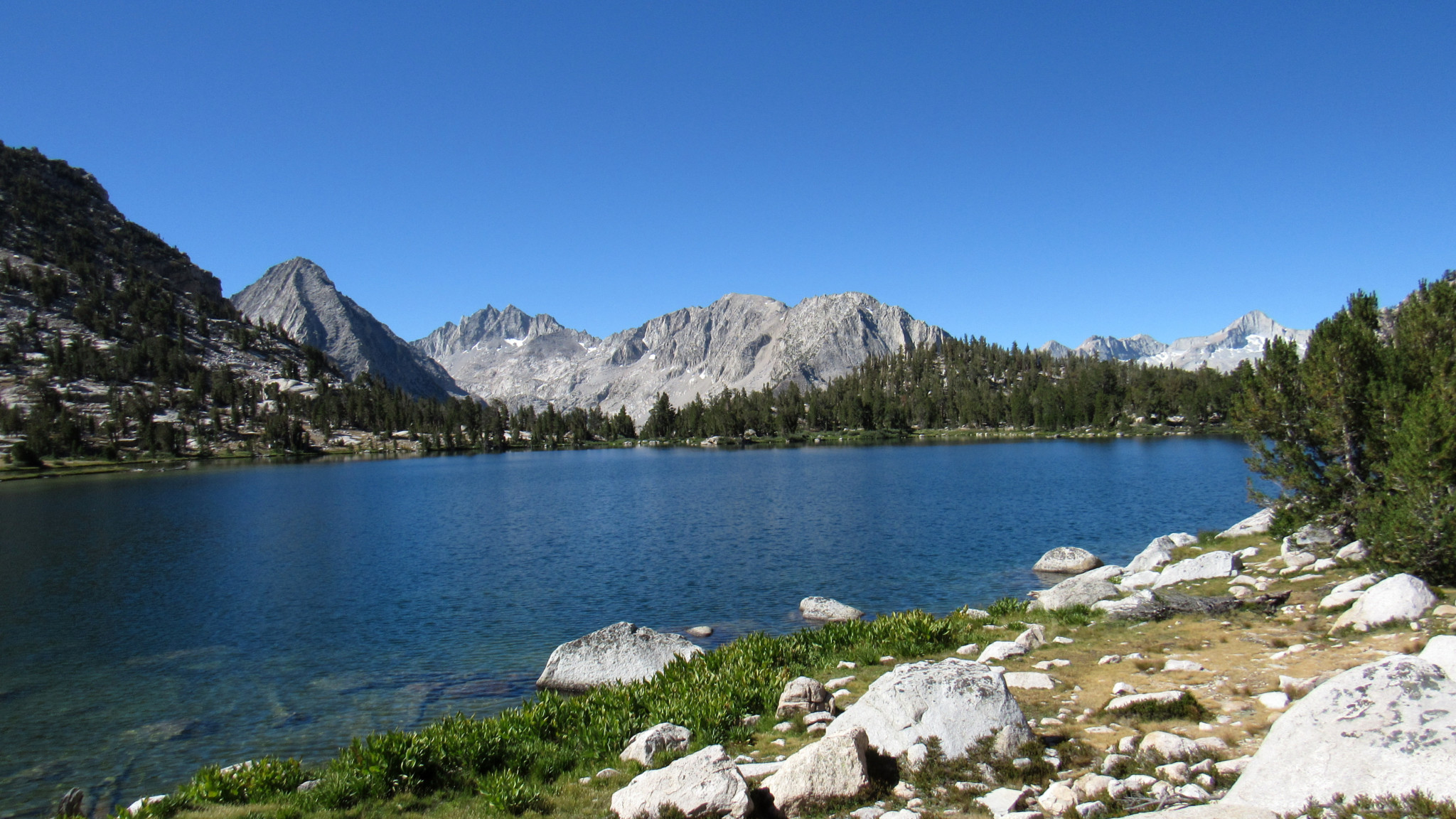
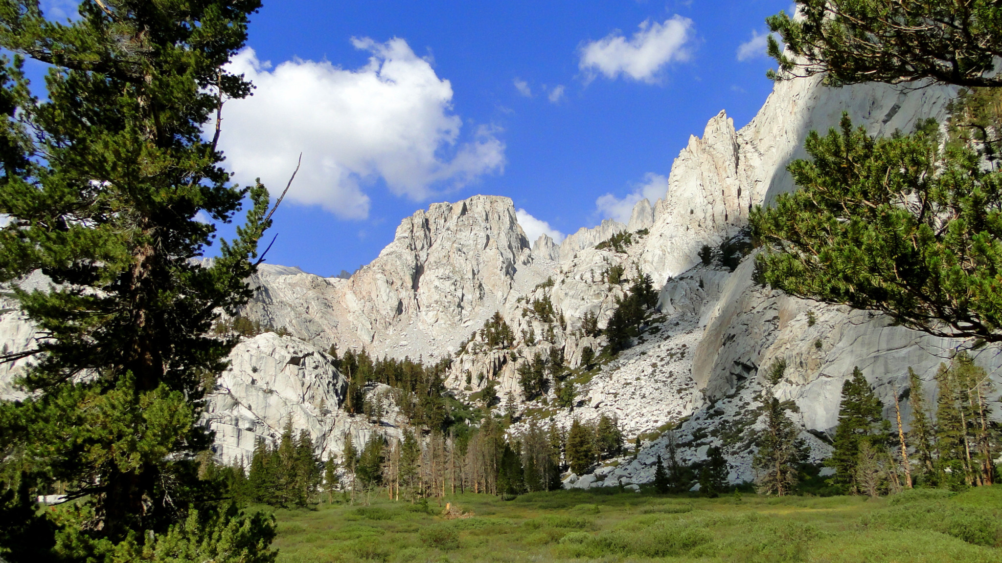
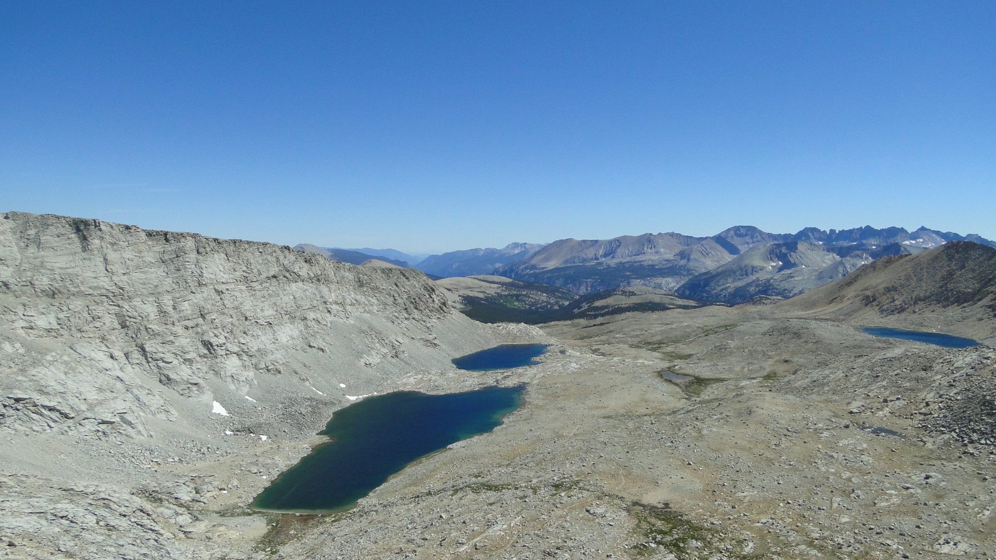
Bullfrog Lake
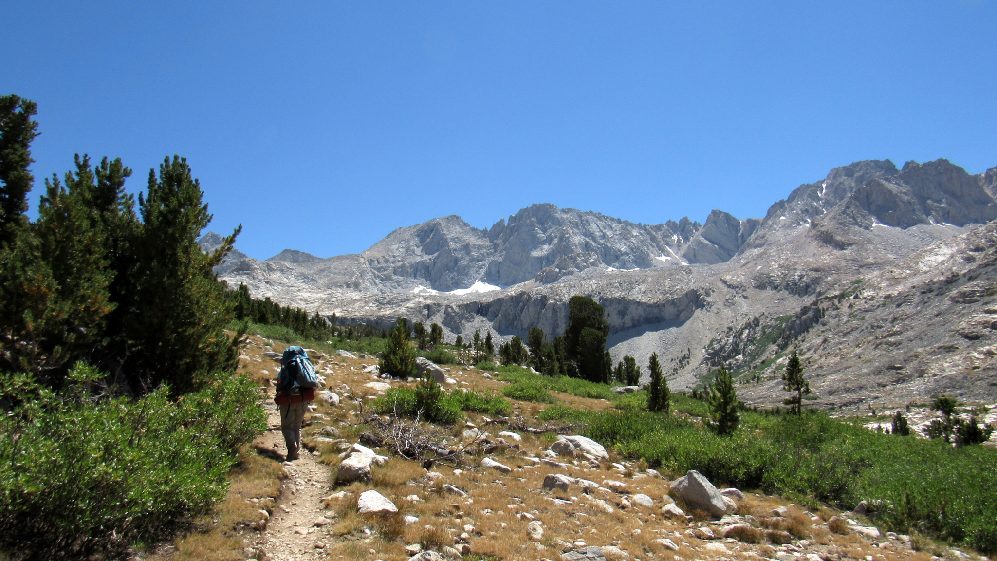
After following the winding trail from Onion Valley to Kearsarge Pass (4.5 miles), descend into Kearsarge Basin. You can follow either of the parallel trails that travel west across the basin toward the PCT, but the lower, southern trail brings you closest to good campsites at the Kearsarge Lakes (5.3 miles) and Bullfrog Lake (6.5). No camping is allowed at Bullfrog Lake, although it is both a beautiful sight and an opportunity to refill after a long stretch without water access. The PCT junction (7.6 miles) lies just west of Bullfrog Lake, and from there, you make a left turn toward Mexico.

Bubbs Creek
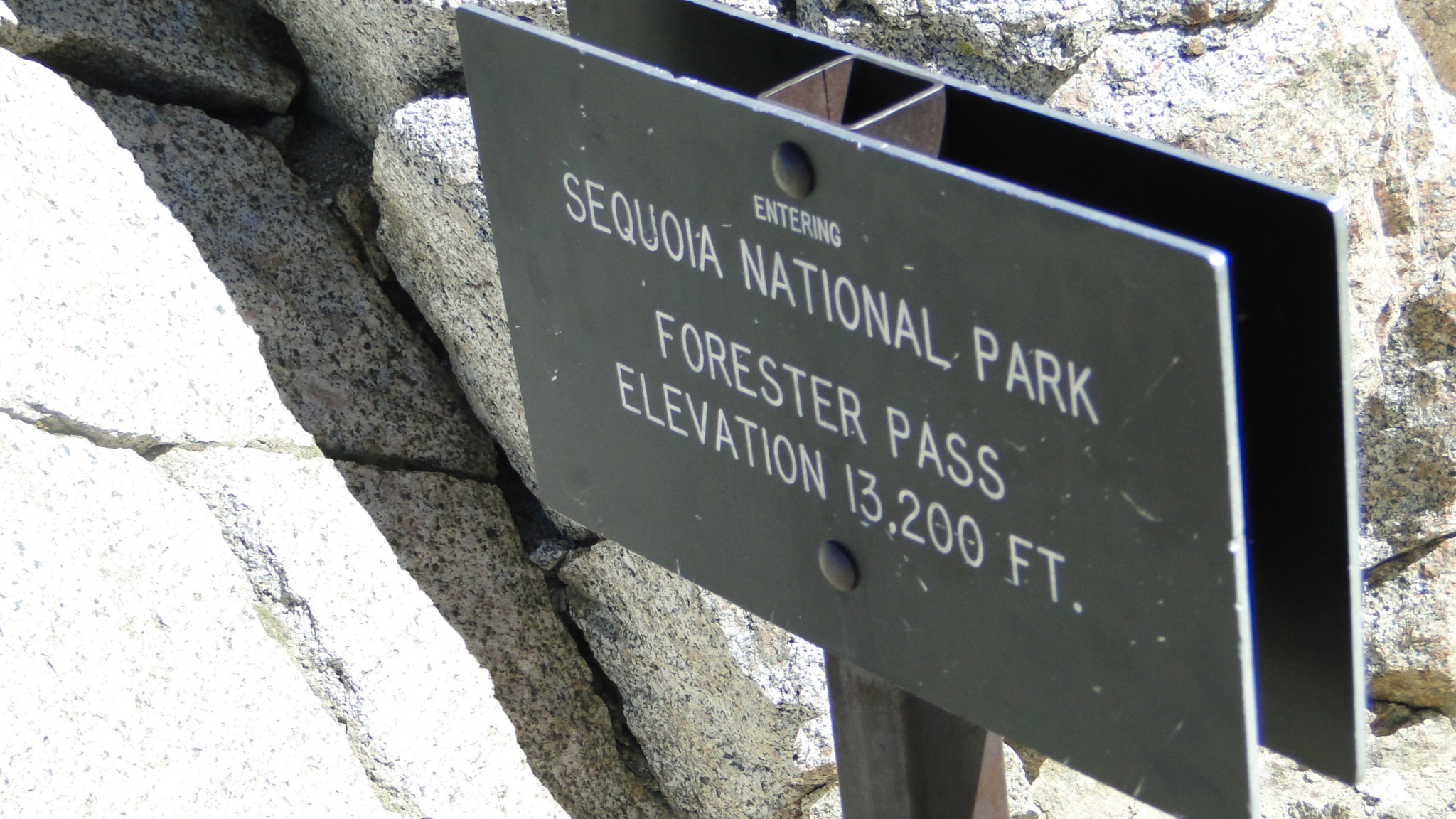
After a twisting descent along a spring-laden slope, the PCT reaches a junction with the Bubbs Creek Trail (8.6 miles) that descends toward Roads End in Kings Canyon. Turn left here to continue south as the PCT begins a long, sustained climb through Bubbs Creek’s upper canyon toward Forester Pass. Forester Pass boasts the fame and notoriety of being the highest pass on the Pacific Crest Trail at 13,200’. Before attempting to tackle the pass, I recommend at least two nights of camping in order to acclimate so that you minimize the risks of altitude sickness. This is also a great warmup for Mt. Whitney. I should also mention that climbing Mt. Whitney from the traditional route leaves you little time for acclimation, so this longer route should leave you in nearly prime shape to enjoy a steep climb from 13,400’ Trail Pass.

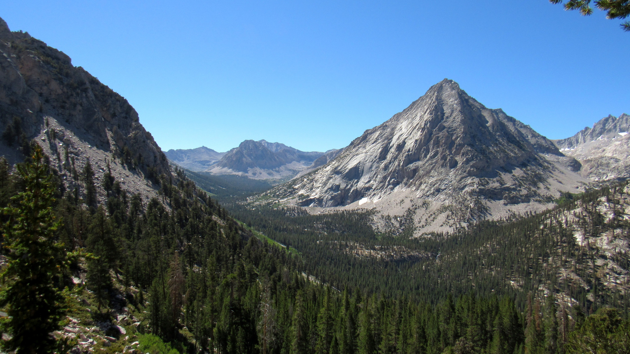
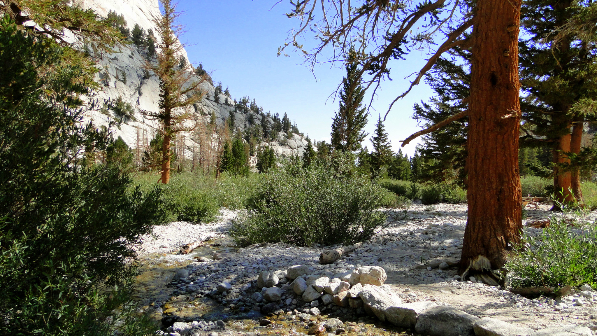
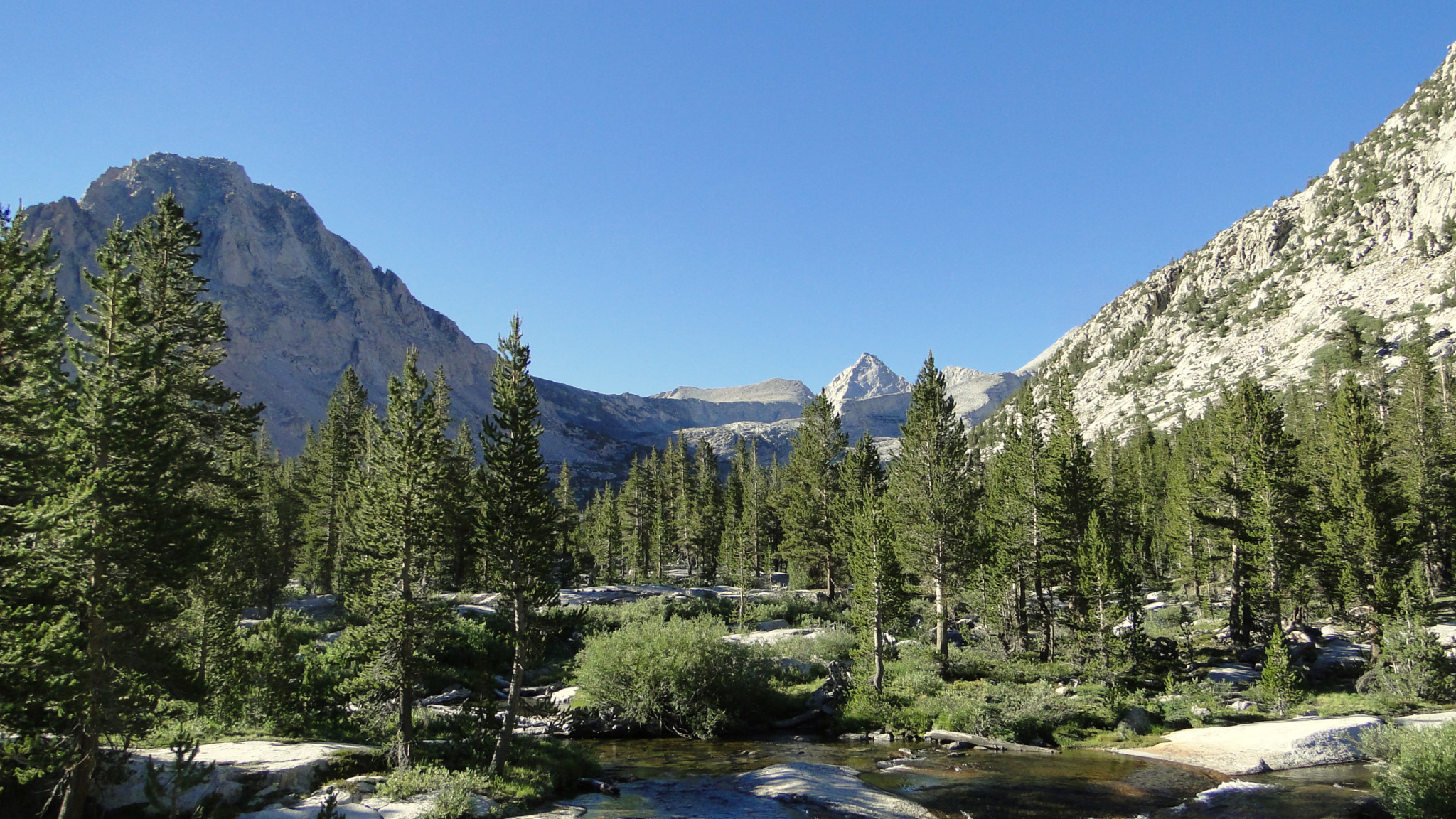
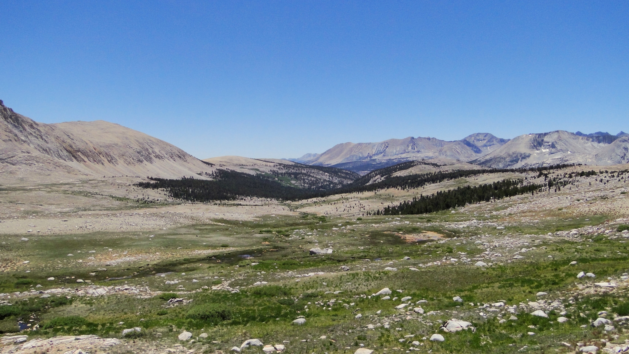
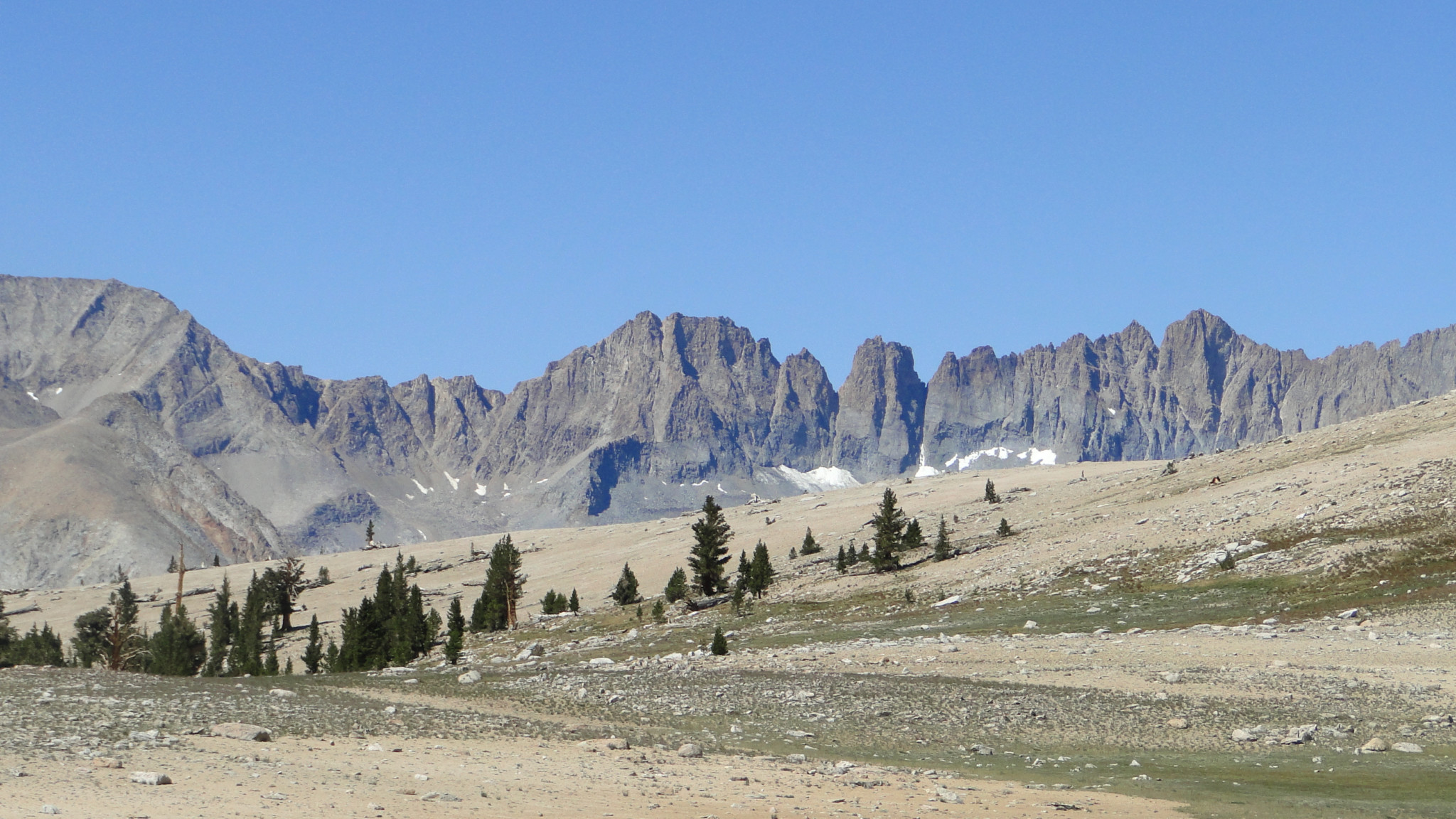
Approaching treeline
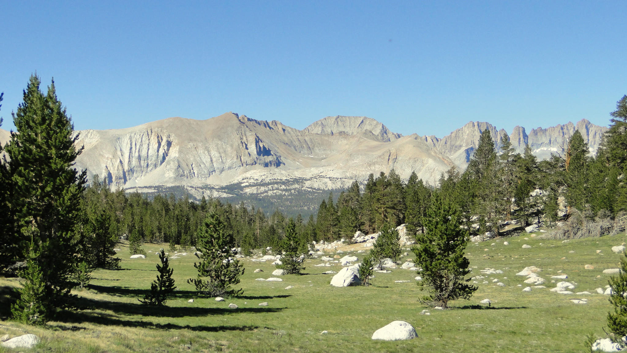
As you travel along Bubbs Creek’s Canyon, you will stay mostly within lodgepole forest until it begins thinning out beyond Center Creek. Along the way, you will pass camping areas at Vidette Meadow (9.2 miles), smaller and more obscure than Lower Vidette Meadow, and Center Creek (11.9 miles). You will catch quick views here and there of East Vidette Peak, Center Peak, and eventually Mt. Stanford and Gregorys Monument. In other sections, you will step out into clearings to watch Bubbs Creek crash and rumble over cascades into inviting, picturesque pools. As the forest thins with altitude gain, these open spaces reveal the U-shaped confines of the canyon walls peering sternly down upon increasingly sparse whitebark pine forest become more prevalent until you near the treeline. A fine series of campgrounds in the last cluster of whitebark pines lies just west from a handful of tarns (14.2 miles). This is a popular camping spot for PCT/JMT hikers, and it will make a fine stop for you since it allows you to camp at a sheltered spot at altitude with a reasonable amount of distance to go before you crest Forester Pass.

Looking south from Forester Pass

Looking north from Forester Pass
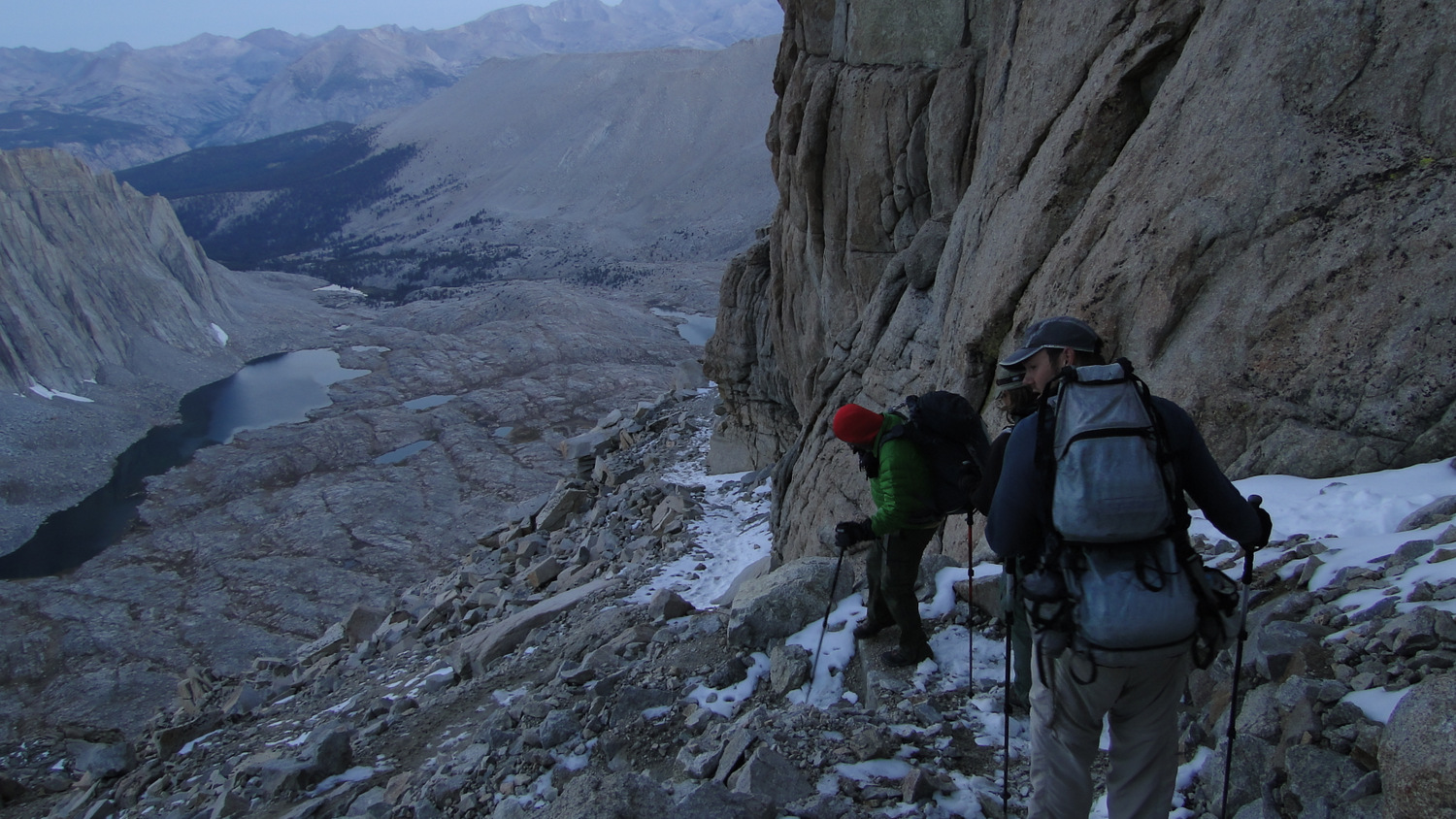
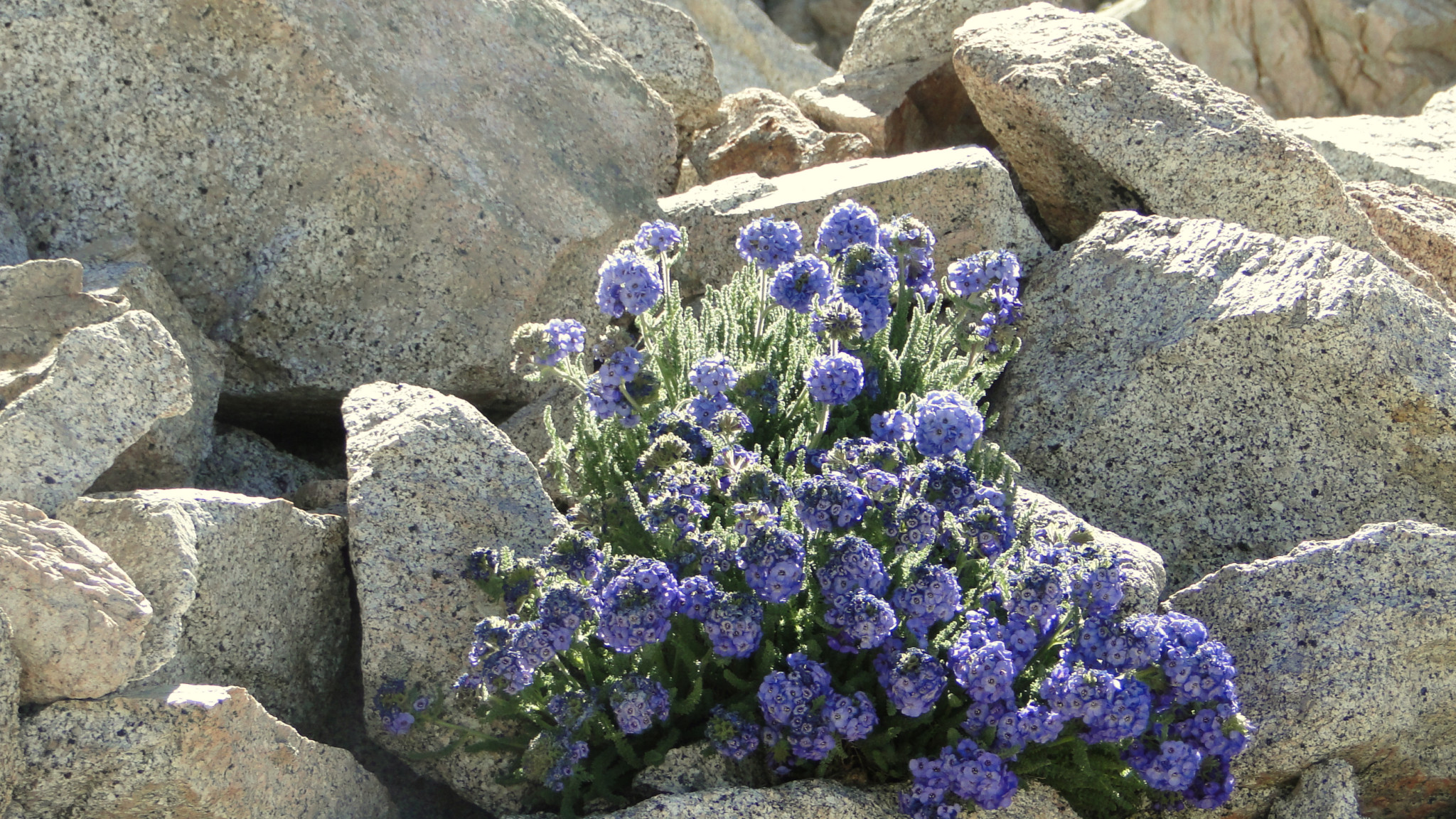
Consider a very early (think before dawn) start for Forester Pass (17 miles) as summer thunderstorms can make crossing the pass a hellish experience. The climb itself is relentless, especially once you cross over 12,000’. Hikers adopting the mindset of a lazy tortoise will benefit from managing their exertion since there is no race to the top, and you will be rewarded with an extended downhill march from the pass all the way down to Tyndall Creek. After wrapping around the east side of a ridge, you will enjoy a handful of ice-cold tarns and small lakes before wheezing and huffing your way up the austere wall of granite dotted here and there with colorful blue clusters of sky pilot. Once atop the summit, enjoy the novelty of putting one foot in Kings Canyon and another in Sequoia National Park (not to mention two separate watersheds, the Kings and the Kern) while recuperating from the exertion.

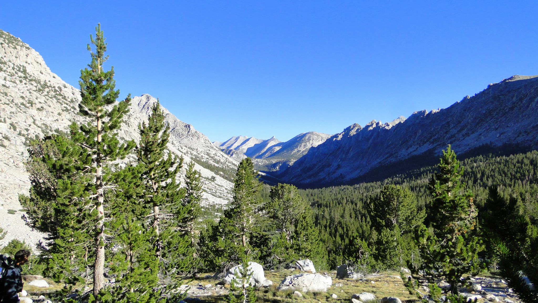
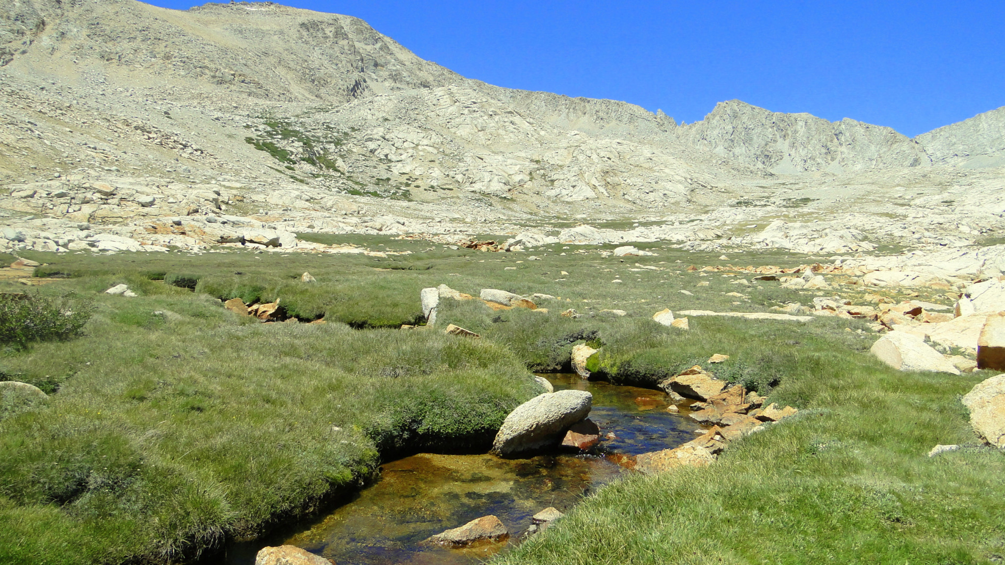
Descending toward Tyndall Creek
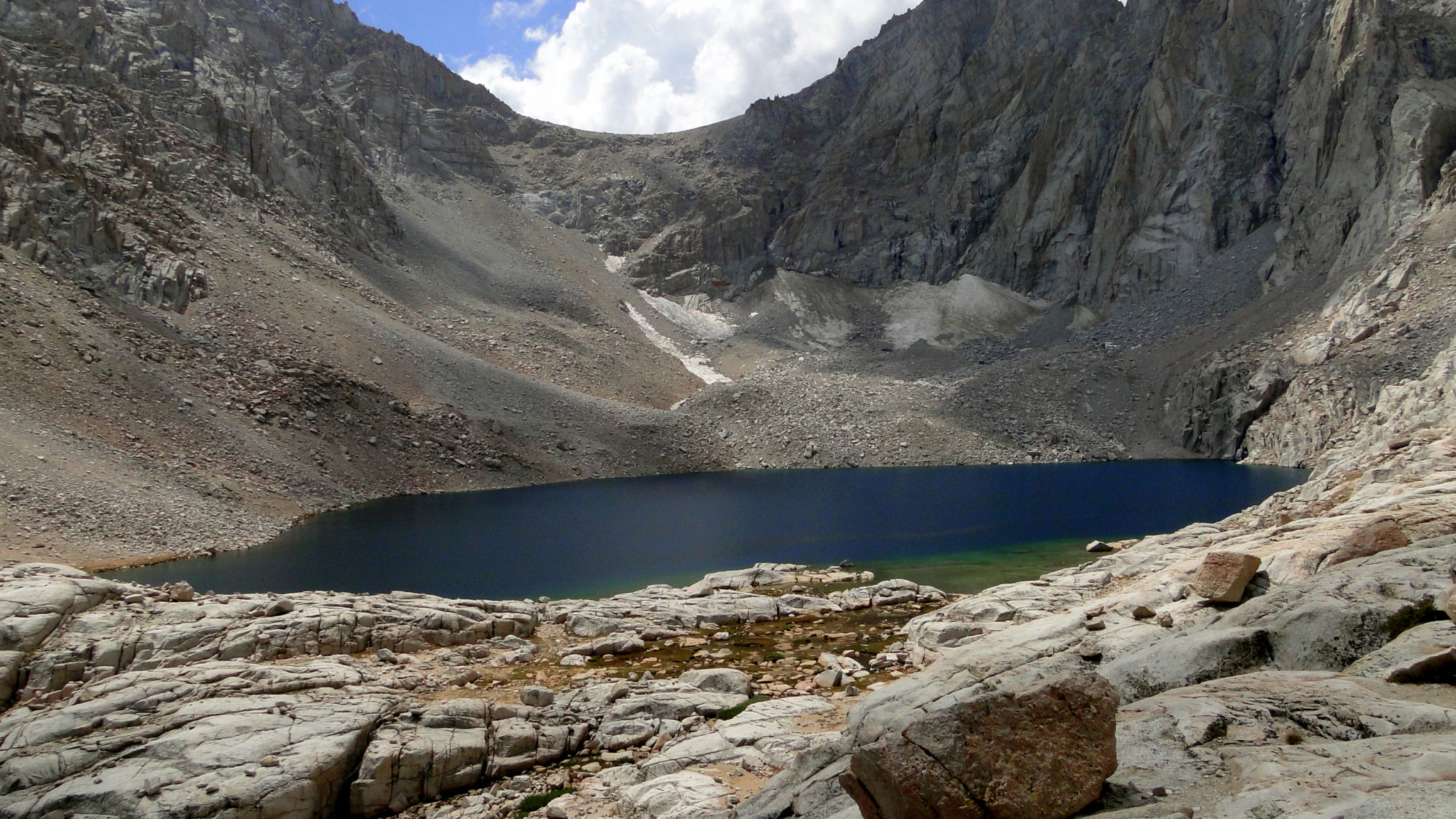
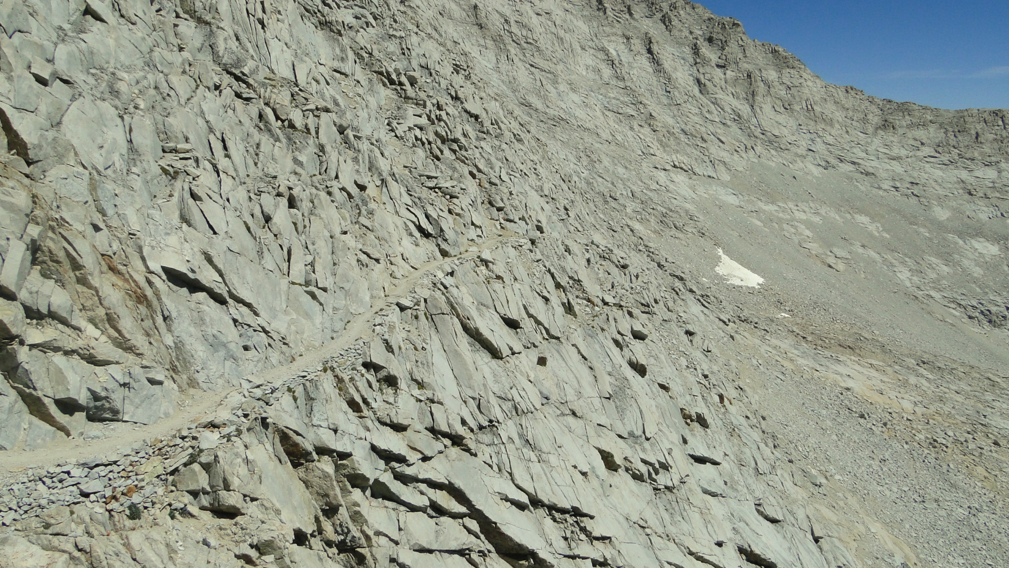
Once on the other side of the pass, you will descend along a narrow, impressively constructed stretch of trail that clings to the steep slopes on Junction Peak as you descend into an alpine basin dotted with shimmering, impossibly blue lakes. The nearly straight west wall of Diamond Mesa bounds the basin on the east, while Caltech Peak looms high above the basin on the west, shielding Lake South America from view. Upon reaching the floor of the basin, the grade of the trail eases as you begin a meandering passage through marshy sections fed by numerous feeder streams for Tyndall Creek. The cover of forest and a fine stopping spot at Tyndall Creek (22 miles) await in the distance beyond a long expanse of alpine tundra.

Tyndall Creek
Upon reaching the campsites at Tyndall Creek, be sure to keep left to avoid following a path down to a seasonal ranger station. After crossing Tyndall Creek (a tall order early in the season), keep your eyes peeled for an informal path leading east toward the Tyndall Frog Ponds (22.8 miles). The lukewarm water in the ponds invites swimming (be sure to wash several day’s worth of grime off before entering). The added bonus of the ponds makes Tyndall Creek a particularly appealing stopping spot.

Bighorn Plateau with the Kaweahs in the background

Bighorn Plateau panorama
Beyond Tyndall Creek, the PCT climbs along the west slopes of Tawny Point before reaching the flat, spacious expanse of the Bighorn Plateau (23.9 miles). The reference to bighorn sheep creates something of a misnomer as bighorn sheep don’t typically inhabit flat, open spaces like this. Adept climbers, bighorns prefer steep, inaccessible slopes with lots of crags that provide innumerable options for fleeing their primary predator, the mountain lion. While you won’t spot any bighorns, you will enjoy excellent views west toward the Kaweah Peaks beyond the hidden depths of Kern Canyon. A small lake atop the plateau creates an “infinity pool” impression when viewed against the alpine country to the west.

From the plateau, the trail descends into the Wright Creek watershed, passing several spring-fed meadows and the main fork of Wright Creek that drains the Wright Lakes to the northeast. A short descent from this relatively gentle, meadow-dotted flatland deposits you at the junction with the High Sierra Trail adjacent to Wallace Creek (26.7 miles). As you continue south, you will climb out of Wallace Creek’s canyon to pass over gradually swelling terrain blanketed by dry lodgepole and foxtail pine forest. Just after the PCT/JMT skirts the eastern fingers of Sandy Meadow, you will reach the first of three possible left turns (29.4 miles) taking you east through Crabtree Meadow and toward the Crabtree Ranger Station (31 miles). A ranger is usually on hand here to check your permit for your approach to Mt. Whitney or to provide assistance depending on what the occasion merits.

Guitar Lake from the JMT/Mt. Whitney trail junction
From Crabtree, you will approach the treeline again and return to the familiar, soaring alpine habitats characterized by trickling creeks, grassy tussocks peppered with wildflowers, lush meadows, and occasional tarns. You pass minute Timberline Lake (32.6 miles) before fully leaving the trees on your approach to the virtual tent city along the banks of Guitar Lake (34.1 miles) that hosts the cumulative traffic of the JMT, PCT, and High Sierra Trail as they approach either the ends or the apex of their journey. If you are looking for a slightly less crowded camping area a bit further along the ascent to Mt. Whitney, you may find a few spots around the tarns just east of Guitar Lake. Crowded though Guitar Lake is though, I have to give it credit for its stunning sunsets and beautifully blue waters. That said, the lake is even more impressive when viewed from above.

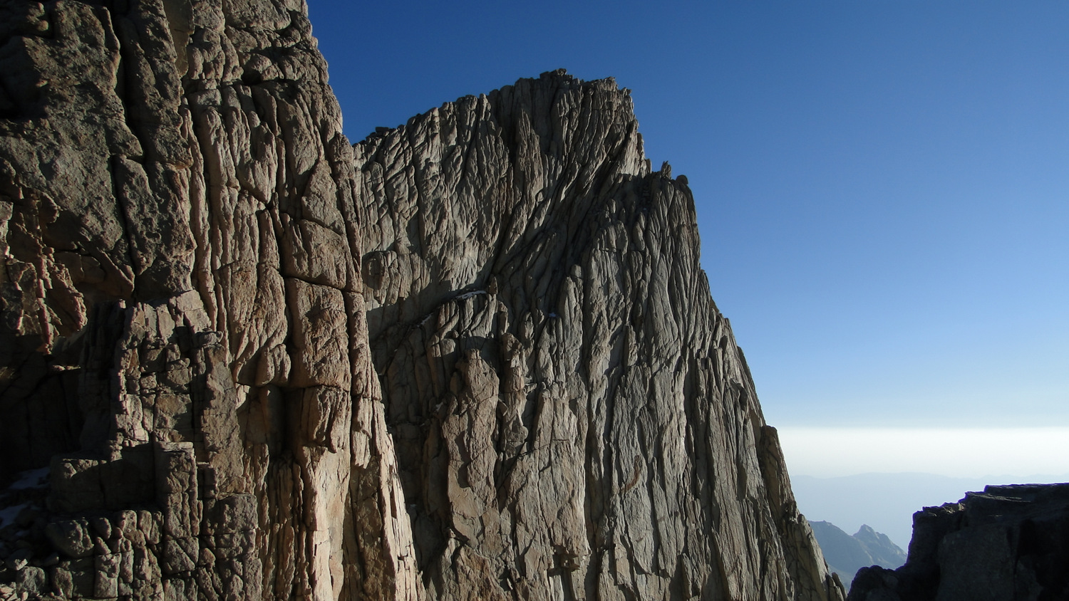
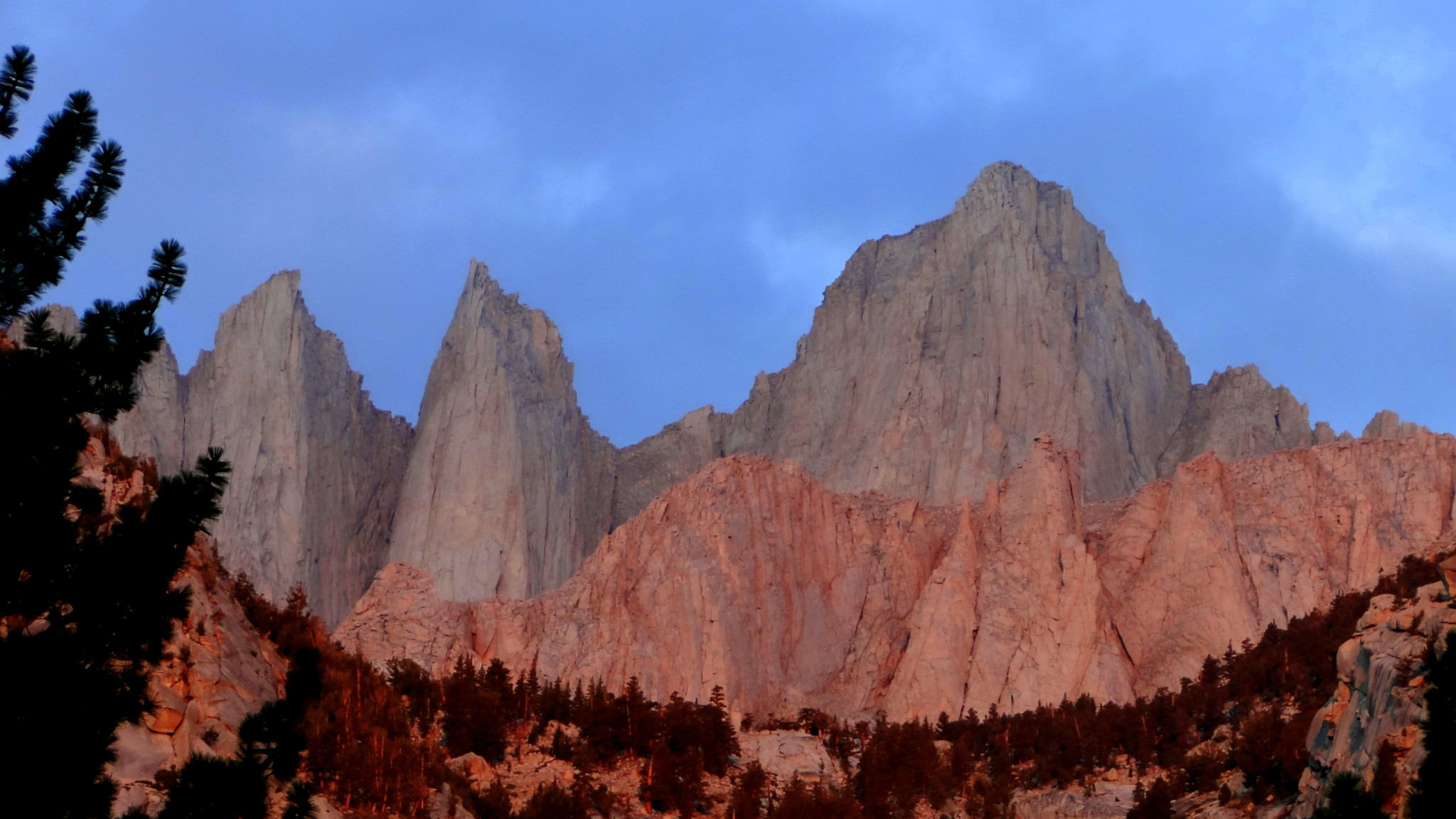
You will face the grand finale of Mt. Whitney when you wake up, preferably before dawn. Pack your gear away, and begin the long, arduous ascent to the junction with the John Muir/High Sierra Trail and the Mt. Whitney Trail. The combined High Sierra Trail/John Muir Trail commences a string of switchbacks that climb the western slope of the Sierra Crest until the junction (36.7 miles). My recommendation — and I cannot recommend it highly enough — is that you get up well before dawn (think 2 to 3 am) and begin the climb in the dark. Not only will you bask in the glory of clear, starry skies unperturbed by air pollution and the denser atmosphere of the lower elevations, but you may be able to cut north at the John Muir Trail junction (stow your packs and use a day pack for the rest of the way) and catch glimpses of the sun rising over the Inyo Mountains from the gaps between the Keeler Needles. If you are even more determined, you might even get up earlier and attempt to watch the sunrise of Mt. Whitney’s summit (38.7 miles) – a once in a lifetime experience.

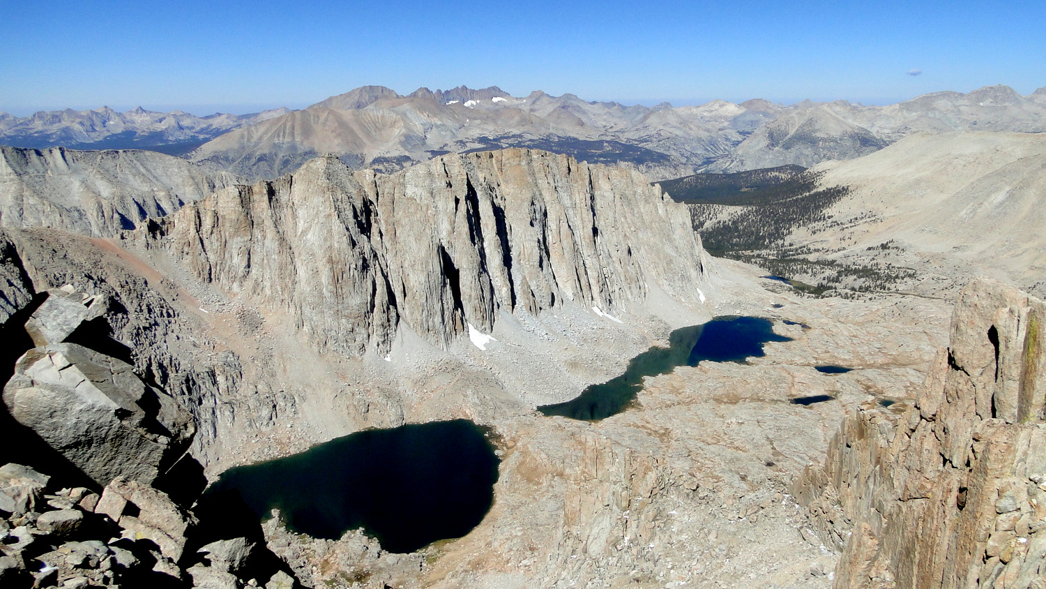
Summit panorama
However you wish to enjoy your time on the summit, bear in mind that you still have a very long way to go on the day. Not only will you need to backtrack to the John Muir Trail junction, you will need to make the brief climb up and over Trail Crest (40.9 miles at 13,400’) before dropping down the fabled 99 Switchbacks to Trail Camp (43.3 miles). You will want to make your return journey before the afternoon’s heat gives birth to convective currents that spawn the Sierra’s legendary afternoon thunderstorms. Plan on leaving the summit by noon in order to get to cover before the storms pick up in earnest, usually around 3 or 4 in the afternoon.

Consultation Lake
As you continue beyond Trail Camp, itself a tent city to rival Guitar Lake, keep your eyes peeled for a hard-to-spot junction bending off to the right and leading to Consultation Lake (43.7 miles). This austere but beautiful lake provides a nice side trip if you have the time, and it also offers a more secluded alternative to Trail Camp. Beyond Consultation Lake, you continue to trace the course of Lone Pine Creek as you descend toward Mirror Lake. You cannot camp at Mirror Lake to protect its recovering environment, and your next camping opportunity arrives at Outpost Camp (45.5 miles) and later at Lone Pine Lake (46.3 miles). Beyond Lone Pine Lake, you drop into Whitney Portal (49.1 miles) via a long, switchbacking descent that I guarantee will feel three times as long as it really is.

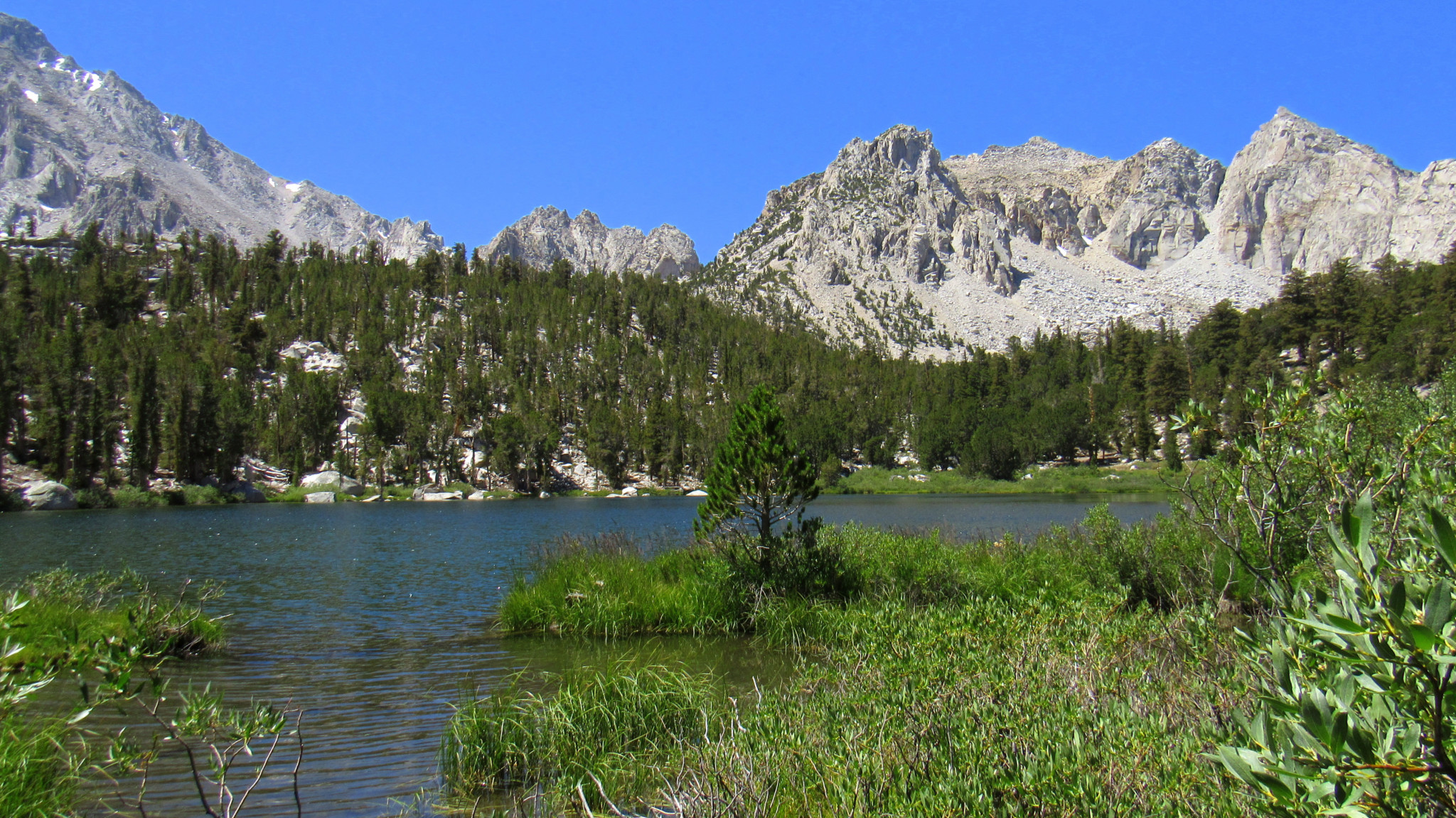
Lone Pine Lake
I have no doubt that by the time you reach Whitney Portal, the only thing you will want is a hot shower, copious amounts of calories, and either a warm bed or a ride home. Tempting though all of these things will be after six or seven days on the trail, I encourage you to consider breaking up the descent from Mt. Whitney to the portal by staying at any one of four camping options (Trail Camp, Consultation Lake, Outpost Camp, and Lone Pine Lake). Remember that you lose 6,500’ of the space of 11 miles as you descend, and the unrelenting pounding will take a toll on your knees, muscles, and feet. Many people I know, myself included, have sustained injuries from attempting to plow through this last stretch, and giving yourself one last night will allow you to avoid injuries.

Campsites:
The campsites described below represent some of the more popular and heavily used sites. They certainly are not the only sites on the route, and you may wish to seek out your own sites in less heavily traveled areas. Every campsite described here except for the Kearsarge Lakes and “Timberline Camp” feature bear boxes, although any bear box on the PCT is reserved for PCT through hikers. Plan on using a bear canister regardless of the presence of bear lockers along the way.

Kearsarge Lakes
Keararge Lakes (5.3 miles): Campsites abound along the banks of the first two lakes with more obscure campsites lying along the rocky shores of the third lake. The bear locker at the first lake was locked as of 2017, so you may wish to call the park to find out whether you can store your food there. A fair amount of traffic passes through, however, so it may not be wise to expect space in the locker even if it is available to you.
Lower Vidette Meadow (8.6 miles): Several fine campsites and a bear locker occupy a wooded area on the west end of the meadow. Be forewarned that the bear locker is reserved for PCT & JMT thru-hikers, meaning you must rely on your own use of an approved canister.
Vidette Meadow (9.2 miles): You will find a bear locker at a handful of sites along Bubbs Creek, but like Lower Vidette Meadow, these are reserved for thru-hikers. Vidette Meadow is not quite as scenic as Lower Vidette Meadow, but this will do as a camping spot if you don’t wish to continue further up Bubbs Creek Canyon.
Center Creek (12.2 miles): Another bear locker reserved for thru-hikers lies along the banks of Center Creek above its merging point with Bubbs Creek. An unmaintained trail into Center Basin leading to Golden Bear Lake and beyond to Junction Pass lie just north of the campsites, presenting a possible side trip for those inclined toward route-finding and cross-country travel.

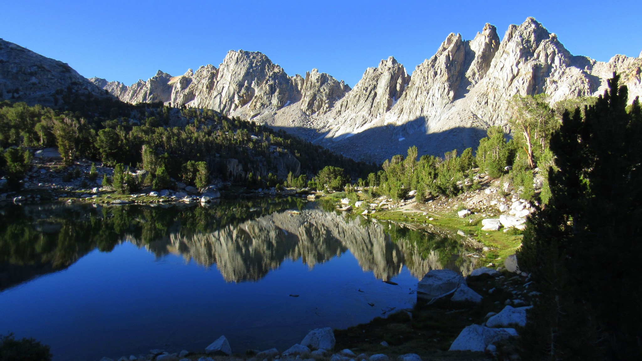
Tarn near “Treeline Camp”
“Treeline” Camp (14.2 miles): An unofficially named camp occupying the last cluster of whitebark pines before trees disappear for good on the way to Forester Pass. Numerous camping areas can be found within the trees and above on the plateau containing a tarn. The density of campsites here creates a more social air, and you will likely rub elbows with your fellow campers. You can also enjoy fine views of the high country of the Bubbs Creek watershed.
Tyndall Creek (22.0 miles): Just beyond a return to the cover of forest, you will find several campsites along the banks of Tyndall Creek. It’s the same story here with the bear locker: reserved for PCT/JMT thru-hikers. The nearby ranger station means you can stop for a chat with the ranger. Also nearby are the Tyndall Frog Ponds, which invite a refreshing swim in lukewarm water.
Tyndall Frog Ponds (22.8 miles): Situated just south from Tyndall Creek and about 100 yards east of the PCT, the ponds feature a bear locker of their own reserved for PCT/JMT hikers.

Sky Pilot
Wallace Creek/HST Junction (26.7 miles): Several campsites and a bear locker adjacent to both Wallace Creek and the John Muir Trail junction provide an option for you to collapse after the rigorous climb out of Kern Canyon. The big drawback with this camping area is that your positioning for the Whitney ascent is a bit awkward given the distance.
Crabtree Meadows (30.9 miles): Campsites adjacent to the Crabtree Ranger Station have a bear locker and abundant space. This is a good, but not perfect place to start on your Whitney ascent. There’s still a good 6.5 extremely challenging miles from here to the summit, and the timing could have you on the summit later in the afternoon. Most people bypass for Guitar Lake, but for that reason Crabtree is less crowded.
Guitar Lake (34.1 miles): Guitar Lake is well-situated for an early start to your ascent on Whitney, and it usually has the crowds to prove it. The combined traffic of the High Sierra Trail, JMT, and PCT usually stops here, so expect to fight for space. However, the sunsets from the lake are great, and you cannot beat the convenience.
Trail Camp (43.3 miles): Trail Camp usually provides a stopping point for overnight hikers ascending Whitney from the Portal, but you can also use this spot if you are ascending Whitney from Wallace Creek or Crabtree Meadows. This will spare you from taking the long, knee-rattling descent to the portal after a long, difficult ascent. Expect crowds given the unceasing parade of traffic to Mt. Whitney.
Outpost Camp (45.5 miles): Although you are certain to be ready for the hike to end by the time you get to Outpost Camp, it is a great option for prudent hikers looking to avoid the entire Whitney to Portal descent and its tendency to punish knees and feet. There are usually abundant spaces, and with an early start on the following morning, you can usually make it back to the portal in time for a late breakfast in Lone Pine.

Looking north toward Forester Pass from Mt. Whitney
Tags: Bighorn Park, Bighorn Plateau, Bubbs Creek, Bullfrog Lake, Center Creek, Charlotte Lake, Crabtree Meadow, Flower Lake, Forester Pass, Gilbert Lake, Guitar Lake, John Muir Trail, Kearsarge Basin, Kearsarge Pass, Lone Pine Lake, Lower Vidette Meadow, Mt. Whitney, Onion Valley, Outpost camp, Pacific Crest Trail, Pothole Lake, Trail Camp, Trail Crest, Tyndall Creek, Vidette Meadow, wallace creek, Whitney Portal, Wright Creek