Overview
The Ohlone Regional Wilderness Trail (ORWT) is a 28-mile trail between Mission Peak Regional Preserve in Fremont and Del Valle Regional Park in Livermore. It is a grueling backpack with over 8,000 feet cumulative elevation gain, and most people do it in two or three days. The undulating route tops out at Rose Peak, 3,817 feet, with ever-shifting panoramas of Mount Tamalpais, Mount Hamilton, Mount Diablo, the Santa Cruz Mountains, and the Sierra Nevada. Spring wildflowers—bird’s eye gilia, purple owl’s clover, butter and eggs, goldfields, and popcorn flower—sparkle up the grasslands confetti. Scrub jays, cattle, eagles, hawks, and ground squirrels live among the woodlands, valleys, and graze lands. This trail guide will go over safety, the permit process, camping options, transportation considerations, and the route in detail.

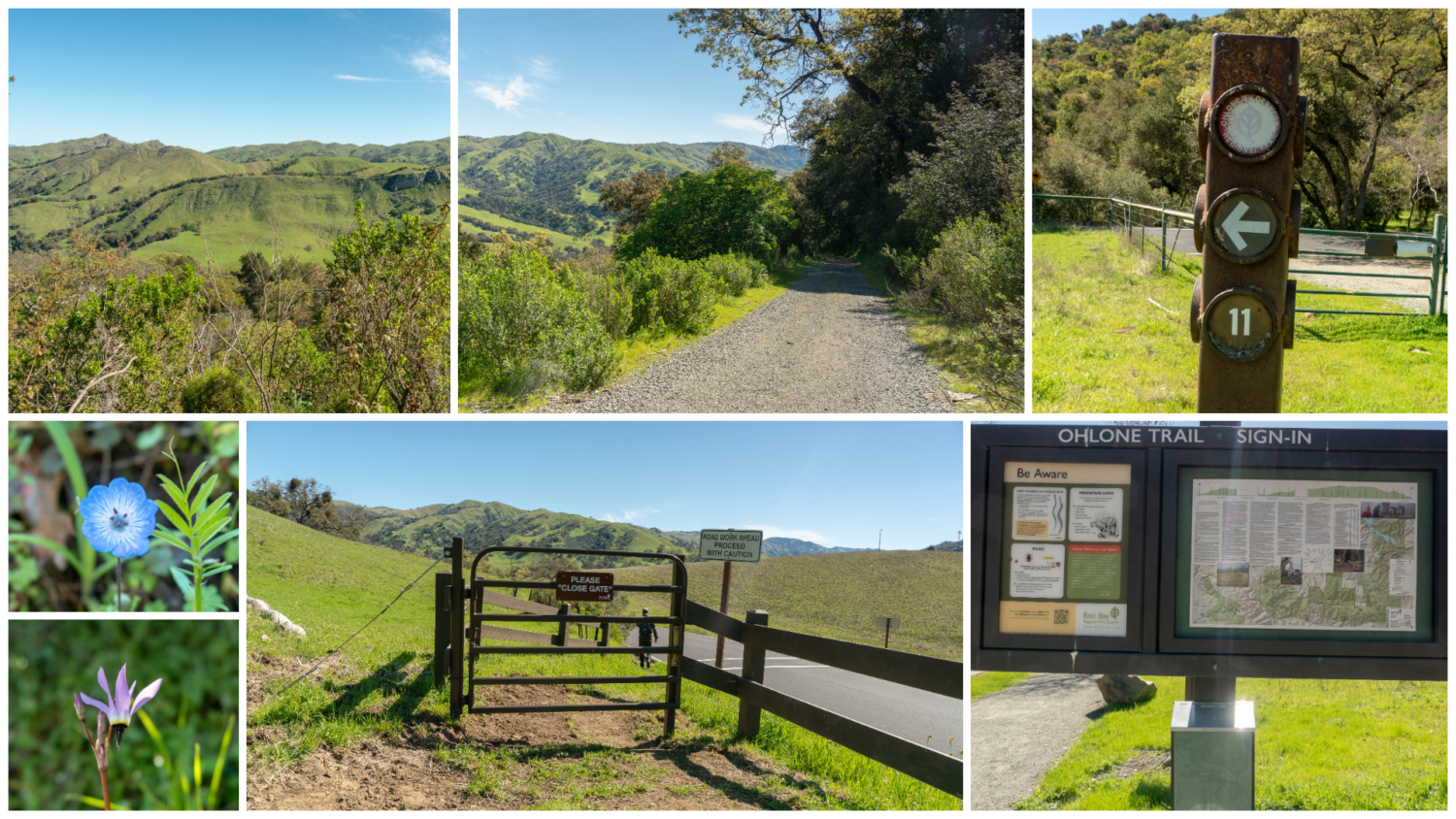
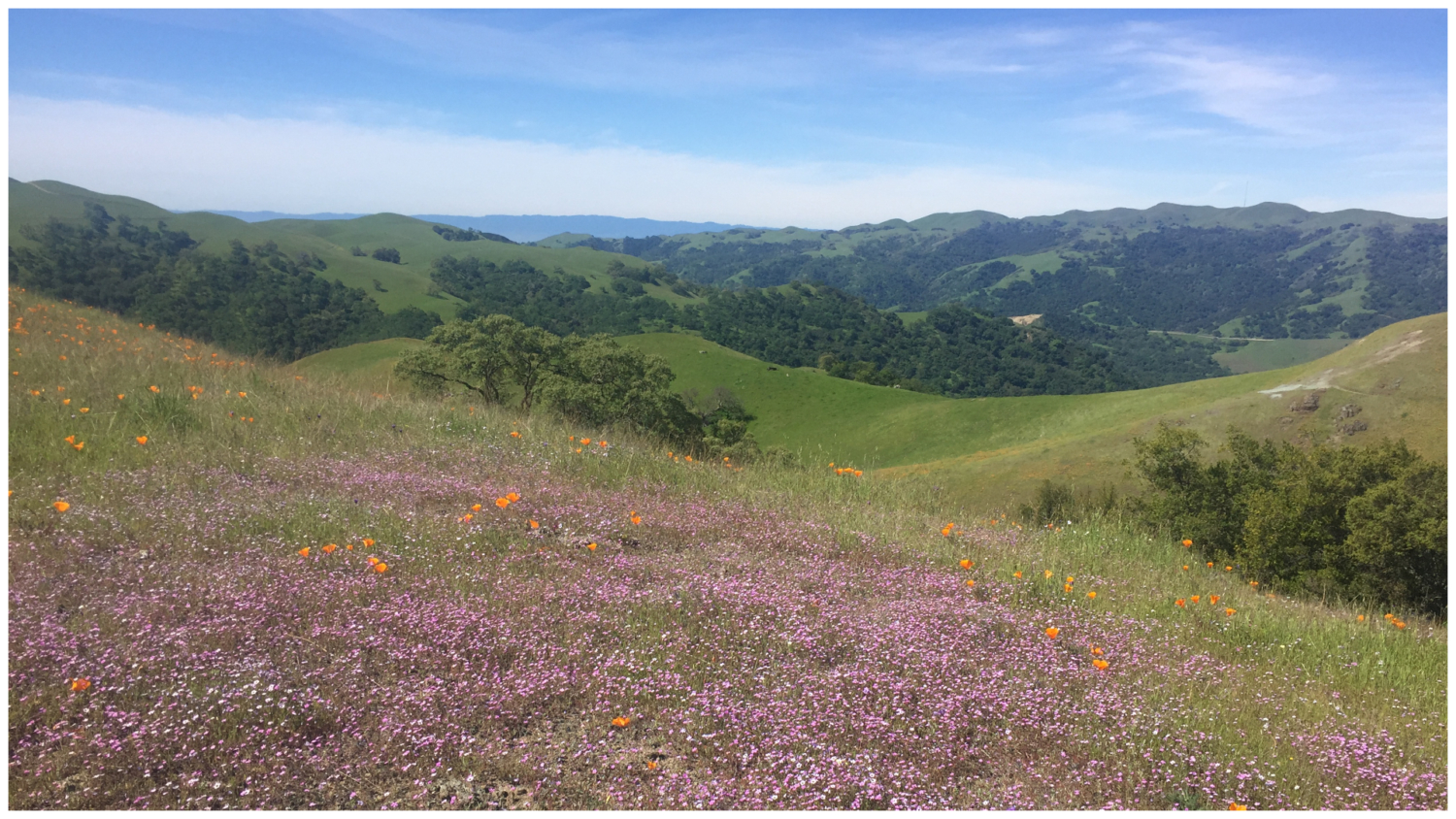
Spring wildflowers, forest green valleys, and mountain views on the ORWT
Safety
The ORWT travels through grasslands and oak woodland with seasonal water supplies, occasional shade, and steep fire roads exceeding a 20% grade at times. It is a strenuous backpacking trip, and dehydration and heat stroke are major concerns. Anyone who has hiked Mission Peak on a hot, sunny day knows that shade-less fire roads can be brutal. Add in a 25+ lb. backpack and extra mileage, and well…you get the idea. Pack plenty of water and reapply sunscreen periodically. A long-sleeved shirt, hat, and pants will help protect your skin from the sun as well as poison oak, bugs, and ticks. It goes without saying: train, train, train. This is a steep and difficult hike, and putting in time on exposed, strenuous trails will help prepare you for it.

Hikers descending from the summit of Mission Peak
Although it does get brutally hot, there are periodic water sources along the ORWT, marked with a W symbol on your ORWT permit. Water supplies at backpacking sites can be unreliable, so check the Ohlone Regional Wilderness website or call up the park (1-888-EBPARKS) to learn the current water availability before you go. You may have to carry your own water to a site if the water supply is depleted. The other important guideline is to filter or treat your water at all backpacking sites.

Stellar views of Sunol Regional Wilderness and Mission Peak from Star’s Rest campsite in Sunol Backpack Camp
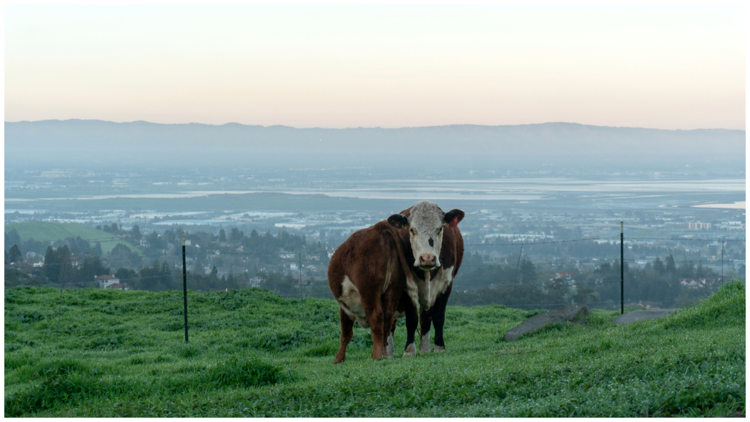
It is common to see cattle grazing next to the trail throughout the ORWT. Speak normally and calmly walk past them. Do not touch them or get between a mother and her calf. You may see rattlesnakes occasionally. If you do see a snake, give them space and leave them be. Mountain lions are not common, but are occasionally sighted. See the East Bay Regional Park District’s guidelines for safety for tips on these and other safety concerns.

A cow and her nursing calf in the morning light on the Hidden Valley Trail
Permits and Reservations
To hike and camp along the ORWT, you will need an ORWT permit, camping reservations, and a guest parking pass if you plan to leave your car overnight near a trailhead. One call to the East Bay Regional Parks (1-888-EBPARKS, option 2) gets you everything you need.
An ORWT permit is required for day users and campers ages 12 and older ($2 per person for in-person purchases, $4 per person for online/phone/mail purchases as of this writing). Permits are good for one year and include a topo map, a trail description, elevation profile, and numbered trail junctions that correspond to signposts along the route. Purchase your permit over the phone, online, or in person at Sunol Regional Wilderness and Del Valle Regional Park entrances, the Coyote Hills Visitor Center in Fremont, or the Park District administration offices in Oakland.

An elevation profile, trail description, and topo map are part of the ORWT permit
Camping reservations are required. Fees are $5 per person per night, age 16 and over, plus an $8 non-refundable reservation fee as of this writing. Up to eight people are allowed per campsite. Reservations must be made at least five business days ahead of your trip so the District has time to mail your permits and camping confirmation. When you call up East Bay Regional Parks (1-888-EBPARKS option 2), a representative will ask you where you want to camp, what campsite you would like, the dates of your trip, and how many people will be in your party. (I did not have much luck finding maps of campsites, aside from Sunol Backpack Camp, but some quick googling brings up campsite descriptions from hikers and bloggers.) The representative will also ask if you already have an ORWT permit. If not, you can purchase one in the same the transaction.

Seven campsites to choose from at Sunol Backpack Camp
Guest parking passes are free. When you’re making your backpacking reservation, let the phone representative know your ORWT trail dates, and they will mail you your guest parking pass along with your campsite confirmation and ORWT permit. If you have two cars, you can request two parking passes. Parking passes are stamped with your beginning date and end date, and have a space to write an emergency phone number.
Campgrounds
There are five major campgrounds along the ORWT. Running west to east, they are:
- Eagle Spring Backpack Camp (mile 4.3) in Mission Peak Regional Preserve (four sites)
- Sunol Backpack Camp (mile 12.0) in Sunol Regional Wilderness (seven sites)
- Maggie’s Half Acre (mile 17.9) in Ohlone Regional Wilderness (three sites)
- Stewart’s Camp (mile 22.3) in Ohlone Regional Wilderness (one site)
- Boyd Camp (mile 26.1) in Del Valle Regional Park (two sites)
Campsites fill quickly for spring weekends — a popular time of year to hike the ORWT and see wildflowers. If you plan to go in spring, make your reservations well in advance. If you are a resident of Alameda or Contra Costa County, congratulations — you can call up East Bay Regional Parks the first Monday in November to make a reservation for the following year. Residents outside those counties can call to make a reservation the second Monday in January for that same year. For more details, see the East Bay Regional Park District’s Backpacking FAQ.

Maggie’s Half Acre Camp, with the view from site #1 in the upper left-hand corner
Transportation
There is no shuttle service for the ORWT. Many people recruit a friend or family member to help drop off their car off at one end and then drive them to the other end. As of this writing, it is possible take public transportation to the western end–the Mission Peak side–of the ORWT. AC Transit buses run to Grimmer and Mission Boulevard, and then it is a 0.8-mile walk to the Stanford Avenue Staging Area. There is neither public transportation nor cell service at Del Valle Regional Park, so if you plan to finish at Del Valle, be sure to arrange your pick-up ahead of time.
The Route
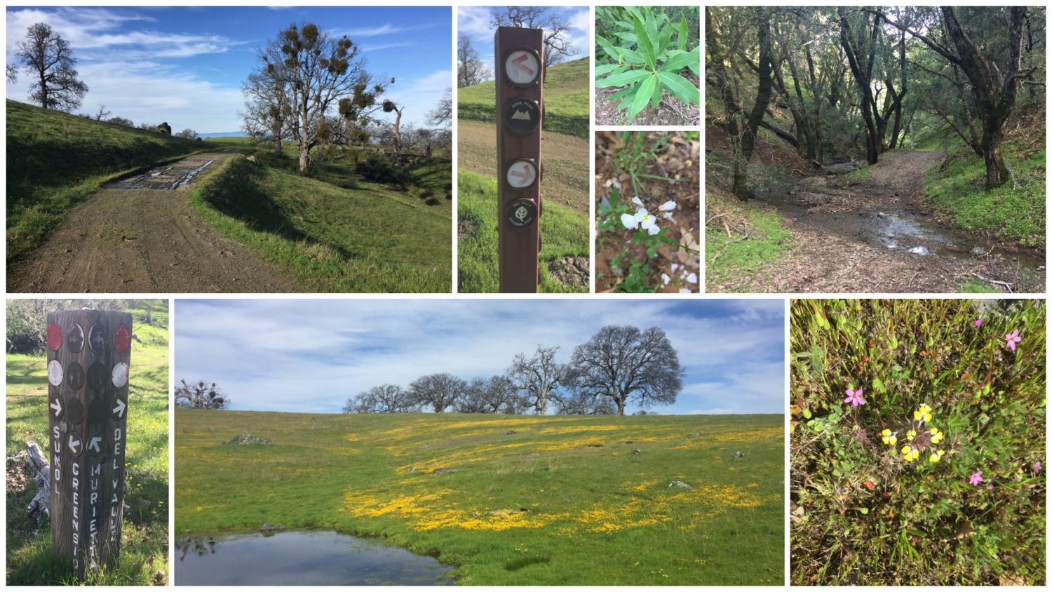
The 28-mile ORWT runs west/east through four East Bay Regional Parks: Mission Peak Regional Preserve, Sunol Regional Wilderness, Ohlone Regional Wilderness, and Del Valle Regional Park. Red discs on signposts, numbered one through 40, mark every junction through the 28-mile trail. The numbers correspond to locations on your ORWT permit map, so you can cross-reference as you hike.

The official distance of the ORWT is 28 miles. It is easy to clock closer to 30+ miles when you factor in hiking to and from your campsite and any side trips you may take. The 8300 elevation gain in this description takes into account all the cumulative climbs throughout the hike, beginning at 390 feet at Stanford Avenue Staging Area, topping out at 3,817 feet at Rose Peak, and then dropping to 750 feet in Del Valle Regional Park. Northwest trending ridges run perpendicular to the ORWT, resulting in ups-and-downs that add up over the course of the route.

A benchmark marks the summit of Mission Peak
Many people hike the trail in two or three days. Westbound or eastbound? It is your choice. Westbound hikers have a quieter experience starting at Del Valle. They avoid the crazy parking space jockeying at the Stanford Staging Area and the predictable crowds at Mission Peak. At the same time, it is a sharp ascent on the ORWT from Del Valle, gaining 3500 feet in the first 6.0 miles compared to 2,350 feet in the first 6.0 miles from Mission Peak Regional Preserve. If you have sensitive knees, you may prefer ascending up from Del Valle versus the rickety, tip-toe-like descent down to Del Valle. You may also prefer certain campgrounds that lend themselves to a westbound versus eastbound direction.

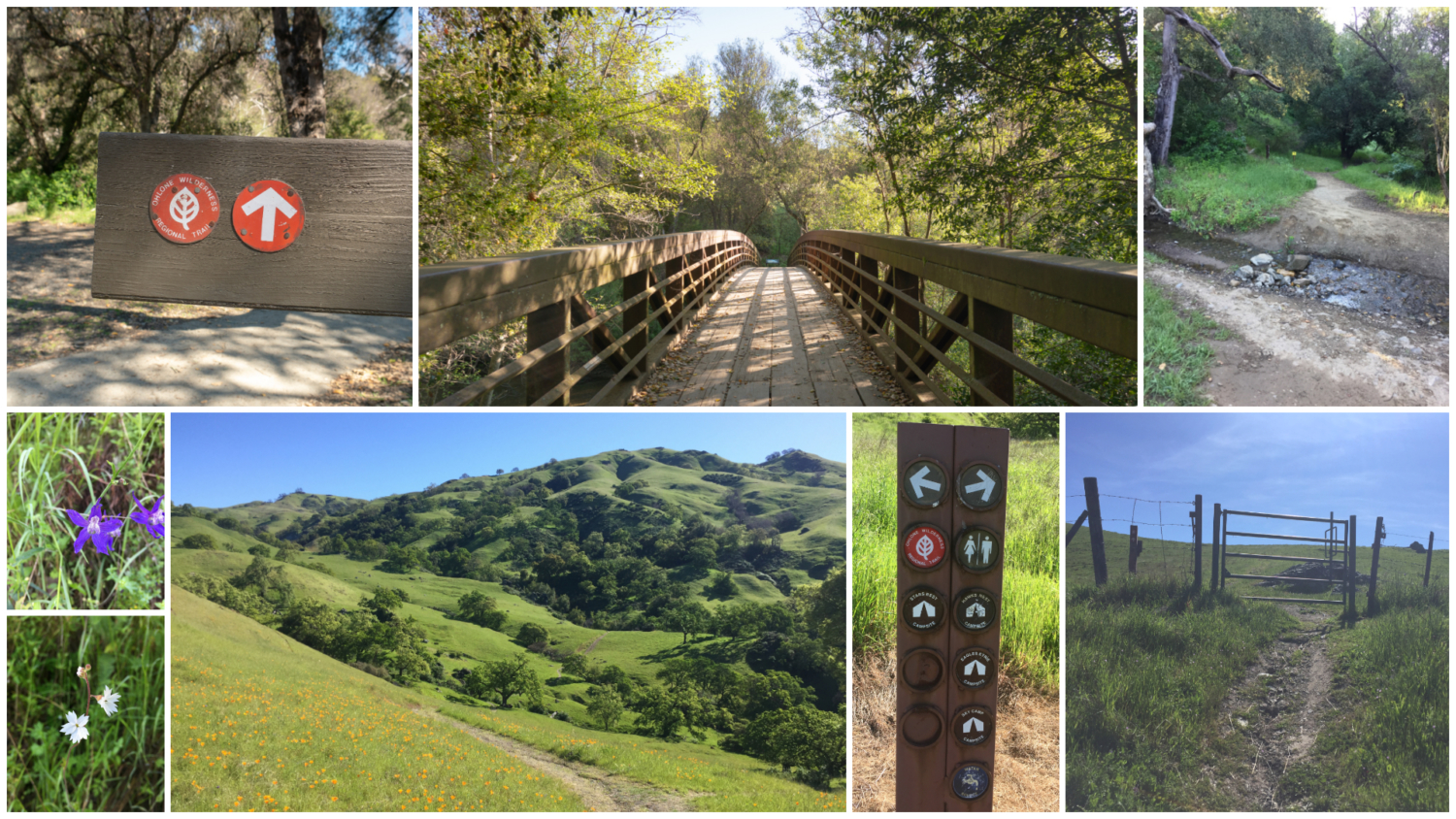
Cattle gates and wide fire roads are common on the ORWT
At the Stanford Avenue Staging Area in Mission Peak Regional Preserve, it is common to see dozens of people crowded outside the gates on weekend mornings, ready to start the moment the park opens (lest you get a $300 citation for being in the park during off-hours). When I started at 6:30 a.m. on a spring Saturday morning, crowds weren’t too bad. Yes, there are many people, especially on weekends, but everyone seems to space themselves out after the first mile or so. I decided to hike this direction—eastbound—to get the “popular part” of the ORWT over with, to avoid the steep start from Del Valle, and to follow the trail as it is laid out in the ORWT permit. A nice bonus was being able to jump into Lake Del Valle at the end.

Lake Del Valle hits the spot after a long day of hiking
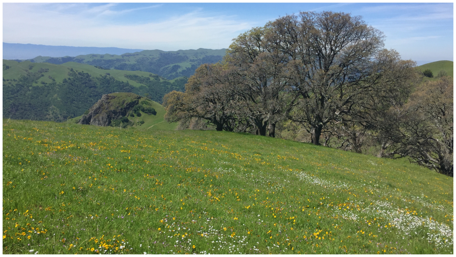
Season-wise, the best time of year to hike the ORWT is spring. Muddy trails have mostly dried up, temperatures are mild, wildflowers are in bloom, grasslands are emerald green, and you juuust might catch Murietta Falls before it dries up for the season (an extra side trip from the ORWT). In summer and fall, the land turns into a dry, hay-colored landscape that is beautiful in its own way. In winter, temperatures can dip to freezing with snow dusting the ridges. At the end of the day, it is a personal call based on your availability, experience, and preference in seasonal conditions.
Trail Description
Stanford Avenue to Sunol Headquarters
Distance: 8.3 miles, 2350 ft gain, 2350 ft loss
Campsites: Eagle Spring Backpack Camp (mile 4.3)
Begin your hike at the Stanford Avenue Staging Area, heading east on the Hidden Valley Trail past cows and wild turkeys. At 2.4 miles, the Hidden Valley Trail intersects with the Peak Trail. Here, folks coming up from Ohlone College join the route to Mission Peak and there is a convenient restroom 450 feet down the hill. Bear right, following signs for the peak and the Bay Area Ridge Trail: the two overlap here for a short time. In 0.3 miles, at junction 5, turn right for the rugged, half-mile climb to Mission Peak, 2,517 feet. The view on the ridge’s edge is phenomenal. Facing west, your eyes sweep down the Mission Peak ridgeline to the southern San Francisco Bay, then rise to the dominant line of Santa Cruz Mountains. Prominent Bay Area peaks complete the 360-degree view: Mount Tamalpais, Mount Umunhum, and Mount Diablo, just to name a few.

After tagging Mission Peak, return to junction 5 and head east on the Bay Area Ridge Trail/ORWT/Eagle Trail. Grazing cattle and green grass give way to more views of Mount Diablo, Pleasanton Ridge, and Sunol Peak. At junction 7, turn left onto the Laurel Canyon Trail and then bear left again on the wide grassy road. Reaching a shady forest, leave the Laurel Canyon Trail behind as it veers north at junction 8, continuing on the ORWT. In 0.5 miles, sign-in at the kiosk marking San Francisco Water Department Land. Be sure to close the cattle gate firmly behind you.

The remaining descent to Geary Road is partially shady, with baby blue eyes, California saxifrage, and shooting star in spring. The Sunol Regional Wilderness peaks form an astounding backdrop, with triangular Rose Peak rising to the east. Cross Calaveras Road at junction 11 and in another 0.8 miles, arrive at the ORWT sign-in kiosk on Geary Road. Sign out if this is the end of your hike. Sign-in if you are starting from here.

Sunol Headquarters to Rose Peak
Distance: 9.9 miles, 4365 ft gain, 985 ft loss
Campsites: Sunol Backpack Camp (mile 12.0), Maggie’s Half Acre (mile 17.9)
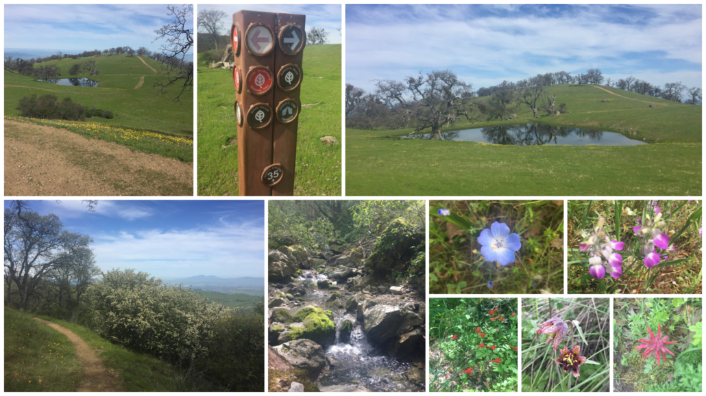
Cross Geary Road, following the red discs to a bridge over Alameda Creek. Turn right onto the Canyon View Trail. Lupine, woodland star, and Persian speedwell pop under a shady canopy of buckeye, alder, and willow. At junction 15, head east on the McCorkle Trail. Gorgeous views of the Calaveras Reservoir open up on a short, grunt-worthy ascent on Cerro Este Road. At junction 18, rejoin the McCorkle Trail, descending to Backpack Road. The trail climbs steeply over the next 0.25 miles to Sunol Backpack Camp. Seven sites are spaced apart, with spur trails leading to the sites from the ORWT. After zigzagging through Sunol Backpack Camp, pass through a cattle gate, entering the Ohlone Regional Wilderness and San Francisco Water Department Land. There is not a sign-in kiosk here.

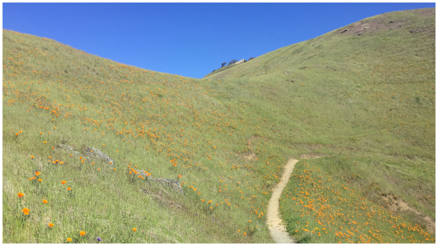
Single-track trails climb east through moderately steep, serpentine grasslands swathed in poppies, bird’s eye gilia, Johnny jump-ups, and popcorn flower. Turn left onto Goat Rock Road at junction 20, and after a short 0.2 miles, turn right to hop back on a single-track trail at junction 21. The wildflower show—and blazing sun—continues with purple owl’s clover, butter and eggs, and goldfields. Pass a cattle gate and pond at junction 24, after which the trail descends to South Fork Indian Creek.

Past the creek, ascend a moderate 750 feet to a sign for Maggie’s Half Acre Camp at junction 28. Just 0.22 miles beyond it is a 0.1-mile spur for Rose Peak. Standing proudly at 3,817 feet, Rose Peak is one of the tallest peaks in the Bay Area, just 32 feet shorter than Mount Diablo. The layers of Sunol ridges, Mt Hamilton, and the Santa Cruz Mountains are breathtaking, along with views of Mount Diablo and East Bay cities. To be honest, reaching Rose Peak feels a little like hiking to the tallest bump on a ridgeline. It is not quite the peak tagging experience of Mount Diablo or Mission Peak, but its remoteness does lend it an air of, “yep, cool, I reached it.” Below Rose Peak, Maggie’s Half Acre is a fine place to camp, and a short hike up to Rose Peak to watch the sunset. Three campsites here have access to one water spigot and an outhouse, with a bit more privacy at site #1.

The turn-off for Maggie’s Half Acre on the upper left, the spur for Rose Peak on the upper right
Rose Peak to Del Valle Regional Park
Distance: 10.1 miles, 1540 ft gain, 4610 ft loss
Campsites: Stewart’s Camp (mile 22.3), Boyd Camp (mile 26.1)
Hike east past Rose Peak, passing the eastern entrance to Maggie’s Half Acre Camp at junction 29. From this point on, the trail turns north and mostly sticks to fire roads. At junction 30, descend a steep 300 feet in 0.3 miles to Indian Creek, with shady oak and California bay. Climb up the fire road to Wauhab Ridge, a grassy area sprouting with oaks. At junction 33, it is decision time. The left-hand trail on Greenside Road leads to Stewart’s Camp in 0.6 miles, and a half mile beyond it, Murietta Falls. Technically, the ORWT continues to the right towards Del Valle, but you can easily link back up to it at junction 35 if you take this detour instead. It adds about an extra mile. I had already visited Murietta Falls and wanted to stick exactly to the ORWT, so I skipped it and continued right, surprised by beautiful meadows filled with goldfields and butter and eggs.

Arrive at junction 35 in front of Johnny’s Pond. This is where you’d meet back up with the ORWT if you had taken the detour to Stewart’s Camp and Murietta Falls. Continuing on the ORWT, pass Schlieper Rock at 3,080 feet, beginning a steep descent on the Big Burn to Williams Gulch. The wildflowers along the single-track trail are fantastic in spring: red larkspur, wild hyacinth, purple sanicle, mule ears, paintbrush, common fiddleneck, woodland star, Chinese houses, and scarlet pimpernel, just to name a few. Watch out for poison oak, too.
After the trail bottoms out and crosses Williams Gulch, you have one last moderately steep climb—550 feet in the next 0.8 miles to Rocky Ridge. The fields of owl’s clover and Johnny jump-ups are a welcome distraction as you sweat it out. After hitting Rocky Ridge at junction 38, the trail descends past Stromer Spring to the Ohlone Trail sign-in panel at junction 40. Across from the sign-in panel, the Vallecitos Trail leads to campsites at Del Valle Regional Park. Stay on the main trail, finishing on the west side of Lake Del Valle at the Lichen Bark Picnic Area. The West Beach swimming area is down below the parking lot near the visitor center. Lifeguards are on duty seasonally. Visit Del Valle Regional Park’s website for more info.

Notes:
- The ORWT is open to hikers and horseback riders. Bicycles are not allowed on the ORWT. An exception is when the ORWT overlaps with the Hidden Valley Trail and Eagle Trail in Mission Peak Regional Preserve.
- Dogs are allowed on the ORWT in the daytime; they are not allowed overnight at campsites. Fees are $2 per dog in Sunol Regional Wilderness and Del Valle Regional Park entrances. Guide dogs are free.
- Water and outhouses are located throughout the route and marked on the Ohlone Regional Wilderness Trail permit.
- Cows graze throughout the Ohlone Regional Wilderness Trail. Here are a few safety tips for hiking near cows.
Tarantulas
In late summer and early fall, male tarantulas scurry from their burrows in search of females, often popping up on park roads and wide, exposed fire roads. Despite their horror movie reputation, tarantulas are gentle and are not poisonous or dangerous to humans. Keep an eye out for their quarter–sized burrow entrances, often lined with silk, as well as their hairy brown bodies, about 4-5 inches long with 8 legs. After mating season, the males perish; however, females can live up to 25 years. A good time to try to see them is early morning and evening before sunset. Check event calendars for tarantula programs and guided hikes, often occurring in September and October.
Tags: Backpacking, Camping, del valle regional park, lake del valle, mission peak, Mission Peak Regional Preserve, Ohlone Regional Wilderness, Ohlone Regional Wilderness Trail, rose peak, San Francisco Bay Area, sunol regional wilderness, wildflowers