Naches Peak Loop is one of the most beautiful and easily accessed trails in the central Cascades. Passing through Mount Rainier National Park and the William O. Douglas Wilderness in Wenatchee National Forest, and joining the Pacific Crest Trail for a spell, the hike circles its 6,400′ namesake peak with views in every directions. Summer wildflowers create a picturesque foreground for mighty volcanoes in the distance, and fall huckleberries attract hungry bears.
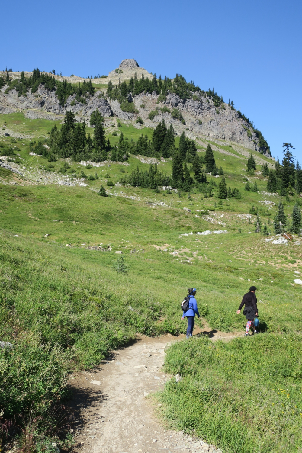
Start at the trailhead east of the Tipsoo Lake parking lot and head left at the junction to hike the loop clockwise. This will give the best views of Mount Rainier. If the parking lot is full, look for a space along the highway shoulder (designated parking) or just over Chinook Pass in a large parking lot. It is easy to find the trail no matter where you start.


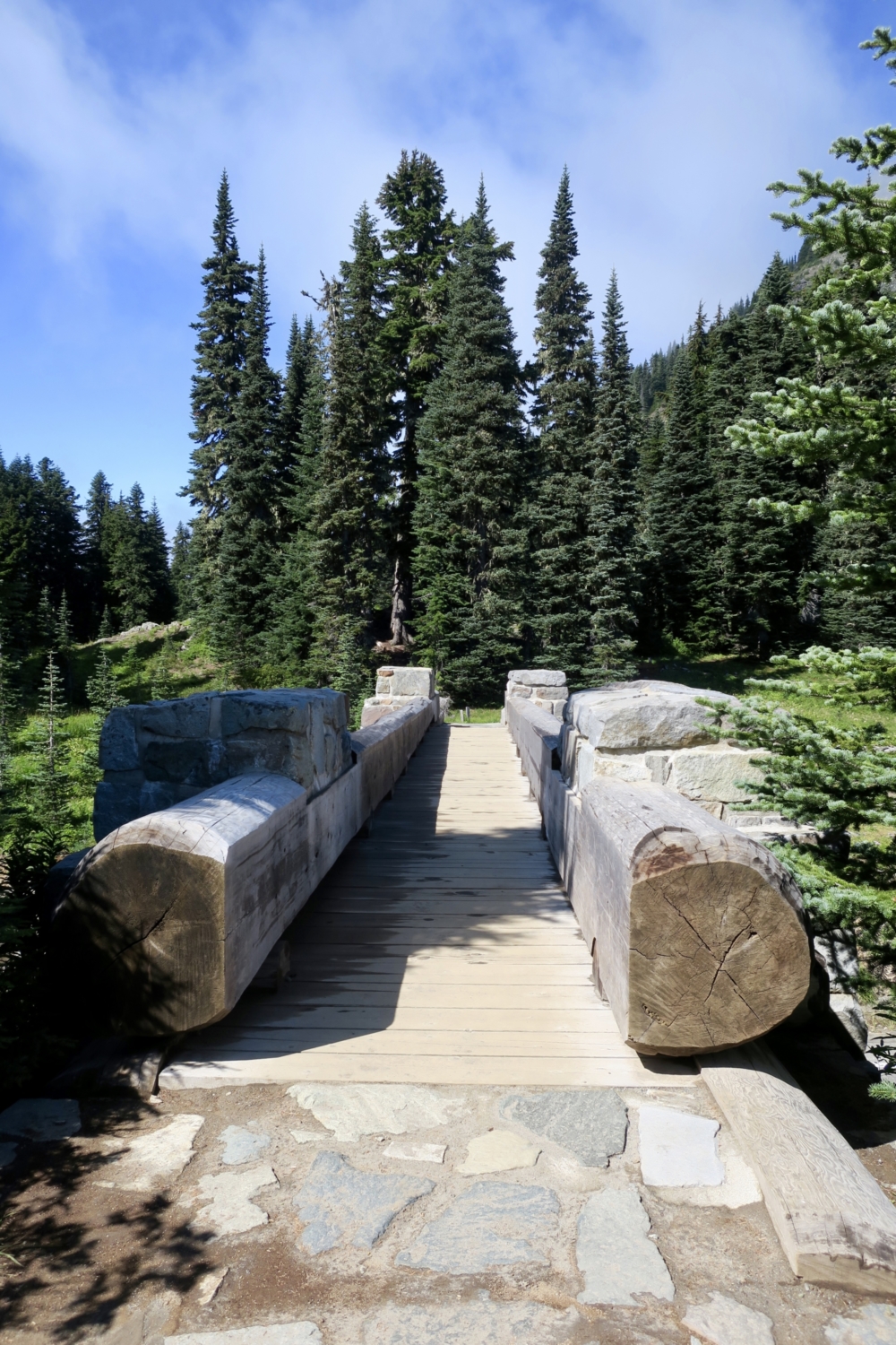
Hike around the north end of pretty Tipsoo Lake, keeping in mind that you can stop here on the way back for excellent photos of Mount Rainier. Head up the short forested slope and come out about a quarter-mile later at a junction with a sign pointing back to Tipsoo Lake. Highway 410 is in front of you, and to your right is a rustic bridge marking the entrance to Mount Rainier National Park. Cross the bridge, which is part of the Pacific Crest Trail, and continue up a gentle grade.


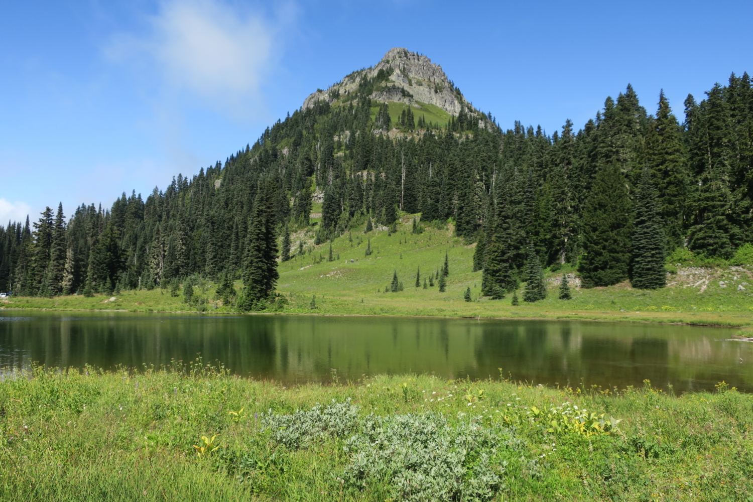
The trail meanders along, following the slope and passing several lovely tarns. Depending on the weather, these could be deep enough for splashing or mostly dried mud. Naches Peak looms to your right, blanketed in wildflowers. Listen for marmots and pikas whistling from the sheer rocks above.


Continue on the trail for another 0.6 mile, when it crosses into the William O. Douglas Wilderness. The former Supreme Court Justice was a Washington native who roamed these mountains as a teenager and became a fierce advocate for the natural environment while on the court.

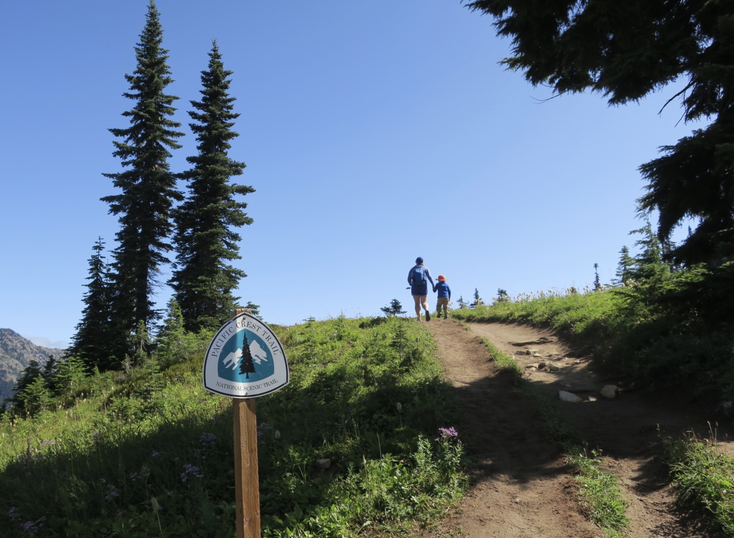
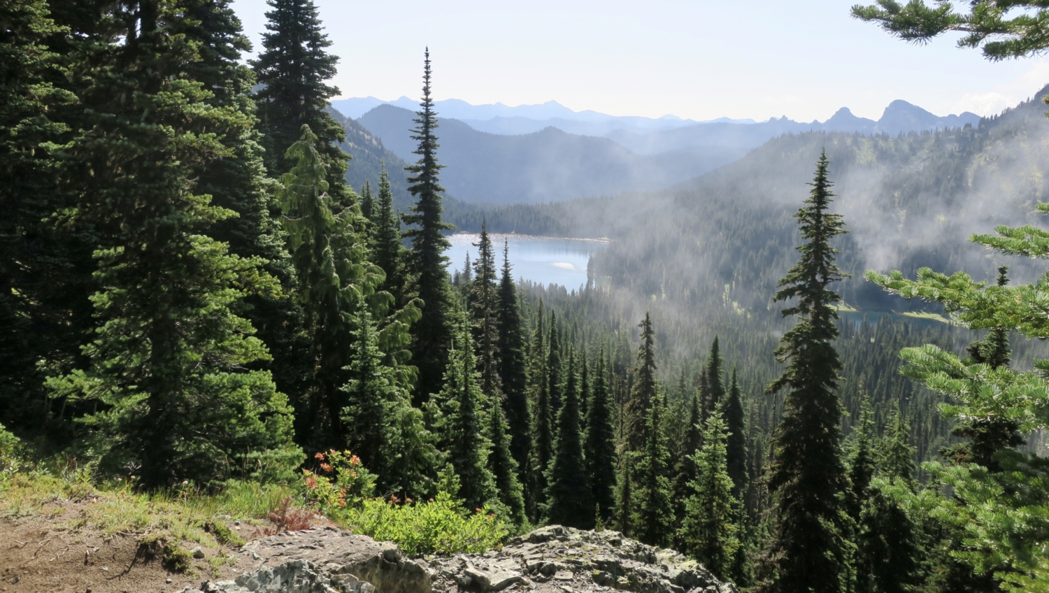
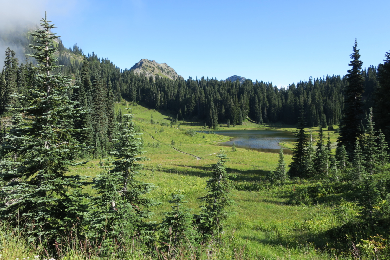
As you continue, watch for Mount Adams to appear in the distance beyond Seymour and Dewey Peaks. Washington’s second-tallest peak is about 46 miles due south. On a very clear day, you may also spot Mount St. Helens’s gray crater to the southwest. In another 0.8 mile, pass the junction for the Pacific Crest Trail continuing southbound. Spot Dewey Lake, a blue jewel nestled in the forest several hundred feet below. The lake offers a few overnight sites if you’re up for a backcountry adventure.


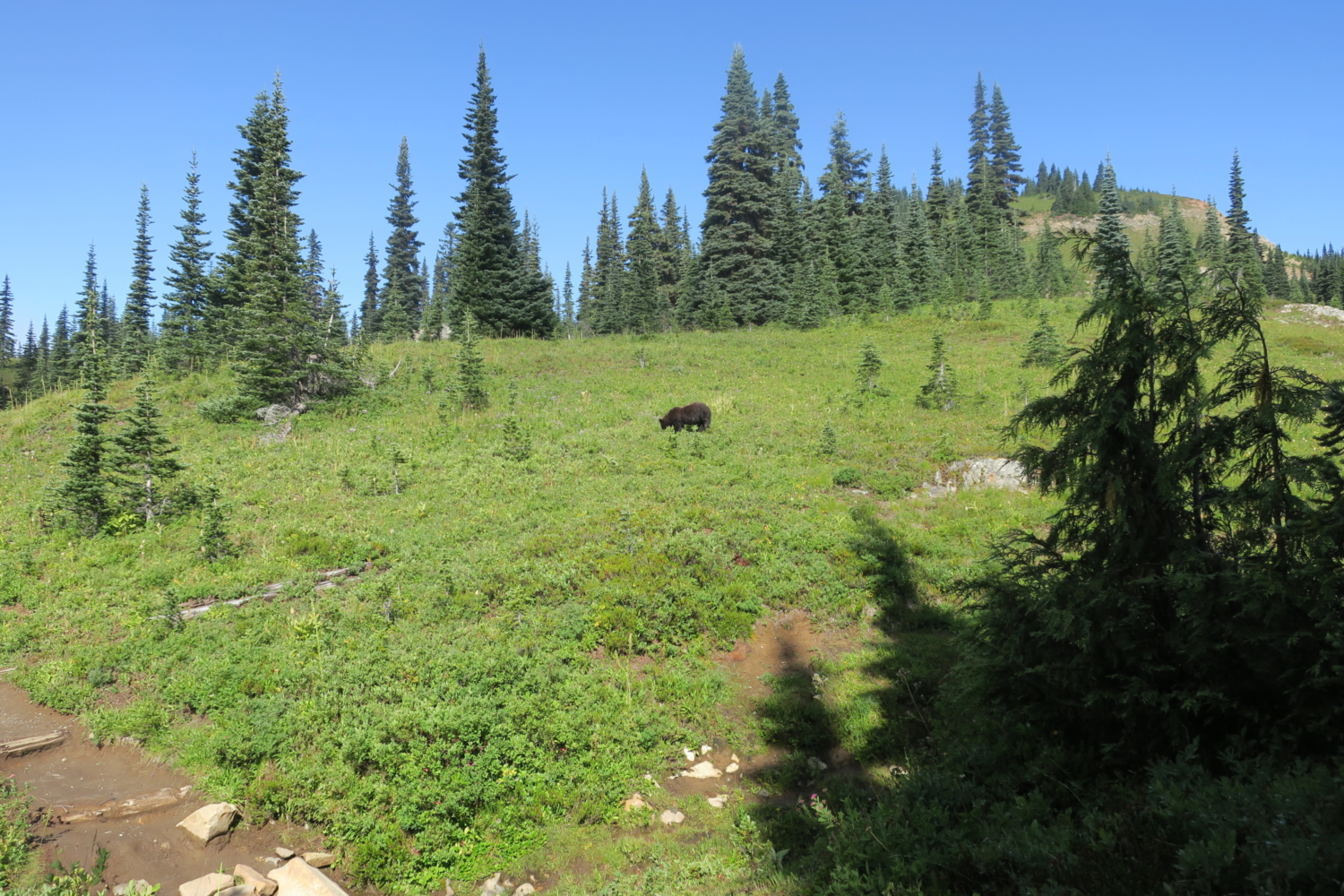
Now the trail turns west, toward the big views of Mount Rainier. For the next mile, The Mountain looms in front of you, perhaps slipping in and out of a summer marine cloud layer. Huckleberry bushes cover the south-facing slopes here, so eat your fill and keep your eye out for black bears doing the same. They are interested in berries, not you, but stay safe. Announce your presence by yelling loudly (“Hey bear!” is a popular refrain on this trail), and keep your distance.


The last half-mile brings you into the subalpine forest and downhill to the highway, where a sign marks the trail.. Cross carefully and continue back to the Tipsoo Lake parking lot or wherever you left your vehicle.


Tags: forest, Mount Adams, Mount Rainier, mountains, Pacific Crest Trail, subalpine, views, wilderness, wildflowers, wildlife