This family-friendly, double-highlight trail takes in a volatile geyser basin paired with an impressive waterfall spilling into a verdant gorge. Uphills and distances are moderate enough on this trail that most children over the age of 5 should be able to complete it with minimal support. Scenery is top notch, with the geyser basin, waterfall, and two different rivers converging at a beautiful spot just north of Upper Geyser Basin.

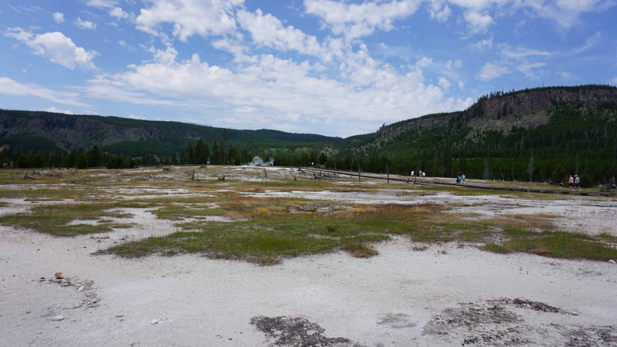
Begin by crossing the Firehole River via footbridge en route to Biscuit Geyser Basin. Follow the boardwalk as long as you travel through the basin, given that the terrain is very fragile. The best-case scenario for going off-trail is causing a lot of irreparable damage to the terrain. The worst-case scenario is severe burns if your feet break through the crust to the super-heated spring water below.

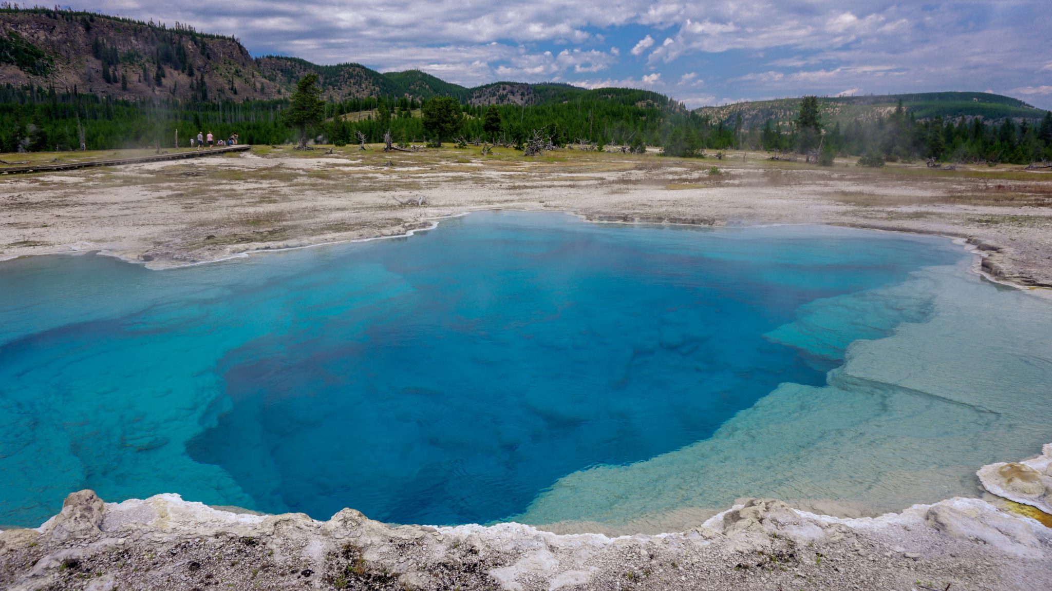
The boardwalk heads due east, crossing several streams that bleed out from the hot springs, nourishing rather unusual looking colonies of algae before arriving at Biscuit Geyser Basin’s principal highlight: Sapphire Pool. This brilliant, deep blue pool was once surrounded by biscuit-shaped mineral formations, giving the basin its name. However, the pool erupted violently in 1957, destroying the biscuit formations and leaving the name as a curious monument.

The boardwalk splits beyond Sapphire Pool. Turn right to swing by a number of thermal features, including mud pots, hot springs, fissures, and small geysers. The boardwalk loop closes at 0.3 miles. For a shorter loop (0.6 mile), turn left to return back to the parking lot. Otherwise, turn right to continue traveling east toward Mystic Falls.

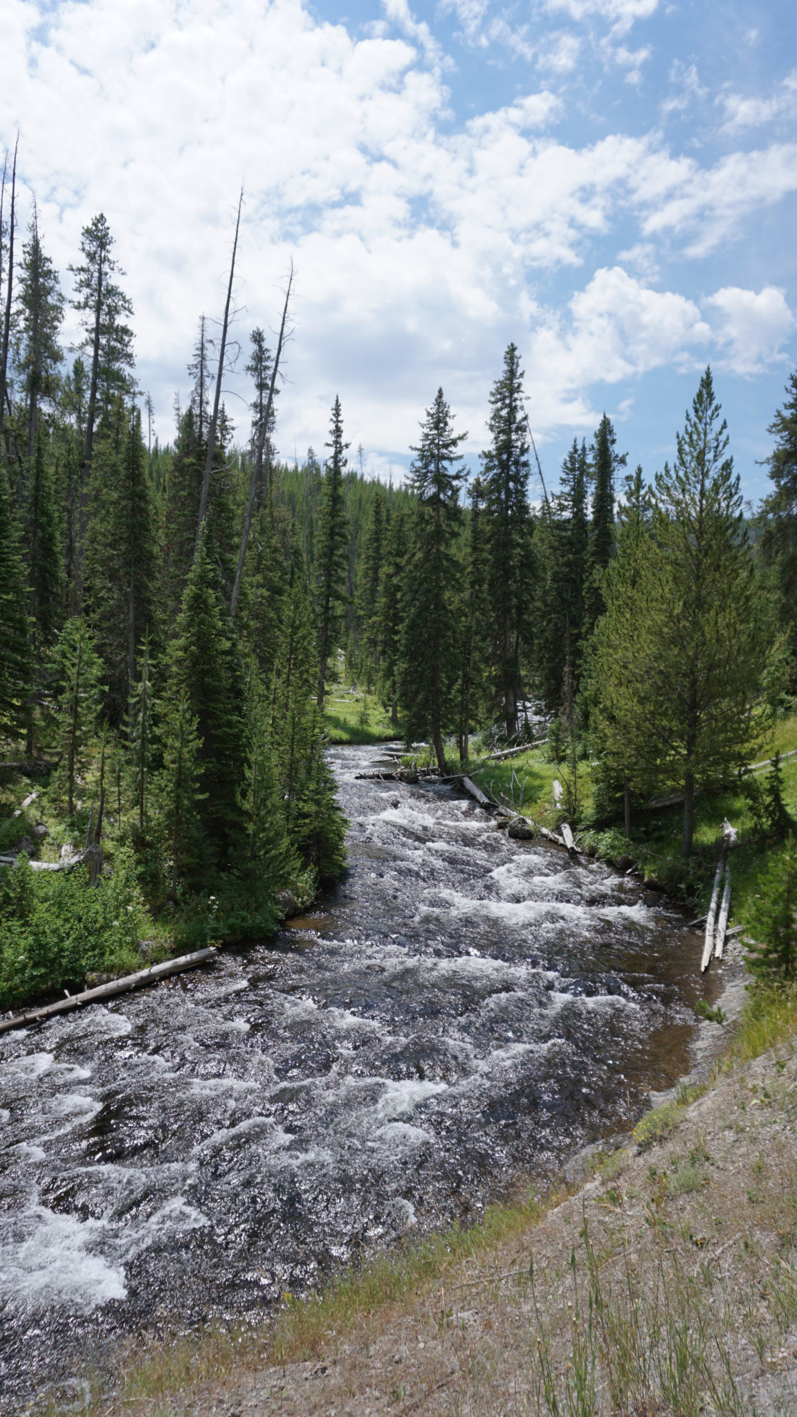
After plunging into a forest of lodgepole pines, the trail continues east to a pair of junctions in quick succession. Turn left at the first junction (0.65 mile) with a trail leads south to Fairy Creek and Imperial Geyser. Turn right at the next junction with a trail that leads south toward Summit Lake. After the junctions, the trail again resumes its eastward progression along the banks of the Little Firehole River, which rumbles along about 20-40 feet below on your left.

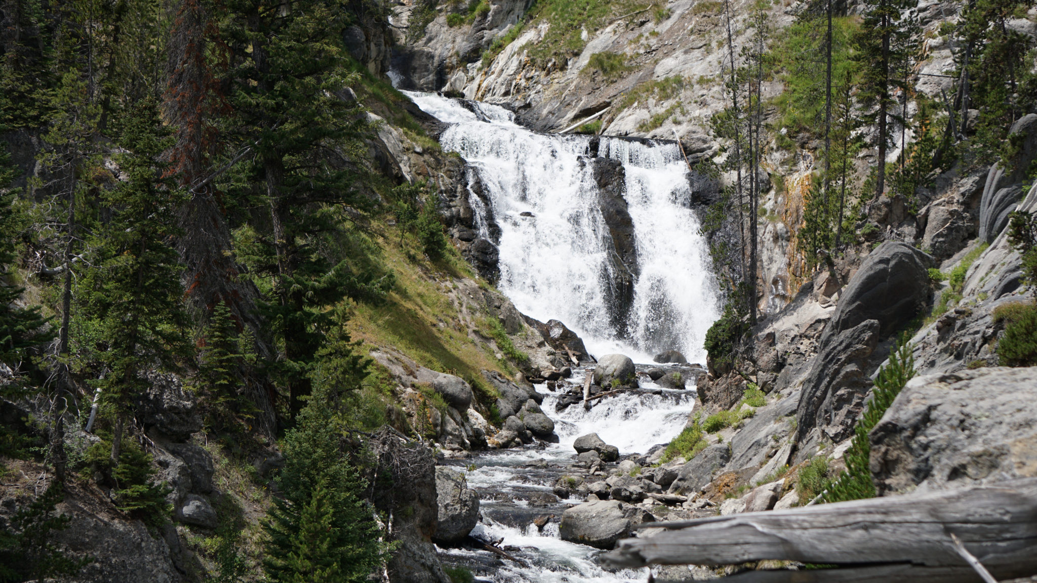
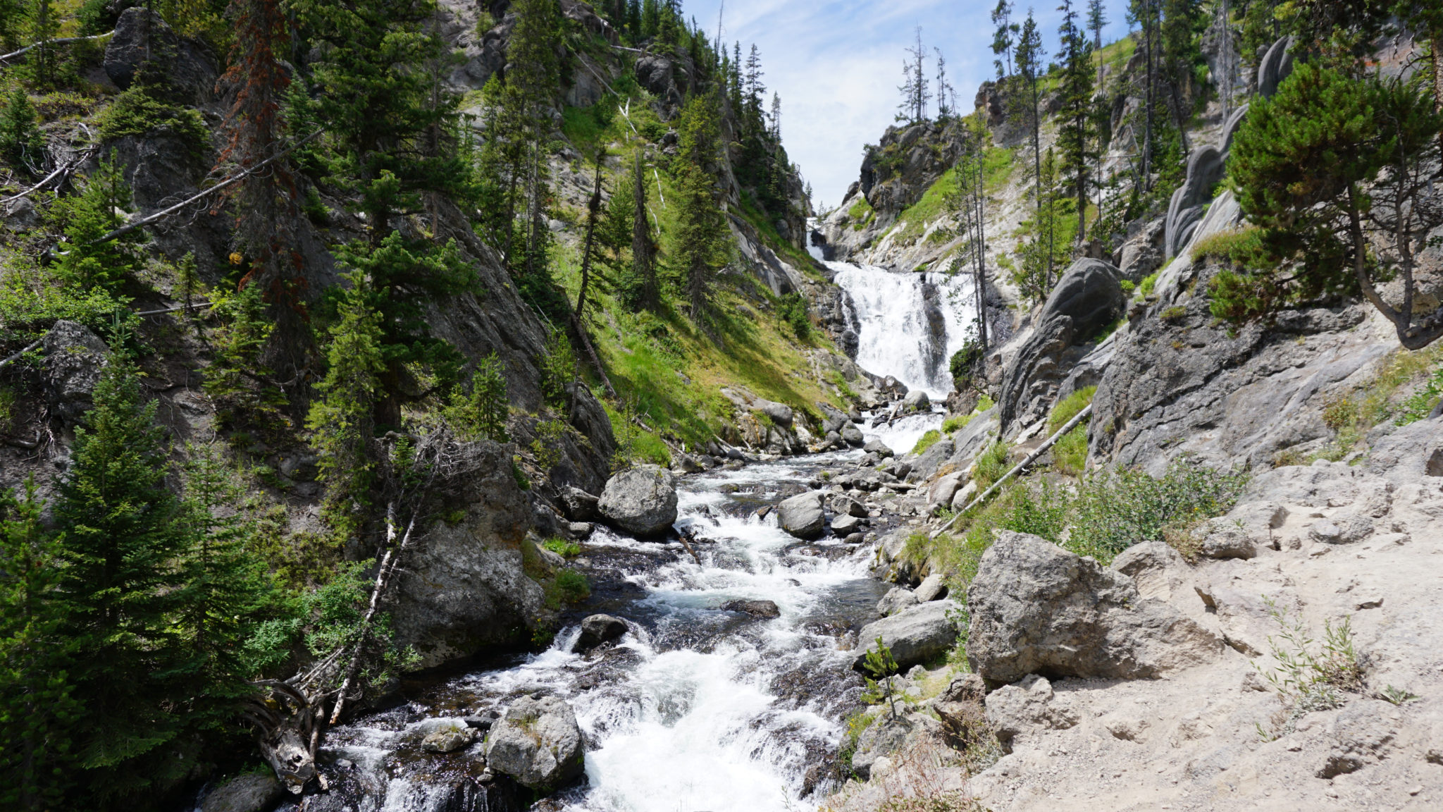
At 1.0 mile, the forest thins out, revealing grassy slopes dotted with over a dozen hot springs within a narrow gorge. Mystic Falls becomes both audible and visible at 1.1 miles. At 1.15 miles, you can view the falls from the trail, or you can carefully drop down an informal path to a spot close to the river for a different view. Another option would be to continue along the trail to its first switchback so you can see the entirety of the waterfall. The terrain below the falls is rugged and dangerous, so this is a waterfall best enjoyed from afar.

On your return journey, keep right at the Biscuit Geyser Basin loop to head due west on the southern branch of the boardwalk loop.

Tags: Biscuit Geyser Basin, Firehole RIver, Little Firehole River, Mystic Falls, Sapphire Pool, Shell Geyser, Summit Lake