There are few things more wonderful than trekking across a foreboding, seemingly barren desert landscape and ending up welcomed into a lush canyon oasis — and Murray Canyon provides that feeling in spades, with the additional joy of a series of small cascades tucked deep in its rocky recesses.
This is a wonderful desert hike — but despite the ample oases and water, remember that it is a desert hike. You’ll want to start early and pack plenty of water, sunscreen, and hats — especially for the sections where you’ll be hiking out in the open. But with the proper gear and right attitude, this can be a fairly moderate family-friendly hike and a wonderful introduction to the world of palm oases.
The trailhead begins at the same developed trailhead for Andreas Canyon (if you want, you can drive a bit farther through the picnic areas, which will cut off a little under 0.4 mile roundtrip from the distance listed here).

Follow the signs toward Maynard Mine and Murray Canyon and head south, crossing the dirt road over Andreas Canyon Creek. Keep left immediately after crossing to continue toward Maynard Mine / Murray Canyon. You’ll follow a road that passes several picnic areas shaded by bending palms, then arrive at another trail sign and map marking the trailhead for Murray and Maynard.


Here, the trail begins — and you’ll lose that welcome shade of the palm oasis. You may notice the temperature feels like it jumps up a bit because of that — which again, is why it’s so important to pack in enough water for everyone even though this is a relatively short hike.

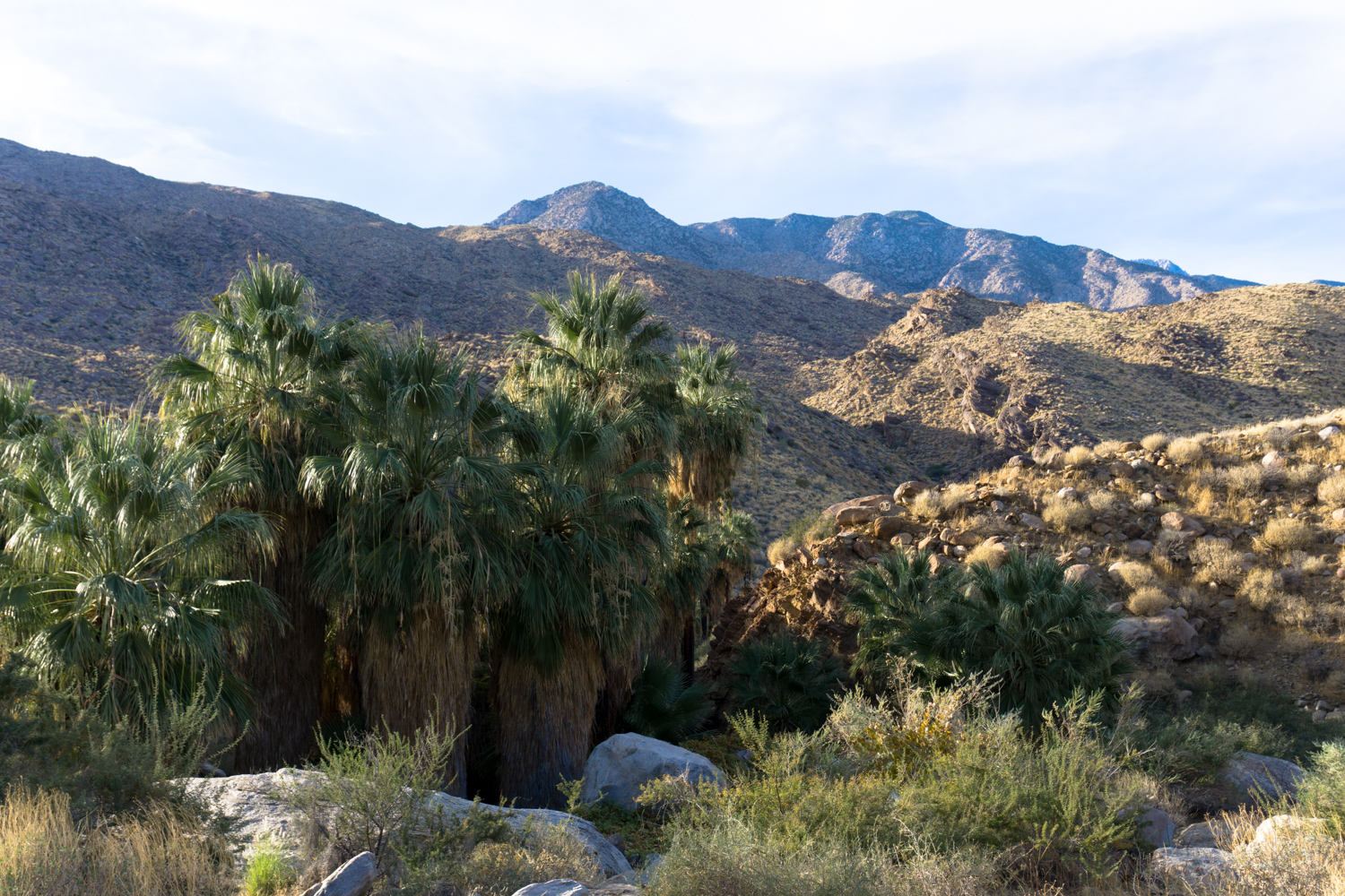
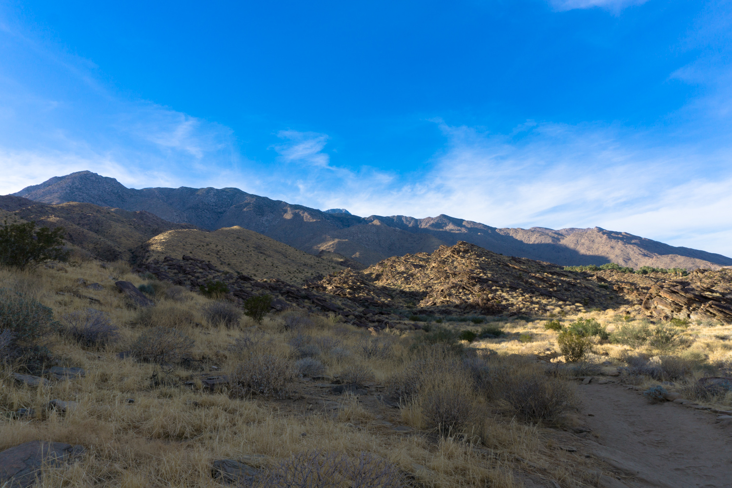
The non-oasis landscape is still pretty darn stunning, though — especially in early morning or late afternoon light, when shadows truly accentuate the rippling geography of the nearby San Jacinto and Santa Rosa Mountains. The rocky trail has a very gradual descent here before widening out and becoming sandier.
Just before the 0.4 mile mark, keep right at the junction to stay en route toward Murray Canyon.
The next 0.4 mile of trail is broad, sandy desert washes and footpaths out in the open — far from any shade but definitely not lacking in beautiful views.

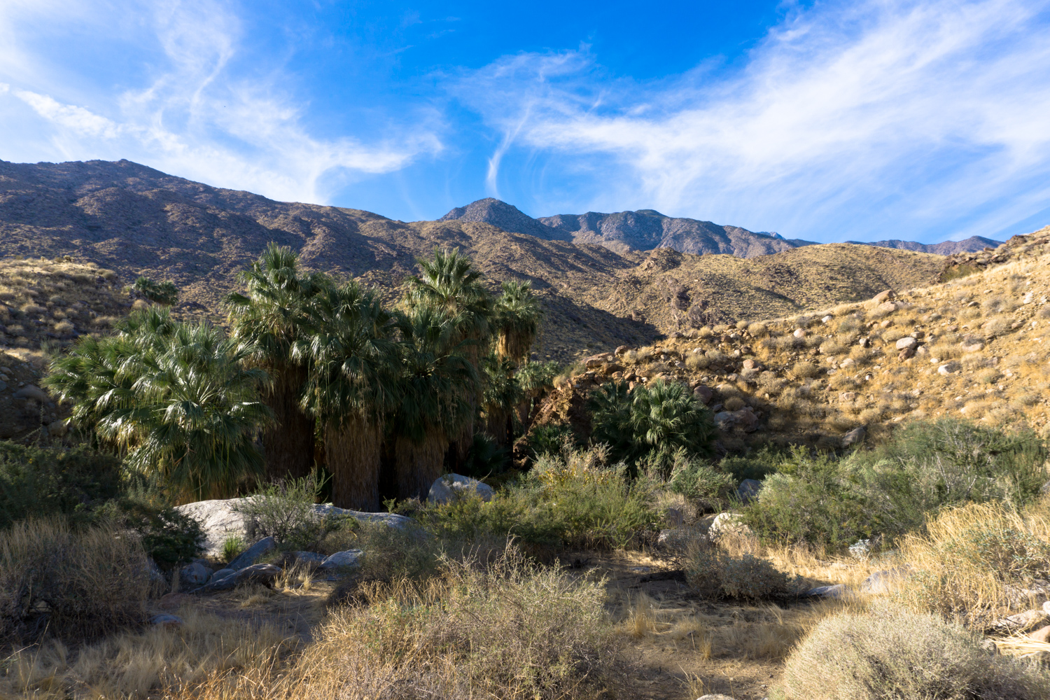
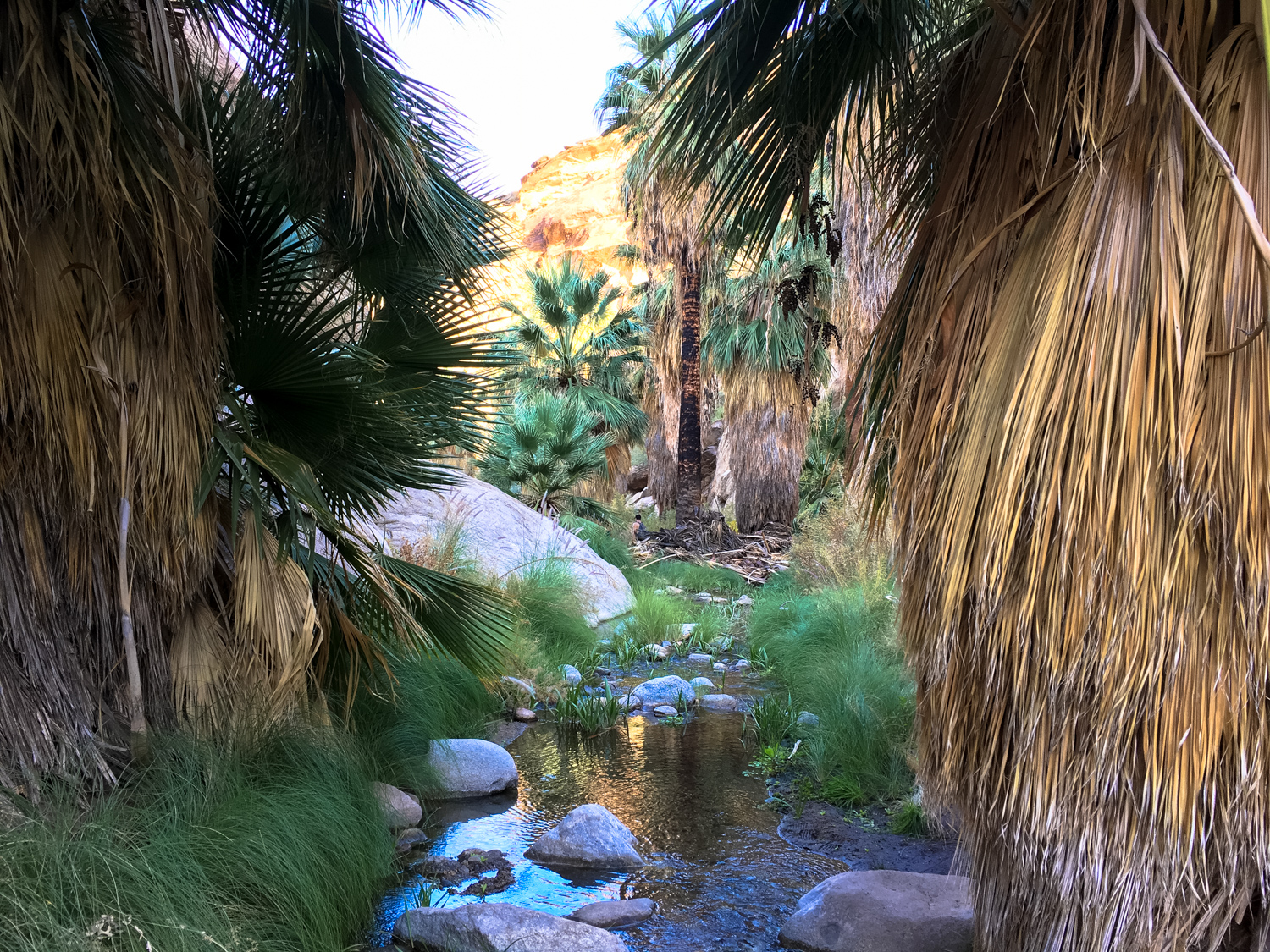
Just before 0.8 mile, you’ll come upon your next palm oasis, at the mouth of Murray Canyon. The trail makes a few quick switchbacks down a rocky face and directly into the oasis itself, and the effect is striking — you’ll hear and see running water, shade and cooler temperatures return, and if you’re quiet you’re likely to hear dozens of birds chirping and flitting about the palm fronds.


Head down onto the canyon floor, hop the creek, and keep to the right at the junction with the Coffman Trail to stay heading west into Murray Canyon.
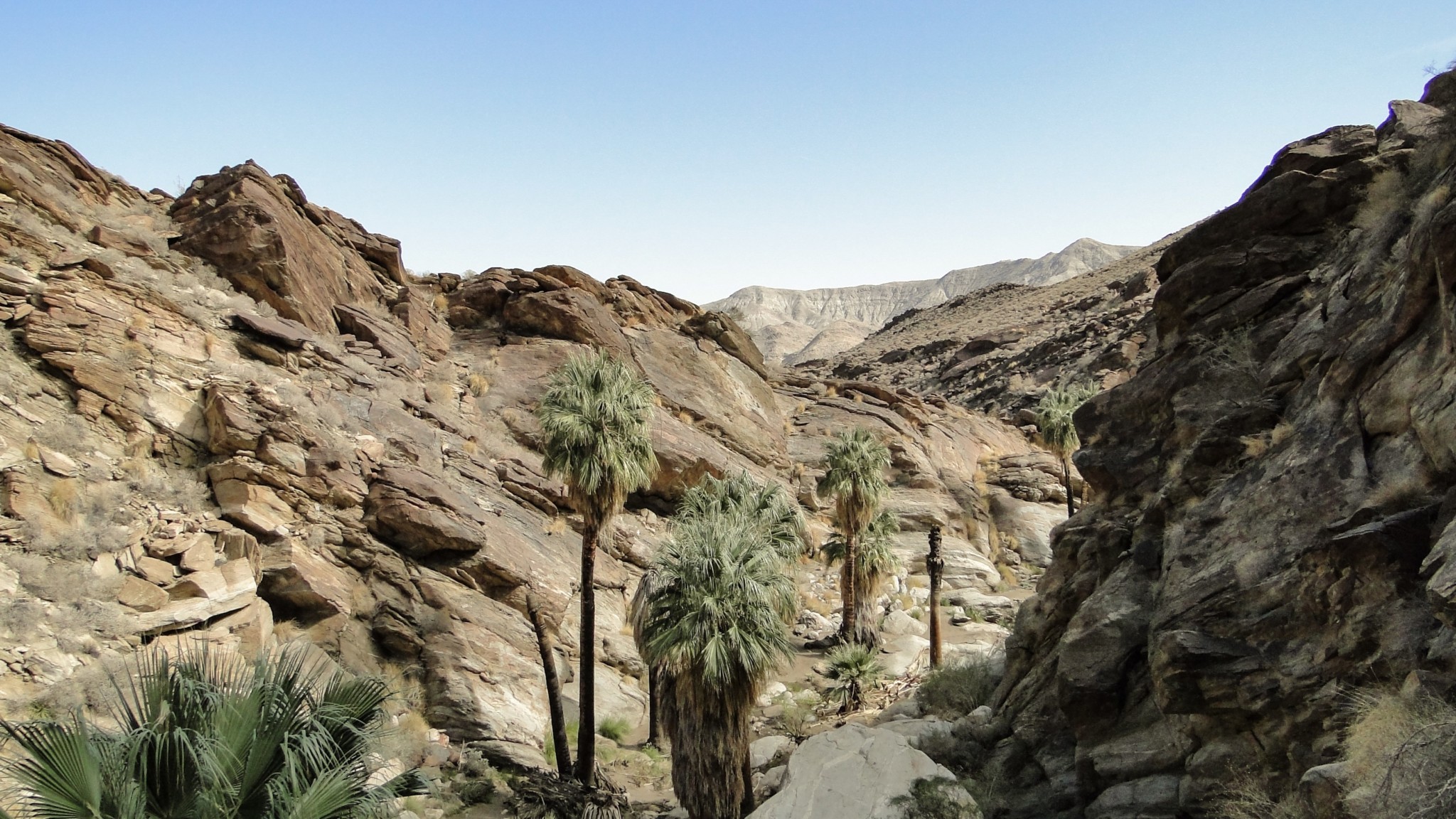
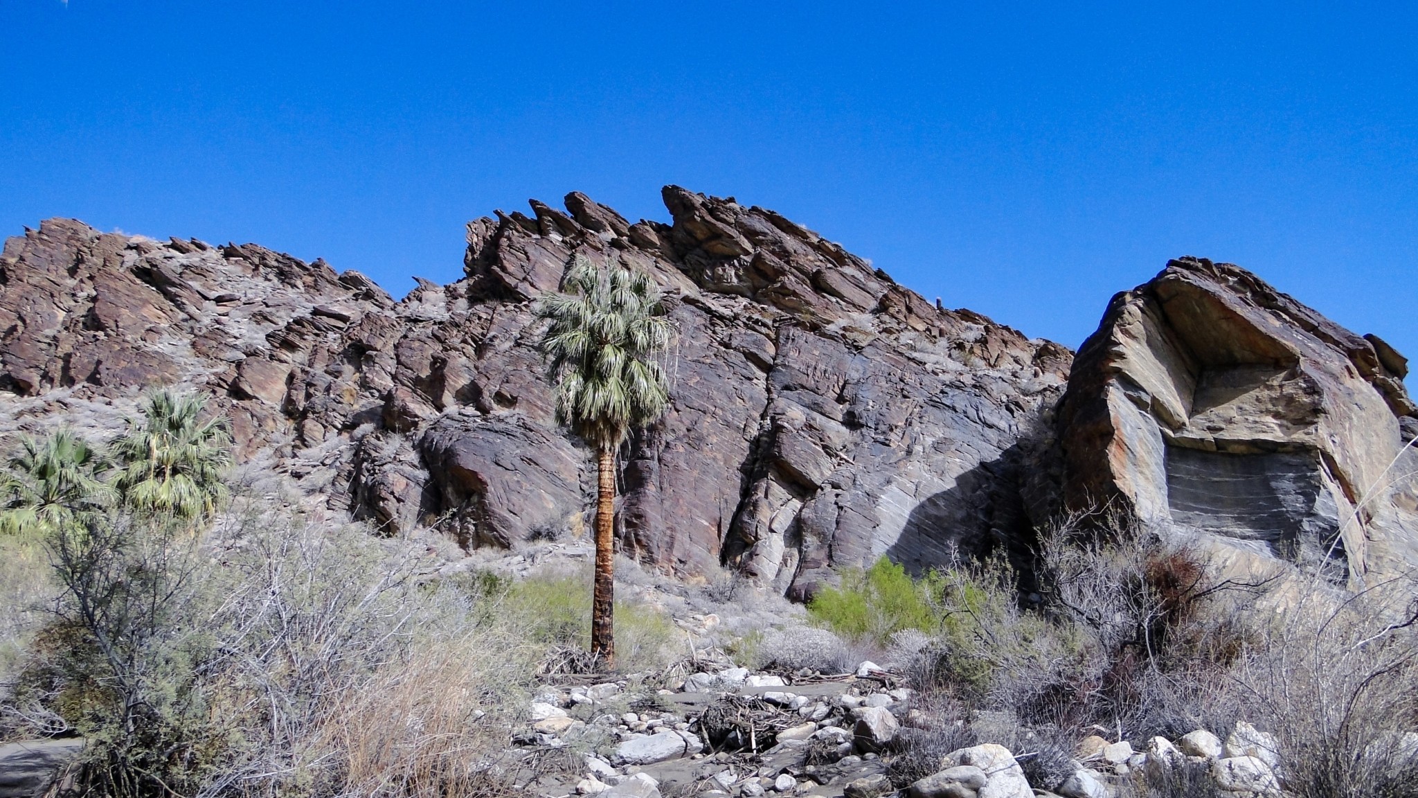
As you head into Murray, be sure to look back and note the strange rock formations and odd angles in the region — the result of nearby tectonic action from the good ol’ San Andreas Fault and its spur fault brethren.

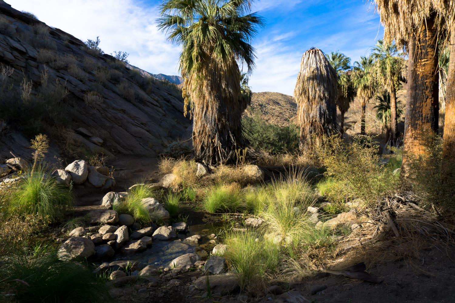
The trail now enters the narrowing Murray Canyon, where you’ll be following and hopping over the creek bed multiple times. The landscape here is remarkably verdant, with plants happy to be near such a reliable source of water.
The trail itself isn’t too tough to follow here, and even if you do manage to get your boots wet on a crossing, you can expect the dry desert air to wick that moisture off pretty quickly. Be on the lookout for bright spots of California fuchsia and desert sunflowers, as well as hyper-fragrant desert lavender.


The trail follows the contours of the canyon, which, in true desert fashion, meanders all over the place. You’ll start out heading west, then turn south, then head back east, then south again, then west, then south. The incline is fairly gradual for the most part, so although you’ll be climbing around boulders and hopping creeks, you likely won’t notice it too much.
At 1.5 miles, a connector trail departs to the left, heading up to the Coffman Trail on the ridge to the east of you. Stay in the canyon to continue toward the Seven Sisters Waterfalls.
Just past this junction, right before the 1.8 mile mark, the trail ascends on the south side of the canyon wall on a steep and rocky stretch that gets pretty close to becoming a scramble. It still isn’t technical and most hikers will be able to navigate this short section without any issue, but it is markedly different than the rest of the trail you’ve been on so far, so expect a slight uptick on the difficulty scale here.
You’ll be done with the steep climb by 1.9 miles, and after one more sharp turn in the canyon toward the south, you’ll be at the foot of the Seven Sisters Falls, where the trail ends.

boulder hopping in Murray Canyon
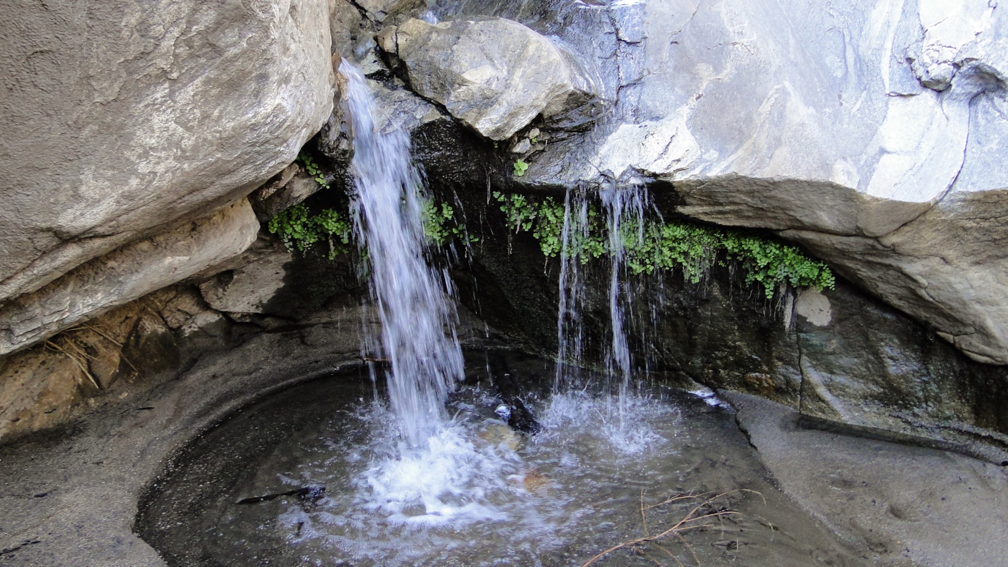
The Seven Sisters Falls is not a thundering or towering waterfall, but it is a lovely and beautiful series of stair step cascades that tumble down the canyon. If you can manage to get here without a crowd (and the distance and park entry fees do a bit to dissuade HUGE crowds), you can enjoy an absolutely sublime moment of desert wonder all by yourself.

The Seven Sisters disappear into the back of the canyon
When you’re done, return back the way you came.
Tags: Agua Caliente Indian Reservation, Andreas Canyon, Cahuilla Indians, Indian Canyons, Murray Canyon, Palm Canyon, palm springs, seven sisters falls