
An expanse of rare, white oak savanna hallmarks Mount Pisgah Arboretum and Buford Park, a natural area with more than 4,000 acres of restored habitat surrounded by farmland. Just a quick 20-minute drive outside Eugene, the natural area hosts day hikers, children’s nature tours and folks out for a casual stroll. The vast size and sinewy web of trails mean you can really choose your own adventure hike-wise – there’s a lot to explore, from wide-open meadows to the top of Mount Pisgah itself.
You’ll want to visit this area multiple times to get the full experience of the place, but for a first run, start at the gravel parking lot near the North Trailhead by taking a left at the end of Seavey Loop Road.

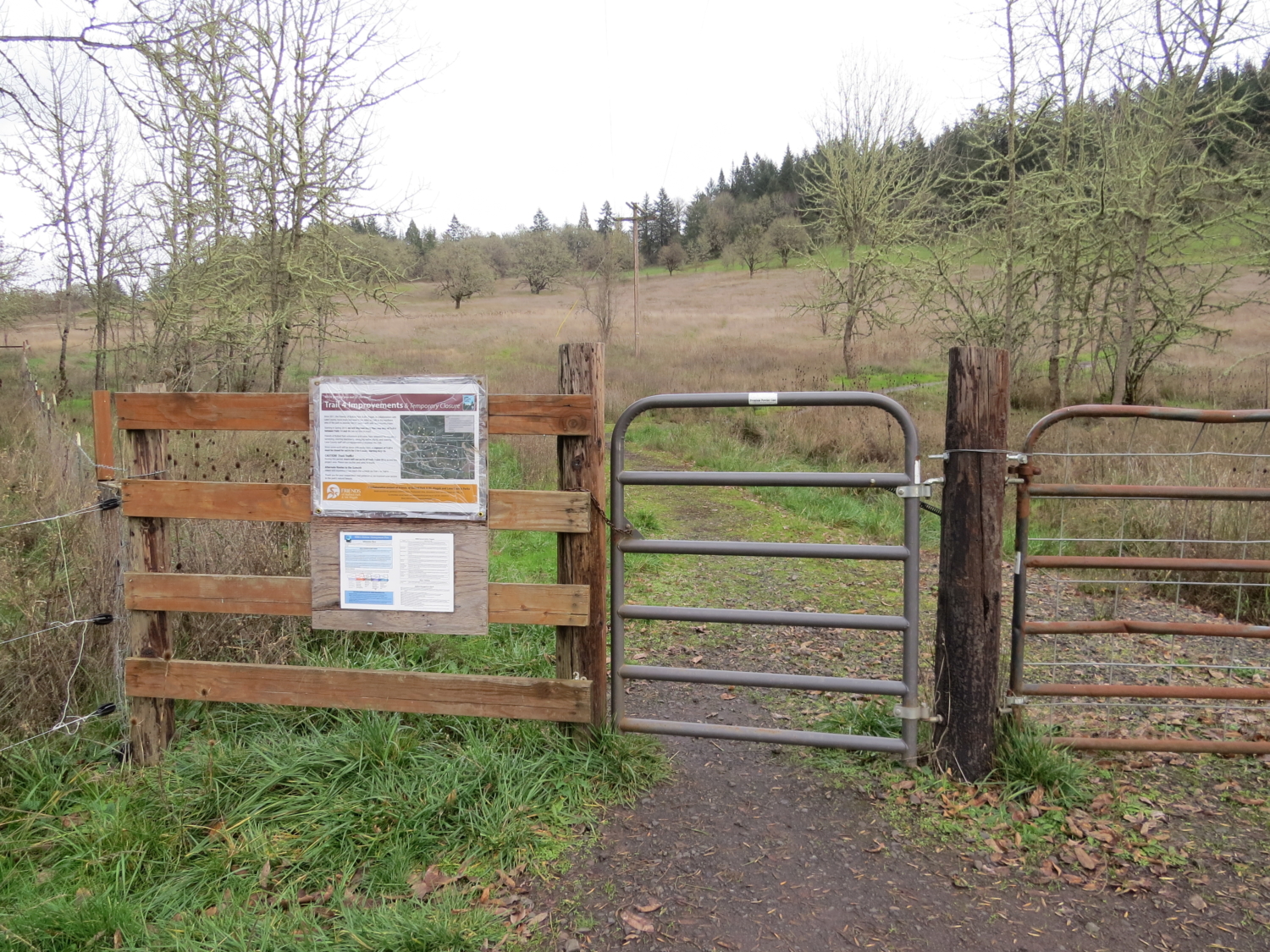
The lot isn’t much to look at – you’ll want to walk around a metal gate and into the heart of Buford Park on a road that takes you right past the native plant nursery. Pisgah is an interesting mish-mash of in-progress restoration projects, retired farmland and wild habitat that hosts hundreds of native species of plants and animals.

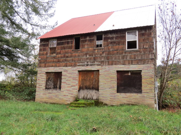
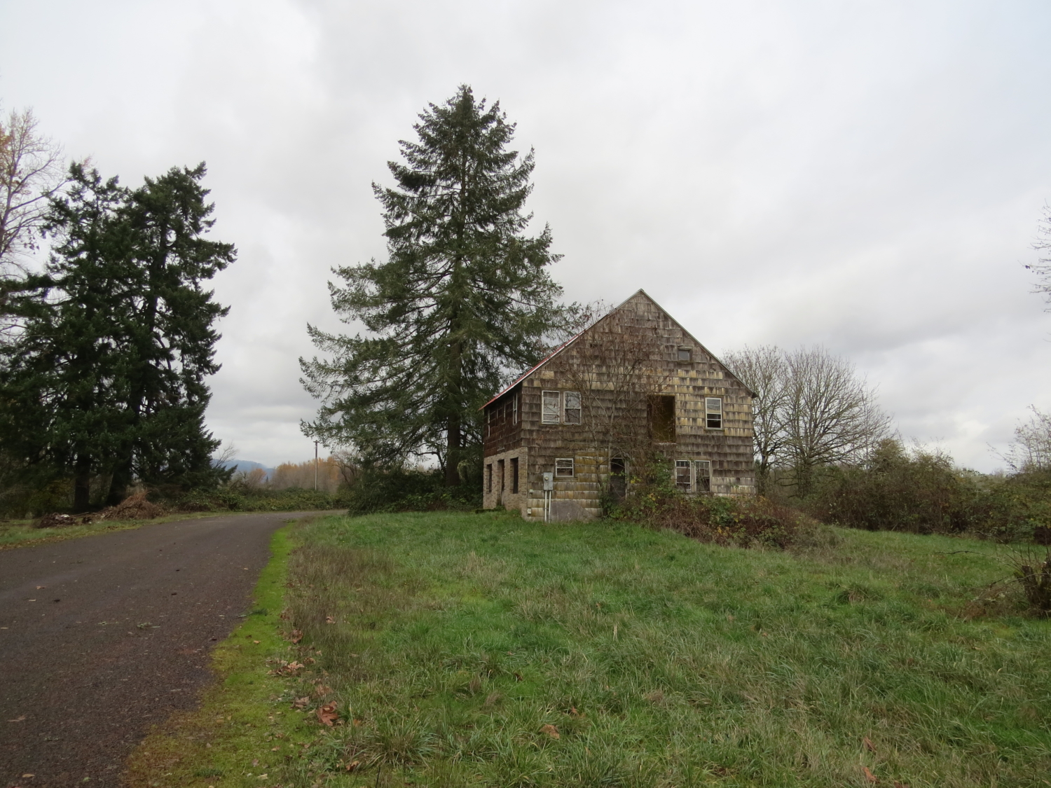
As you continue down the road to the trailhead, features such as an abandoned barn, a ramshackle farmhouse and a horse arena lend an unusual air to the arboretum landscape.
A metal gate marks the start of your trek – let yourself in and start your way up the hillside.

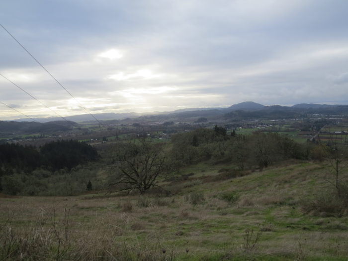
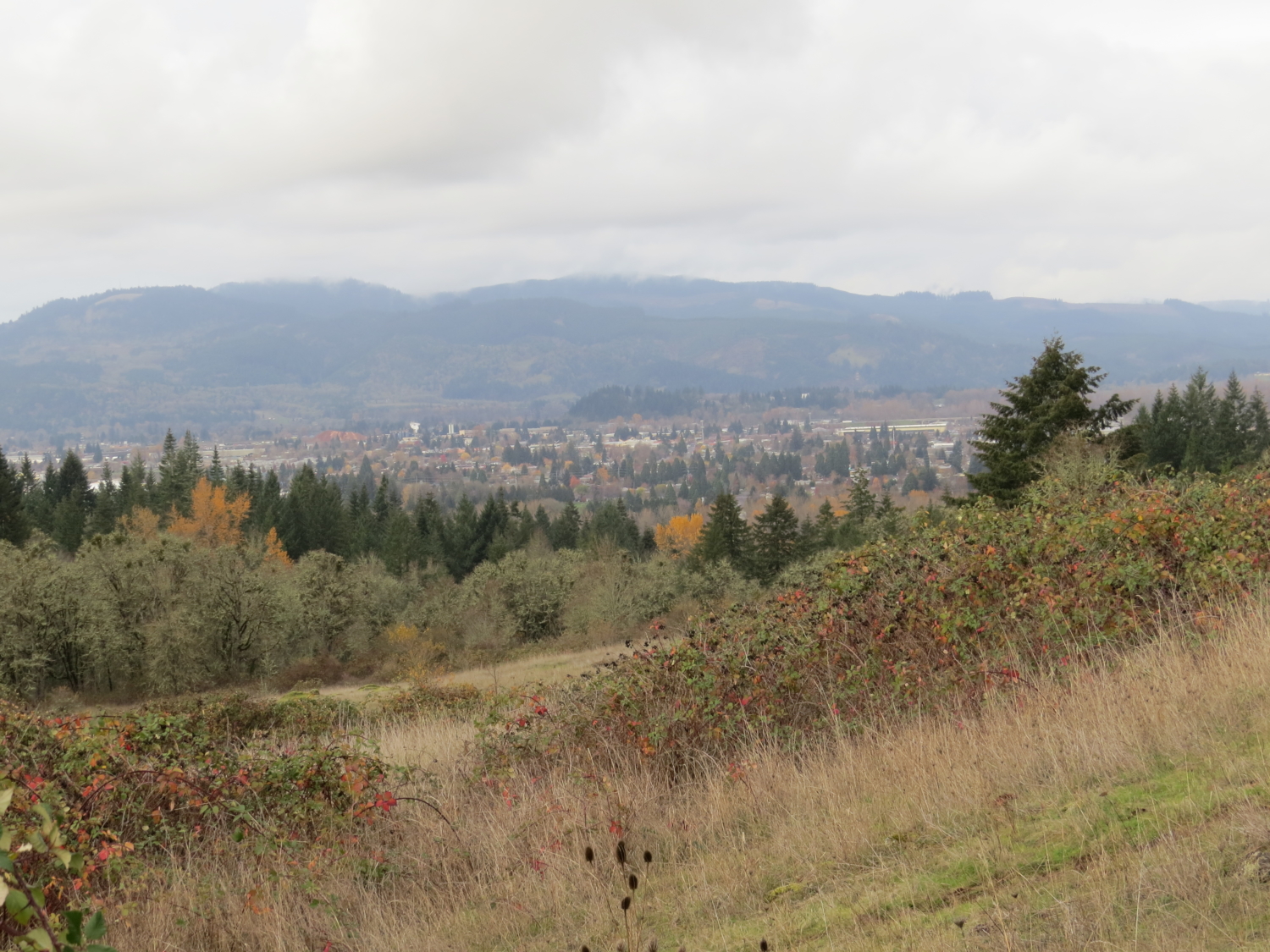
As you gain elevation, don’t forget to turn back every once in a while to catch a glimpse of the open fields of the arboretum below.
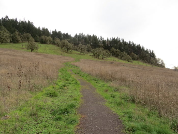
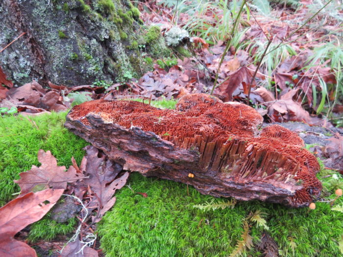
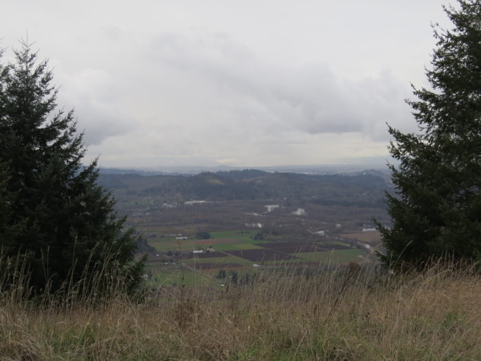
When your path hits its first diverging point, take a left instead of a right. This will keep you steadily climbing. Expect the openness of the countryside to give way to thicker, evergreen forest. In the quiet dampness, you’ll spot flitting Oregon juncos and plenty of unusual-looking fungi.

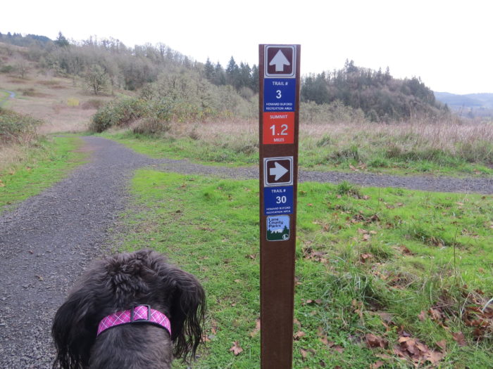
Once you break out of the dense tree cover, you’ll notice a series of well-marked trail signs. I chose to take Trail#3 to the top, but you can check out the trail map for shorter or longer routes.
The remaining climb upward offers some rewarding views of the land below. If you’re lucky, you might catch sight of an osprey or red-tailed hawk joining you in your ascent above the valley.

A few more steep pushes upward, and you’ve made it to the top. On a popular hike like this, prepare to be joined at the summit by a handful of day hikers and dogs eager for a romp.
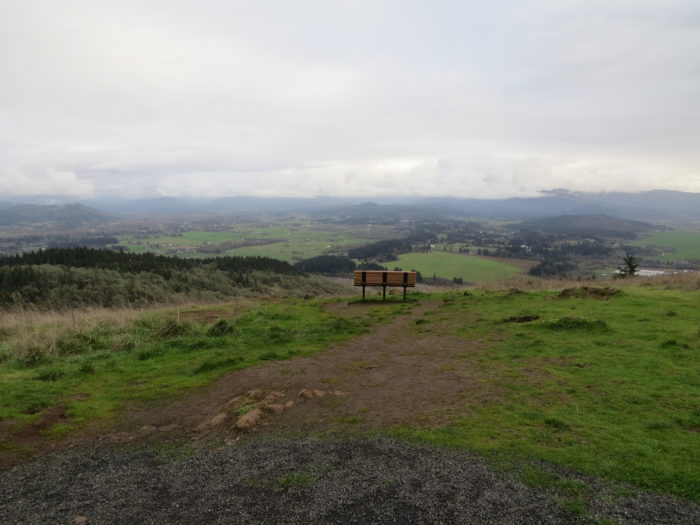
The top of Mount Pisgah is large, with plenty of room to accommodate the crowds. Views of the valley below span out in all directions, draped in sumptuous Oregon green. The crisp air and gentle breeze lend a meditative, mountain-top quality, if you momentarily forget you’re only 1,500 feet up.

Take a leisurely stroll at the top, then choose your way back – several paths will take you to a separate trailhead and parking lot, while others will drop you back where you started, though perhaps in a more circuitous way. If you’re feeling really adventurous, you can attempt to find the secret rope swing that has always eluded me but is rumored to exist.

Tags: day hike, dog-friendly, Eugene, foliage, Hiking, Lane County, nature, oregon, outdoors, Trail Write-Ups


