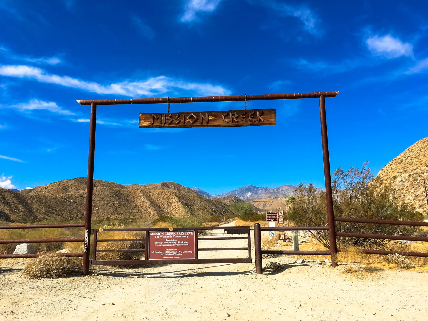
If crowded trails in nearby Joshua Tree National Park get you down and you’re still in the mood for some beautiful desert hiking — and maybe a bit more water — you’ll want to head down to the nearby Sand to Snow National Monument. The Monument connects the western edge of Joshua Tree with the larger San Bernardino Mountains, and features exemplary desert and mountain scenery. Here in the Wildlands Conservancy’s Mission Creek Preserve, hikers can trek through desert wetlands (!) alongside Mission Creek, passing historic structures and stunning desert plant communities, all with the backdrop of Southern California’s tallest peak looming in the distance.
From the 29 Palms Highway, turn west onto the dirt Mission Creek Road. The washboard road is passable for most cars as long as we haven’t had a ton of rain recently. You’ll continue down this road and eventually reach a locked gate.

If you didn’t get in touch with the Wildlands Conservancy prior to your visit, you’ll have to park your car here and start your hike along the dirt road, adding about 3 miles roundtrip to the hike.
If you let them know you’re coming in ahead of time (2 business days minimum, please!), you’ll get a code to open the gate. Be sure to lock it behind you and continue along the road to the Stone House.
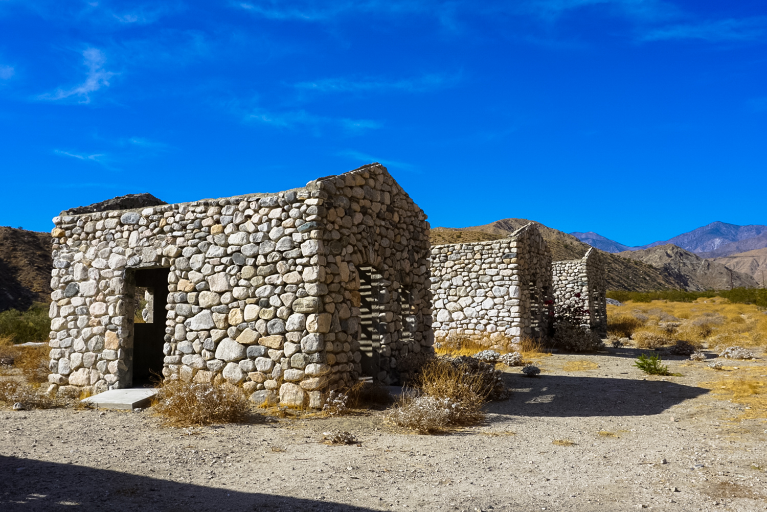
On the way, you may want to stop to check out the remnants of a former reservation area turned into a not-terribly-successful dude ranch.

the interiors of these old cabins are now shaded picnic areas

An old swimming pool, if you can believe it.
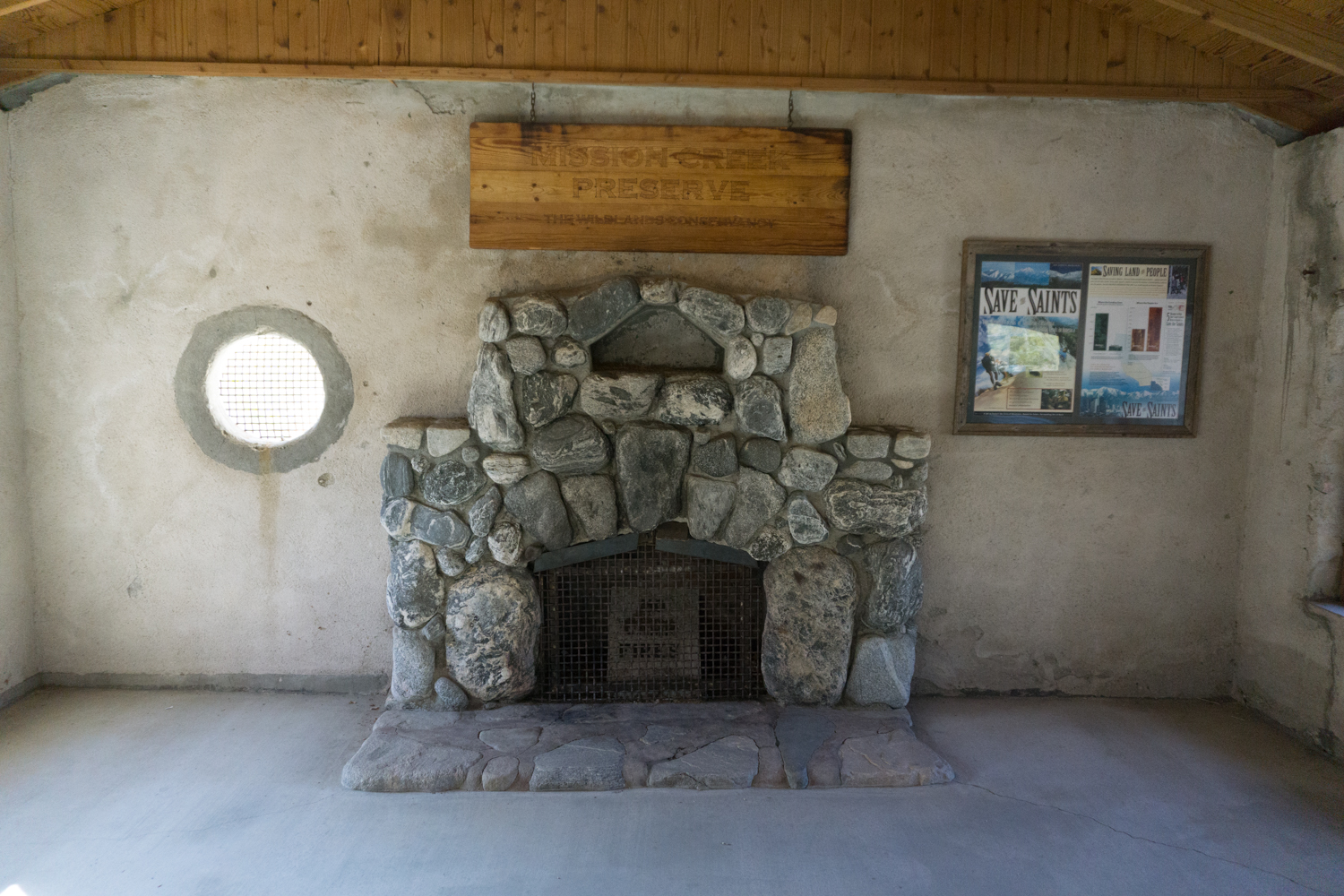
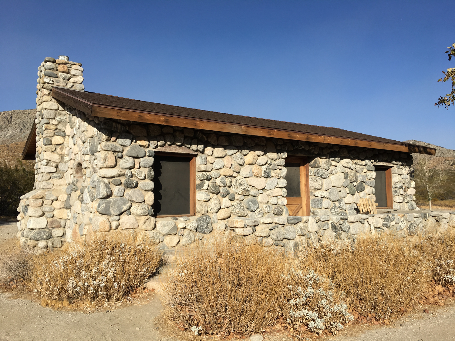
Continue to the Stone House — another remnant of the dude ranch days. The interior of this building is open, featuring maps and a few interpretive exhibits. There are also nicely maintained flush toilets, but you are warned not to drink the water because of elevated fluoride levels.

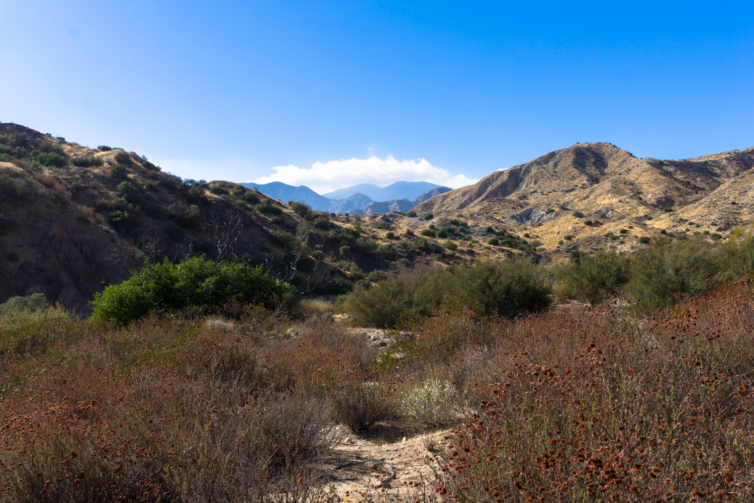
The trail dips along the south side of the house, then continues heading generally west as it follows the canyon of Mission Creek.
The terrain here is beautiful and stunningly quiet — even in the early winter before our wet season has truly kicked in, the rust-colored remnants of buckwheat and feathery rabbitbrush provide a fall color palate that nicely balances the creosote, mesquite, and yucca. Mission Creek generally flows year-round, and you’ll likely get a chance to enjoy the gurgling of the stream on most of the hike.


As you hike, you’ll be pointed in the direction of San Gorgonio Mountain — the tallest peak in Southern California. If we’re having a good wet winter, these towering mountains might even be capped in snow and ice, allowing you perhaps a greater appreciation of the National Monument’s name while you’re tromping through the sandier sections.

There are rolling swaths of fragrant creosote covering the rolling hills and impossibly large, dense groves of desert willows that may reward hearty summer desert hikers with their showy pinky blooms (not to mention their tendency to attract hummingbirds).
Just past the 2.1 mile mark, the trail meets up with the venerable Pacific Crest Trail at a signed junction. You can hike another 1.2 miles to a beautiful overlook of San Gorgonio Mountain, or if you have a car shuttle, you can head south on the PCT toward the Whitewater Preserve and the Canyon Loop Trail.
Tags: mission creek, mission creek preserve, Sand to Snow National Monument, Whitewater Preserve, wildlands conservancy