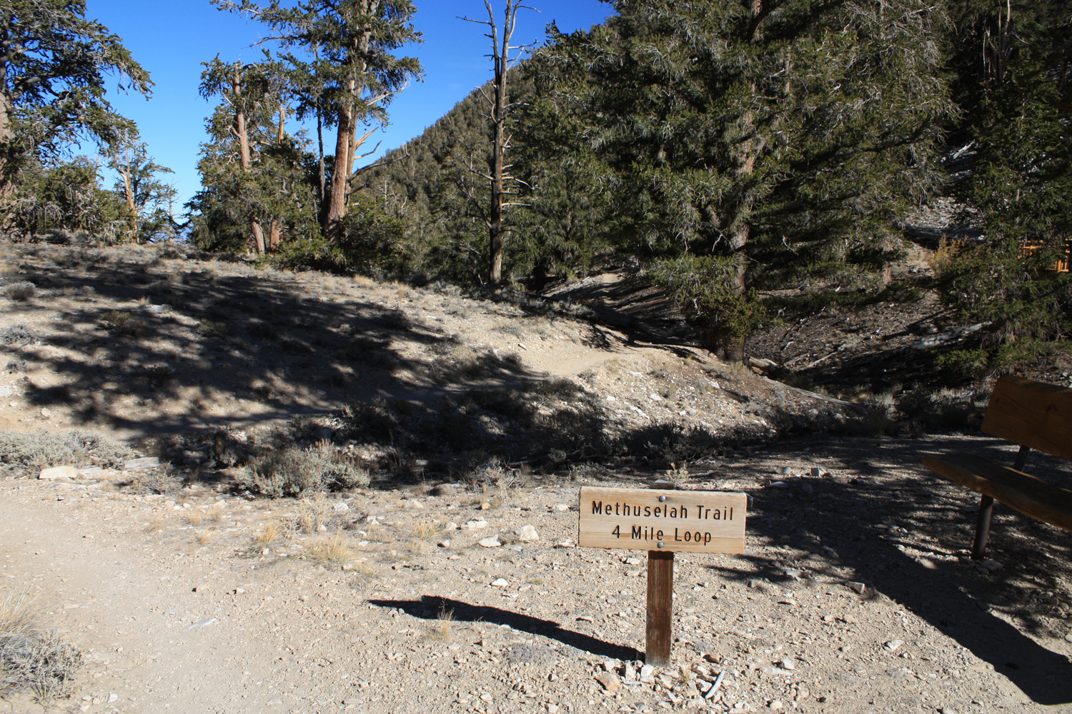
The Methuselah Walk is a 4 mile loop trail in the Ancient Bristlecone Pine Forest section of the White Mountains, where hikers can escape the heat of the Owens Valley floor to walk through the oldest known living forest — and the world’s oldest living trees.
Even if the prospect of hiking near trees that are over 5,000 years old doesn’t get you excited (and come on, why wouldn’t it?), the hike itself is an exceptional taste of the scenery of the high altitude bristlecone pine forest in the White Mountains. You’ll pass a community of plants that has carved out a sliver of existence and stood the test of time in some incredibly harsh weather and extremely difficult growing conditions.
Begin at the Ancient Bristlecone Pine Forest visitor center, which offers lots of information on the region and the plants and animals you might encounter on your hike.

Once you’re all stocked up on information, head out to the circular parking area and look for the signed Methuselah Walk trailhead.
One thing to note about this trail: although it’s not terribly difficult or technically challenging, you will be hiking around and above 10,000 feet of elevation, so expect this hike to potentially be a bit slower than you’d expect at sea level. You should also be prepared for large temperature swings and definitely slather on the sunscreen.
For extra interpretation, leave a dollar and pick up one of the printed brochure / maps for this route. It will point out some interesting features along the way, as well as provide a greater understanding of the bristlecone pine forest as a whole.
You’ll start off with a slight drop in elevation as you dip into the upper drainage of the South Fork of Birch Creek. At about 0.2 mile, keep to the right with the closure of the loop to walk the hike in a counterclockwise direction. Here, you’ll notice the forest on this north-facing slope is a bit more dense than it is on the south-facing slope of the hill to the north of Birch Creek. Although these trees receive less sunlight, the snow lasts much longer on the north-facing slopes, meaning the bristlecones have a longer opportunity to soak up that moisture. The White Mountains are a desert mountain range, and the forests here average between 10 to 12 inches of precipitation per year. For comparison, the Sierra Nevada, just west across the Owens Valley, can get between 20 and 80 inches depending on the location and elevation.


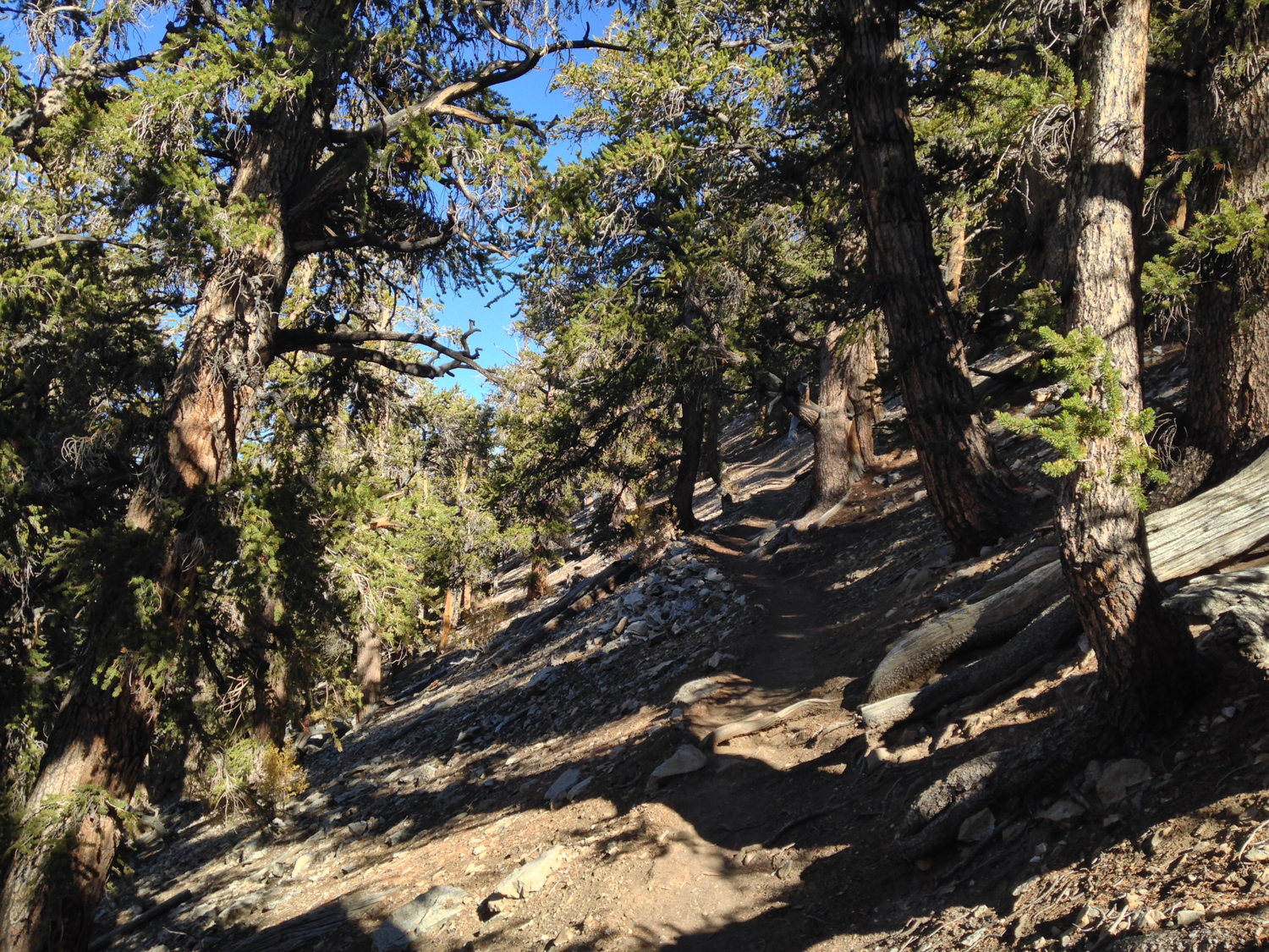
At 0.5 mile, you’ll reach the highest point of this loop trail, as well as the first of several rest benches available along the route. This is a great place to soak in the views, as well as appreciate just how rugged these trees can be.
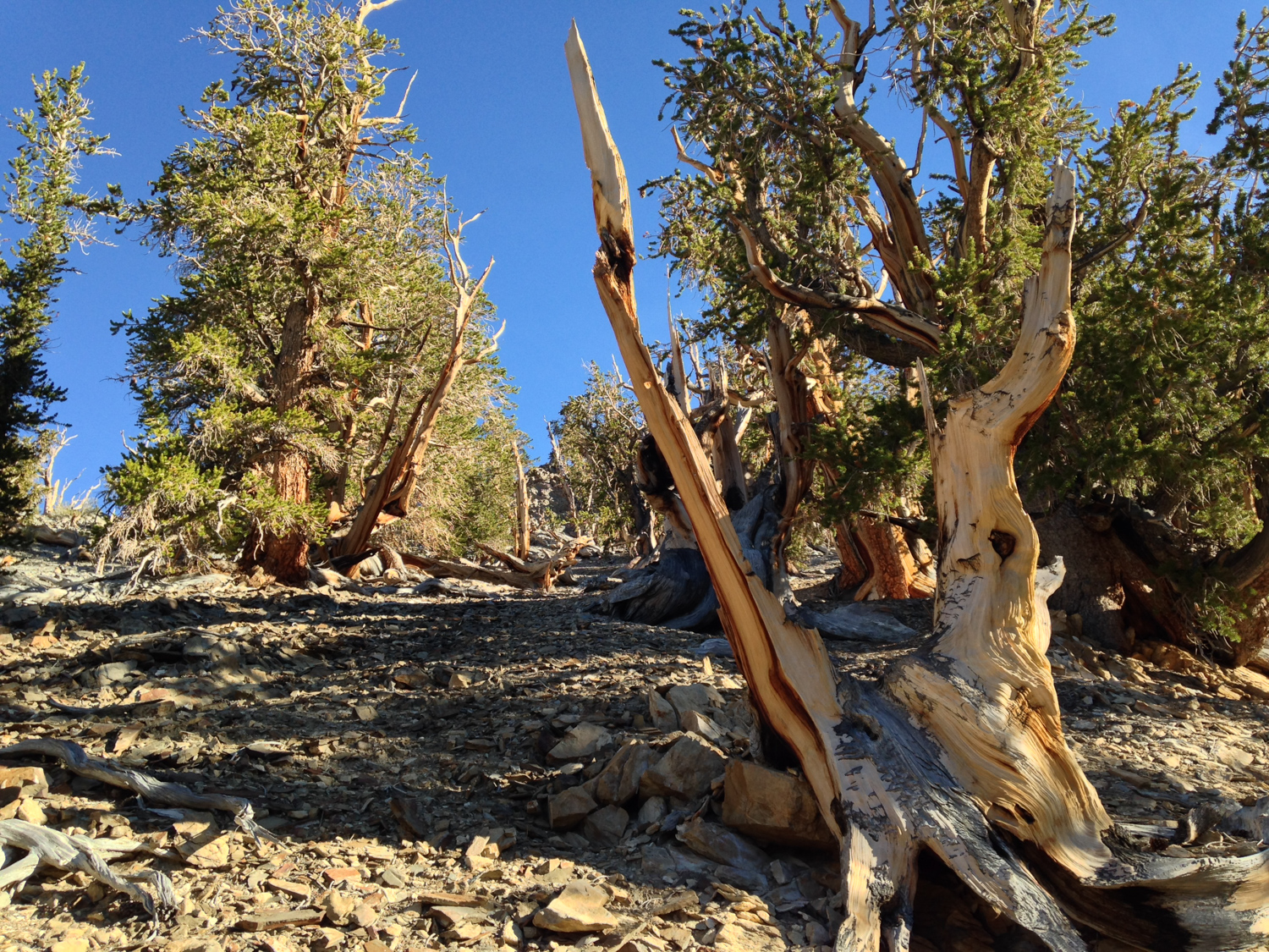
Bristlecone pines are one of the few plants that can grow in this very alkaline and nutrient-poor dolomite soil — which is why you’ll often find them growing where nothing else is growing nearby.


As the trail turns south, you’ll have some spectacular views of the ragged valleys to the east, and stay straight at 0.8 mile at the junction with the Cabin Trail to stay on the Methuselah Walk.


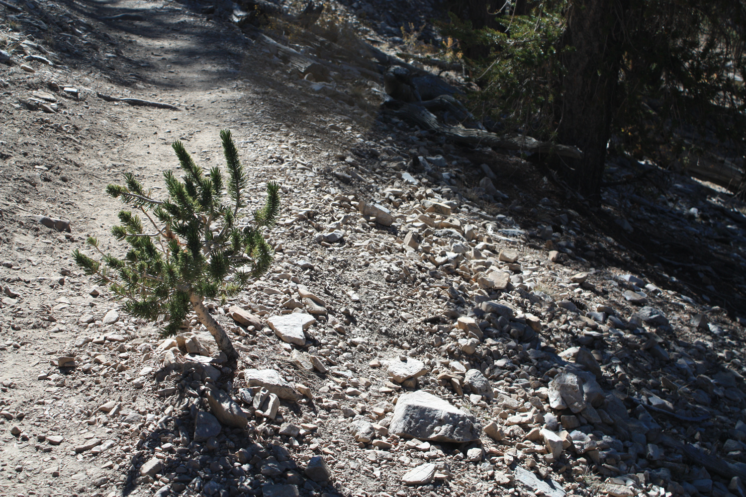
Here, you may notice some of the bristlecones’ roots stretching out and across the trail here. Despite potentially growing to showcase massive, gnarled trunks, the root systems of bristlecones are surprisingly shallow. After they sprout, seedlings rapidly send out lateral roots near the soil surface but never the deep taproots many other plants use in dry environments. Some roots can reach up to 50 feet away from the main trunk, and they can be fragile — so please do stay on the trail to avoid accidentally damaging these plants.

At 1.4 miles, the trail turns toward the east and continues dropping in elevation. The lower elevation and south-facing slopes here mean you’ll be hiking out of the sub-alpine zone and into a transition zone where different plant communities thrive. Here, you’ll notice fewer bristlecone and limber pines and more Mountain Sagebrush and Mountain Mahogany.
By the 2.1 mile mark, the trail makes a sharp switchback to the southwest, where it continues heading downward. However, now you’ll be on a north-facing slope, meaning cooler temperatures and better homes for bristlecones again.
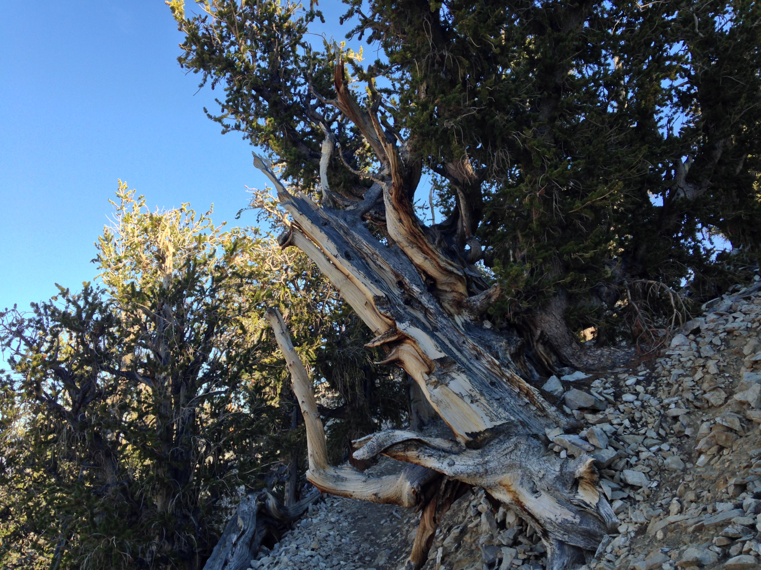
At about 2.3 miles, you’ll hike into an area called the Sculpture Garden. Here, extreme weather conditions, wind, and ice have sculpted these slow-growing bristlecones into impossible shapes. Many of the trees here are several thousand years old, so take your time and enjoy these unique and beautiful plants.


Just beyond the Sculpture Garden, at about the 2.4 mile mark, you’ll enter the Methuselah Grove.
It was in this location in 1957 where Dr. Edmund Schulman took a sample from one of the bristlecones nearby while doing research on climate records in tree rings. Back at camp, while inspecting the specimen under a microscope, he exclaimed “We’ve got a 4,000-plus tree!”
That tree, known as Methuselah, was eventually dated to be over 4,800 years old with a germination date of 2833 BCE! It is still somewhere in this grove, although its exact location is not available to the general public. Part of the charm of walking through the grove, honestly, is not really knowing which one is Methuselah — with bristlecones, larger doesn’t always mean older, so while you may spot a towering, thick-trunked specimen, the runt down the trail may actually be hundreds of years older.
For many years, Methuselah was the oldest known living non-clonal organism. A researcher accidentally cut down an even older bristlecone in Nevada in 1964, but in 2012 another bristlecone pine near the Methuselah Grove was discovered with a germination date of 3050 BCE.
It is impossible to hike through this place and not feel yourself as an infinitesimal speck on the timeline of the universe. Soak in that feeling. It’s good for you.

The trail hits its lowest point of elevation at 2.75 miles, and then you’ll close the loop at 3.9 miles.
Tags: Bristlecone Pines, Inyo National Forest, methuselah tree, Schulman Grove, White Mountains