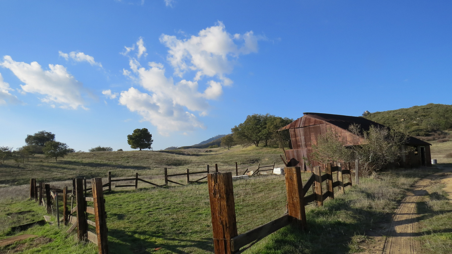
UPDATE 8/2020: The rusted-out old barn was removed approximately three years ago.
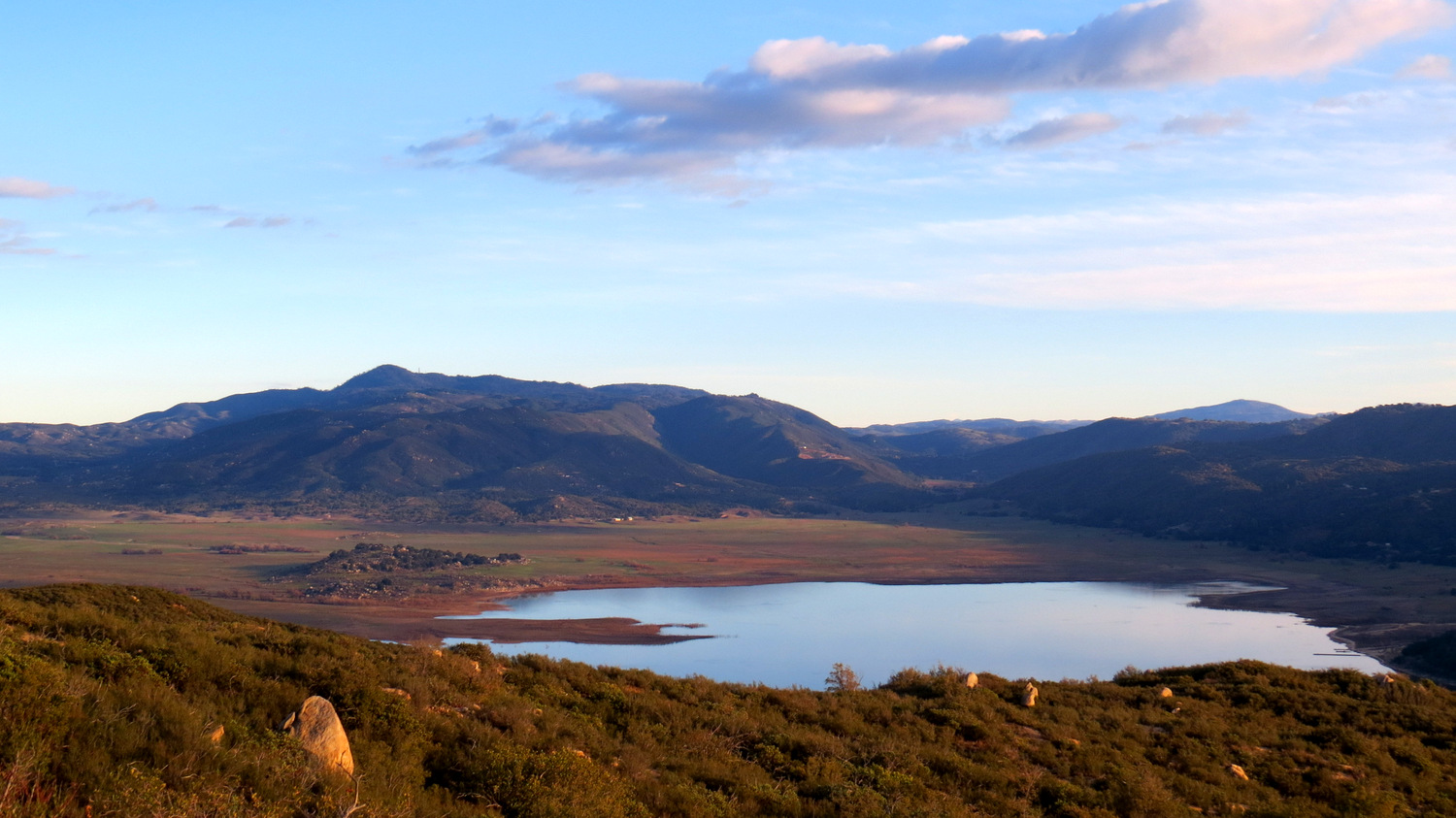
Palomar Mountain’s topography features a number of pocket valleys hidden within the folds of rolling ridges. Historically, these valleys have served as cattle pastures for pioneering ranchers who settled the range and adjacent San Jose de Valle south of Warner Springs. Over time, a handful of these valleys, including the Doane Valleys and French Valley in Palomar Mountain State Park, passed into public ownership and became available for recreation. Serene, secluded, and resplendent especially in the winter and spring, Love Valley offers repose, beauty, and some impressive views across Lake Henshaw.

Although Love Valley has passed into the stewardship of Cleveland National Forest, the pioneering Mendenhall Family (they of Mendenhall Valley fame) continue to graze their cattle on the land during the winter and spring. Visitors during that time can expect to share the area with bovines, and it is partly for this that the area is managed as a day-use area only despite its attractiveness as a backpacking destination. Cows are generally docile and intellectually vacant, but they have been known to show aggression when people get too close, especially to the babies. Keep a respectful distance.

From the signed trailhead, pass through the gate and follow the dirt road heading south. After a hundred or so yards, look for an unmarked, informal path that leaves the dirt road. Turn right, passing first through dense chaparral and soon through an oak-shaded ravine. Three types of oak populate the rim of Love Valley: coast live, black, and Engelmann. All three trees are beautiful, especially here in a relatively wet part of the county at a transition zone between hot foothill climate and cooler montane climates. The coast live oak features dark, leathery green leaves that curl like a taco shell during drought. Engelmann oaks have sparser, semi-deciduous foliage of a lighter green-gray color. Deciduous black oaks transition through a range of colors with new spring leaves coming out pink, transition from light to dark green, and then ultimately turning gold and orange during fall.

Coast Live Oak

Black Oak in Spring
This informal trail terminates at a dirt road on the northern end of the valley. Looking south, you will see a rusted corrugated metal barn slowly working toward a state of romantic dilapidation. Turn left on the road to head toward the barn, which you can enter at your own risk. Continue south from the barn past the small stable. Just beyond the stable, a faint informal path leads southwest and south into the center of the valley toward a small pond set in a depression in the valley’s center. During winter and spring, particularly in wet years, this pond shimmers in the sun, reflecting passing clouds or brilliant sky blue. Looking north from this spot, the front ridge of Palomar Mountain swells toward the forested heights of Birch Hill.


After returning to the barn, make a right onto the dirt road. The road skirts the eastern edge of the valley. As you walk, you will have the valley’s meadow on your right with a thin barrier of oaks dividing the valley from the chaparral on the hill to your right. At 1.45 mile (assuming you go down to the pond first), you reach a junction. The left turn will lead you around the edge of the valley before petering out at the the valley’s southernmost point. Turn right to climb away from the valley on a dirt road that loops back to the parking area.


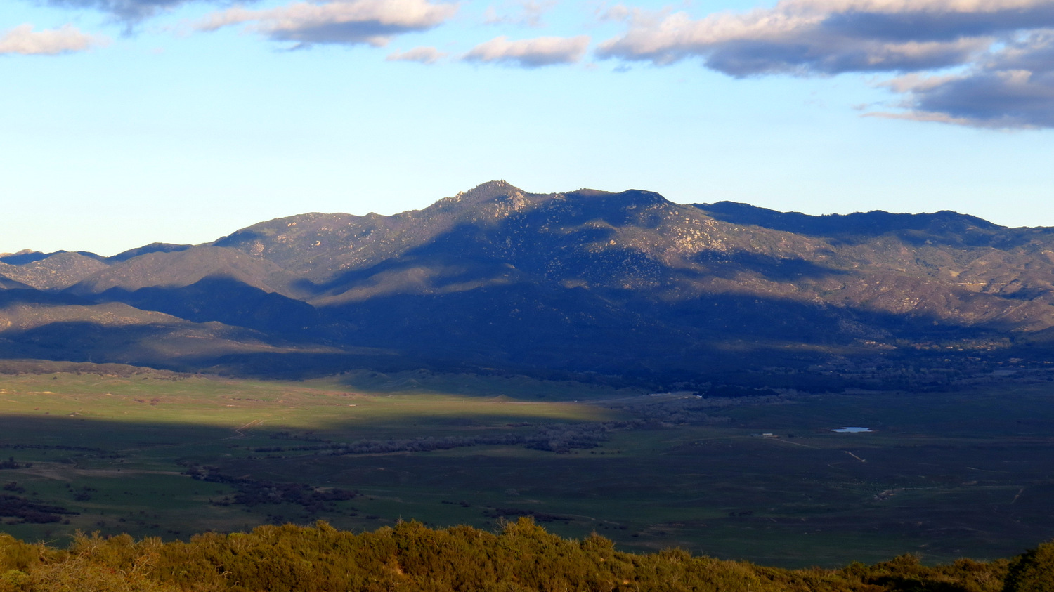
The road reaches a high point just southeast of Peak 3679 (as marked on USGS topo maps). From this point, beautiful views emerge looking south across Lake Henshaw toward the Volcan Mountains in the southeast and the San Ysidro Mountains dominated by Hot Springs Mountain to the east. Those views diminish somewhat as the road turns to the north and heads back toward the parking area. You will pass through one last small meadow shaded by several stately black oaks before the road returns to the gated starting point and the end of the route.


Tags: Cleveland National Forest, East Grade Road, Lake Henshaw, Love Valley, Palomar District, Palomar Mountain