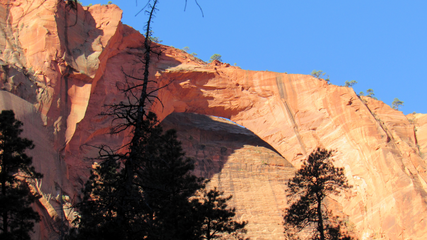
Tucked deep within a side canyon feeding into La Verkin Creek Canyon stands one of the world’s largest freestanding arches. Kolob Arch spans 287 feet across open space high above a heavily wooded grotto. This route through La Verkin Creek Canyon offers an easy backpacking trip or a strenuous dayhike through the relatively quiet confines of La Verkin Creek and Timber Creek Canyons.

Although conditioned hikers can complete this route over the span of a fairly long day, the option for backpacking may prove more inviting. Ten designated sites line the route at irregular intervals beginning just before the trail climbs away from Timber Creek and culminating near the junction with the Kolob Arch Trail. Each of these trails are numbered, with the lowest numbered sites beginning in Timber Creek Canyon and progressing sequentially as you travel up La Verkin Creek.

Backpacking in Zion National Park requires a wilderness permit, which you can reserve in advance or, if you’re feeling lucky, attempt to procure the day of or before your hike. Given that even this lightly visited area can fill up during Zion’s high season (late spring through early fall), it behooves backpackers to attempt to reserve their permits in advance. Using Zion’s online permit reservation system, you can attempt to reserve a specific campsite. On the 5th day of every month at 10:00 am Mountain Time, campsite reservations become available for the month after the next month. For example, if it is January 5th, campsite reservations would become available for March.
Also remember that a permit reservation is not the same as the actual permit. Before you commence your hike, you will need to obtain your actual permit from the Kolob Canyon visitor center. Until you actual have the paper permit in hand, and until you’ve demonstrated to the issuing ranger that you understand Leave No Trace principles and that you are ready for your endeavor, you will not be able to start your hike. Yes, this process is as convoluted as it sounds, but so it goes with National Parks as popular as Zion.
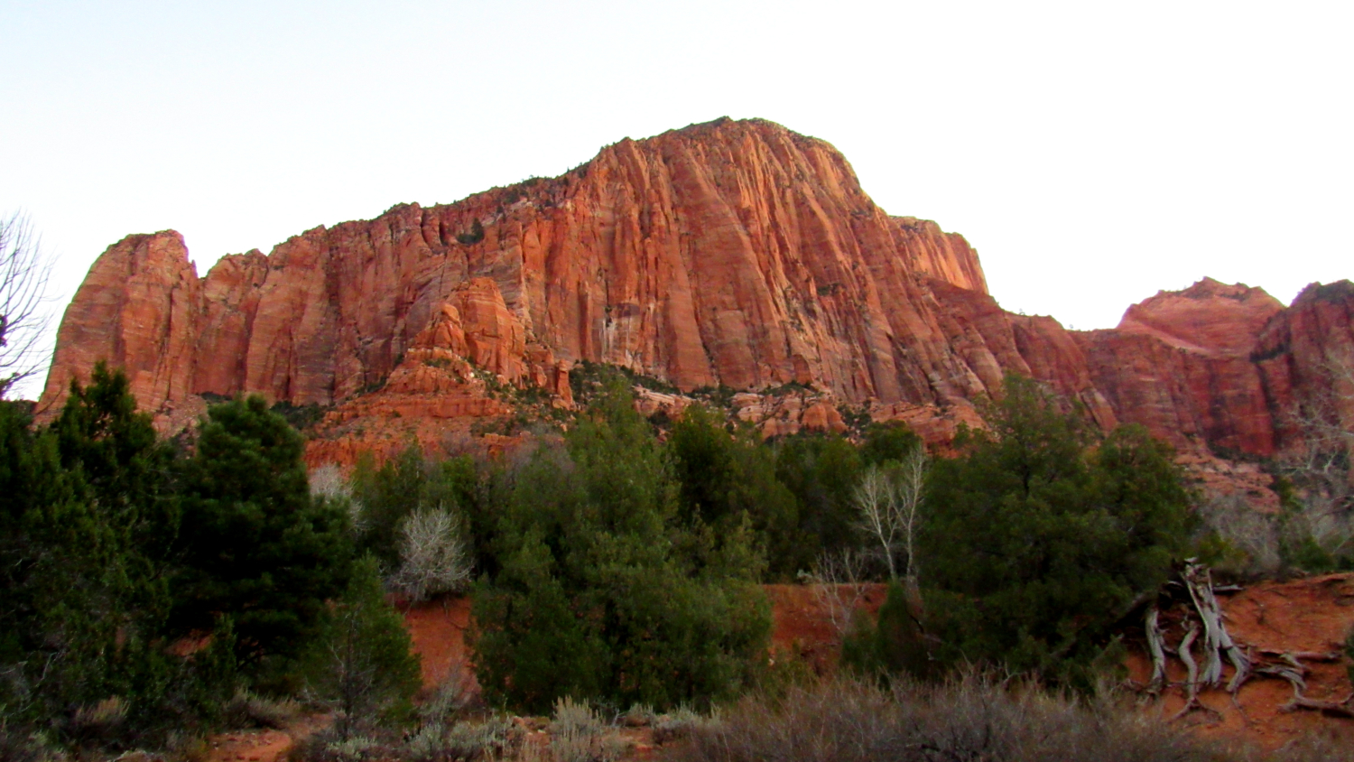
Whether you have jumped through all the hurdles or simply wish to dayhike, you will start from the Lees Pass Trailhead that grants access to the La Verkin Creek Trail. The parking area is about 100 yards south from the actual trailhead. Before you even set out for the trail, you will no doubt notice the deep red sandstone cliffs and buttes divided by deep canyons due east from the trailhead. These are the Kolob Finger Canyons, about which much more will be said later.

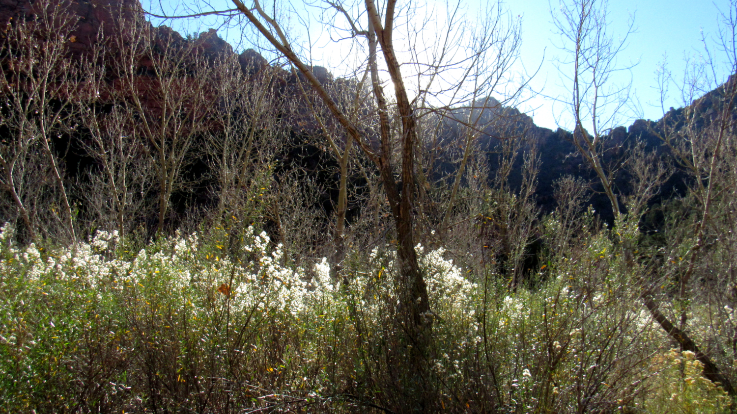
Once on the trail, begin a steady decline into the broad confines of Timber Creek Canyon. After winding into and out of a ravine, the trail drops at a steeper rate along a wooded ridge separating two forks of Timber Creek. Pinyons and junipers dot the ridge, while views down Timber Creek Canyon and east toward the Kolob Canyons will maintain your interest. Each downhill step signals future regret, as you will have to climb this occasionally steep ridge at the very end of your hike.

The trail bottoms out at the confluence of the two forks divided by the ridge you just descended at 1.1 miles. From here, continue south as the trail hopscotches back and forth across the usually dry bed of Timber Creek. Stately cottonwoods, some of which are picturesquely gnarled, punctuate pinyon-juniper woodland while the mint-green foliage of Great Basin sagebrush suffuses the air with cowboy cologne. The trail continues south in this manner for the next 3 miles, passing various drainages joining Timber Creek from the east.

Each of these drainages carry water shed from one of the seven Kolob finger canyons. Three of the canyons (North, Middle, and South Forks Taylor Creek) lie north of Lees Pass, but the remaining four provide both visual spectacle and geologic interest. These canyons line the western end of the Kolob Plateau. Eons of run-off from rain and snowmelt have carved through the wall of Navajo sandstone. This brilliant red rock formed between 190 and 136 million years ago as the climate of western North America transitioned into an arid desert not unlike the modern Sahara. Massive sand dunes accumulated during this time, reaching a depth of up to 2,200’. Iron oxide from the iron rich Temple Cap permeated this porous layer of sand, creating the deep red coloration. As further layers piled upon the Navajo Sandstone layer, calcium carbonate cemented the fine sand particles together and time and pressure compressed the dunes into a remarkably homogenous layer of rock that characterizes Zion Canyon.

At 3 miles, the trail climbs up and out of Timber Creek Canyon over a densely wooded shelf that divides Timber Creek from La Verkin Creek. The trail climbs up and over this shelf while simultaneously making a wide arc to the east before dropping down to the banks of La Verkin Creek. A side trail leads down to a small cascade at _4.6 miles. And yes, you’ll have to climb back up the shelf on the way out, so be sure to conserve your energy for the return trip if you’re dayhiking.

As pleasant as the Timber Creek section of the route can be, La Verkin Creek Canyon is the real show stopper. Gregory Butte, a formidable wall of Navajo sandstone, looms on the north side of the canyon while the equally picturesque Neagle Ridge dominates the southern wall. La Verkin Creek’s reliable water flow provides the first sure opportunity to tank up if you are backpacking, and you will never stray too far from the creek along the imperceptibly ascending section between here until the Kolob Arch junction. Cottonwood and pines line the creek, adding a splash of color during the fall.

At 6.5 miles, the spur trail leading to Kolob Arch branches off on the right to penetrate a deep crease on the east edge of Gregory Butte. The trail roller coasters over a handful of obstacles as it passes along an intermittent stream before reaching a wooded cove where three forks of the creek converge. The fork to the left contains a broad amphitheater over which Kolob Arch towers. The arch is pretty hard to see from the place where the trail ends. The park doesn’t recommend going any further than this, but you can find a faint use trail blazed by climbers to a vantage point where you can really get a clear look at the arch.

The return journey re-traces the route you came in on, but keep in mind that you will have to short, but steep climbs when you hike over the shelf dividing Timber Creek and La Verkin Creek as well as the climb out of Timber Creek Canyon. Do not underestimate the energy required to tackle these two climbs, as you will likely be tackling them during the warmest part of the day when your energy levels are at their lowest. This particular challenge recommends backpacking over dayhiking, but if the red-tape prohibits you from backpacking, simply take your time and remember to keep well nourished and hydrated.
Tags: Gregory Butte, Kolob Arch, Kolob Canyons, La Verkin Canyon, La Verkin Creek, Timber Creek Canyon, zion