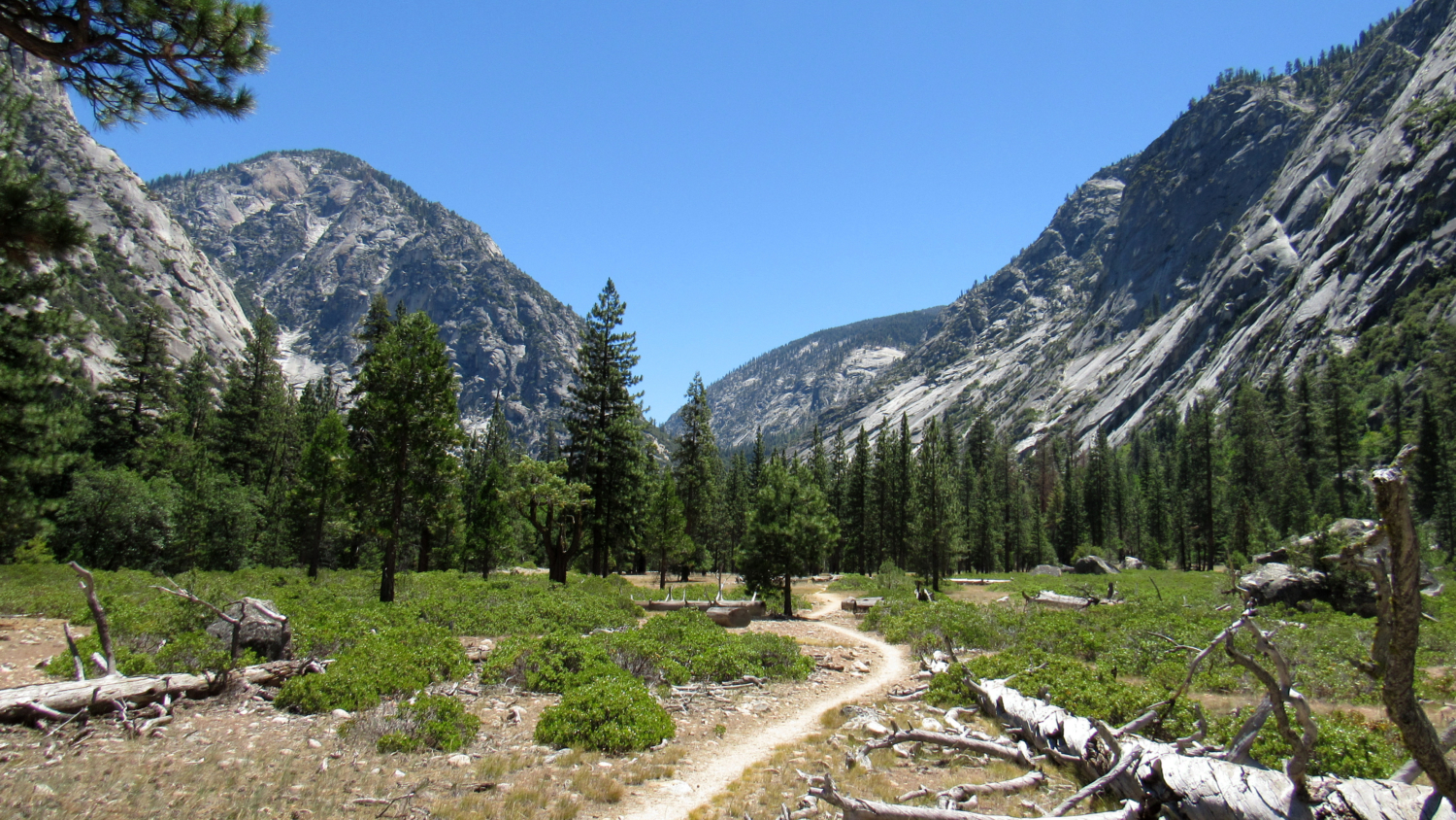
In the Sierra, hikes where you can enjoy spectacular scenery paired with a lack of strenuous activity are hard to come by. The nature of mountains begets trails that often rise and fall, requiring a level of exertion that often excludes less experienced or fit hikers. On the Kanawyers Loop, however, hikers will find a fantastic introduction to the best features of the canyon, including soaring granite walls and crags, mixed-conifer forests, raging cascades, and the omnipresent rumble of the Kings River all within reach via an easy, family-friendly dayhike.

The Sphinx
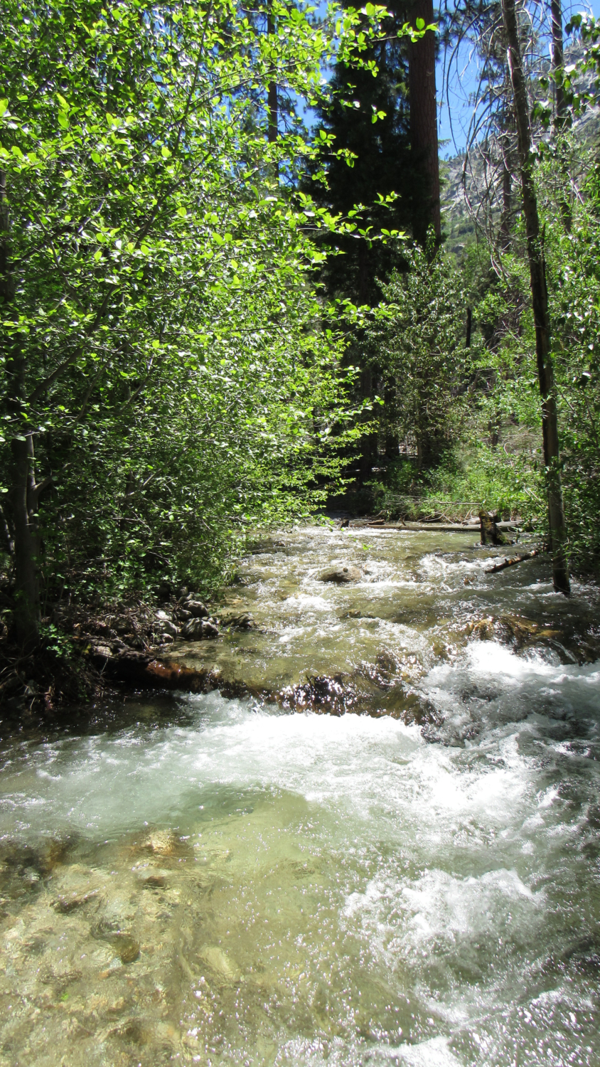
From the Roads End parking area, find the trail leading south from the parking lot. This trail is distinct from the trail leaving from the ranger station, which is your return route. You can go that way (clockwise) if you wish, but having done it both ways, I’m partial to the counter-clockwise route. Follow the trail as it plunges into the forest and heads toward a steel footbridge crossing the Kings River. The impossibly clear water rushes below the bridge, and the translucent green and blue hues of the water appear otherworldly.

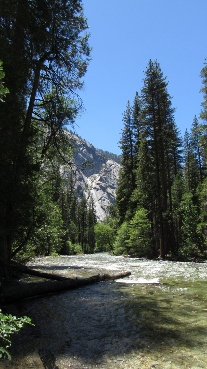
Kings River
On the opposite bank, the trail reaches a junction with the River Trail. Turning right would lead you west to Zumwalt Meadow and Roaring River Falls. Turning left takes you east toward the confluence of Bubbs Creek and the South Fork Kings River. Turn left, and follow the trail as it leads you into pine and cedar forest. After 1 mile, the trail leaves the shade of the forest to enter a sparsely wooded, sandy flat with growths of manzanita scattered about. The views from this section of the route are magnificent, as the towering walls convey the full impact of Kings Canyon’s grandeur.

The trail eventually returns to the shade of the forest and then reaches the banks of the river, which remains close by until the trail approaches Avalanche Creek. This creek crossing is unimproved, which means a painstaking log-hop across during high water in the early season. A better strategy may be to take your shoes off and wade across as your odds of falling in are high.

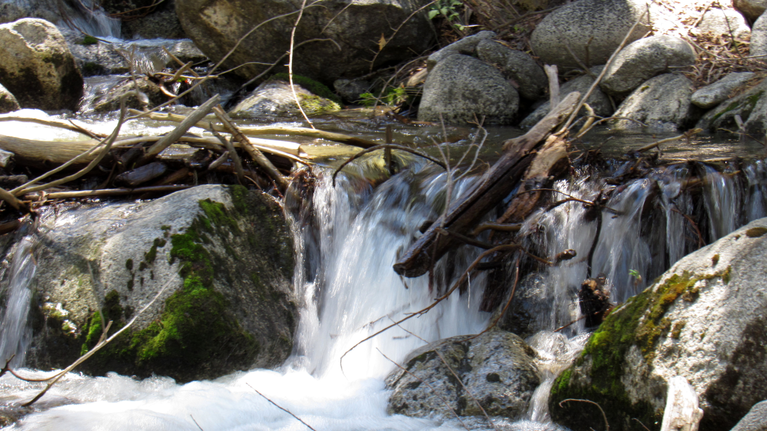
Beyond Avalanche Creek, the trail bends to the north to cross over a series of bridges spanning forks of Bubbs Creek, which braids out during high water. At 2.5, you arrive at a junction with the Bubbs Creek Trail just before the banks of the main watercourse for Bubbs Creek. The return route to Roads End splits off on the left, while the route that follows Bubbs Creek all the way to a junction with the Pacific Crest Trail splits off on the right. If you go that right, you will cross a bridge spanning Bubbs Creek just below a set of impressive cascades. Hikers with a lot of extra energy can continue on as the trail begins to switchback along the canyon wall above the confluence of Bubbs Creek and South Fork Kings River to a number of viewpoints revealing impressive views down canyon toward Cedar Grove.

If you intend to skip this diversion, turn left to follow the trail to the Bailey Bridge. Despite the evocative name, this bridge is not named after some pioneering explorer. Rather, Bailey Bridges are a type of fabricated bridge often used for foot traffic to span bridges. On the other side of the bridge, you reach a junction with the Paradise Valley Trail leading to Mist Falls. Keep left here to return to Roads End.

Although this rather mundane explanation of the bridge’s name saps a bit of mystique from the trail, more historical interest can be found as you progress westward through pine and cedar forest and dense thickets of manzanita to a crossing at Copper Creek just before Roads End. Just south of this crossing, hikers can work cross-country along the eastern bank of the creek to reach the site of Kanawyers. The namesake historical site marks the spot where Napoleon and Violet Kanawyers hosted travelers who stopped here before embarking on explorations deep into the Kings Canyon interior.

Ambitious hikers can pair this route with either the Zumwalt Meadow loop by following the River Trail west to the meadow. Additionally, hikers can continue north toward Mist Falls for an additional 6+ miles of hiking.
Tags: Kanawyers, king's canyon national park, Kings Canyon, Kings River, Roads End