Wilderness. A word for regions wilder than what wild alone can describe. Desert to tundra, it is weirdly defined by the variety of texture it represents underneath the allure of remote, even foreboding adventure. And while easily compared across ecosystems, this breadth of texture is just as easily found across opposite sides of a backcountry trail.
John’s Meadow is a perfect example. The well-kept trail to this former campground in the San Gorgonio Wilderness sports spectacular views, a creek crossing, and the feeling of near solitude in the dense forest of the San Bernardino Mountains. If you can make it up the rocky access road, and tough out the path’s initially steep grade, you’re in for a worthy wilderness experience.
Officially designated in 1964, the San Gorgonio Wilderness has grown to encompass just shy of 100,000 acres on the eastern slope of the San Bernardino Mountains. It’s one of five wilderness areas within San Bernardino National Forest, but the only one found within the fledgling Sand to Snow National Monument, established by President Barack Obama in 2016. True to that name, the Wilderness area is sandwiched between the Mojave desert to the east and snowcapped peaks to the west, playing host to multiple ecosystems across 9,000 feet of elevation change. With over forty trails accessed across eight trailheads, it’s a veritable backcountry treasure chest.

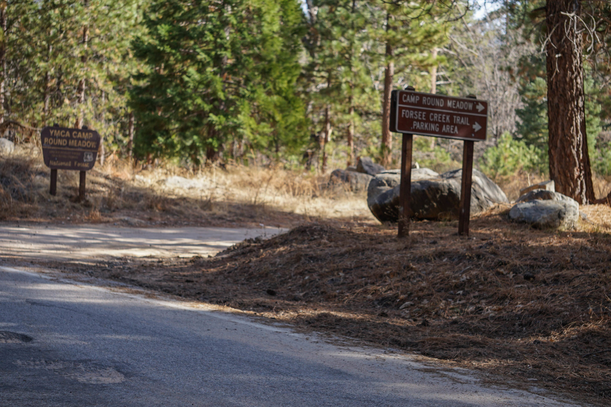
CA-38 will take you into the national forest, a winding, picturesque drive with a number of turnouts worth dawdling in. But the adventure starts on Forsee Creek Road, a dirt track filled with rocks and divots. If you can, opt for a vehicle with higher clearance and four-wheel drive, and take it slow. Parking is fortunately not a concern up at trailhead. There aren’t likely to be many people crowding this hike, there’s plenty of space, and it’s free—unlike the parking at Barton Flats, where you can also pick up the trail.


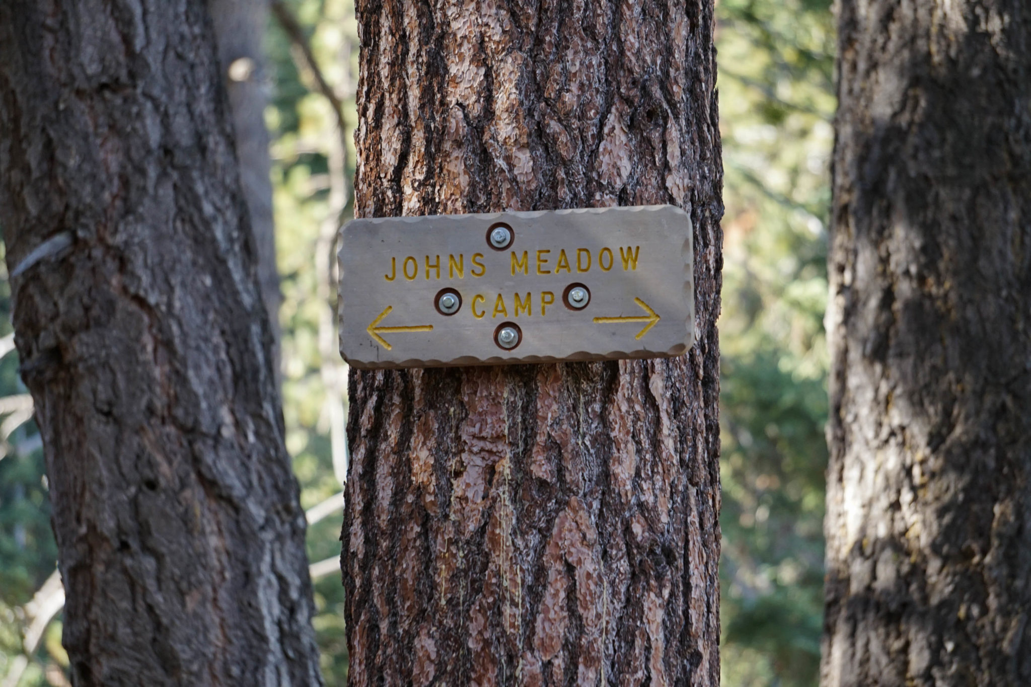
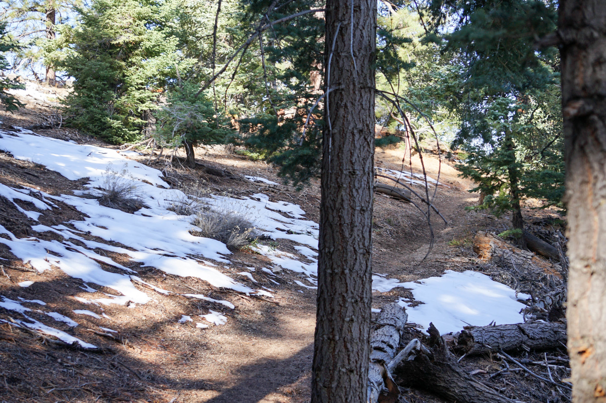
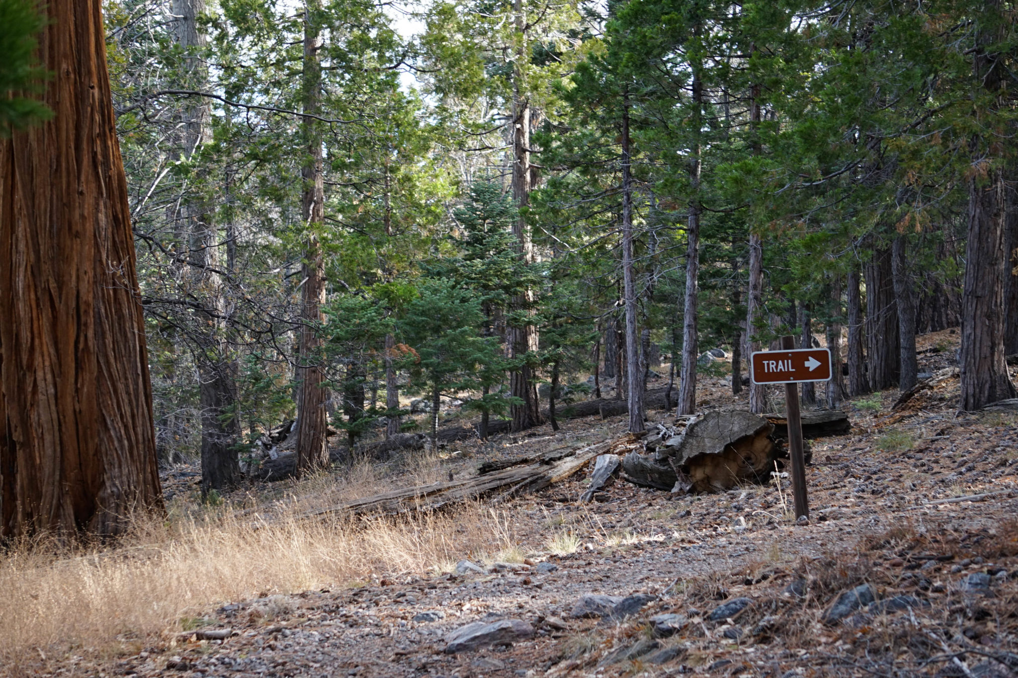
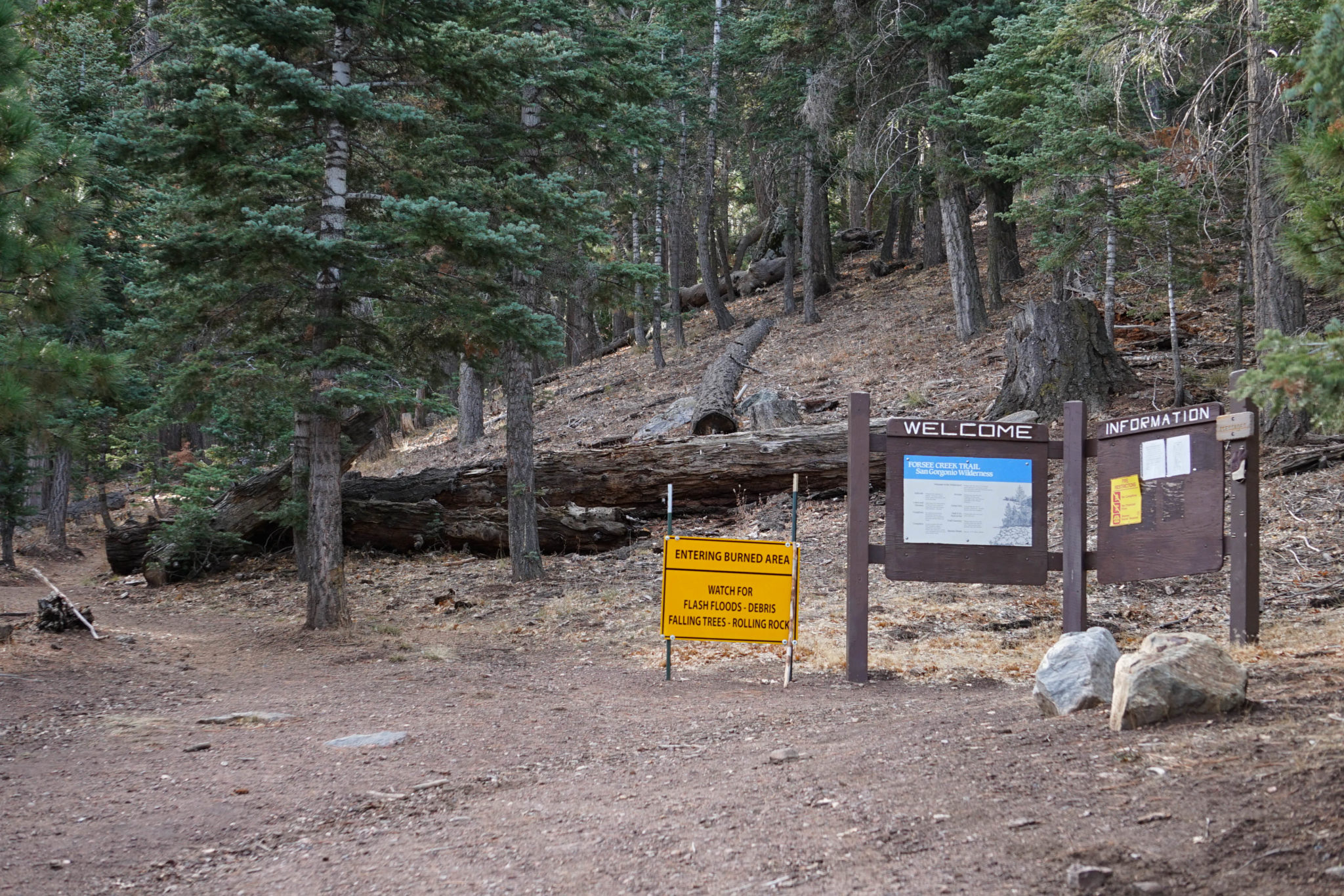
For a wilderness area, the trail is practically pristine, fantastically maintained end to end. The first quarter mile is the most strenuous, with a relatively steep incline through the dense pine forest. You’ll see a sign pointing out the trail along the way, and another formally welcoming you to the San Gorgonio Wilderness. Eventually you’ll hit a fork—the right, towards Jackstraw Springs, and the left towards John’s Meadow. Take the latter.


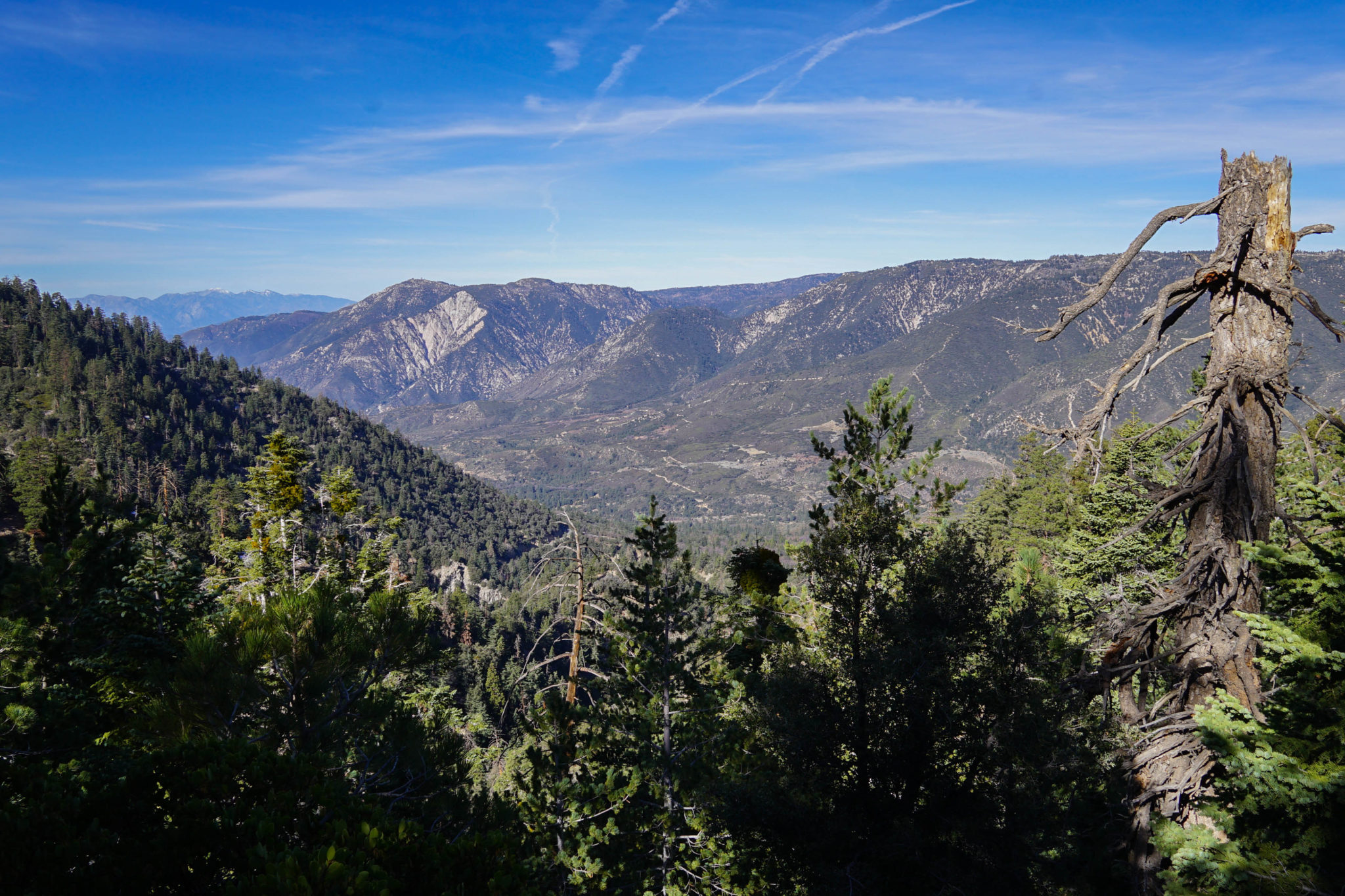
The trail levels out soon after that, and the ground to your right drops off sharply to join the valley beneath, revealing spectacular vistas back-dropped by rolling hills and snowy crags. It’s chilly that high up, and patches of snow can be found lingering through the winter, so a sturdy sweater and reliable pair of hiking boots are your friends.


The trail winds its way along the upper third of abutting hillsides, occasionally reflecting mild changes in altitude, but never approaching the hike’s initial grade. The forest thins midway through the hike as you crest the ridge, but the robust pines that flank the trail are nothing short of spectacular. Pinecones make a full buffet for a suite of finch species, and birdsong, constant and soft throughout the hike, swells in pockets around plentiful harvests. Rich, mottled brown trunks complement the weathered silver of dead trees still standing, and rise above a tangle of lumber already fallen. Keep an eye out for woodpeckers and giant logs sawed through to accommodate the path.


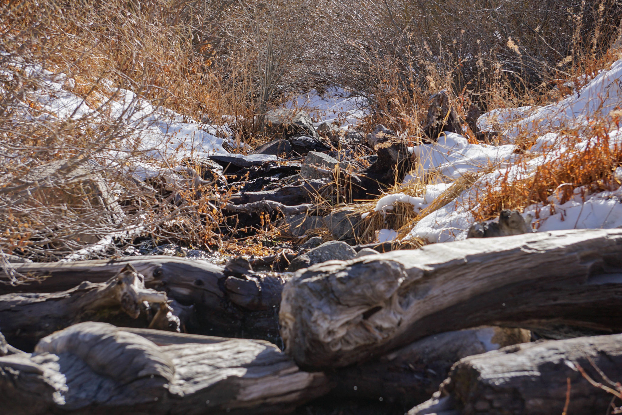
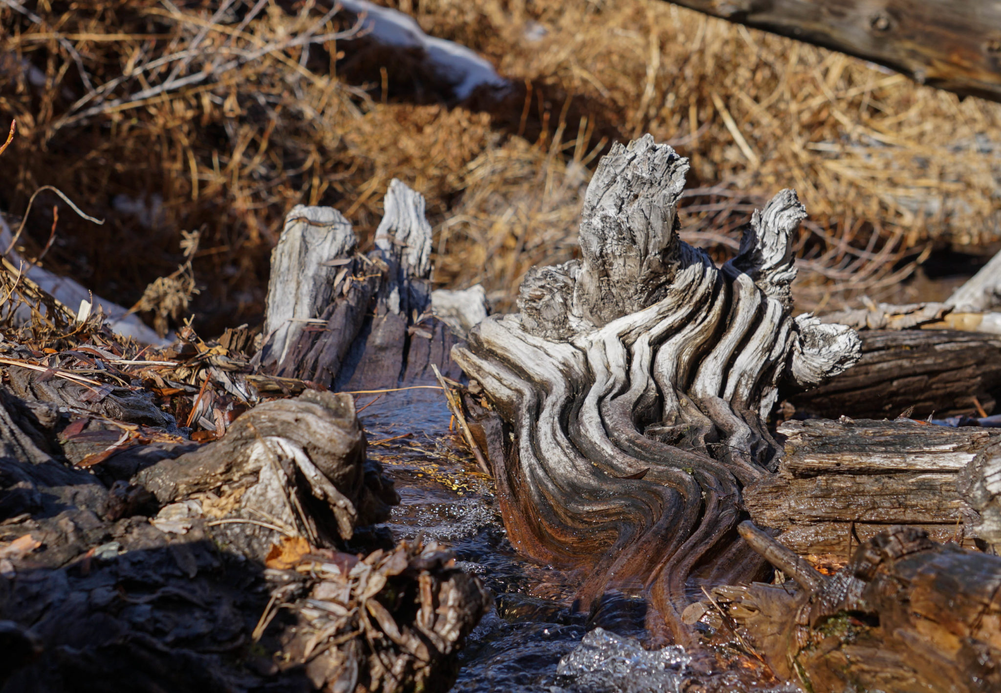
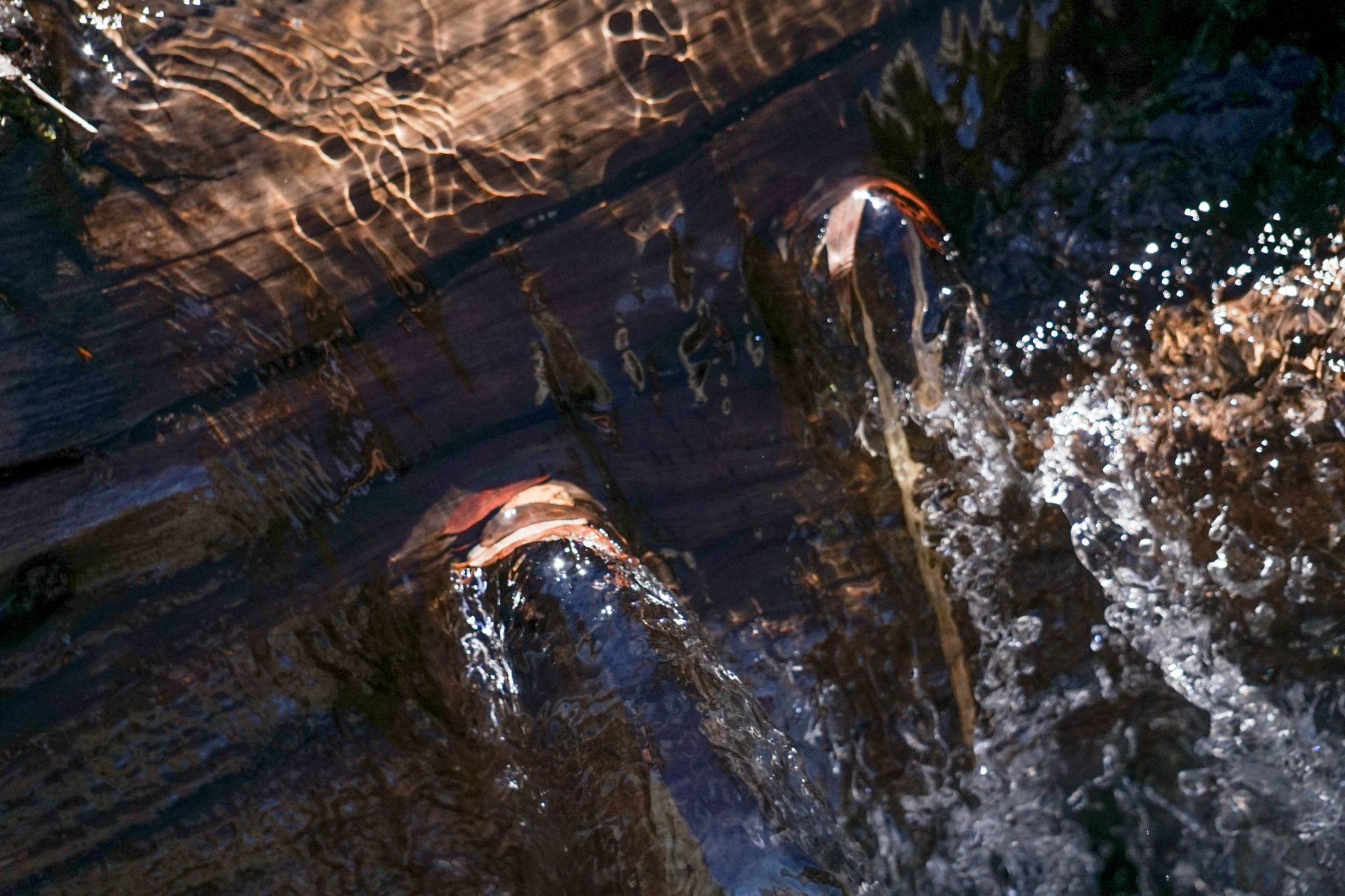
Little rivulets and muddy patches crisscross the trail, but you have to wait for the end of the hike for the real aquatic attraction. To make it to the John’s Meadow campsite, you have to ford Forsee Creek (which flows year-round). The creek is full of rocks and tree debris, dry perches on which to admire small cascades over fallen logs and leaves spiraling downstream. There’s a solid stretch of creek to explore here, so clamber around—see what you can find. Falling in might be worth it once or twice.


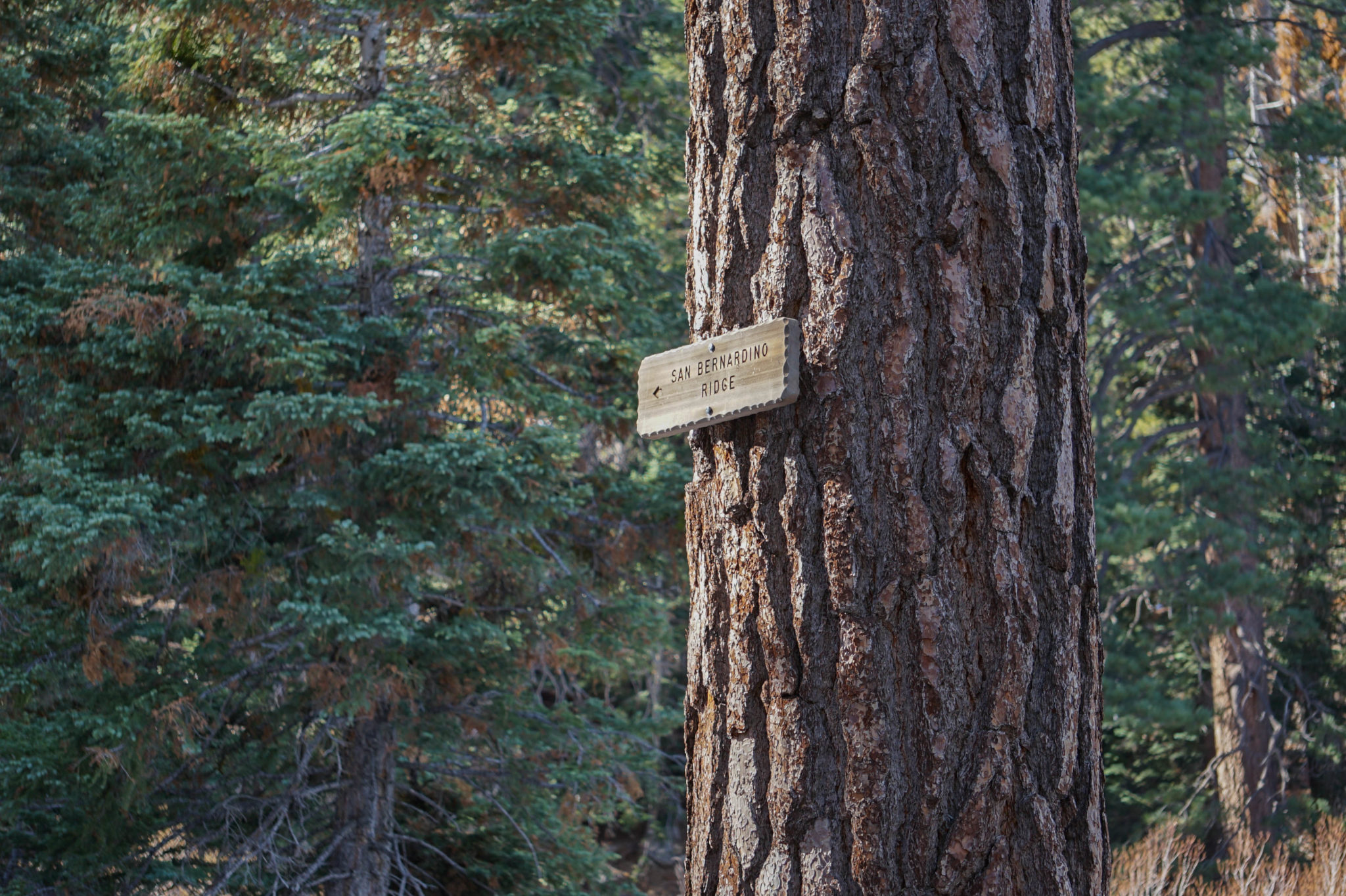
The campsite itself is a short walk past the creek. It’s not currently recommended for overnight stays—dead standing timber abounds—but it’s a perfect spot to stop for a while. From there, you can either continue up the San Bernardino Ridge Trail, or head back the way you came. Over snow and soil, in copses and creeks, through open vistas and cluttered pines. This trail is bursting with different textures. With wilderness. Go explore.
Tags: creek, forest, John's Meadow, snow, views, wilderness