The Horton Lakes hike shows off the shifting landscape of the ecologically diverse Eastern Sierra–dusty, boulder-strewn fields of desert sage lead to alpine elevations with verdant meadows, creeks and remote, icy snow-melt lakes. The route follows an old mining road–hacked out of the hills below looming Mount Tom. Two picturesque mining camps are also tucked away along the lonely route, one charmingly sequestered next to a rippling creek and the other perched high in a dramatic hanging valley.
The trek starts at a locked gate meant to keep vehicles from driving the old mining road that serves as a trail. The road was originally built for the Hanging Valley Mine, a defunct tungsten mine on the side of Mount Tom above Lower Horton Lake. The trail zig zags in long switchbacks, an exposed slog across a glacial moraine that is dry, brittle and rocky.
This region in the foothills of the Eastern Sierra Nevada is called Buttermilk Country. Local lore has it that it got its name from goat milk deliveries, turned to buttermilk as they traveled through the knobby, exposed hills. The rock here is eroded granite, standing out in piles and hoodoos, or thin spires. The obvious peak in the distance is Mount Tom, elevation 13,652 feet; your goal is its southern flank.

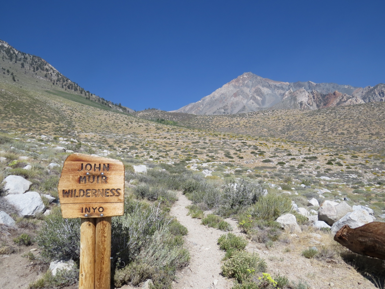
The trail switchbacks across exposed terrain into the John Muir Wilderness.

The well-defined mining road climbs toward the Sierra Nevada wall.
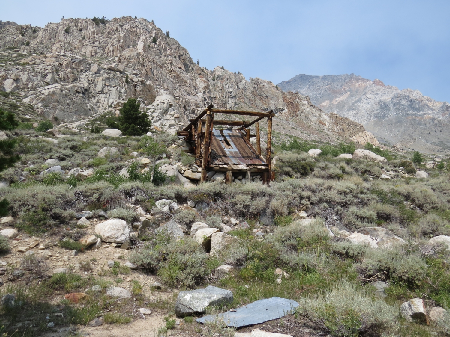
About one mile in you will pass a stand of aspens as the trail continues to climb. After a slight drop, look for a spur road on the right at 1.5 miles. This is the short spur to the Sonny Boy Mine. This is a great place to stop and explore. Desert and mountain micro-climates meet here. The scenic little camp stands at the far end of a sage-filled expanse ringed by aspens. Horton Creek ripples behind the camp’s two structures.

Sage and aspens with surround the Sonny Boy Mine camp.

The beautifully weathered Sonny Boy Mine cabin.

Horton Creek with rusting wagon wheels.
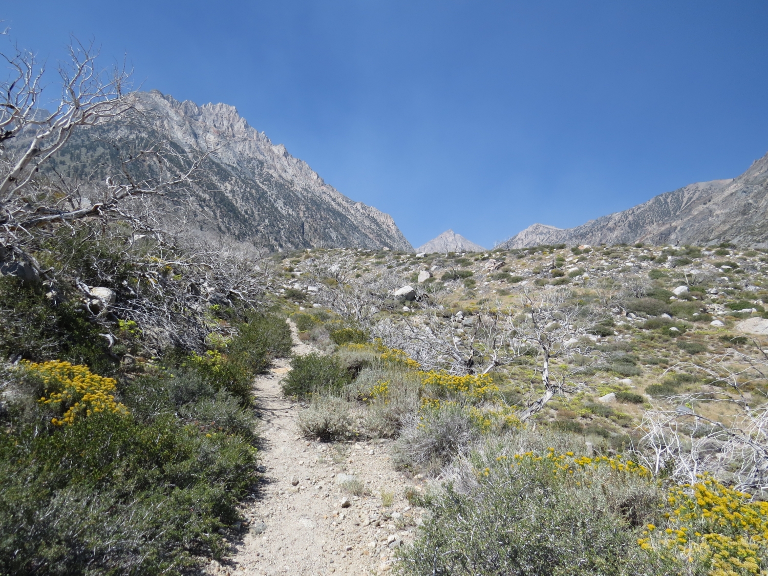
Back on the main trail, you’ll get some relief from the exposed desert scrub at about 2.0 miles when the route crosses a lush meadow with a log footbridge and a babbling stream. Soak it in (seriously, stop and splash some water). After this you’re about to start marching up the brushy, rocky road again.

A grassy respite before the trail hits the rocks again.
The slow climb moves up and away from the momentary green. Tantalizing, below on your left, Horton Canyon rolls out in a luxurious meadow. You can even make out a waterfall in the distance. It’s unfair as you tramp through the sun-crumbled hills, but hang in there, refreshing alpine country is within reach.

The old two-track cuts toward Mt. Tom leaving the green canyon below.
The road climbs steadily with two more sets of switchbacks all the way to the Hanging Valley Mine Camp. Even though you’ve been following the road this whole way, coming across the camp is still a wonder in such a high, rugged location. The structures of rich nutty wood and corrugated metal cling to a distant past in this remote, hidden valley. It’s hard not to think about the life of a miner in winter, snow piled high in the glacial territory (despite the likely hot slog you’ve just completed). The main road continues straight; its destination is the mine works at 12,000 feet.

Ore chute at the Hanging Valley Mining Camp.

Cabin at the Hanging Valley Mining Camp.
Head to Lower Horton Lake by continuing left through the camp and continuing downhill via a trail. The short trail goes through evergreens and a number of back country campsites. It ends at the rocky shores of Lower Horton Lake. You’ll likely be the only one here, your company the sharp peaks of the Sierra Nevada.

Lower Horton Lake with smoke from a distant forest fire drifting over the mountain peaks.
Best map: Tom Harrison Mono Divide High Country
Tags: Big Pine, bishop, Buttermilk Country, Hanging Valley Mine, Highway 395, Horton Lakes, Inyo National Forest, Sonny Boy Mine