Early explorers of the Sierra Nevada Mountains often set their sights not on the lofty peaks, sparkling lakes, and lush meadows but on the area’s mineral resources. As one of the most formidable natural barriers in the country, the Sierra also prevented the easy transfer of mineral resources from the Owens Valley to the San Joaquin Valley. Around the time the Civil War raged, numerous explorers attempted to establish routes over the formidable barriers of the Great Western Divide, Kern Canyon, and the Sierra Crest.

One such explorer, John B. Hockett of Tulare County, established a route beginning in the foothills surrounding the South Fork Kaweah River watershed. This route headed along the South Fork onto a plateau dotted with expansive meadows before crossing the Great Western Divide at a relative low point. The trail then continued through what’s now known as the Golden Trout Wilderness before reaching the Lone Pine region.

Although safer and more efficient trans-Sierra routes would eventually open, the Hockett corridor became a hiking route when activity in the Southern Sierra transitioned from resource exploitation to recreation. Denied the notoriety of establishing a preferred trade route, Hockett at least received the honor of having a meadow named after him – Hockett Meadow.

This meadow lies at the heart of this choose-your-own-adventure write-up. No fewer than three trails – including a new alignment of the historic Hockett route – provide access to the meadow, and this write-up covers the Atwell-Hockett Trail departing from the Atwell Mill Campground. A second trail, the more mellow but less scenic Tar Gap Trail, departs from Cold Springs Campground. A third route, which departs from the South Fork campground and passes through Garfield Grove, is less desirable owing to the often excessive summertime heat at the trailhead and the sustained, steep grade.

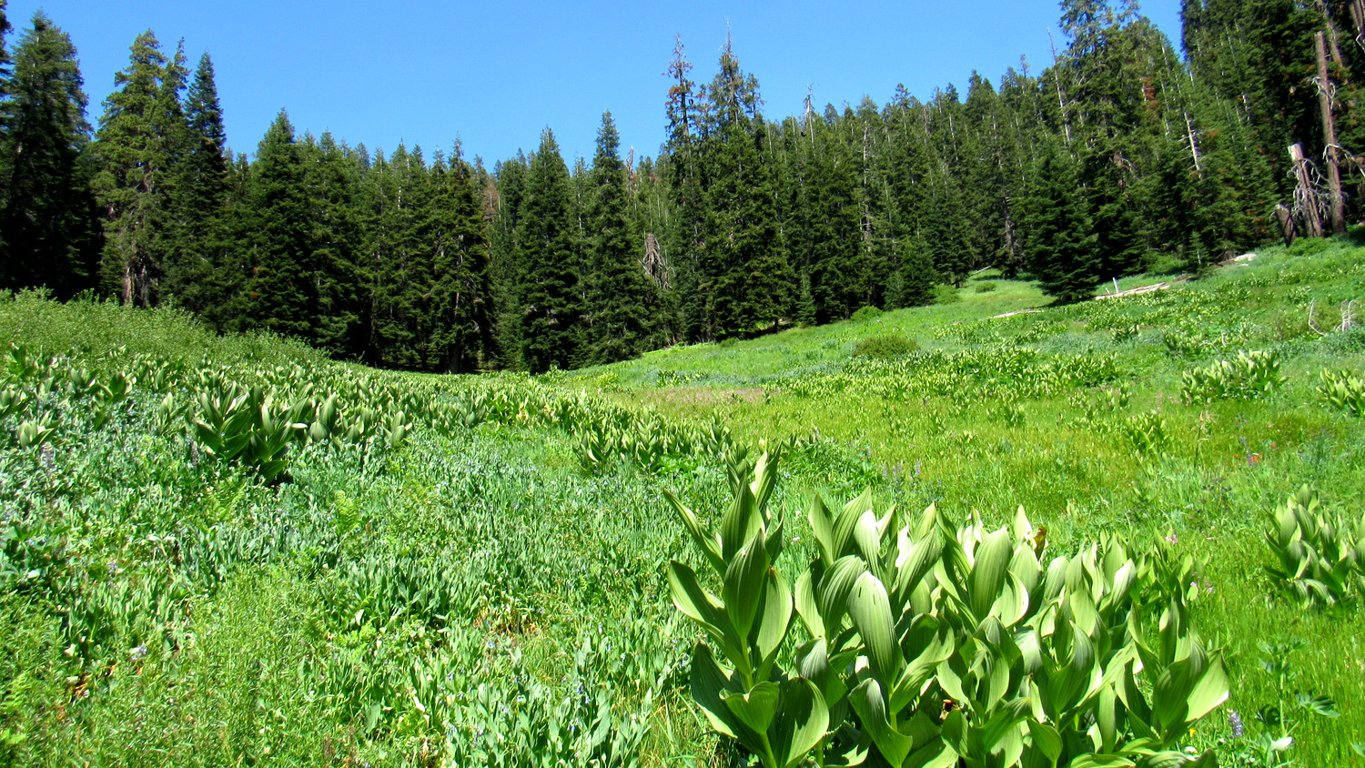
As a destination, Hockett Meadow provides a somewhat-less-visited option that features several potential day hikes that you can enjoy over a 3-4 day stay. The meadow itself is a lush, subalpine gem that attracts an abundance of wildlife. The nearby ranger station, itself a historic structure, houses a friendly ranger who can offer support and suggestions.

Sequoia-Kings Canyon National Parks have recently revamped their permit system. Instead of the old “spend the day waiting for your fax to go through” system, the new 3-step process requires you to fill out the application and then email it to the park. After that, you receive a confirmation email indicating that you have the reservation. After that, you go to a government pay site to pay for the permit. Remember that the permit reservation is insufficient as a permit. You will still need to pick up your permit from the Mineral King Ranger Station either on the day before your hike or the day of your hike. This handy webpage allows you to see what kind of availability remains at each of Sequoia-Kings Canyon’s trailheads.

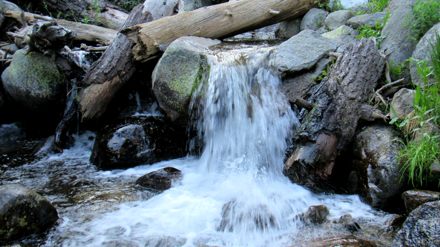
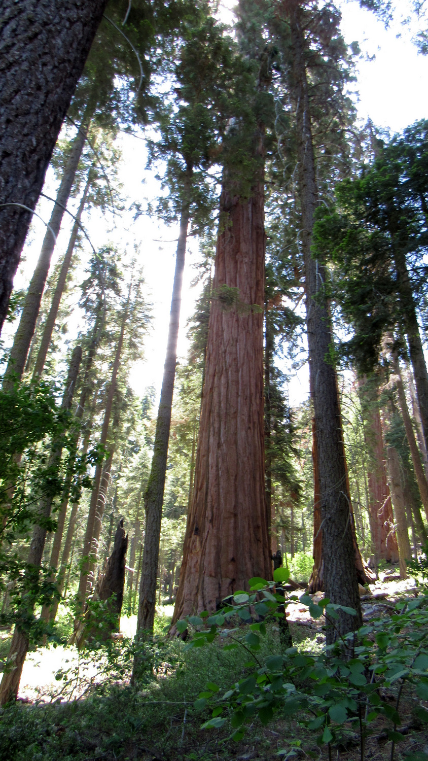
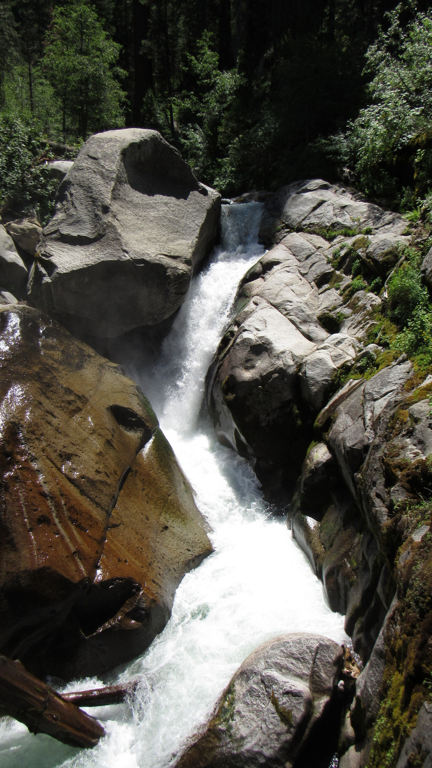
The newer Atwell-Hockett Trail departs from the western edge of Atwell Mill Campground. From the meadow, the trail descends through sparse sequoia forest to the banks of the East Fork Kaweah River. From the bridge spanning the East Fork, hikers will observe a thundering cascade where the East Fork gushes through a gully below towering sequoias. This tranquil scene juxtaposing the fury of the river against an unlogged portion of East Fork Grove serves as a good turnaround for day hikers, and for backpackers it presents a nice rest spot before commencing the moderate climb along the southern wall of the East Fork’s canyon.

Beyond the bridge, the trail begins a long ascent through East Fork Grove. Sequoias within this grove occur at a lower density than other groves. Like scattered punctuation in a poem, the effect of occasional sequoias is a bit more startling than denser groves as the relative scarcity of the trees seems to draw more attention to their disproportionate size.

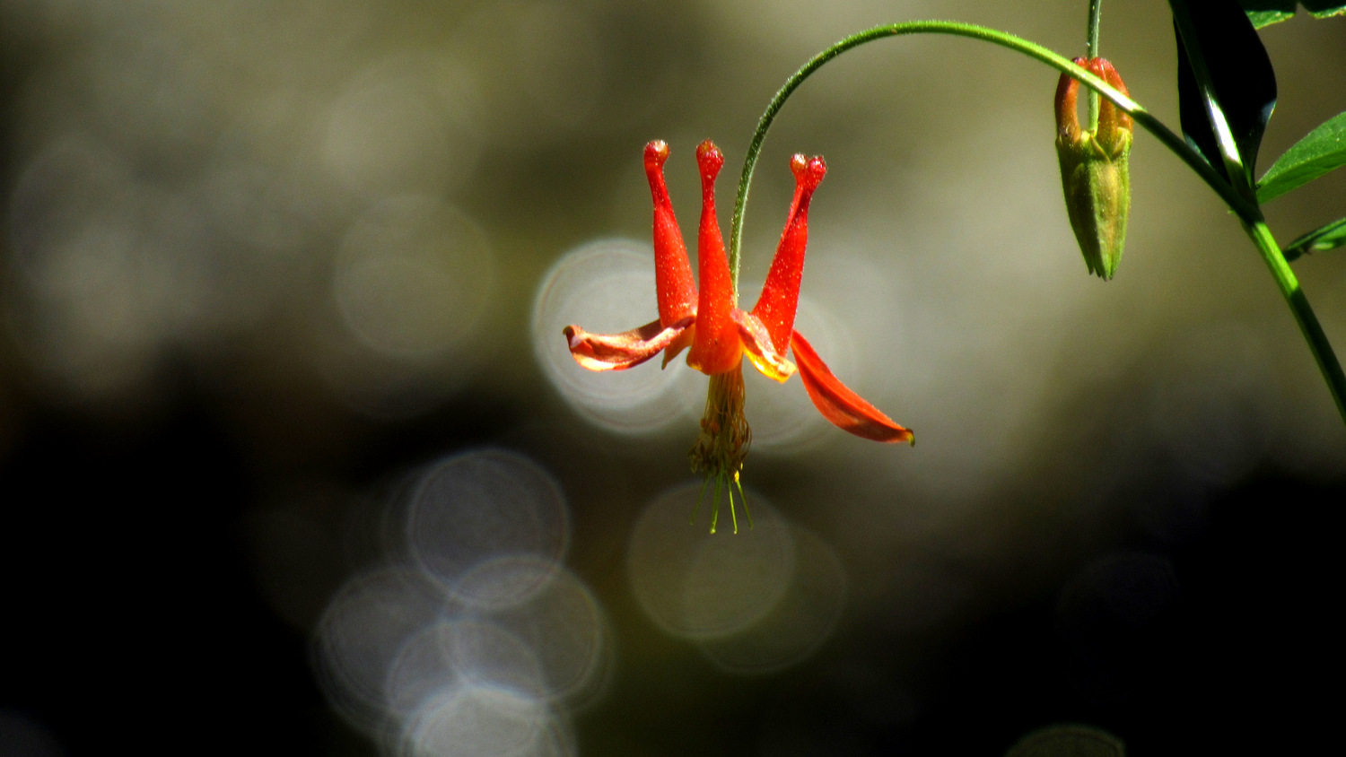
Beyond the grove, the trail crests a ridge and then trends southeast high above Horse Creek and the Horse Creek Grove. Sparse Jeffrey pine and white fir forest alternates with denser groves of red fir and occasional hillside meadows alight with wildflowers and lush verdancy. Two significant creek crossings occur at Clover Creek and Corner Creek before the Atwell-Hockett Trail reaches a 3-way junction with the Tar Gap Trail. The first legal campsites occur at Clover Creek, but there aren’t many suitable spots. You’re better off waiting until you get to Horse Creek or Hockett Meadow.

The forest at this junction transitions into a dense, wet, even marshy forest dominated by close-growing lodgepole pines. A spacious camping area along the banks of Horse Creek presents a possible stopping point that is especially appealing after the long climb from East Fork. There are no bear lockers here, so you will need a portable bear vault if you plan on camping here.

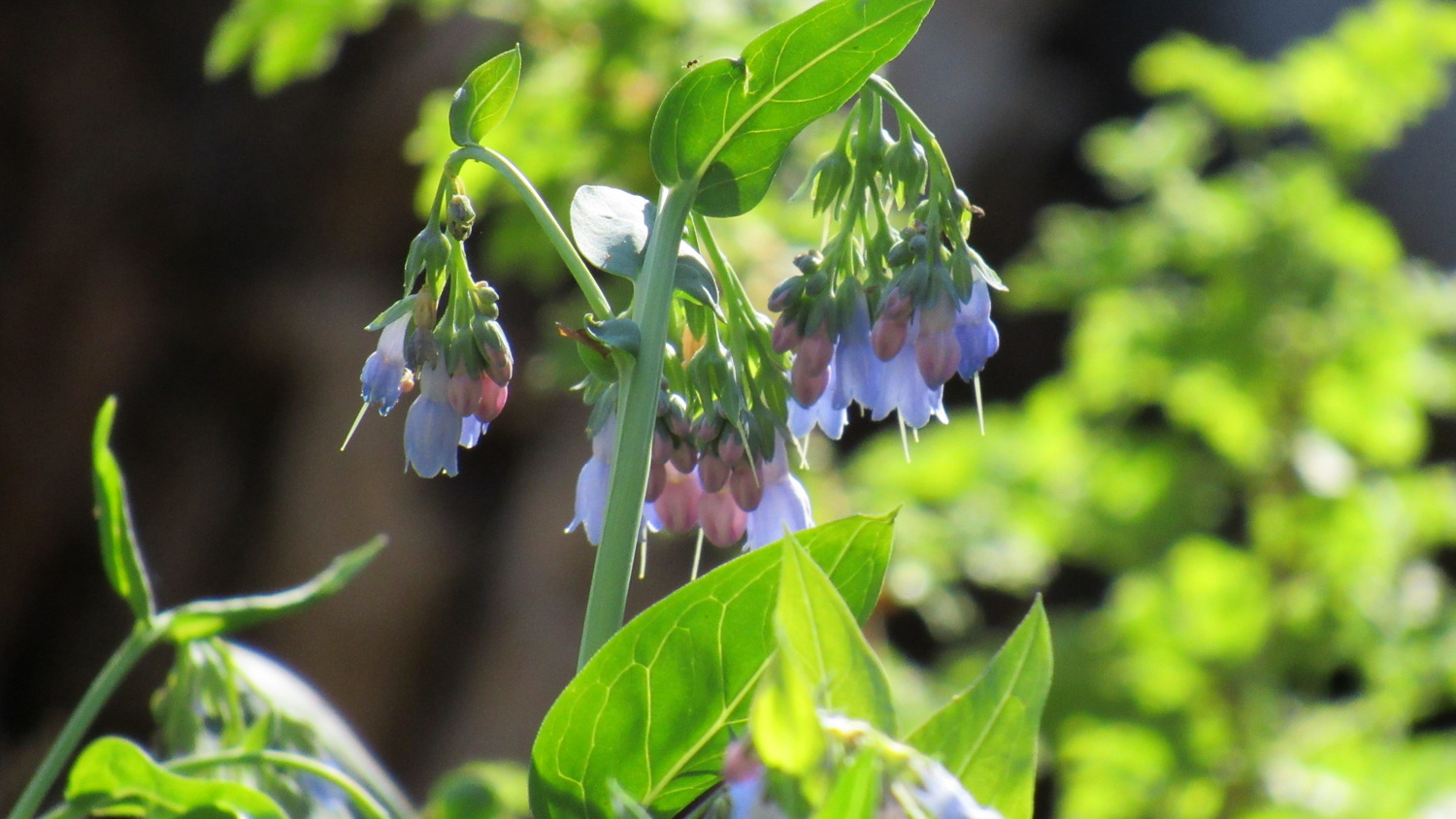
After Horse Creek, the Atwell-Hockett Trail climbs up and over a ridge before descending gently toward Hockett Meadow. Just before the meadow and the ranger stanger station, a side trail leading off toward Evelyn Lake and Cahoon Rock provides access to campsites and a bear box adjacent to Whitman Creek. The meadow itself sprawls across a vast spread, and provided you time your arrival correctly (usually late June through July), you should see a dazzling array of wildflowers. Mule deer browse through this buffet, and black bears occasionally amble by.

From Hockett Meadow, a number of side trips invite two to three days worth of casual exploration. The best way to approach these side trips is to establish a base camp at either Horse Creek or Hockett Meadow and then engage in a number of easy day hikes. Included within these side destinations are the tranquil waters of Evelyn Lake and the marvelous vistas of Cahoon Rock. Both destinations lie to the west of Hockett Meadow, and a single 7.5 mile day hike gaining and losing about 1500’ will allow hikes to reach both destinations during an afternoon.

Heading south from Hockett Meadow, hikers can continue toward Sand Meadow, which is larger, but not quite as pretty as Hockett Meadow. A fairly flat 4.7 mile loop leaving from Hockett Meadow will pass through Sand Meadows, skirt the eastern edge of the Hockett Lakes, and then return along the east side of Sand Meadows. Hikers can take a short side trip heading east to approach South Fork Meadows where the South Fork meanders through a series of lush meadows.

Finally, the seriously devoted hiker can continue south and southwest past Sand Meadows toward the Tuohy Creek Trail Junction. Bearing right at Tuohy Creek, you can follow the Garfield-Hockett Trail downhill all the way to the boundary with Garfield Grove. Be forewarned: this route loses about 1400’ of elevation gain, which you will have to make up on the return journey.
Tags: Atwell Mill, Cahoon Rock, Cold Spring Campground, East Fork Grove, East Fork Kaweah River, Evelyn Lake, Garfield Grove, Hockett Meadow, Hockett Plateau, John B. Hockett, John Krebs Wilderness, Mineral King, Mineral King Road, Sequoia National Park, South Fork Kaweah river, Tar Gap, Tuohy Creek