Lying partially in the Puente Hills Habitat Authority lands and partially in Los Angeles County’s Peter F. Schabarum Regional Park, this loop through Powder Canyon takes you through some beautiful woodland areas and into a canyon cutting through the Puente Hills before turning around and climbing back over the hills. More popular with equestrians (there are centers and corrals at either end of the canyon), this route appears to be more lightly traveled by hikers than others in the hills. At times, you may end up having the entire place to yourself.
Please note that hours of this trailhead have been reduced — this trailhead is currently open from 9AM-6PM from June 1-September 30th and 9AM-5PM the rest of the year. Be sure to check with the Puente Hills Habitat Preservation Authority for further updates.
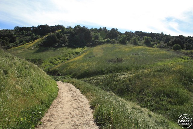
This route begins from the Puente Hills Preserve land on the southern end of the hills. Park either at the small equestrian ring or the small spillover lot near the Nogales Trailhead. The trail begins on a gravel fire road just to the north of the equestrian ring. The gravel doesn’t last much beyond the ring, and the trail soon becomes a fairly even dirt road.

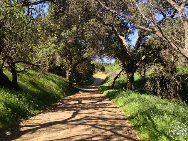
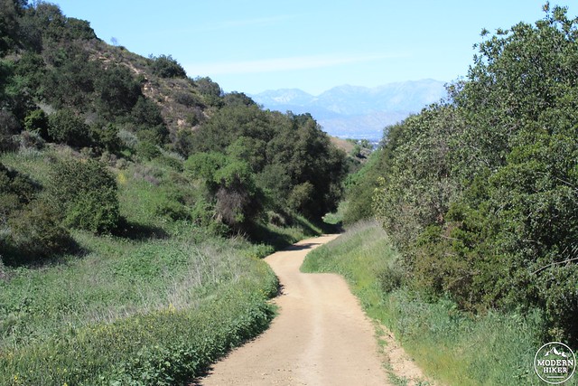
After a very short time spent in the ubiquitous sun and grassland of most of the Puente Hills, you’ll have the pleasant surprise of hiking through a small but dense collection of native oaks. If it’s a hot sunny day, you’ll notice a definite drop in the temperature here – and may be tempted to slow your hiking pace just a bit to enjoy it.
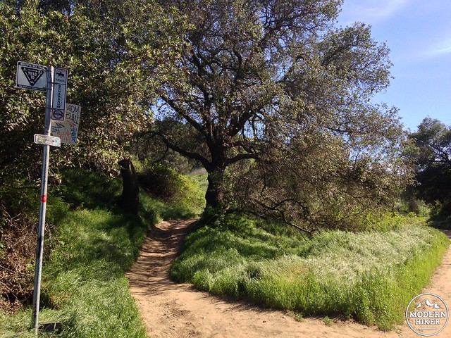
At 0.35 miles, keep right at the junction with the Gray Squirrel Trail to continue on the Powder Canyon Trail. Now, the trail turns to the north, and the shaded woodland sections will be limited to the side of the trail instead of offering a nice canopy for you.
Gradually the forest falls behind you, and by the junction with the Black Walnut Trail at 0.6 miles, you’ll be out in the sun again. Stay straight to continue on the Powder Canyon Trail.
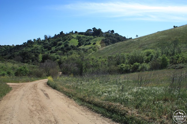
After climbing to the top of a very short hill, you’ll reach a major junction between trails and fire roads that’s clear on maps but not very clear in terms of trail signage.
Ignore the fire road to your right just before you crest this hill – then, stay on the fire road / trail that continues straight into the canyon ahead of you and starts descending. To your left is the Purple Sage Trail (a fire road) as well as an unnamed fire road that leads to the west.
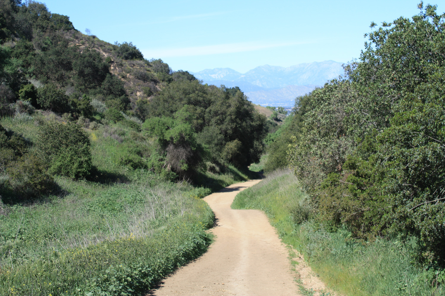
Once you start descending into Powder Canyon, the fire road narrows a bit and you’ll start to see some views of the San Gabriels through the end of the canyon. You cross into the boundary of Schabarum Regional Park just past the 0.9 mile mark and begin a slow descent inside the canyon.
The Schabarum Trail Extension joins the Powder Canyon Trail at 1.2 miles. Stay straight and continue heading north.
Eventually you’ll see some red barns and street lamps appearing in the distance ahead of you. When I first hiked this route, I didn’t know the trail connected with the Schabarum Regional Park, and was surprised to find that the trail basically puts you right in front of a large equestrian complex with lots of trailer parking at mile 1.46.
The park also has some very nice picnicking areas, and you may see some people relaxing outdoors on blankets or at tables while equestrians practice their riding skills or trot past you on the trails.
To continue on this hiking route, hug the western side of the parking area as much as you can and look for this footbridge crossing a stream bed.
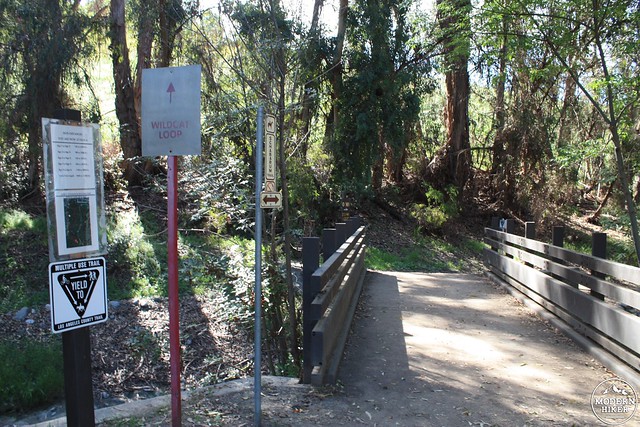
This is part of a trail that runs around the perimeter of Schabarum that is known as the Bobcat or Wildcat Trail (depending on what sign you’re reading). You’ll be hiking here for the next 0.3 miles on a mostly flat route that runs along the northeast slope of the hills you just hiked through.
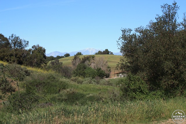
In the late winter and early spring, the grassland here is very picturesque. In the summer, the green gives way to a drier gold – still nice to look at, but not quite as nice as this:
At 1.78 miles, stay to the left to continue on the Schabarum Trail.
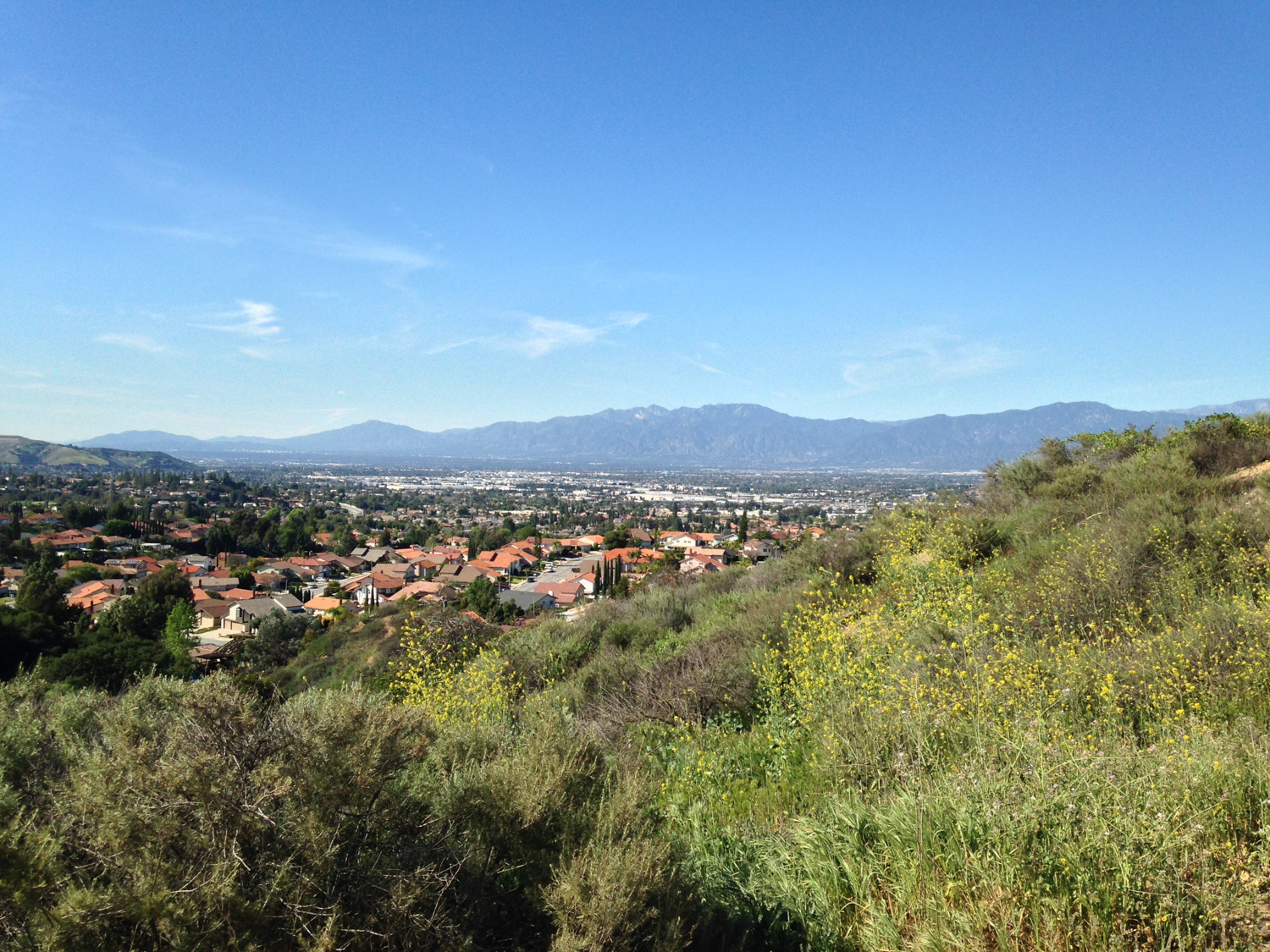
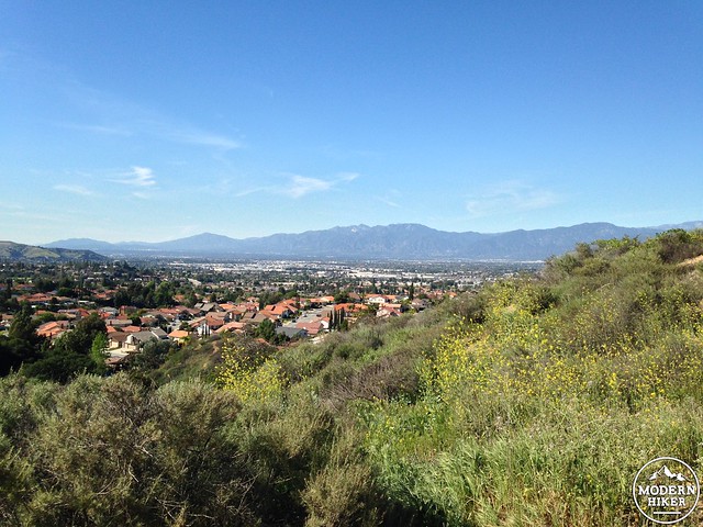
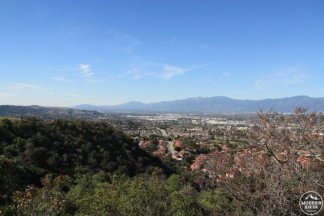
Here, the trail begins to rise again along a hill behind a suburban tract at the end of Azusa Avenue. The hills here have been covered by large colonies of prickly pear cacti and California sagebrush. Combined with the manicured space in Schabarum Regional Park and the distant high San Gabriels, there’s a bit of civilization-butts-up-against-the-wild here that can be an interesting sight to soak in for a while – and the views get better as the trail gains elevation. To the west, other areas of the Puente Hills rise above the sprawl below.

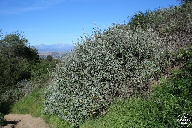
The Schabarum Trail makes a fairly steep and noticeable elevation gain here – definitely the toughest you’ve had on this route so far. Even late in the day, this can be a tough stretch of trail to hike when it’s hot out – and shady sections are few and far between. Enjoy them when you see them. And if you can’t, at least enjoy some of the massive purple sage bushes along the way.
Just before the 2.5 mile mark, the trail turns south again, revealing more of those high-tension power lines that are so prevalent in the area.
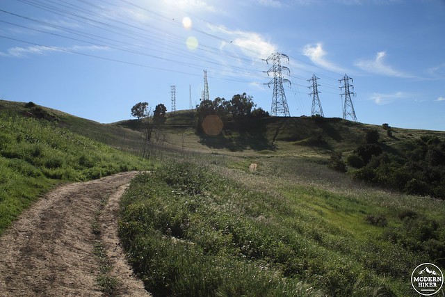
At 2.94 miles, the Schabarum Trail makes a sharp southward turn. From here, join the unmarked Buena Vista Trail as it branches off to the left and rises up the hill between the towers.
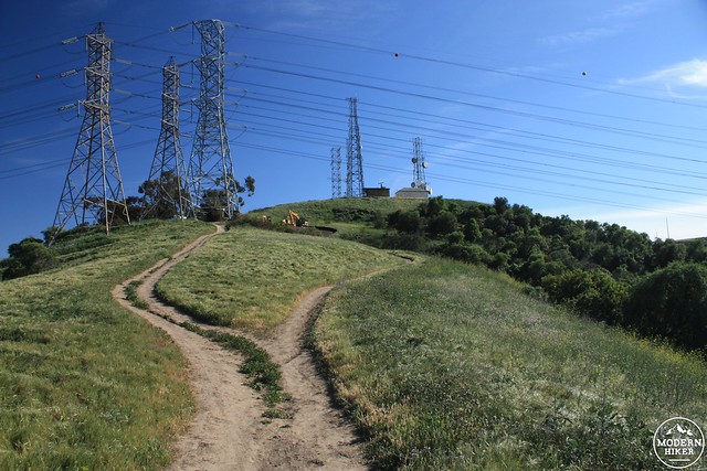
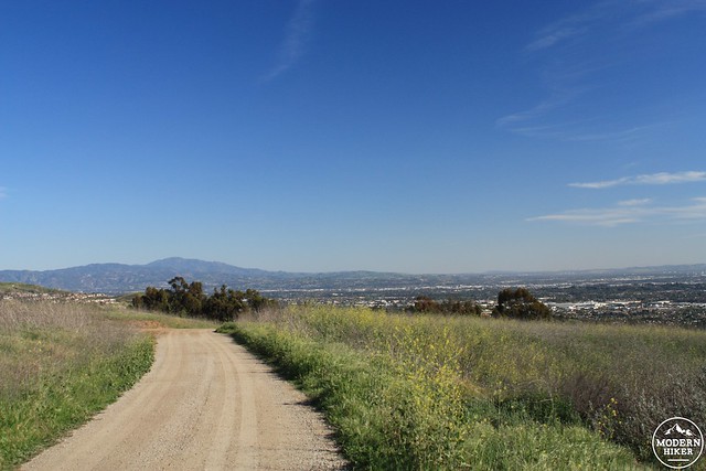
The Buena Vista Trail is a very short 0.2 mile connector route that takes you to the base of the first tower, then puts you on a level fire road that will connect with the Purple Sage Trail (also a fire road) at the 3.17 mile mark. Take a left to head to the southeast on this slowly descending route and enjoy the stellar views (on clear days) of the Santa Ana Mountains and coast to the south.
At 3.6 miles, stay straight at the junction with Skyline Drive, and just past the 4 mile mark you’ll return to the major trail / fire road junction with the Powder Canyon Trail. Keep right at this junction and return back to the trailhead the way you came.
Tags: Buena Vista Trail, hacienda heights, La Habra, La Habra Heights, La Puente, Peter F. Schabarum Regional Park, Powder Canyon Trail, Puente Hills Preserve, Purple Sage Trail, Rowland Heights, schabarum trail