A pleasant loop through the low mountains and wide grasslands of northern Point Mugu State Park. This route features a seasonal waterfall, cabin ruins, and great spring wildflower blooms — and while I hiked just under 11 and a half miles, there are plenty of alternate, shorter routes.
This area of Point Mugu State Park is at the western end of the Santa Monica Mountains National Recreation Area — a loose patchwork of public lands owned carved into state parks, county parks, and National Park Service territory. There is some privately-owned land scattered throughout, but for the most part, it’s basically an open, free, sparsely traveled National Park. It’s one of L.A.’s best little secrets.
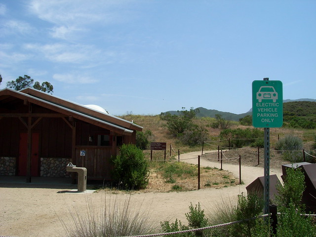
While the southern La Jolla Canyon is part of the State Park, the northern end of Big Sycamore Canyon is part of the NPS’ Rancho Sierra Vista / Satwiwa unit — the main differences you’ll probably notice are the good parking, abundant signs, and clean bathrooms.
 From the trailhead, follow a very short .3 mile path from the parking lot to a small pond and recreated Chumash village. On the weekends, the Satwiwa Culture Center is staffed with Native American rangers, and is a worthwhile stop if you’ve got some time — but if you want to get right to the hiking, cross the fire road and head straight for the wide open meadow.
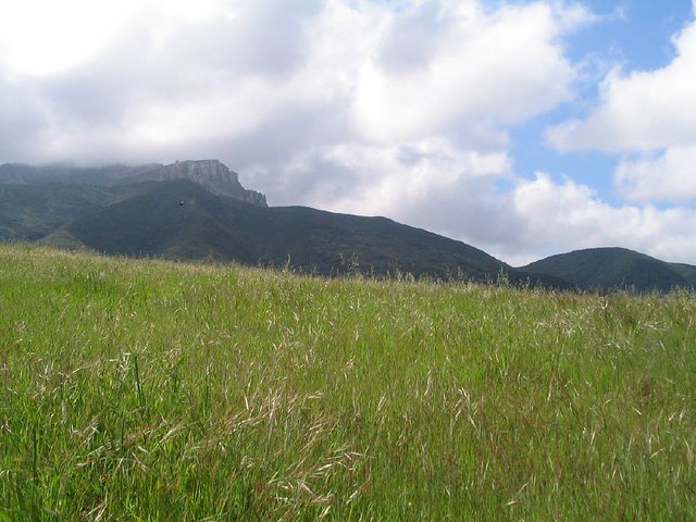
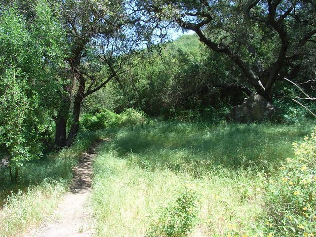
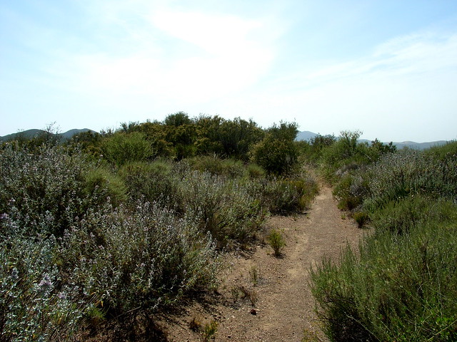
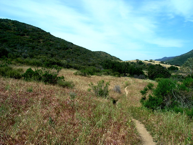
 There is a network of wide, established trails running through the meadow, and depending on how green the grass is or how much is blooming, you may want to wander around for a bit. When I was there, the grass was very clearly turning from green to gold …
 … but on an earlier hike — in a much wetter year — everything was bathed in green.
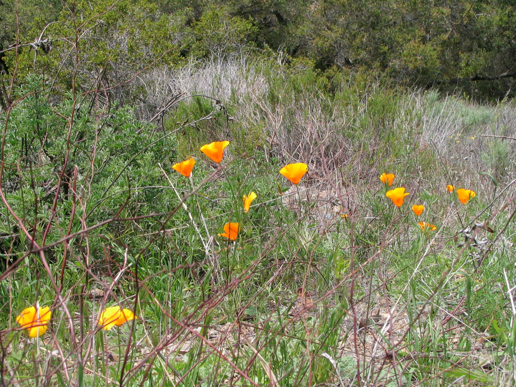
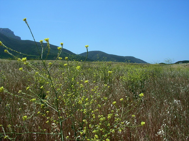
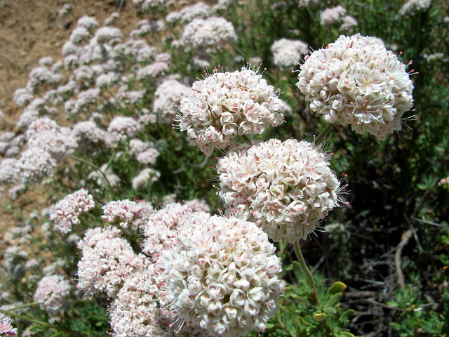
 There were still plenty of blooming wildflowers this weekend, though — especially some very prominent buckwheat flowers.
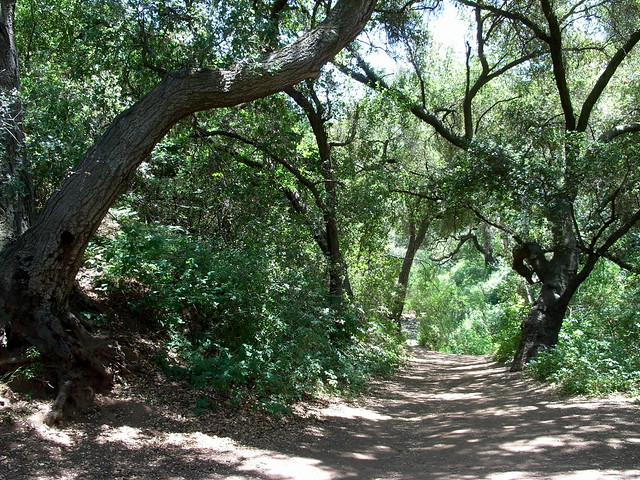
 After you leave the meadow, you’ll officially be out of National Park Service land, and into Point Mugu State Park’s Boney Mountain Wilderness. Stay on the Old Boney Trail as it travels down the northernmost walls of Upper Sycamore Canyon. There’s a seasonal stream that runs through this part of the canyon, and you’ll notice the tree cover growing thicker as you approach the canyon floor.
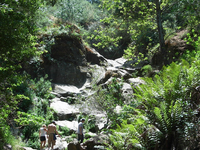
 At the junction with the Upper Sycamore Canyon Trail, continue on the Old Boney Trail farther into the canyon. If you’re hiking during the wet season, you’ll cross a small, flowing stream on your way up — if so, it’s worth it to take the very short side trail to the base of a small, tiered waterfall. It’s shady the entire way, and there are several huge boulders that make for nice “sittin’ and relaxin'” spots. If it’s dry, you can try you hand at scrambling to the top — just watch out for poison oak.
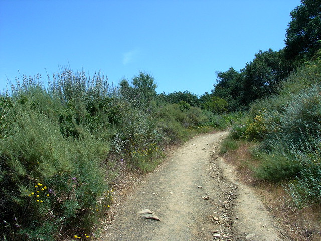
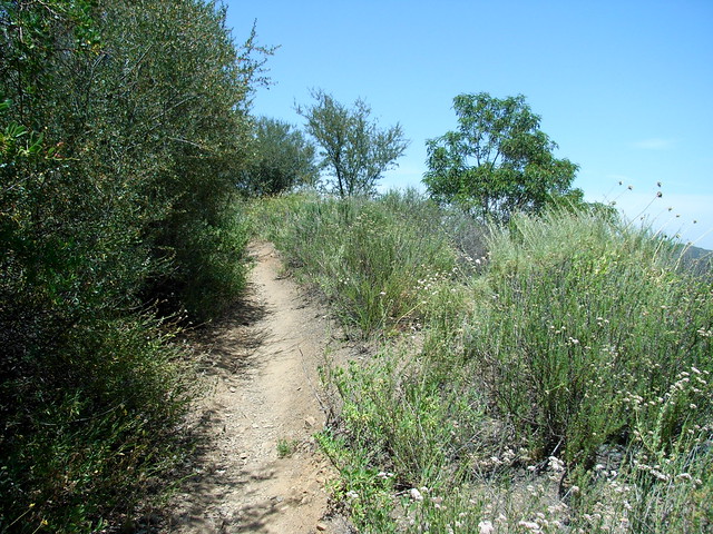
 After you’re done chilling out in the shade, continue back on the Old Boney Trail, and say hello to the sunshine — most of the rest of your time here will be spent in full or near-full sun. The wide, well-maintained trail makes some long switchbacks as it ascends one of the long ridges north of Boney Mountain. The trails are much wider than single-track, and the high grass is kept far away from hikers’ legs. So still make the occasional tick check, but you don’t have to freak out about it.
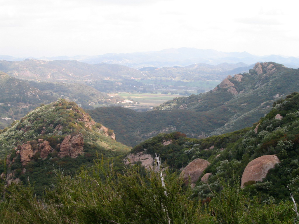
 As the trail gains in elevation, you’ll eventually start to get some sweeping vistas of the landscape below. If you look to the northwest, you can see the high meadows you walked through at the start of the trail — as well as the sprawling housing developments that seem to inch threatening close to the park.
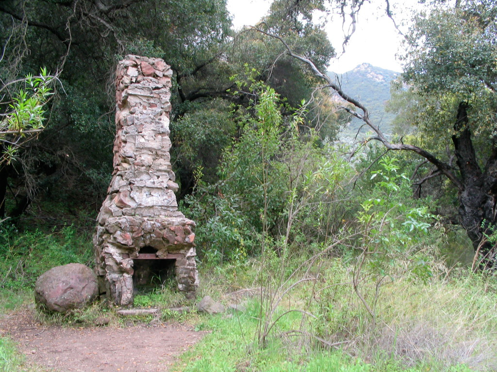
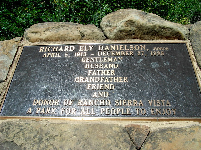
 Just under a mile from the waterfall trail, another side trail marked “Old Cabin Site” splits off from the Old Boney Trail. This short 0.3 mile trip takes you to the site of Richard Ely Danielson, Jr.’s cabin. As for the cabin itself, only the chimney remains —
 — but right nearby is a very serene stone and wrought-iron monument to the man who donated a large chunk of his ranch for preservation as parkland.
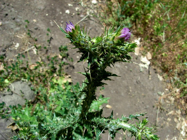
There are a lot of nasty thistles in the area, so watch where you’re stepping.
 This route skirts very close to Boney Mountain, but never actually ascends its summit … but if you’re dying to get to a mountaintop and don’t mind going on some rough trail, look for a small but well-worn path that keeps going beyond the monument:
 This is an unofficial trail — unmaintained and unmarked on topographical maps. I’ve done a small part of it (and will probably have to go back to mark the rest of it, now), but it’s a rough, eroded, no-nonsense ascent that climbs its way south until it reaches the summit of Tri-Peaks. It’s doable, but if you’re going to make an attempt, you’re going at your own risk.
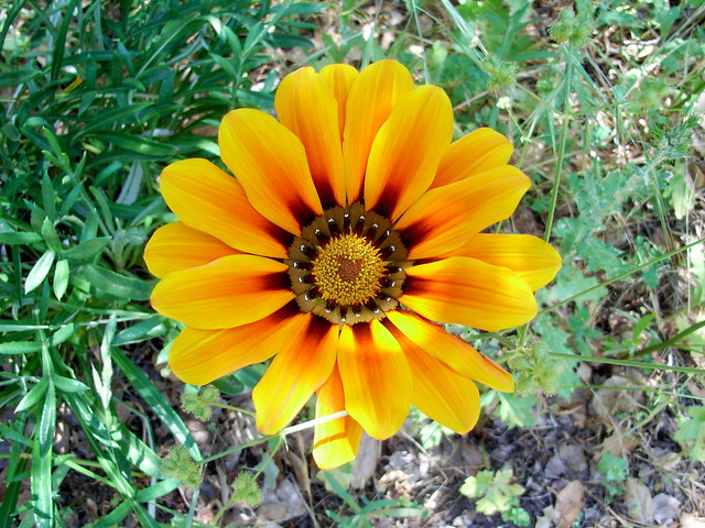
If you’re not summit hungry, turn back the way you came and return to the Old Boney Trail — keeping your eyes open for brilliant gazania blooms hiding in the underbrush.
 When you continue the ascent on the Old Boney Trail, you’ll know when you’ve reached the spot where most hikers turn and head back to the parking lot. Until now, the trails have been clear and wide, but now they’ll get rugged and overgrown.
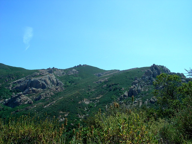
 Now is when you’re going to want to start making regular tick checks. I noticed a few hanging out in the grass, but never got any on my legs — so you probably don’t have to obsess about it, but it never hurts to err on the side of safety. Plus, while you stop to admire the increasing definition of your calves, you can get some rather impressive views of Boney Mountain as it watches over the enormous valley below.
 The very short section right after you get back on the Old Boney Trail is the worst ascent of this entire loop, but thankfully you won’t be dealing with the incline for too long. Your highest elevation — just over 1800 feet — is almost directly to the west of the Danielson Monument. The next six miles or so are predominantly downhill.
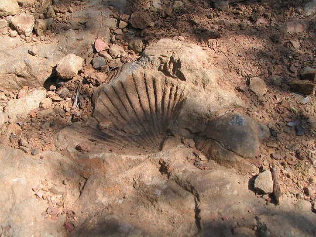
About a mile and a half after trudging along the ridges of the Old Boney Trail, you will reach a marked junction with the Fossil Trail. If you want to shave a few miles and hours off your hiking expedition, turn onto the Fossil. It will take you back to the Sycamore Canyon Fire Road and a junction with the Upper Sycamore Canyon Trail – both of which will take you back to where you started.
You can also spot dozens of fossilized shells lining the path. You didn’t think a trail called Fossil would be without them, did you?
 Skip the Fossil turn-off and continue south on the Old Boney Trail. The route continues for another 2.1 miles along some open ridges until it intersects with the Blue Canyon stretch of the Backbone Trail.
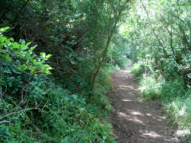
 Turn west here and head down the canyon, which will slowly grow thick with trees (and shade!) as it parallels a seasonal stream. If it’s hot out, this will provide a welcome respite from the rest of the trail so far, which has been mostly in open chaparral.
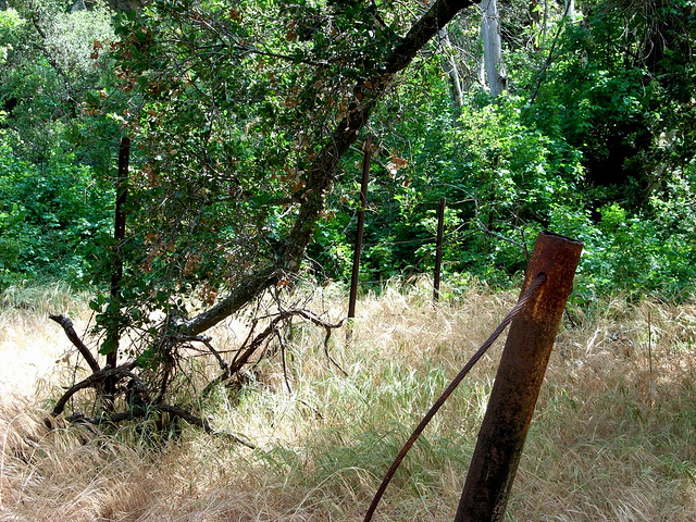
 After an easy 0.8 mile descent, you’ll pass a rusted barbed-wire fence that marks the former boundary of the Danielson Ranch.
 At the site of some former ranch buildings is the Danielson multi-use area — a group and equestrian campsite. When I hiked through, there were a handful of large tents and horse trailers, and several SUVs.
When you hike through the camp, you’ll come across the paved Sycamore Canyon Fire Road. Hang a right to hitch north.
Now, if you’re like me, the only thing you like less than hiking on fire roads is hiking on paved fire roads. If you want, you can stay on the pavement for just over three miles and get back to the trailhead.
But you don’t want that.
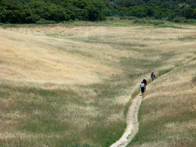
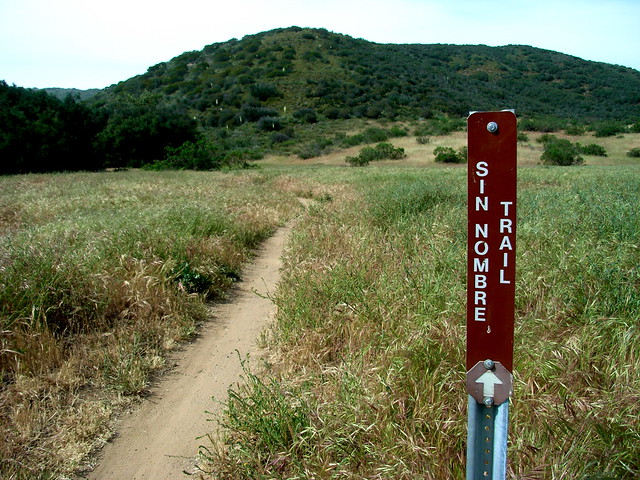
You want to stay on the fire road for just a few hundred yards, and then cut across a small path on the west side of the road that takes you back into the meadows. This path does travel south, and you’ll probably feel like you’re going in the wrong direction — but in under a tenth of a mile you’ll see a sign for the Sin Nombre Trail — part of a pair of trails that parallel the fire road at just a slightly longer distance. Your soles will thank you for getting off the road.
 This is a lovely stretch of single-track trail through thigh and waist high grasses that not only provides better views of the Sycamore Canyon valley than the road, but is also infinitely more peaceful.
 When I was there, I kept hearing this low, dull roar coming from all around me — a sound like a distant motorcycle or airplane. After a few minutes of wondering where all the bikers were, I realized it was just the collective buzz from the flying insects scattered around the valley. Not exactly the greatest of “Wow, nature” moments, but I’ll take it.
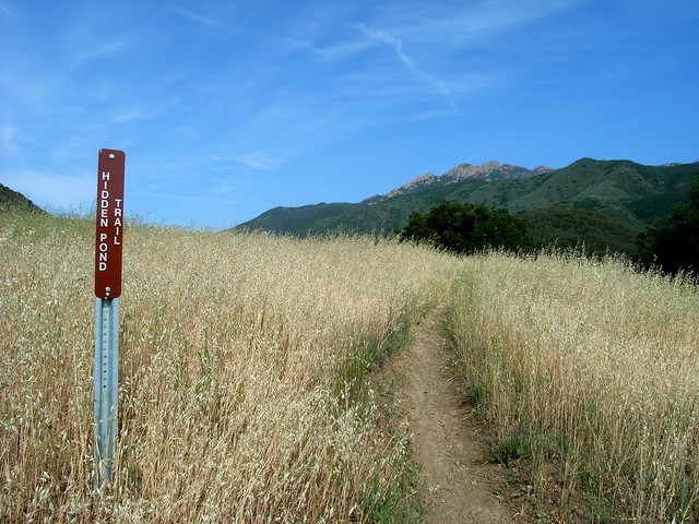
The Sin Nombre Trail continues across the valley floor before turning west and meeting up with the paved Ranch Center Road. Cross the road and rejoin the beaten path on the Hidden Pond Trail for more wide meadows and views of the mountains overhead.
 … just watch out for snakes. I spotted a small coiled one right by the start of the trail, but it kept its distance and didn’t bother me … even though I instinctively yelped as soon as I saw it.
It’s 1.2 miles on the Hidden Pond Trail until it returns to the Fire Road, after crossing a wash that wiped out part of the trail’s former path. After that, it’s another 1.4 miles on pavement back to the trailhead.
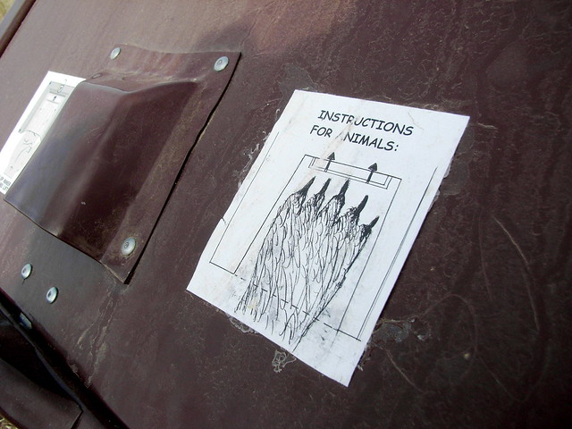
Just make sure you stop to take a look at the trash can overlooking Sycamore Canyon. If the Park Service hasn’t removed it, you’ll find some fairly entertaining graffiti.
 Note: This park was badly burned in the Springs Fire of May, 2013 – but quickly reopened just a few weeks later. Most of the trails are open although some may be closed due to erosion or for other safety reasons – so be sure to check with the park staff before you head out.
And if you think being burned has diminished the park’s beauty, you’re sorely mistaken. This is a great opportunity to get some first-hand experience with fire ecology. Hopefully, the wildflower show this spring will be spectacular. Click here for my experience hiking through the burned section of the park just after it reopened.
Tags: Boney Mountain State Wilderness, Danielson Monument, hiking in Los Angeles, Old Boney Trail, Point Mugu State Park, Rancho Sierra Vista, Santa Monica Mountains, Sycamore Canyon, Waterfall