This 5-mile lollipop loop just east of Jasper Townsite takes you along the Maligne River and into the ever-narrowing Maligne Canyon — the deepest gorge in the Canadian Rockies. As the canyon progresses, the walls get taller and close in on the river, creating tumbling cascades and waterfalls through the slot-like canyon. Springs are abound on this route and water seems to seem out of the rocks in nearly every direction and the trail turns around at a popular tea house. This is a highly recommended trail, and winter hikers may be able to hike along the frozen river itself!
Lying just outside Jasper Townsite near the Athabasca River, Maligne Canyon (pronounced muh-LEEN) is perhaps one of the most scenic and picturesque places in all of Jasper National Park. Although it is possible to drive to the tea house (which is really more of a cafeteria), this canyon’s beauty is best experienced beginning near its confluence with the Athabasca River.
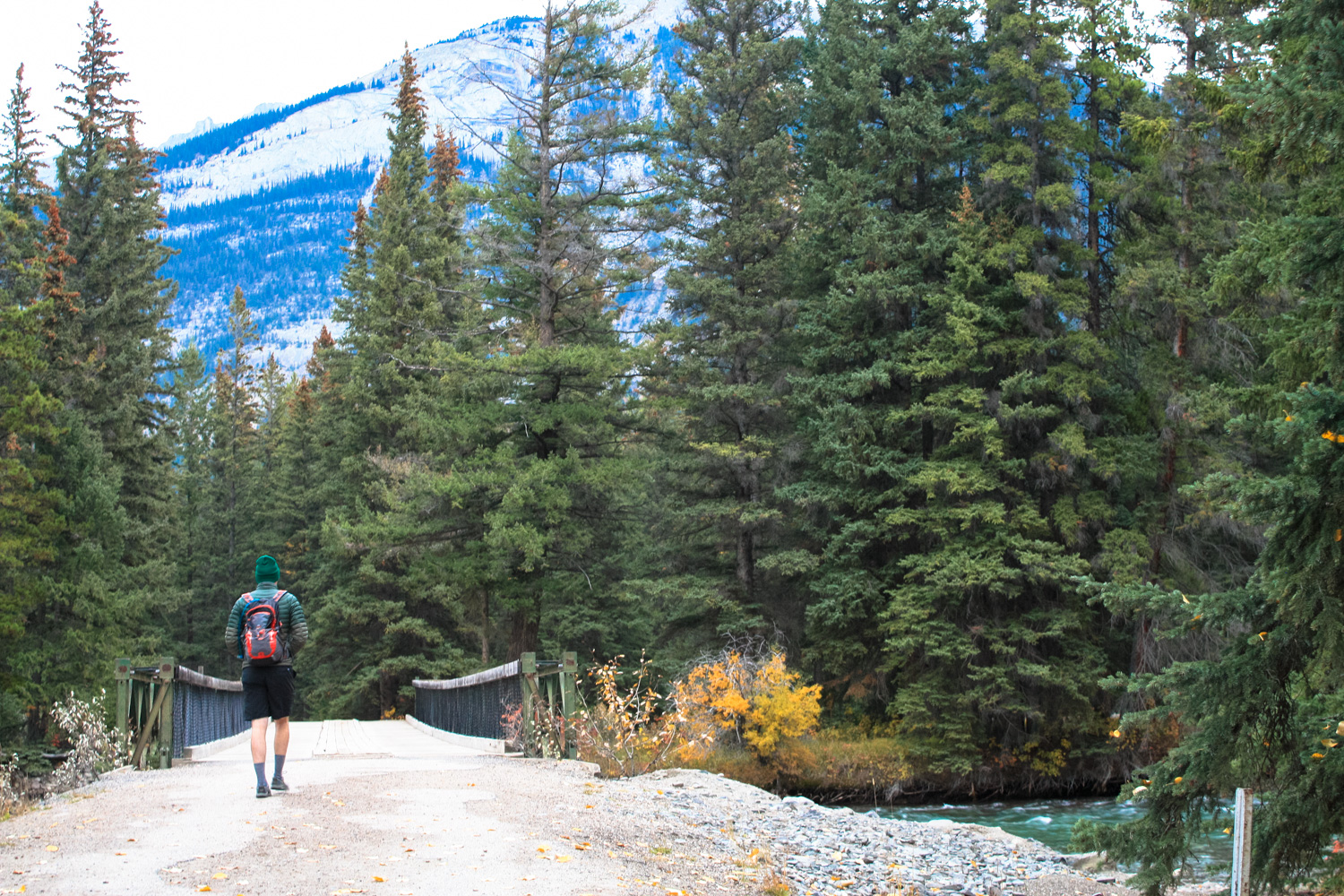
Beginning from the trailhead near Fifth Bridge, cross the Maligne River and keep right at the junction with the Overlander Trail to head southeast along the Maligne on Trail #7. Look for yellow diamonds on tree trunks to mark the route.


looking southeast along the Maligne
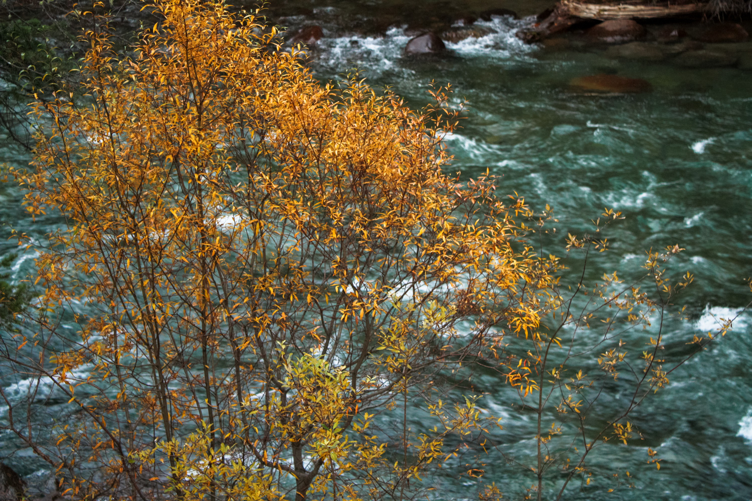
The trail enters a dense pine forest on the north bank of the river. You’ll be able to spot the rushing water through the trees occasionally, but for the most part you’ll be simply enjoying its sounds at this point in the hike. If you’re hiking in the fall, you’ll also get some nice splashes of color along the way from the region’s aspen groves. If you’re used to hiking in semi-arid climates like I am, even just being near this many trees and this much water is an extremely welcome change of hiking pace.
Be sure to watch out for springs along the trail between the Fifth and Fourth Bridges, some of which have such a strong flow of water that they really seem more like streams that just seem to pop up out of nowhere.


Shortly after the hike begins, the trail splits into routes marked 7 and 7f (I know, great names). The trails generally run parallel to each other, but 7 stays closer to the water and offers better views of the water — not to mention the occasional option to get to the river itself.

At 1.1 miles, keep right at the junction with the steep Rock Garden Path trail. Here, in sight of another suspension bridge across the river, the trail climbs up along a ridge above the water. A guard rail protects hikers from slipping down the canyon wall. Ignore a junction to the left with Trail 7h and keep right as the canyon path splits again. Similarly to the earlier split, the upper trail runs nearly parallel to the lower, which offers better access to the river.
Juniper and pasture sage hug the hillside here, filling the air with fragrant scents as the wind travels down the canyon toward the Athabasca.


Climbing up above the Maligne River
Stay to the right to return to the riverside, where you can take some short side trips to hop onto rocks near the river itself.
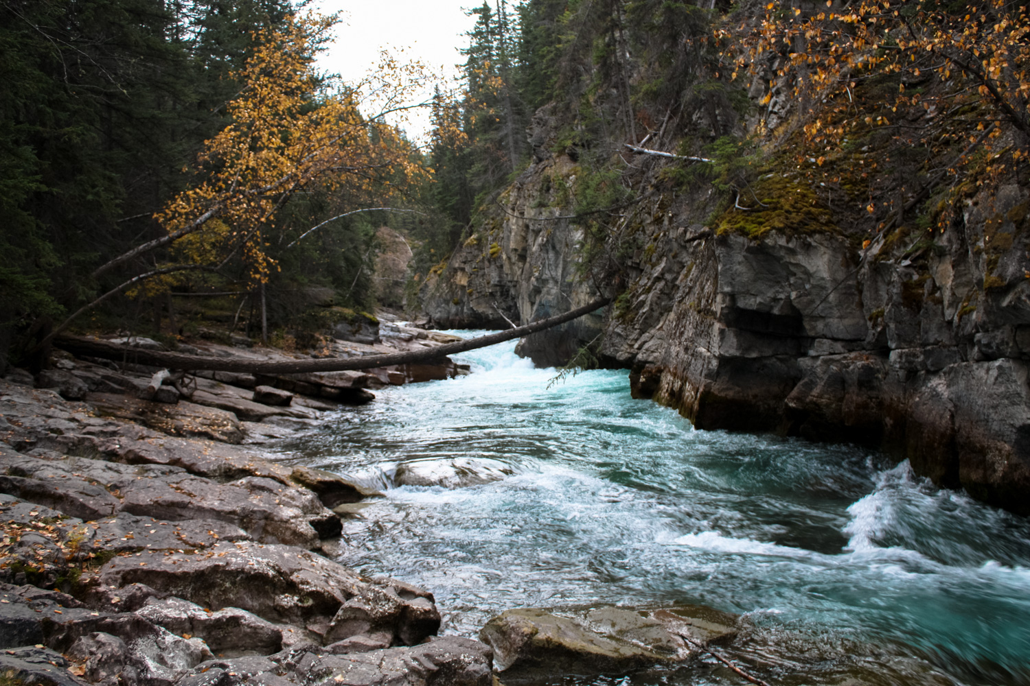
You’ll notice as the canyon walls narrow and rise, the river begins to take on a different character. Although the flow is fairly quick near the mouth at the Athabasca, the river is broad and low enough to not make much noise. Here, the flow is squeezed and forced through ever-smaller canyons, meaning that glacial blue flow gets to turn into some really lovely cascades during this section.


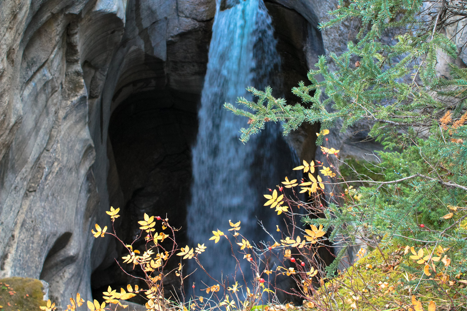
Around the 1.9 mile mark, look toward the south side of the river near a bend and you’ll spot what appears to be a cascading waterfall erupting from the ground itself.

Beneath your feet lies an enormous underground cave network that reaches all the way to Medicine Lake, some 16km upstream. The caves act as a subterranean river system that drains excess water from the lake, causing these strange surprise waterfalls to form and downstream springs to bubble over enthusiastically. This is especially apparent during the spring and summer, when snowmelt rushes into the rivers and lakes upstream — but it’s also visible following a rainstorm as precipitation permeates into the caves from above.
Even in mid October when we visited, the springs were flowing well — and I imagine it’s even more impressive during the warmer months.
After this point, the trail becomes a little more tamed. You’re closer to the tea house now and can expect to see more people on the trail here — and less of them in proper hiking gear. More guardrails and concrete pavement enter the canyon here as well, but it’s definitely not without reason. The canyon becomes significantly more dramatic — narrowing to a width of 2m (6.6 feet) and a height of up to 50m (160 feet)!
The trail splits again here, traveling on both sides of the deep, narrow scar of Maligne Canyon. For a chance of pace, cross the canyon at the Third Bridge and cross again at the First Bridge to head toward the Tea House and main parking area. You’ll see a series of impressive cascades hemmed in by the canyon walls as you cross the bridges — and if it’s cold enough, they may actually be frozen solid.


Grab a snack or use the restrooms at the tea house, then head to the western edge of the parking area. A very vague map posted on one of the canyon’s interpretive signs makes it seem like a trail loops around to the north of the canyon from the restroom area, but we were not able to find this trail. Instead, look for the yellow diamonds on the trees pointing toward Trails 7h and 7f and head in that direction.

Follow this path west. You’ll be well above the river on this route, but while you’ll miss that access to the water you’ll also get some really lovely views looking toward Jasper Townsite and the nearby peaks.


At 3.5 miles, you will return to the Maligne Canyon Trail by following Trail 7h (stay to the left) or by taking the more direct and steep route down the Rock Garden Path.
Return to the trailhead the way you came in.
Tags: Jasper National Park, jasper townsite, maligne canyon, maligne canyon teahouse, waterfalls