

Recently, I played a game on a hiking group on Facebook called “Can you name this spot?”. I would show a picture and ask other hikers to identify the location. When I posted a photograph of Carson’s Crossing in Los Peñasquitos Canyon, one of the hikers stated “The Florida Everglades.” How on Earth does one confuse semi-arid San Diego County with the marshes and swamps of southern Florida? Visit Peñasquitos Canyon, and the answer will be less mysterious than you’d think.
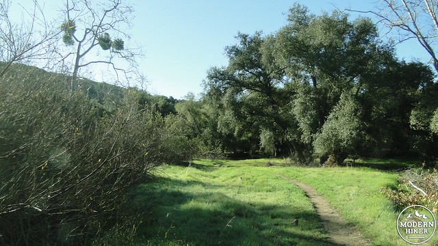
Grassy meadow on the foot trail
Peñasquitos Creek is a lesson in the power of water and its ability to turn a near desert into a subtropical paradise. The canyon and attending preserve encompasses a six mile strip of land bordered by suburban development. The preserve protects the ecosystem within, which is dominated by the year-round flow of Peñasquitos Creek, which supports a robust riparian woodland. Parts of this strip of woodland are so dense, damp, and lush, that it is easy to forget that with a few hundred yards on either side of the creek emerges the usual scratchy carpet of chaparral.
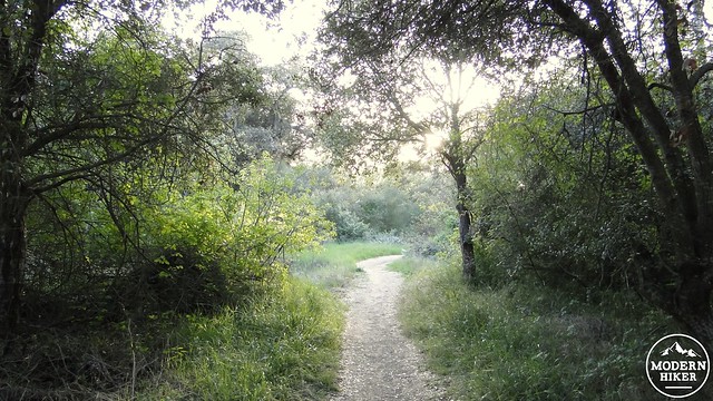
Near Carsons Crossing
This write-up describes the eastern (and more lush) portion of the canyon, which divides at a waterfall about halfway through the preserve. This route also eschews the crowded fire road running parallel to the creek on the south, as well as the trail running parallel to the north. This single-track trail runs near the banks of the creek and through the densest parts of the woods. In theory, this should also allow you a respite from the multitude of mountain bikers who frequent the main trail, although you should still be prepared to encounter a few bikers who disregard the clearly marked signs describing this trail as off-limits to all but bipeds and quadrupeds.
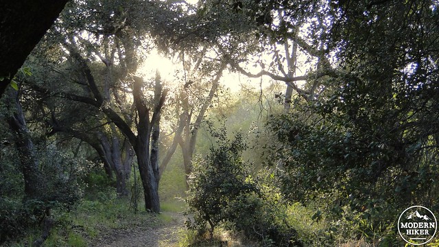
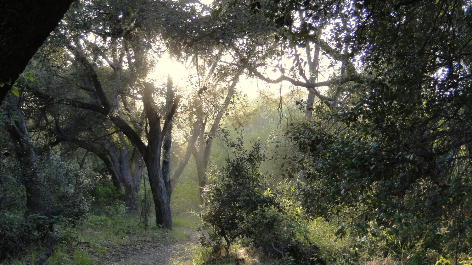
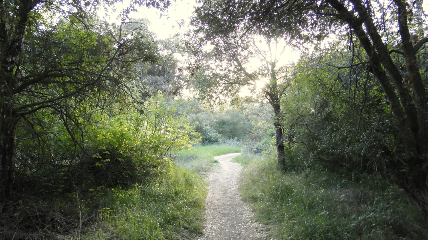
Trail near dusk
After parking at the lot and paying the fee ($3 at the time of writing), find the trailhead marked by an info kiosk and a closed gate. A gap allows you to emerge onto the wide fire road that heads due west. After about a tenth of a mile, a smaller single-track will emerge on the right. Take it. You’ll soon pass through dense patches of prickly pear cactus into a lush woodland of coast live oak, sycamore, and willow trees. This scenery will stay with you through the majority of the hike, shading you from the sun and providing a welcome sense of isolation from the din of suburban noise around you.
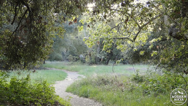
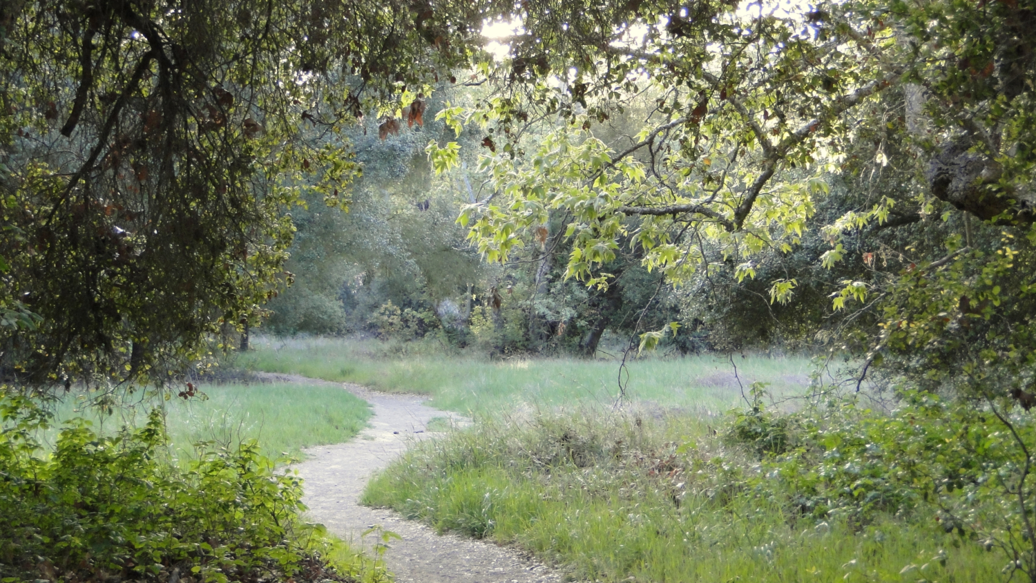
Spring grasses
The single track trail that you’re traveling on will dive into and out of the woods, connecting with the main trail for brief stretches. As the side trail is only ever marked with signs warning mountain bikers not to enter, it can be a little disconcerting to venture onto them, especially if you’re not certain where they might lead. Trust them. The only places they will lead will either be to the handful of creek crossings or back to the main trail. You will not get lost here, and as long as you stick to the trail and don’t wander off, you will have a lovely experience.
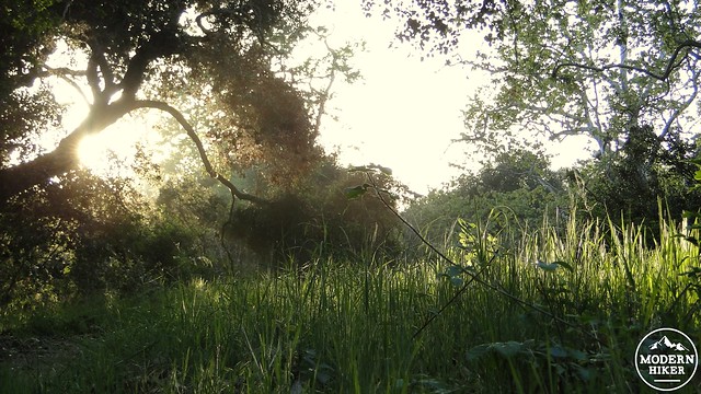
Early evening sun
One thing to be aware of is that with the generous amount of oak trees will come an equally generous amount of poison oak. If you are unable to recognize the shiny, bright green (or reddish in late summer and fall) leaves, you should make it a priority before attempting this hike. Remember the old adage, “Leaves of three, let it be.” Also know that poison oak prefers cool, shady spots beneath oaks, where it will grow like weeds beneath the trees on either side of the narrow trail. This isn’t necessarily a concern, as you’d have to go off trail to encounter it. However, poison oak can also grow as a vine up into trees and off of the branches. Occasionally, a poison oak vine will separate from the tree and emerge at chest, shoulder, or even head height on the trail. Remain mindful lest you inadvertently get a face full of poison oak.
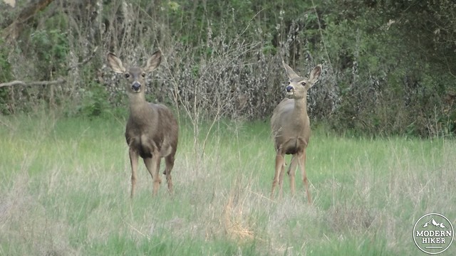
Mule deer
As you follow the meandering trail through dense groves of oaks and sycamores, punctuated by small meadows, patches of cactus, and occasional glimpses of creek, you will frequently experience the sensation that you have left San Diego and wandered somehow into a swamp-like environment. The word “riparian” refers to growth supported by watercourses. The more water, the more growth, and as the creek is reliable, so too are the woodlands. The trail itself is remarkably flat, and the combination of easy, flat hiking and dense trees makes the first 2.5 miles of this trail a delight.
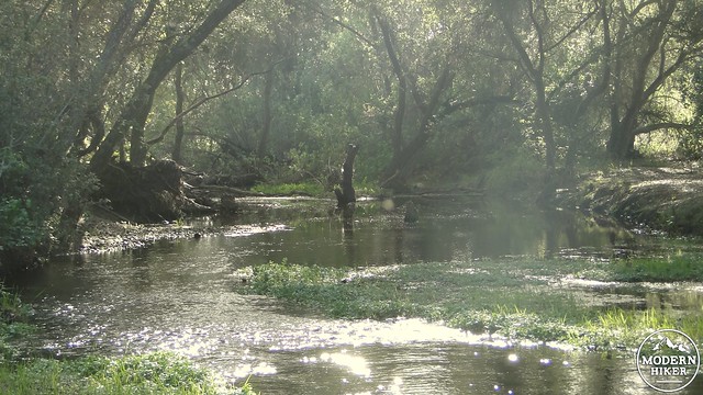
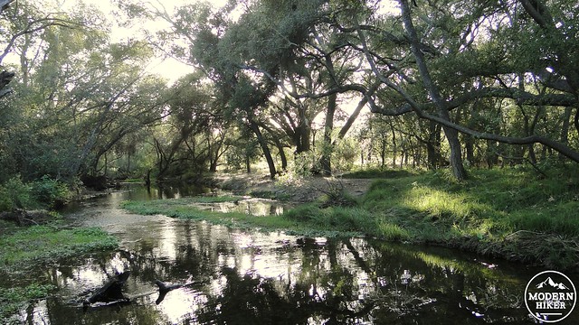
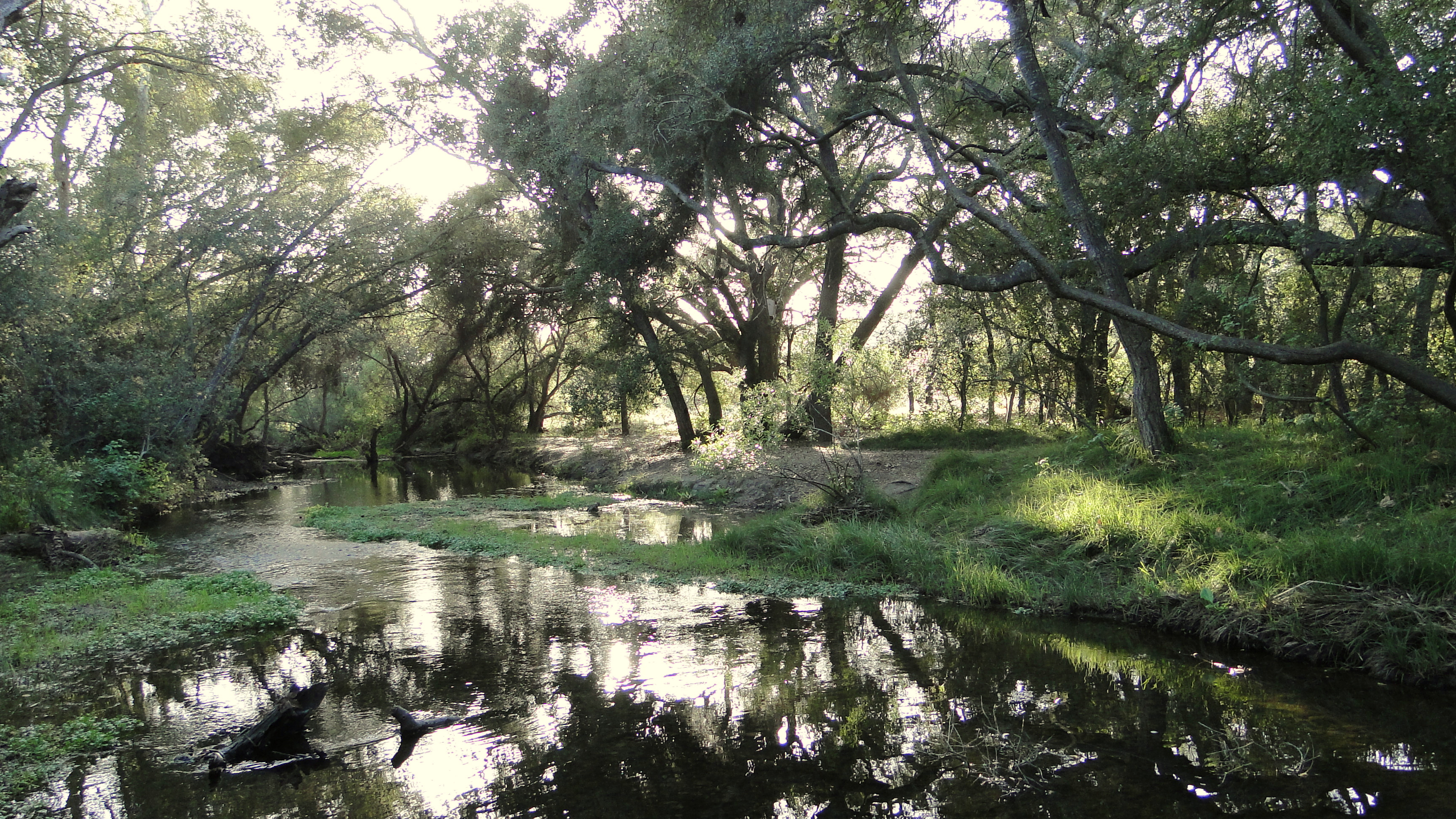
Peñasquitos Creek
At 2.5 miles, the trail emerges from the woods and re-connects with the main trail at a junction called Carson’s Crossing. This is a worthy side-trip as the crossing is a beautiful spot. A wooden bridge crosses the creek beneath the shade of mature oak trees. The creek slows and collects into a large pool by which one can sit and read or simply soak in the sound of birds singing and frogs croaking. The peace is not absolute as mountain bikers frequently cross over the bridge and throw their loud conversations into the mix. If you don’t wish to continue to the waterfall, this is a good place to stop and rest before turning back for a 5 mile round trip hike.
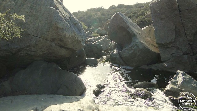
The top of the waterfall
However, if you find waterfalls inspiring, trace your way back to the main trail, and turn right to continue west on a gentle ascent. There, you will find a large volcanic rock outcrop seemingly out of place in this grassy, gentle landscape. The creek tumbles over the outcrop forming a small waterfall that is somewhat difficult to view head-on due to the lack of access to a frontal view. Be careful climbing about here, as there are a number of drops that could cause injuries.
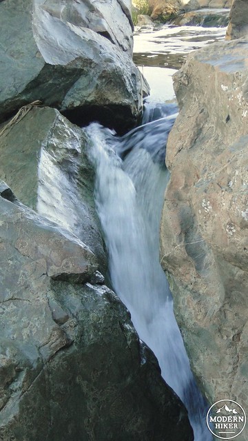
Peñasquitos Falls
This point marks 3.2 miles in and is a fine place to turn around and return. If you continue west for for another 2.8 miles, you will reach the west trailhead for a 12 mile out-and-back trek. This 12 mile hike is an excellent hike for runners seeking to practice for long-distance trips, although the scenery on the west end is not as nice as that on the east end. Should you feel satisfied, re-trace your steps back along the creek until emerging back at the trailhead.
Inner trail during February
Tags: creeks, Hiking, Los Penasquitos Canyon, riparian, San Diego, San Diego County, waterfalls, woods


