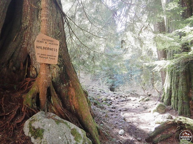
Few hikes give you this much bang for your buck. Even though the 10-mile roundtrip trek might seem daunting to less experienced hikers, the elevation gain of a mere 1300 feet is minimal. While most lakes nestled in the Northern Cascades make you work for a refreshing dip by forcing you to climb an exhausting amount in a shorter distance, the beauty of Goat Lake is that it’s accessible with much less effort. In fact, everything about this trail seems to cater to the hiker – from the large parking lot that opens right into the trailhead to the overnight campsites and day use areas conveniently skirting its blue green waters. These enticing features do, however, draw a lot of hikers, so the earlier you get to the trailhead, the better.
Right foot. Left foot.
Right foot, left foot, right foot, left foot.
I was cranky. Irritated. And severely ticked that on my one morning off I had to get up early and hike. And to add to that already negative vibe, I was annoyed that I was annoyed I had to hike.
Hiking is one of my favorite things to do. If I could spend my entire life on the trail – minus a few short weeks at a lovely little resort on Cannon Beach – I would. The simple act of putting one foot in front of the other provides a momentum that I crave. A forward motion in a life that doesn’t always move as fast as my adventure-craving soul wishes it would.
This last week has left me drained and grumpy. Three busy ten and a half hour work days in a row forced me into bed each night earlier than I would have liked, leaving absolutely no time to decompress before having to get up and start the madness all over again. Needless to say, by Saturday morning my eyes burned, my head felt like it had been stuffed with cotton, and my body ached in ways that you wouldn’t think a mere receptionist’s body would. (I mean, most people think we just sit around and answer phones all day, right? Right.) Above all else, I was angry that my job left me too tired on my days off to pursue the things I truly loved – hiking being at the top of that very long list.
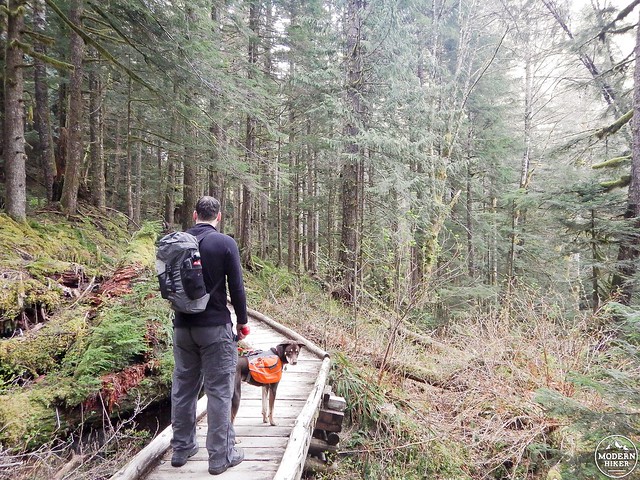
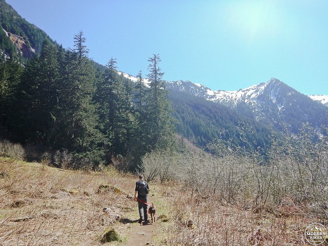
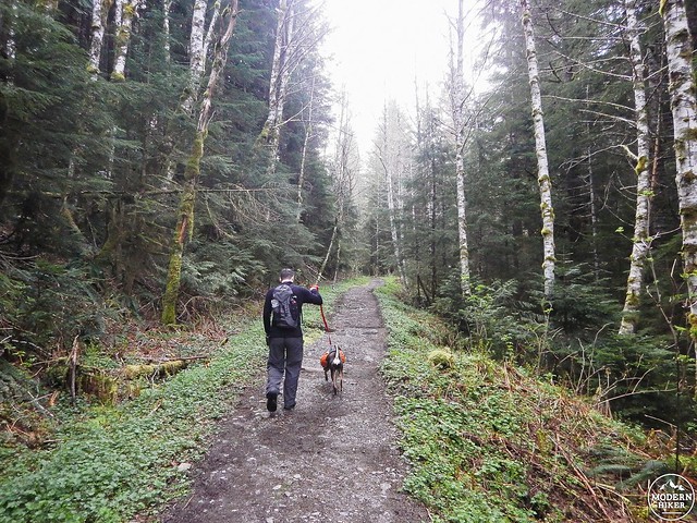
So when we pulled up to the Goat Lake trailhead bright and early that morning, I laced up my boots and pulled on my pack with a lot less enthusiasm than usual. My shoulders drooped as I stared down the trailhead, and for the briefest of moments I considered returning to the comfort of our Jeep and hauling it home. But then my husband brushed past me with a smile, our little dog trotting eagerly behind him, and I knew then that as much as I didn’t want to be there, I wanted to be there. I took a deep breath and, with a very unladylike growl, pushed forward. Right foot, left.
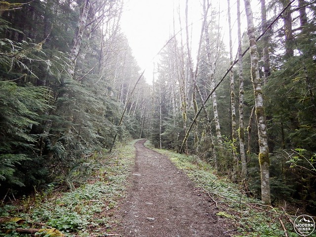
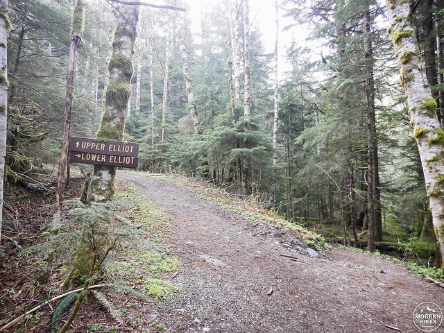
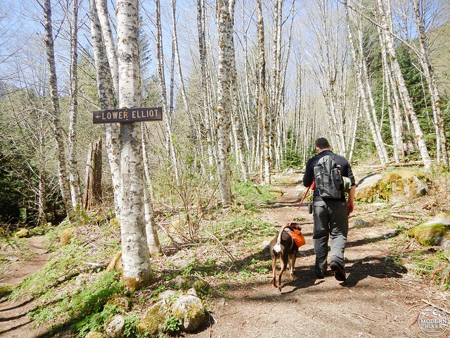
This easy-to-follow trail opens to a landscape that isn’t very unique (at least to the Pacific Northwest), but it doesn’t have to be. A wide path steers you quickly to a fork in the trail, allowing you to choose your own adventure. Rising to the left is Upper Elliot, while Lower Elliot beckons on the right. The two routes become one again a few miles into the hike, so either option will eventually lead you to Goat Lake. If you don’t feel ready for a climb just yet, opt for dropping down into Lower Elliot and hitting the upper trail on your way back. After seven miles of hiking, you’ll more than appreciate the gentler descent!
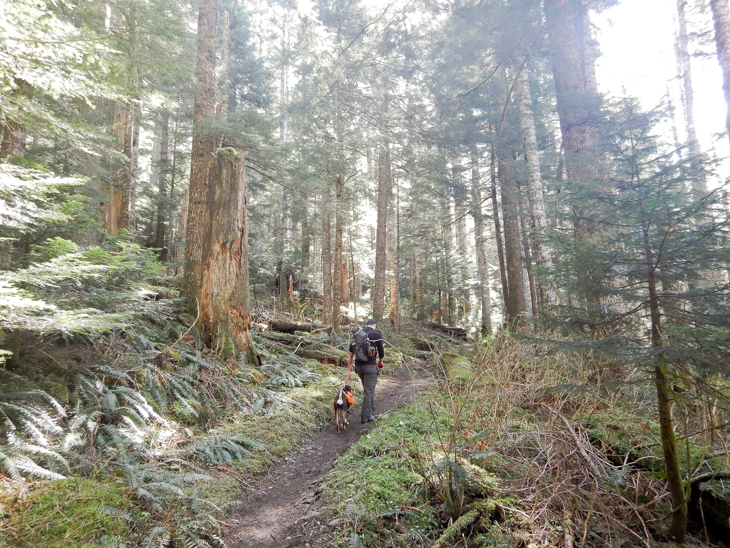
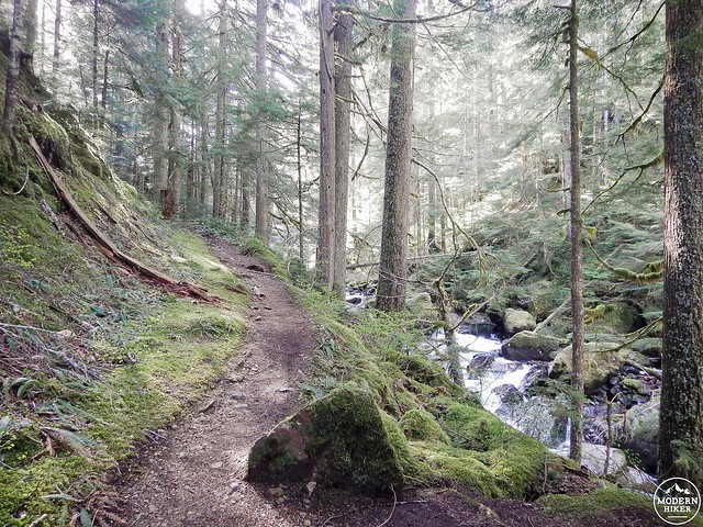
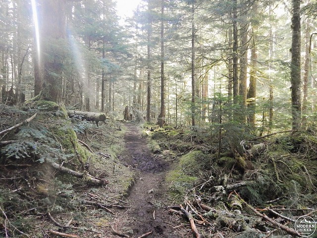
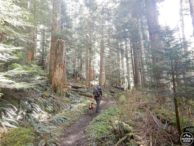
Fed by the creek, Lower Elliot is vibrant, green and absolutely bursting with life. The sound of rushing water greets you just a few paces in and, like aloe to a sunburn, it immediately begins to soothe any and all stresses (I, for one, vouch wholeheartedly for this). Strategically placed logs and modest bridges steer you off and on for a mile or so, making the trail easy to follow. The path narrows the further you trod, flanked on each side by lush ferns, moss-covered trees, and vivid yellow-petal skunk cabbage. You’ll encounter a few (very mild) stream crossings, but leaping across them is easy thanks to several protruding rocks and downed branches. Follow the footpath for almost two miles as it rolls gently alongside the creek, all the while breathing in the fresh scent of pine and appreciating the cool, mountain air on your face. And although you’ll only ever catch glimpses of the rushing water through the thick forest, her music will serenade you during this entire stretch.
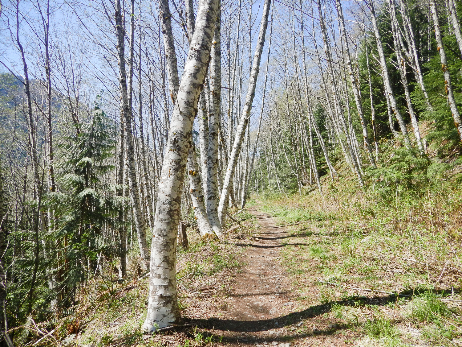
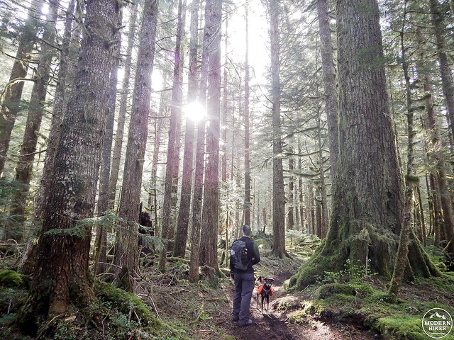
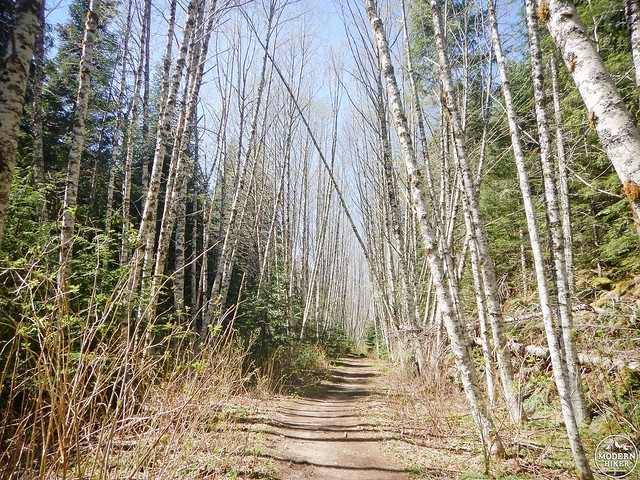
After about two miles, begin a gentle ascent away from the creek and merge once again with Upper Elliot. At this point, you’ll have traversed three miles of the trail. The path immediately levels out and passes through a beautiful stretch of alder trees, their slender trunks and bare branches a striking contrast to the lush forest you’ve just left behind. Enjoy this bit of flat tread, because a climb is coming.
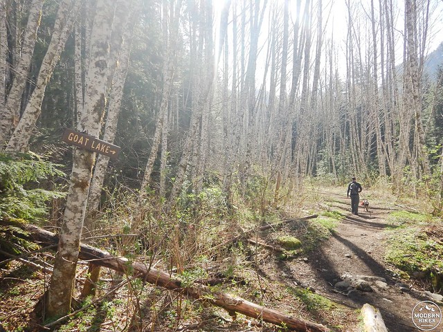
It isn’t long before the scenery changes again, and the trail becomes more and more rugged as you approach the four mile mark. Gone is the soft tread of Lower Elliot. Instead, chunky rocks and exposed roots dot the path, which might force you to slower your pace to better pick your way across the jagged terrain. The trail also starts to climb at this point, rising swiftly. You’ll climb approximately 491 feet in just under a mile. During this time, keep an eye out for an upturned tree – the path appears to split, and you’ll want to veer left (instead of heading straight) in order to continue on to the lake. We were helped out by a fellow hiker who stopped us as we started our ascent to let us know about the fork in the trail. He even went so far as to prop a couple of fallen branches up, directing others where to go. Hikers really are the friendliest bunch, aren’t they?
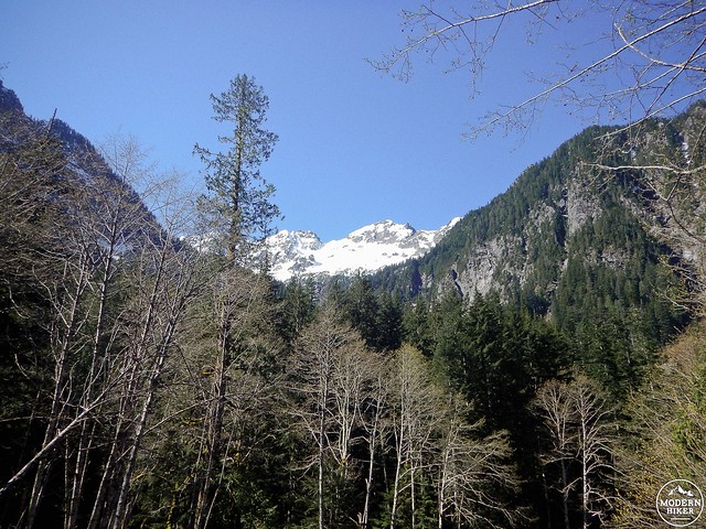
A few lazy switchbacks zig and zag you farther and farther up through the trees, and if you feel comfortable enough tearing your eyes away from the jagged terrain you can catch glimpses of snowcapped peaks and several far-off glistening waterfalls.
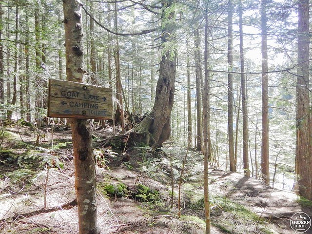
The sound of McIntosh Falls will greet you as you finish your climb, though it’s hard to glimpse the rushing water from the trail. It’s shortly after this point that you’ll come to a junction directing you to either campsites (a path which rises to the left) or Goat Lake. Take a deep breath and adjust your pack – you’re almost there.
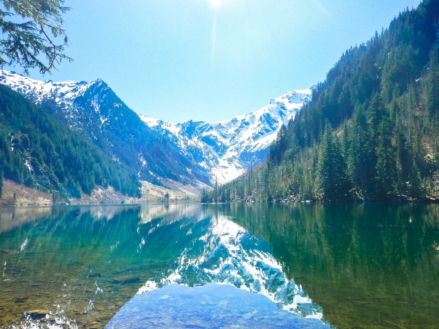
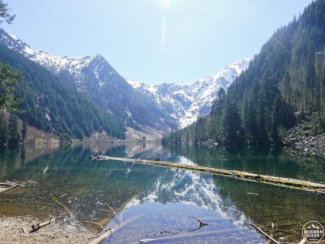
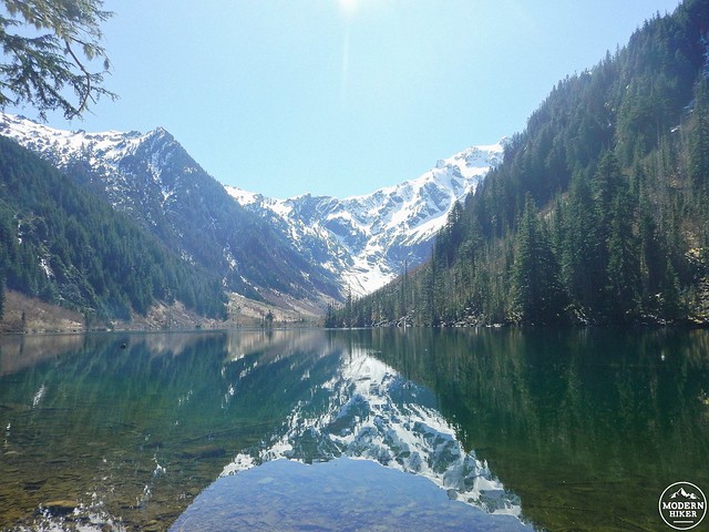
While there’s no camping allowed on Goat Lake’s shores, there are plenty of spots carved out along the water to enjoy the spectacular view. Crystal clear blue-green water mirrors the surrounding forest and snow speckled mountains, forming a scene that will literally take your breath away. If you don’t forget your own name, surely you’ll forget any worries or stress that may have accompanied you on the hike up. Soak in the delicious mountain air and the cool breeze coming off the lake while munching on a snack – you’ll need the fuel for the five mile trek back.
Once you’re done with the lake (whether it be minutes or hours), retrace your steps, hiking down instead of up, and all the while feeling that life is just a little bit better that it was before. Because, you know, that view…
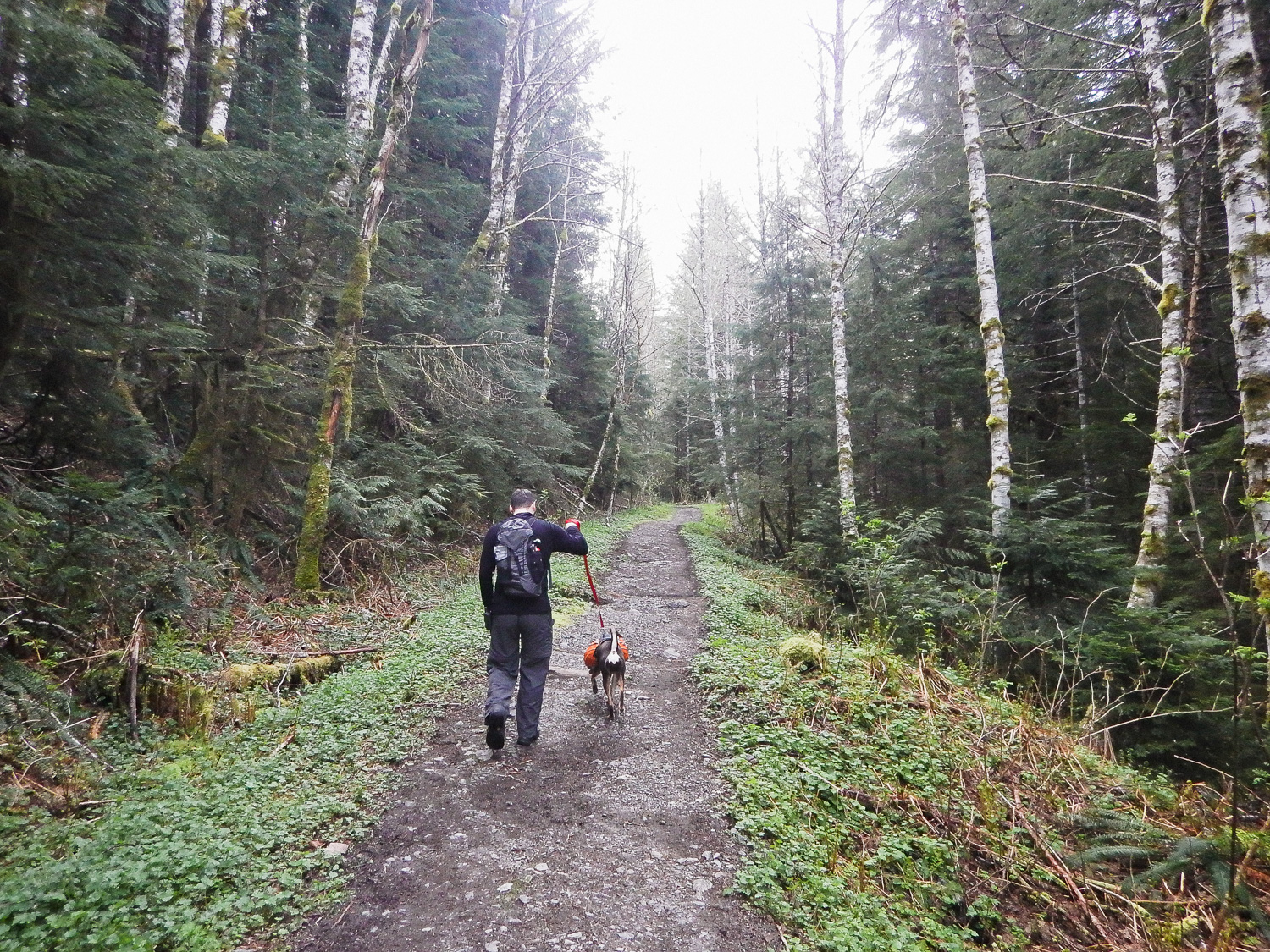
Roughly two miles of backtracking will lead you to a recognized fork in the road. If you opted for Lower Elliot Trail on your way up to Goat Lake, consider taking Upper Elliot on your way back. When coming from the lake, Upper Elliot veers away from the fork in a slight climb but quickly levels out before spending the next two and a half miles sloping gently downward.
The upper trail is vastly different from the lower. While the latter is lush, green and vibrant, its sister trail is dry, dusty, and – on a sunny day – hot. Higher elevation and little tree cover leaves the rocky trail more exposed and open to the elements. Prepare for this portion of the hike with sunblock, sunglasses, and even some extra water. (I ran out about a mile before we hit the trailhead and, let me assure you, that was one long mile.)

In contrast to the sound of rushing water that constantly serenades Lower Elliot, Upper Elliot is quiet, still. The open sky is expansive, giving way to views of craggy mountain peaks and soaring birds stretching their wings. This unassuming atmosphere ignites a sense of freedom, and as the upper trail is less traveled than the lower one, the possibility of running into a horde of hikers is slim. Contemplation – a chance to go within– is more than attainable during this three mile stretch, as the only sound you’re likely to hear is the steady, almost hypnotic crunch of your boots on the path and the occasional whisper from Mother Nature.
Sounds of Elliot Creek will begin to tickle your ear as you wind up this section of the trail, growing louder and pulling you, almost reluctantly, back to reality. Reconnect to the main trail and walk the short path back to the trailhead, feeling altogether refreshed, renewed, sore, content and, above all else, grateful for the journey.
Even if, like me, you were a little cranky to begin with.
Tags: dog-friendly, Goat Lake, Hiking, lake, McIntosh Falls, Mountan Loop Highway, Mt. Baker - Snoqualmie National Forest, North Cascades, Seattle, trail write-up, Washington State