Hidden in the remote folds of the eastern flank of the Palomar Mountains lies one of the most satisfying and adventurous hikes in Cleveland National Forest. The trek to the lofty perch of Eagle Crag passes through many of the mountain ecosystems of San Diego County, including high desert, montane chaparral, oak woodland, riparian woodland, mixed-conifer forest, and conifer and chaparral woodlands. The reward for this challenging 17+ mile adventure – beyond the adventure itself – is the fantastic view at the summit of the crag, which takes in the Agua Tibia Wilderness, northern San Diego County, Temecula, the San Jacinto and San Bernadino Mountains, and Anza Valley.
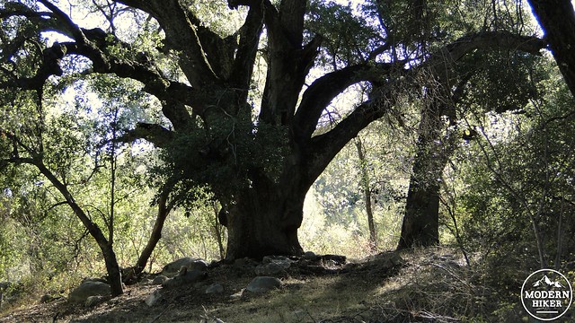
The small…
. . . and the large
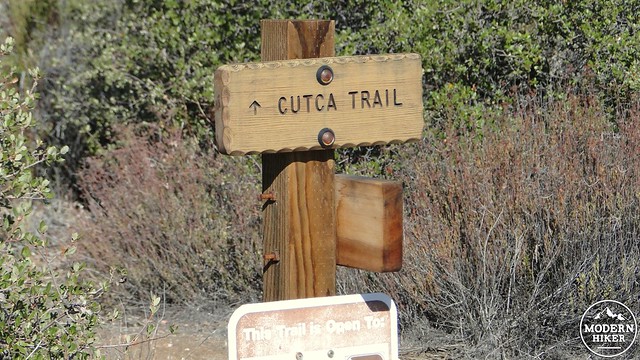
The hike itself is only a part of the adventure. Getting to the trailhead can be a challenge in itself. After driving the long, lonely Highway 79 along the backside of the Palomar Range, you will need to follow several miles of rough dirt road to the Cutca Trailhead. The Forest Service occasionally closes this gate during inclement weather, so it is advisable to check ahead to determine if it is open. You can reach the Palomar District of Cleveland National Forest at (760) 788-0250.
It’s also worth noting that Cutca Valley is one of the better backpacking destinations in San Diego County. Numerous seasonal streams crisscross this rolling backcountry, and there is one particularly excellent campsite (see description below) alongside a seasonal creek past the junction with the Cutca Trail . The Palomar District requires that you obtain a wilderness permit. Print out this permit application, fax it to the Palomar District, and they will mail the permit back to you. Allow a couple of weeks for the process.
It should also be noted before the description below that this is a very challenging and difficult hike. Aside from the extreme length (at least for dayhikes), the trail gains a lot of elevation with a significant chunk coming in the last .6 mile. Large parts of the trail are overgrown and difficult to follow, with one particular stretch being overgrown with poison oak and another stretch featuring rampant patches of poodle dog bush. The attempt on Eagle Crag follows a steep route up a ravine before hitting what appears to be a nearly impenetrable wall of shrubs that are recovering from a recent fire. Some of these recovering shrubs include the dense thickets of poodle dog bush, which is mostly dead but still dangerous in its ability to cause skin irritation. The bush is nearly unavoidable, despite my efforts to hack a rough trail through the worst of it.
Also, you will need to come prepared with abundant fluids – a gallon of water at the absolute minimum, salty and hearty snacks to maintain your energy, a first aid kit, and a good understanding of route finding, including a map and a compass. It’s also advisable to have a fully charged cell phone (there is reception throughout most of the hike) and a GPS device that will help you maintain the route. Finally, it is not advisable for inexperienced hikers to attempt this hike alone. It’s long, sometimes hot, and challenging, and if you’re not traveling with somebody familiar with the trail, you will be incurring more risk than with a more casual hike.
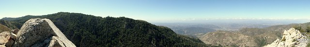
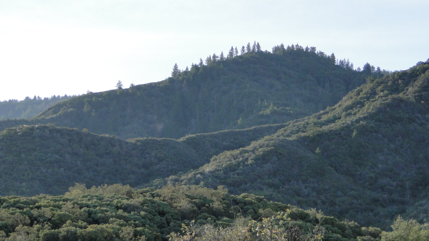
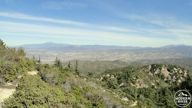
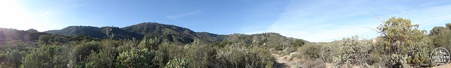
The view from Eagle Crag
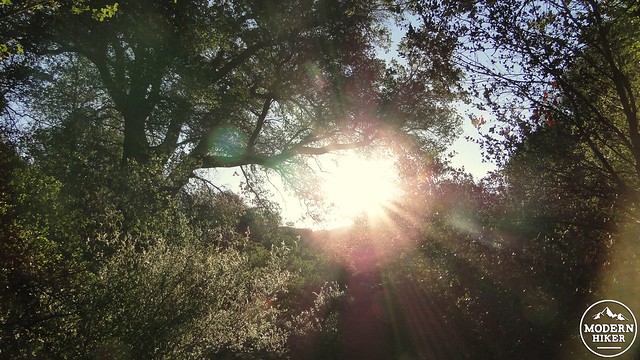
Alders along a creek
Those cautions aside, this may be the single best non-desert adventure in all of San Diego County. You will experience variety on this hike that is hard to find anywhere else in the county. You will enjoy soaring views both east and west. You will backpack in a wild, nearly unspoiled wilderness. With a hike of this level of difficulty, there also comes a clear sense of accomplishment.
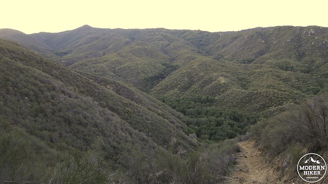
The descent to Cottonwood Canyon
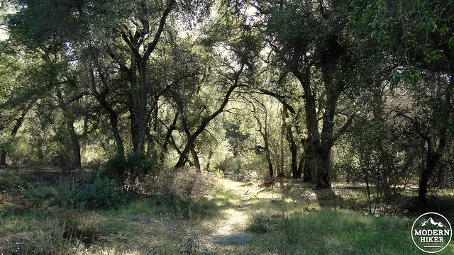
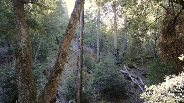
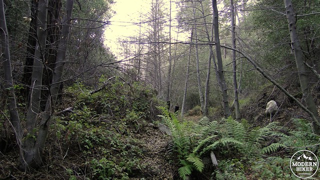
To start, you will pass the trailhead sign for the Cutca Valley Trail and begin an immediate, rocky descent into Cottonwood Canyon. Right off the bat, you lose 500′ of elevation dropping into the canyon’s cool, shaded depths. Water runs through here during the wet season, and there are a handful of spots that might be suitable for dispersed camping. Once at the bottom, the trail will turn to the right and follow the creek for a few tenths of a mile before bearing left to follow the climb a steep and narrow ravine. This ravine is shaded by dense groves of coast live oaks with a smattering of sycamores. Dry leaves will crunch beneath your feet along the occasionally faint trail, and cool air from the dense shade will provide relief on warm days.
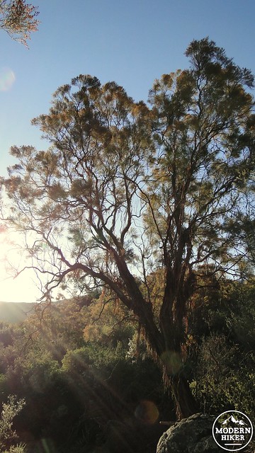
Ribbonwood
Eventually, the trail will climb up and out of the ravine to emerge in a section of old growth chaparral. The chaparral here is dominated by sweet-scented ribbonwood. This member of the rose family gets its name from its perpetually peeling bark, which appears to be stripping away in ribbons. Some of the specimens here reach 15-20′, which gives it a tree-sized proportion. Along with manzanita, which grows large here as well, ribbonwood is one of the more attractive and pleasantly fragrant chapparal plants. You’ll see quite a bit of it along the way to Eagle Crag, so enjoy it well.

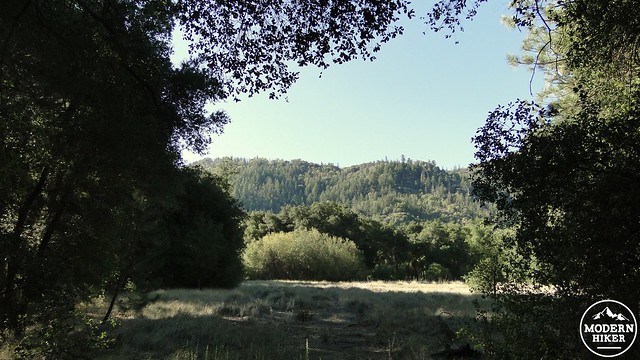
The meadow near the camping sites
The trail straightens out a bit as it follows the overgrown remains of an old road bed. At times, the trail nearly disappears in the modest undergrowth, and it is clear that this trail receives very little regular maintenance. After a lengthy stretch of chaparral, the trail will round a bend through oak woodland, with some impressive specimens of coast live oaks. For the next 3 miles or so, the trail will undulate gently through a combination of mature chaparral and long stretches of oak woodland along occasionally dry watercourses. This will include the one tedious stretch of the trail where the route contours with a slight descent around the foot of a large hill. It’s not so bad on the way in, since you will be enjoying views over Anza Valley with Mt. San Jacinto and Mt. San Gorgonio towering in the distance. On the way back, however, you will have a modest amount of climbing during a much warmer part of the day.
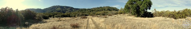
The trail ceases its contouring in order to pass through heavily-wooded Cutca Valley. You will soon come to a junction marked by some indistinct signage. It doesn’t help that you have been traveling on the Cutca Valley Trail and will now be traveling on the Cutca Trail. If you stay straight on this junction, you will walk along the alder-shaded stream on your right until you reach a large meadow with the upper reaches of the Palomar crest towering above. A large, sandy flat presents an appealing site for camping.
This is an ideal spot for backpacking, and it is one of the two recommended spots. This spot is especially preferable if you are traveling with a group. For one to two person groups, there is another site further along that is equally pleasant. When I visited, there was a rock ring established at the site; please know that ground fires are prohibited at all times within Cleveland National Forest. Even if you’re not camping, this is a great spot to stop and take a snack break. You’re about 5 miles into the hike at this point, which means you still have 4 miles to go to reach Eagle Crag. However, this is also a good spot to turn back if you’re only interested in camping out for the night or if you don’t feel up to the full scope of the hike.

Once you’ve finished your snack and are ready to continue, return to the junction and turn left (if you’re facing east) onto the Cutca Trail. Cross the stream and continue along the fire road through sparse chaparral. Great views of the forested Palomar Crest above hint at what you will soon be traveling through. You’ll follow this fire road for a 1 mile stretch until coming to another junction in which the Cutca Trail splits off to the left. Take the left turn and commence traveling on single-track trail that is closed to mountain bikes to “avoid conflict between users.” This is just as well, since mountain bikers will struggle to navigate the rough trail over the next few miles.
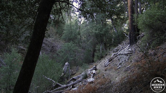
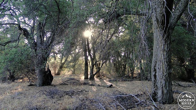
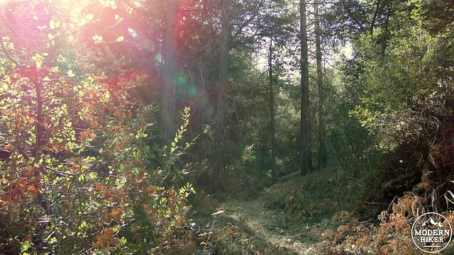
After passing through dense chaparral and oaks along the right bank of a seasonal brook, the trail will plunge into the twilight beneath dense thickets of alders and canyon live oaks. The first conifers of the hike – mainly bigcone Douglas fir and Coulter pine – show up here, although the area receives enough moisture to support incense cedars as well. The vegetation along the trail is often so dense that it obscures the track, and the frequent crossings over the seasonal brook (usually from November to May) mean a lot of cautious rock hopping. The narrow trail is occasionally rough and crumbly, and it’s reasonable to expect to encounter at least one blow down that you’ll have to climb over or crawl under.
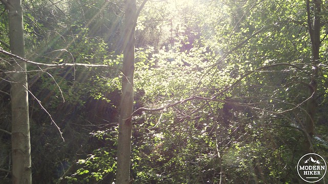
Overgrown section of trail
Right before you pass through the thickest part of this forest, you will notice a flat spot just above the brook. This would be a great campsite for small groups. There would be regular water during the wet season, and the shade would block out any heat. Furthermore, this point is a mere 1.9 miles from the crag, allowing the possibility of watching the sunset from the peak. Beyond this point, the trail becomes a little easier to follow as it switchbacks through manzanita dotted with copses of bigcones and Coulter pines. Looking back down canyon, you will see the High Point Lookout Tower atop High Point, which Cleveland National Forest operates during the fire season running from May to December.
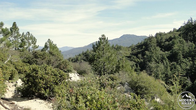
As the trail continues to switchback upward, the views you had previously enjoyed return. The San Jacintos and San Bernadinos look especially impressive now that you’ve gained a higher vantage. The switchbacks will terminate at a junction with Palomar Divide Road, which occupies an old, eroded road bed. Turn right on this trail (going left leads to Indian reservation), and negotiate your way through numerous rocks and overgrown plants. After .2 mile, you will come to a spot marked by a cairn at the bottom of a steep ravine. This is where the real fun begins.
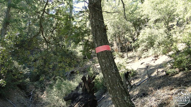
Climb up these ravines and follow the pink ribbons to keep to the route
You will turn left here to make the short but brutally steep attempt on Eagle Crag. To find your way on the occasionally faint trail, keep your eyes peeled for the pink or silver ribbons tied to the branches of trees. These will serve as guides, at least until you reach the burn zone. When you reach the burn zone, all bets are off, since whatever trail may have once been here has now disappeared entirely. In its place, you will find regenerating manzanita, which in the future (starting from 2014) may be too dense and thick to navigate without a lot of bushwhacking. You’ll also encounter plenty of poodle dog bush. I spent a lot of time hacking my way through it, so there is definitely something of a path, but you will need to be extremely careful. Most of the bush is dead, but it still contains the oils that trigger the allergic reaction. It isn’t as potent, but it could still cause a problem. Pass through here on your own risk. If you elect to avoid this segment, do not feel any shame. You still will have traveled 16.8 miles roundtrip and conquered one of the hardest hikes south of the big mountains to the north.
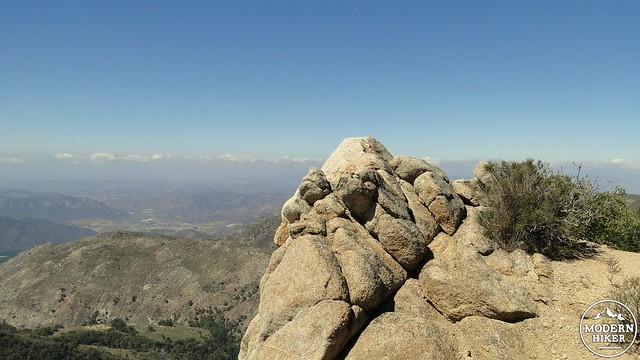
Eagle Crag
The view toward Pala Valley
Should you find your way through the first round of bushes (the GPS might be a decent guide, although I had to do a fair amount of backtracking myself), hug the edge of the cliff on your left and follow it upward toward a granite outcrop. This is Eagle Crag, and once you set foot upon it, you will have reached your destination. There’s a summit register you can sign for the bragging rights. There’s also a relatively comfortable spot for sitting on one of the lower perches. Be warned that this spot is not for those with a fear of heights, as the drop-off below your feet is a nearly sheer 1,000′ feet down.
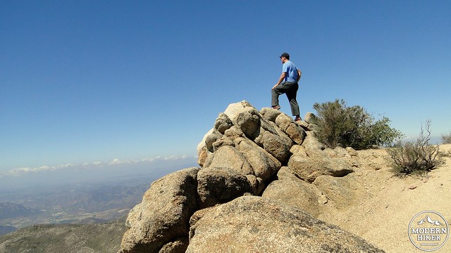
This author soaking in the view
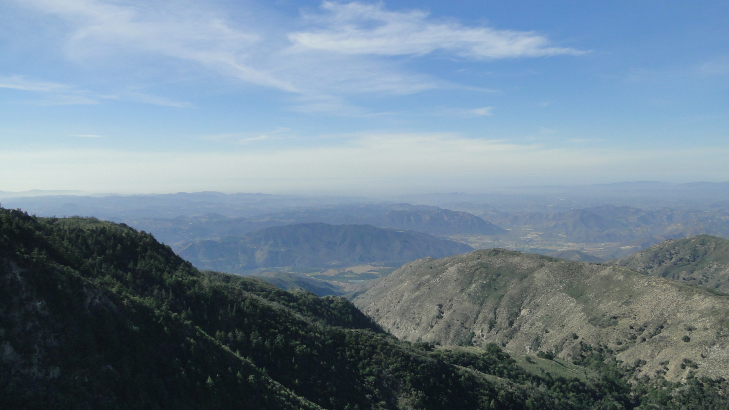
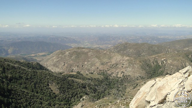
Now for a glorious hour or so, you can forget about all of the challenges that you know you’ll have on your way back to soak up the view you just earned yourself. The dark, forested flank of the Palomar Crest obscures part of the landscape looking south, but you’ll have an unimpeded view due west and northwest over Camp Pendleton, Fallbrook, Pala and Pauma Valleys, the Santa Ana Mountains, and Agua Tibia Mountain. This is a unique view that very few people ever get to experience. It’s also a wonderful spot to sit and enjoy another snack, knowing that you’ve still got another 8.5 miles to go. Enjoy it. You’ve earned it.

Another self-portrait
Once you’re finished on the crag, it is time to make the long journey back. One of the things that makes this hike so difficult is that the climbing is dispersed along several different spots. Aside from the main summit ascent, which is about 3/5’s of the climbing, you will still have to make a long, tedious climb when you pass the campsite in Cutca Valley. And, as mentioned before, you will ‘enjoy’ the excrutiating 500′ climb up and out of Cottonwood Canyon on the last .5 miles of the trail to reach your car at the trailhead. Therefore, it is very important to pace yourself, and – I can’t emphasize this enough – ensure that you are well enough conditioned to handle a 17 mile roundtrip journey, especially if you are day-hiking. This wonderful experience could turn awful in a hurry if you find you have bitten off more than you can chew.
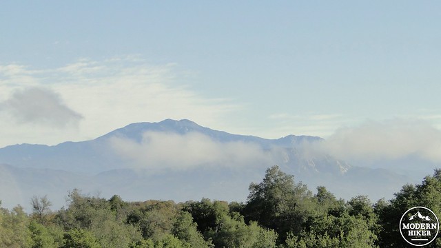
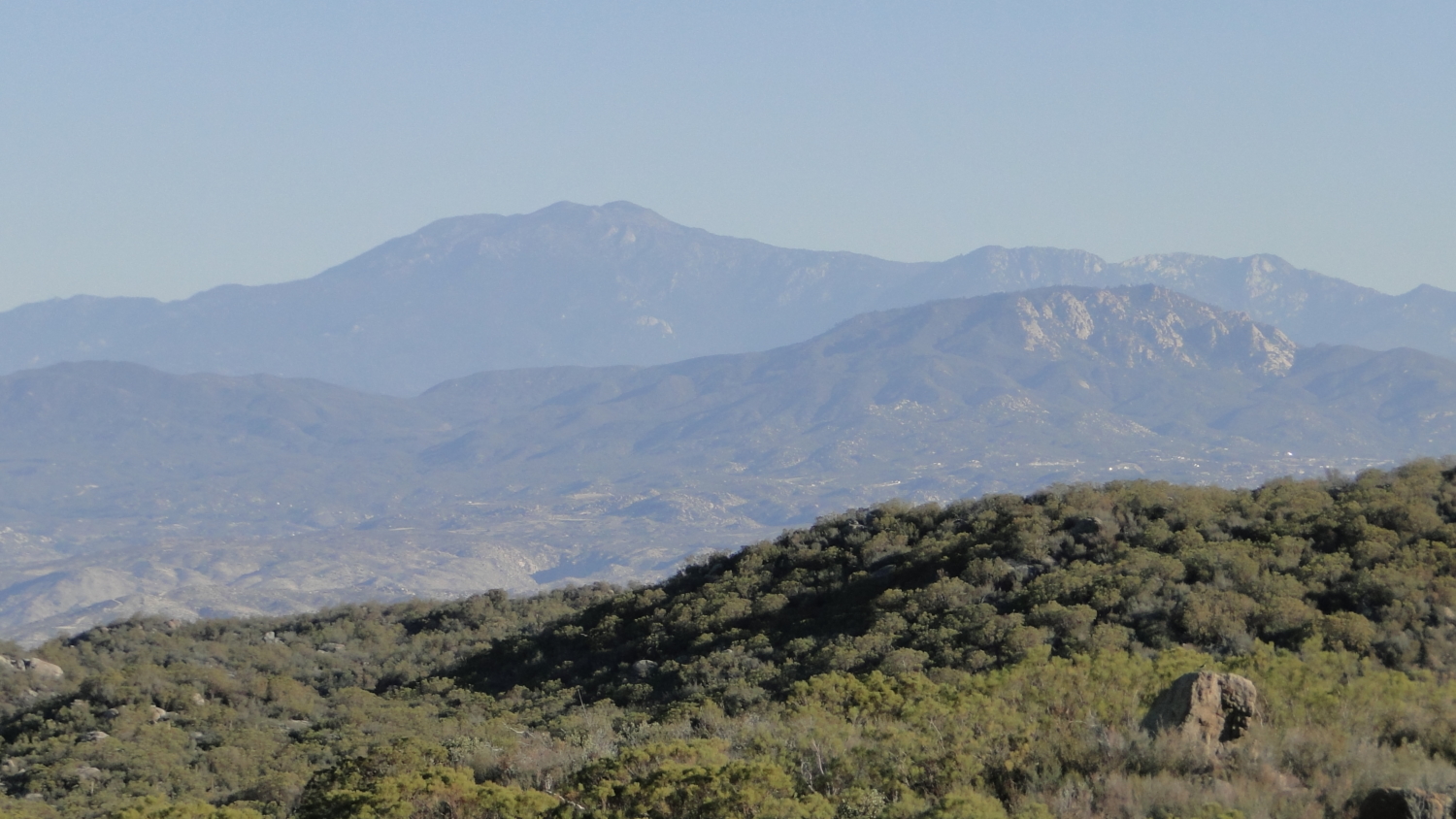
Mt. San Jacinto
To return, it’s a simple matter of retracing the route in reverse. Chances are that you’ll be returning during the warmest part of the day, so hopefully you have saved a generous amount of water to maintain your hydration. Take breaks whenever you need them. The biggest challenge is the desire to be done with it, which may inspire you to rush at a time when your energy is at its lowest. Take breaks. You will get there eventually.When you finish, you can congratulate yourself on finishing a seriously challenging hike. You will have seen some of the best of what the Palomar Mountains have to offer in a part of the county that few of the millions of San Diego residents even suspect exists. As tough as the hike is, it is more than worth it for the sense of accomplishment and the remote, untrammeled nature of the landscape.
Tags: Agua Tibia Wilderness, Cutca Trail, Cutca Valley, Eagle Crag, High Point, Palomar Mountains