Voted Canada’s Best Hike in 1981 and rated one of the world’s most thrilling trails by National Geographic in 2014, the 11-mile trail to Crypt Lake and back is definitely worthy of superlatives. Your trip begins on a boat ride from Waterton Township, then climbs up nearly 2200 feet of trail through dense forest surrounded by towering peaks. You’ll pass three gorgeous waterfalls along the way (with a bonus one on the return trip if you’re up for it), navigate through a natural tunnel, climb up exposed ladders and cling to chains on a cliffside before reaching the calm, cool, turquoise waters of Crypt Lake itself — right on the U.S.-Canadian border. This hike requires a bit of planning, but it’s absolutely worth the effort.
Note: Because this trail has some technical sections, it’s important to check trail conditions before you go. When there’s no snow in the summer, most experienced hikers should be able to do this without issue — but wintery conditions often require ice axes in challenging, avalanche-prone terrain.
Note: If you don’t want to take the boat, it is also possible to make your own short water crossing at the Bosporous beneath the Prince of Wales Hotel and join a trail along the lake shore, or by taking a much longer hike from Maskinonge Lake on the Wishbone Trail.
The hike to Crypt Lake begins unlike most other hikes you’ve done — at a dock.
The Waterton Shoreline Cruise Company runs a ferry service from Waterton Township to a tiny dock on the other side of the lake … where the actual hiking begins (reservations strongly recommended). The short voyage is a unique way to kick off your hiking morning, and the crew will give you some helpful tips and information about the trail on your way over.

They will also spend a significant chunk of time and effort really hammering home the importance of making it back to the trailhead dock on time — and with good cause. Depending on the season, the boat makes either one or two return trips. Miss those, and you’d better have packed a tent or your own kayak, ’cause it’s a long walk back to town.
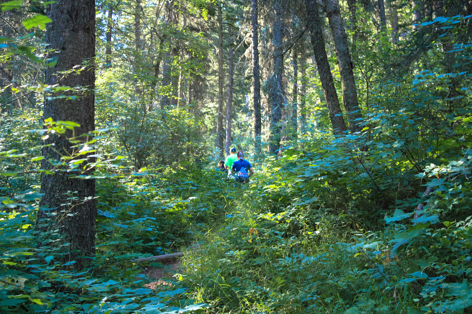
Once the boat makes its landing on the other side of the lake, the crowd files out and hits the trail.


Here, let me offer a bit of a pro-tip. Unless you’re fond of or don’t mind hiking in a large pack of people filing toward the same destination in single file, consider one of two options: First, you could hold back for a few minutes to give the pack a bit of time to break up along the main trail. Or you could also take the side trip to Hell-Roaring Falls instead of making a bee-line for Crypt Lake.

this will be your view if you decide to stick with the fast hiking pack

this switchback section basically looked like a human conveyer belt in the woods
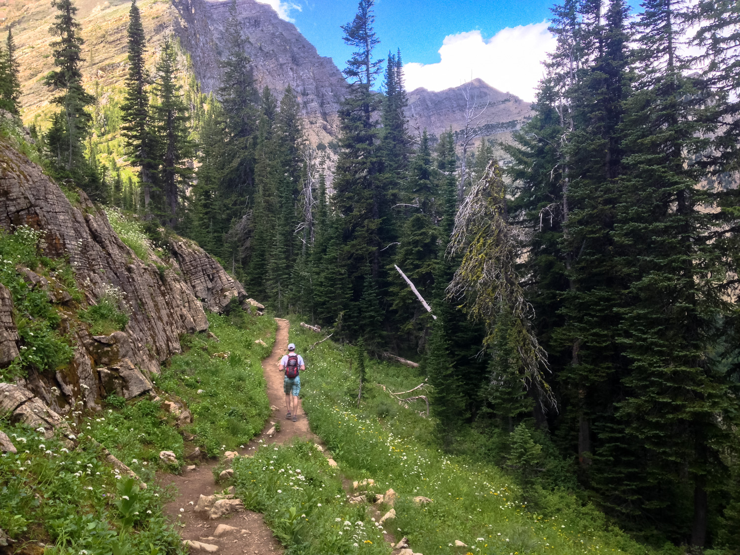
After sticking with the fast-hiking pack for a bit, we chose the first option and just let some of the crowds spread out along the path. Here in the lower stretches, the trail is a fairly narrow single-track in a dense forest, so there isn’t even much space to pass. We saved the Hell-Roaring Falls sidetrip for the return, when we discovered that side trail is definitely less-traveled than the main trail to Crypt Lake — but it’s also significantly more steep and rougher going, so it’s easier on the downhill.
Either way, anything you can do to put a little bit of space between you and that boatload of hikers is going to make a world of difference in how you perceive this trail. Once we put our hiking egos aside a bit and let other people be the First To The Lake, we had a much nicer time enjoying the incredibly dense forest along the trail’s lower stretches.
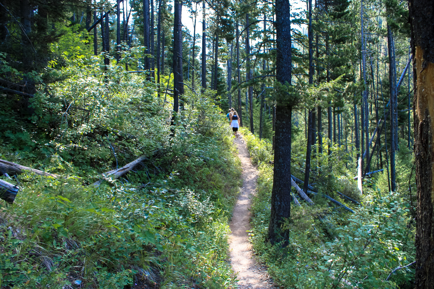
The junction for Hell-Roaring Falls is about 0.2 mile from the beach/trailhead. As I’ve already mentioned, that route is better experienced on the return trip if you have time, so stay to the left to continue on the main route.
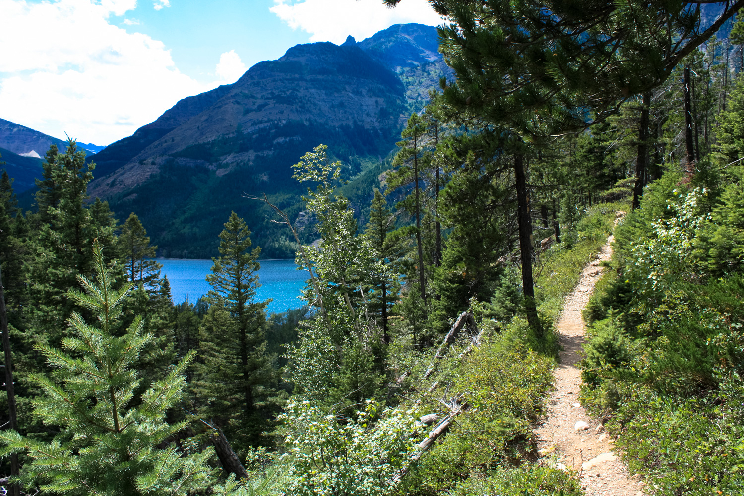
As the trail climbs up some short, tight switchbacks, eventually the forest thins and you’ll be able to get some nice views back toward the Waterton Lakes.


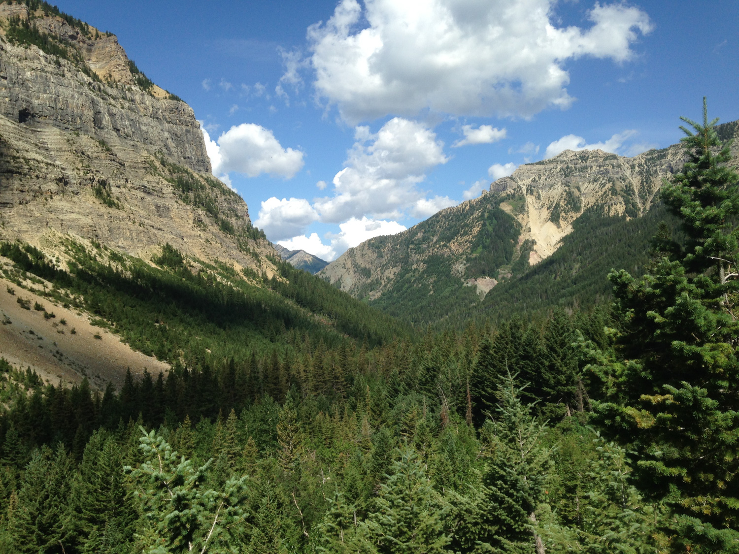
Even more enticing are the views further down the canyon, though — this epic landscape of the Border and Wilson Ranges that just lures you deeper and deeper with every passing glance.

The Crypt Lake Trail meets up with the Hell-Roaring Falls Trail again at 1.4 miles. Here, you get a bit of a break from the incline as the trail remains relatively level for the next mile and a half. At 2.1 miles, there is a very short spur trail that leads to an overlook of Twin Falls, your first major cascade on this adventure.

Twin Falls
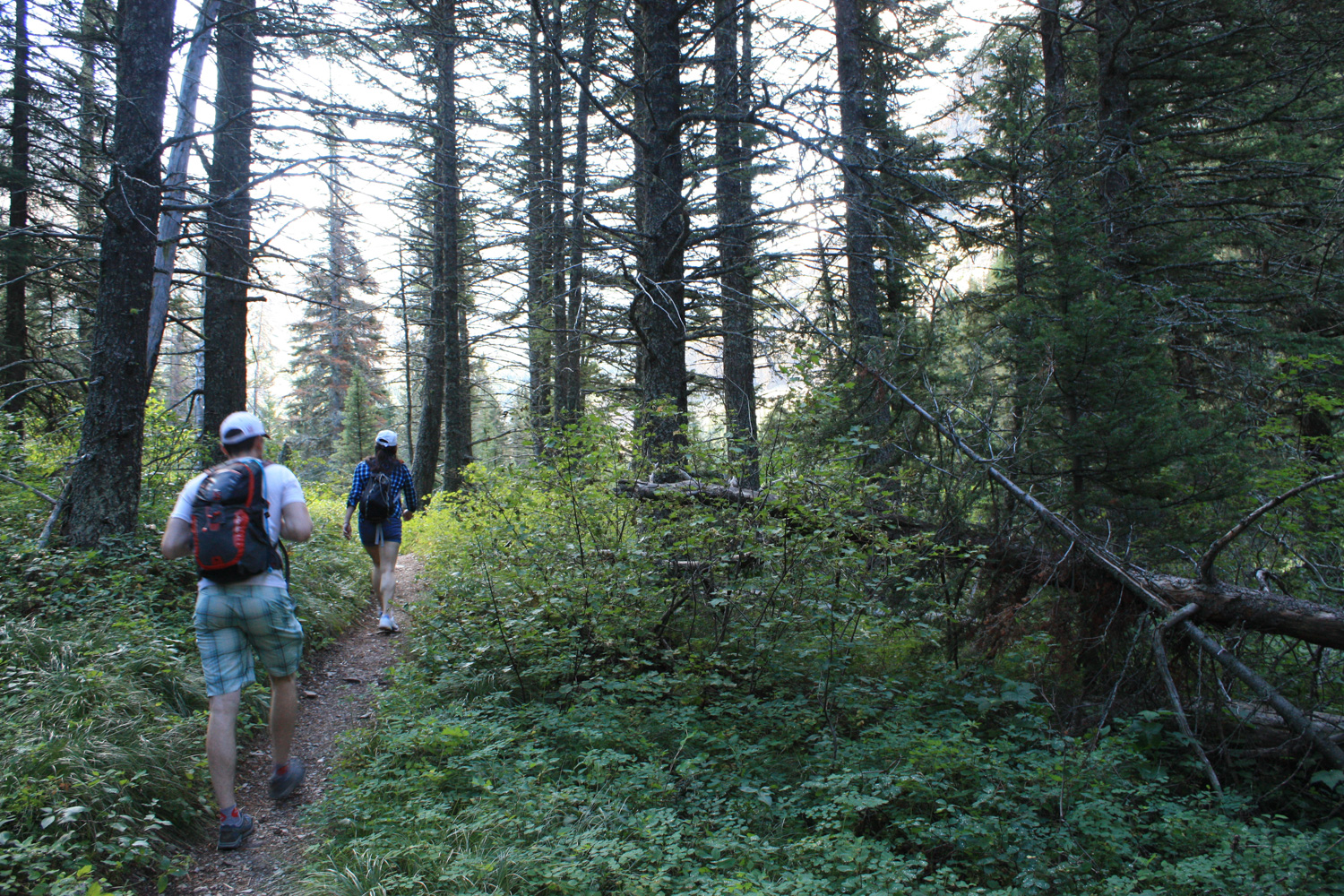
The trail stays in relative shade under the pine forest until about the 3 mile mark, where it once again begins to gain elevation. Although there are still plenty of trees around, they’re a bit more spaced out here which means you’ll have a better look at the surrounding scenery.


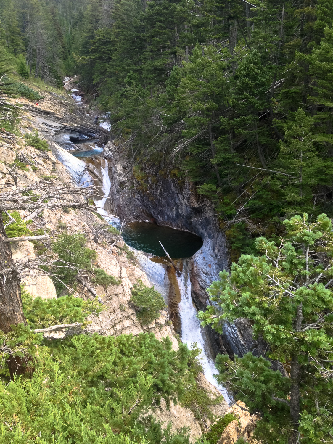
Burnt Rock Falls is the next waterfall on your hike, and you’ll get your first glimpse of it just after climbing this rocky section of trail.

Burnt Rock Falls
Hell-Roaring Creek crashes at the bottom of Burnt Rock Falls in a large natural amphitheater, which means the sound of the cascade is amplified quite a bit, providing a wonderful natural soundtrack to this section of the hike.
Past Burnt Rock Falls, the trail picks up in incline and enters into significantly more open alpine meadow and open mountainside terrain. The views down Crypt Valley from here are spectacular, so remember to occasionally look backward while you continue your journey.


“Hey, nice marmot!”
The trail passes the closest to the edge of Burnt Rock Falls at about the 3.8 mile mark, where it reveals the last section of Hell-Roaring Creek and Crypt Valley before Crypt Lake itself.
A small, emerald tarn sits between two forested areas around Hell-Roaring Creek, and just to their south is the towering Crypt Falls, a horsetail waterfall that plummets 574 feet into the valley that sits below you.

Crypt Falls
It’s a few more switchbacks and epic scenery on your way up — and I really and honestly cannot emphasize how epic this place is.


At 4.6 miles you’ll reach the former home of the Crypt Lake Campground. The campground is permanently closed, although an outhouse does remain. Hop over a small creek near the former campground and be sure to look back toward the trailhead for postcard-perfect views of the Crypt Valley … not to mention a scene that will inspire some well-deserved feelings of “Did I really hike that whole thing?!”

Mount Boswell (left) stands watch over the Crypt Valley
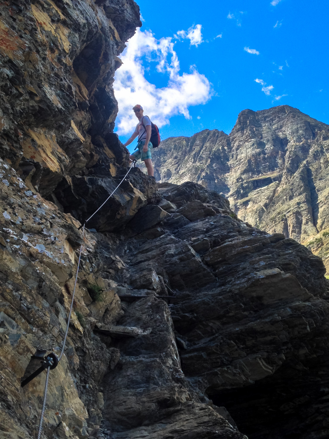
Past the former campground lies the primary technical challenge of this route, and the things that will either give you a sense of euphoric, adrenaline-fueled delight or nervous, anxiety-fueled dread: the ladder, tunnel, and chains.

No turning back now!
Challenge One: The Ladder

As far as challenges go, this one’s not bad at all. It’s just a simple, standard-sized metal ladder bolted to the side of the rock face. Although there is a very steep drop-off below you, there’s a decent amount of level ground around the ladder and the ladder’s angle is gradual enough that if you’re really nervous about it you can just lean forward and you’ll be just fine. We even saw someone hoist a dog up this thing without any trouble.
Challenge Two: The Tunnel

The ladder section is immediately followed by a natural tunnel that’s just under 100 feet long. Although you can’t stand up inside this thing (it’s only about 4 feet tall), at least you don’t have to worry about falling, right?
If you’re hitting this section with other hikers, be sure to give plenty of space for the people ahead of and behind you — if someone is claustrophobic they may want to be able to see both ends of the tunnel at the same time. Also, it’s polite to give a quick shout through the tunnel just in case someone’s about to start coming in from the other direction.
Challenge Three: The Cables

Just after making it through the tunnel, the trail drops about ten feet to a short section of cable trail that climbs up a narrow, exposed cliff.
Now, full disclosure, I am not a big fan of cables on my trails — but this route is secure and you actually have more room for your feet than the photos would lead you to believe. Also, it’s mercifully short and once you’re done, you’re almost at Crypt Lake!

After the cable section, the trail heads through more beautiful alpine scenery. At about 5.1 miles, there’s a short spur trail that will lead you to the top of Crypt Falls. It’s tough to get a good view — because you’re kind of just standing on a patch of dirt and tree roots that’s clinging to the side of a cliff, but you may be able to see that the Hell-Roaring Creek doesn’t cascade over the side of the cliff like you’d expect it to. Rather, it pours from the side of the cliff face. Crypt Lake drains through a short cave system!

Hell-Roaring Creek emerges from the rock here. Crypt Falls is just a short distance to the right of this.
The trail climbs up this small rock wall and then you’re standing face to face with your destination: Crypt Lake.

Oh man this place is stunning and 100% worth the effort it takes to get here.
Crypt Lake’s clear, turquoise-tinged waters are often full of ice until the summer months. The lake is also stocked with trout and is popular with anglers (be sure to check here for current conditions and information on how to purchase the required National Park license to fish here).
There is also a rough trail through the snow and scree that usually borders the lake, which you can use to walk along the shore of the entire lake. Directly across the lake from the trail entrance, you can actually set foot into the United States, too! You won’t need a passport for this border crossing … as the mountains do a fine job as their own form of border control.

Soak in the scenery, enjoy the lunch you packed in, or take a frigid dip while you’re here — just keep an eye on the clock and make sure you give yourself enough time to get back to the dock at the trailhead before the ship leaves.


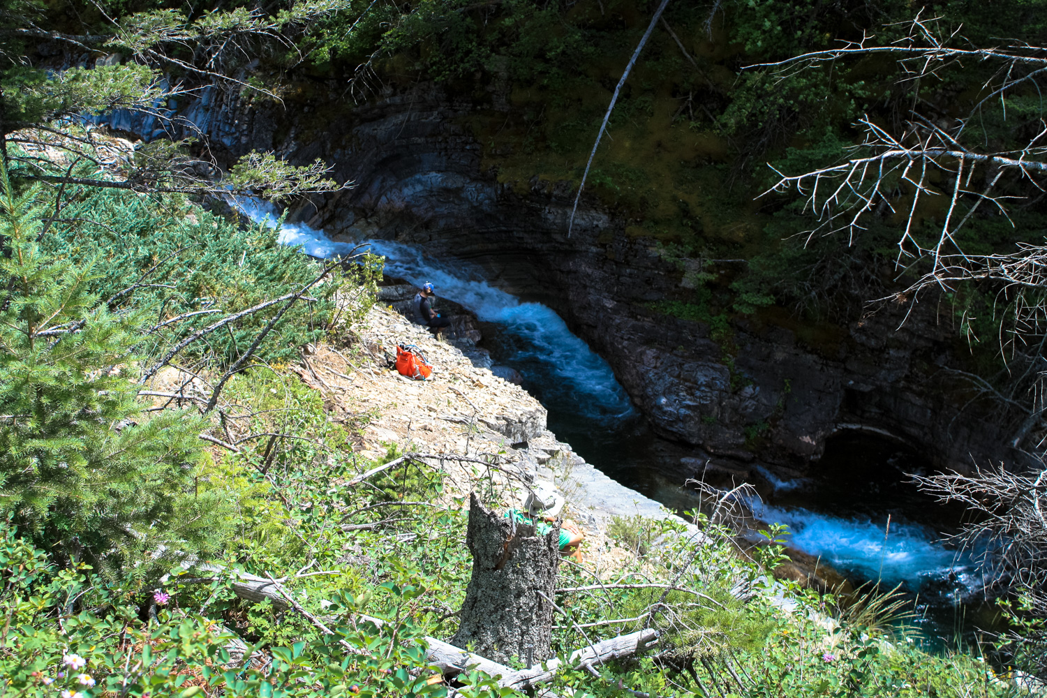
On the way back down, if you’d like to take the alternate route via Hell-Roaring Falls, keep left at about the 9.3 mile mark. This trail drops down closer to Hell-Roaring Creek than any other section of trail you’ve been on so far, and in a few places you can even reach the water itself with a bit of scrambling. The geology of this section forces the otherwise broad creek into a narrow canyon, which makes for some fast-moving and (as the name of the creek implies) loud rushes of water.
This trail is definitely not as well-traveled as the Crypt Lake Trail, so expect some overgrown and washed out areas along the way. It’s also significantly more steep, so watch your footing.
You’ll pass Hell-Roaring Falls at 9.7 miles, but you kind of have to keep hiking a bit past it for a decent view of the multi-tiered, multi-pooled maelstrom.

Hell-Roaring Falls
The trail turns away from the water at 10.1 miles and enters another heavily forested section. You’ll rejoin the Crypt Lake Trail at 10.8 miles. Keep left to return to the dock, the ship, and then to Waterton Township for a well-deserved meal (and beer).


Tags: alberta, Burnt Rock Falls, canada, Crypt Falls, Crypt Lake, Crypt Valley, Hell-Roaring Creek, Hell-Roaring Falls, Twin Falls, waterton lakes national park