A beautiful, moderate trek through a dense pine and larch forest to a picturesque alpine lake surrounded by majestic peaks, the trail to Chester Lake is a gentle incline with a huge visual payoff. Perfect as a day hike or as the start of a backpacking trip, this route is also accessible during the winter months as a snowshoeing trail.
South of the town of Canmore lies a series of Provincial Parks that border the much better-known Banff National Park. These Provincial Parks offer scenery that rivals that of any mountainous National Park but feature a fraction of the foot traffic. Bow Valley Wildland, Boy Valley, Elbow-Sheep Wildland, Spray Valley, and Peter Lougheed Provincial Parks overlap and wrap around each other, offering a fantastic array of skiing, snowshoeing, boating, camping, and hiking opportunities. Generally, together they’re known as Kananaskis Country and they’re an incredible outdoor destination.
Just south of the Mount Engadine Lodge lies Peter Lougheed Provincial Park and the trailhead to Chester Lake. The popular trailhead has trails that stretch west toward Mount Burstall and the Burstall Lakes, south toward Mount Murray, and east toward the Headwall Lakes, but this route begins heading north crossing Chester Creek and will eventually climb up to its namesake Lake.
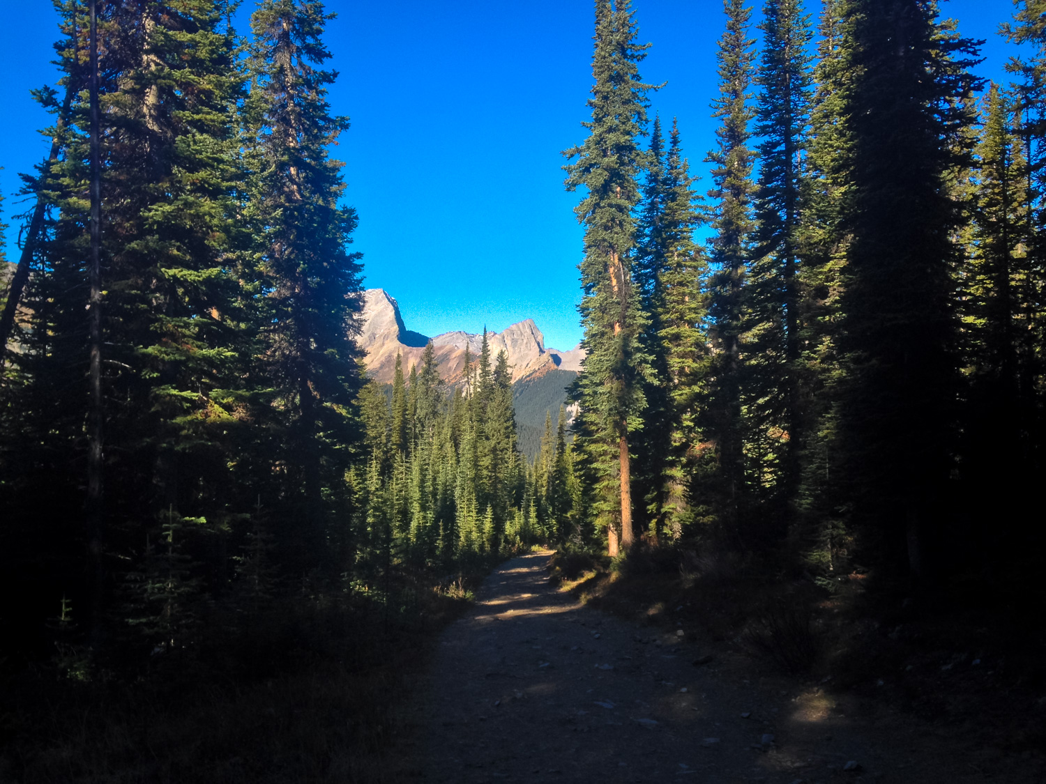
The trail is primarily on a wide, evenly graded fire road that is lined by towering pines. The trees will block most of the views on the early section of trail, but provide an incredible scent as you slowly gain elevation.

At 0.3 mile, ignore the junction with the snowshoe trail (unless you’re snowshoeing, of course!) and just beyond this the Chester Lake Trail splits at a junction. There are signs here directing foot traffic one-way, but I assume that is more for cross-country skiers in the winter.
Both routes seem to be about the same distance and level of incline, so why not follow the sign’s suggestion and head to the right?
As the trail climbs and twists around, you’ll begin to finally start seeing some of the mountain scenery you’re hiking around — although for a time it will be limited to the space of the trail itself.

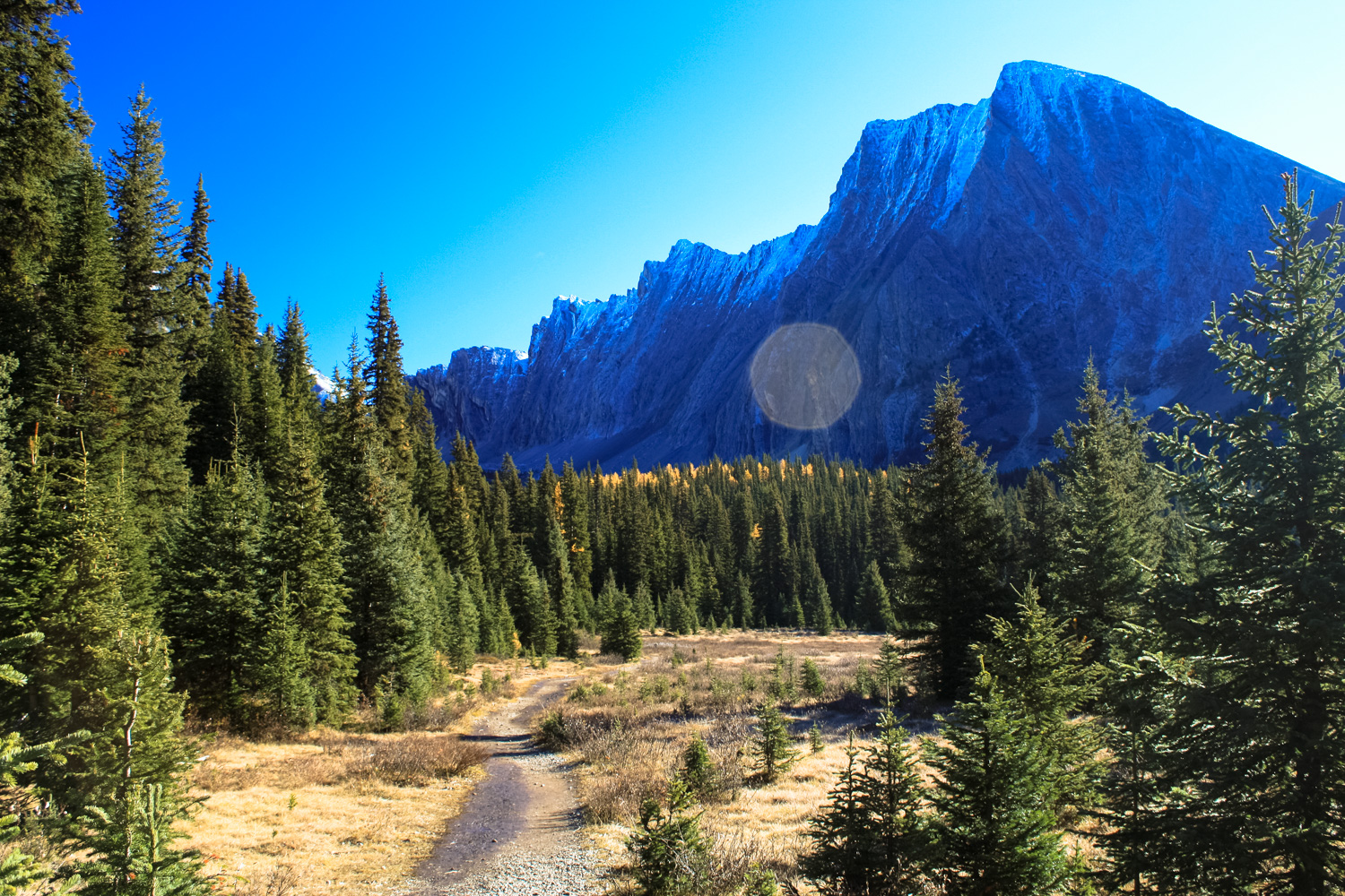
At 1.3 miles, keep to the right at the next junction with the Chester Lake Trail. By about 1.7 miles, the majority of your climb will be over and the hike really kicks into visual gear.
Here, the route starts to open up into meadows and the huge looming peaks will come into view for the first time.

Mount Chester on the right. The Fortress in the center and a western flank of the Fortress on the left.
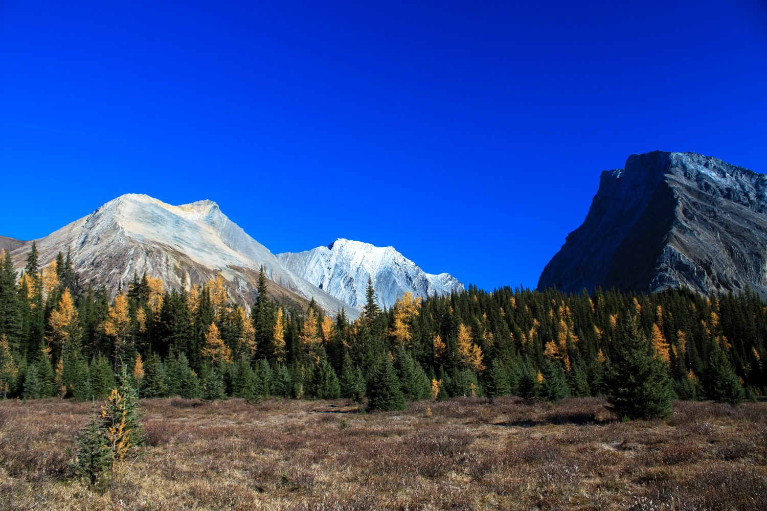
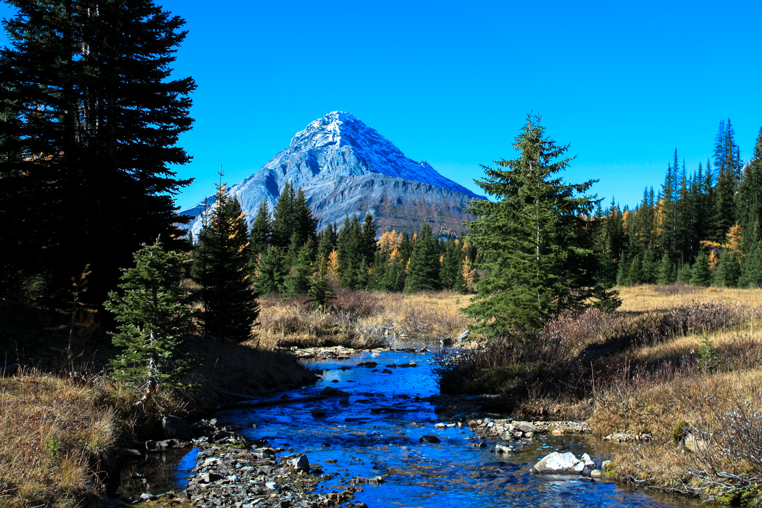
You’ll pass through a few more stretches of forest and at the 2 mile mark the trail meets up with Chester Creek again. The views really open up here and the hike takes on an entirely different character from the first few miles.
As jagged, rocky peaks climb into the sky around you in seemingly every direction, you may find yourself at a loss for words. It’s OK – just enjoy the scenery and keep on hiking.


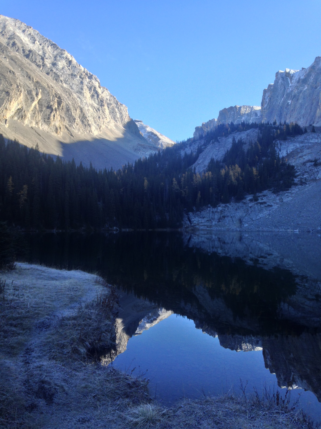
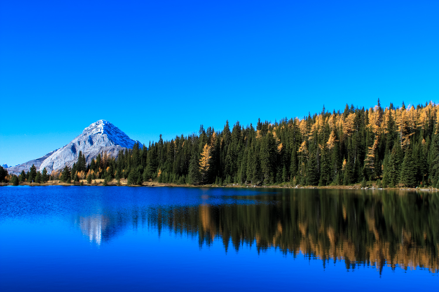
You’ll pass a small outhouse and finally reach the shores of Chester Lake at 2.6 miles. Its picturesque turquoise water is a beautiful mirror on the surrounding landscape, although if you’re hiking during the fall and in the morning, you may see the lake partially frozen over and frost along the ground. The long ridge of Mount Chester casts a long shadow over this valley that doesn’t really recede until mid-day.


Keep left to begin a clockwise trip around the lake. The trail hugs the shore here … and I imagine after times of heavy rain or snowmelt, may be partially underneath it.
If the lake is still in deep shadow when you reach it — or if you’re just looking for a nice lunch spot a little off the trail — head left at 2.8 miles to hike along the Three Lakes Valley Trail. You’ll make a short climb and in about 0.2 mile you’ll reach a group of huge boulders that make a lovely place to soak up some warming sunshine and have a snack.

Return back to Chester Lake and keep left to continue your trek around the edge of the water.
Looking southwest from the lake will provide you with some unbelievable views of Mount Burstall and the prominent incline of Commonwealth Peak. Set against the still, shimmering lake, it’s a sight you won’t soon forget.


You’ll pass a small waterfall on the Lake’s eastern shore, and as the trail continues along the southern and western shores you’ll find yourself climbing over large granite chunks that have fallen into place off the wall of Mount Chester.

Rejoin the Chester Lake Trail at 3.8 miles and return back the way you came — or take the alternate route to the trailhead at the split at 5.1 miles.
Tags: alberta, canada, Canmore, chester creek, chester lake, Kananaskis Country, mount chester, peter lougheed provincial park, the fortress