Just across the L.A. River Basin from Griffith Park, lie the Verdugo Mountains, a small member of the fault-created east-west Transverse Ranges. Like Griffith Park, the peaks and valleys of the Verdugos provide a variety of outdoor activities to the residents of Glendale, Burbank, and the Valley neighborhoods on its northern boundaries – but unlike Griffith Park, this small range is generally less crowded.
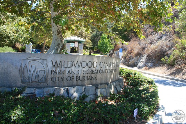
For relatively easy ascents, hikers and bikers can use the Beaudry Boulevard Loop on the range’s eastern side. Hikers and trail-runners looking for more of a challenge make their way to Burbank’s Wildwood Canyon Park to tackle the Vital Link Trail.
If you do some research on this trail, you’ll find that some people say it’s an easy hike while others seem thrilled and surprised that they made it home in one piece. This is because there are several different starting points for the trail. It is possible to drive to the end of the road in Wildwood and take a short, steep fire road to the trail, which will cut off around a half mile of distance and about 600 feet of elevation from the hike. But we’re not going to do that, because we like a challenge when we see it.
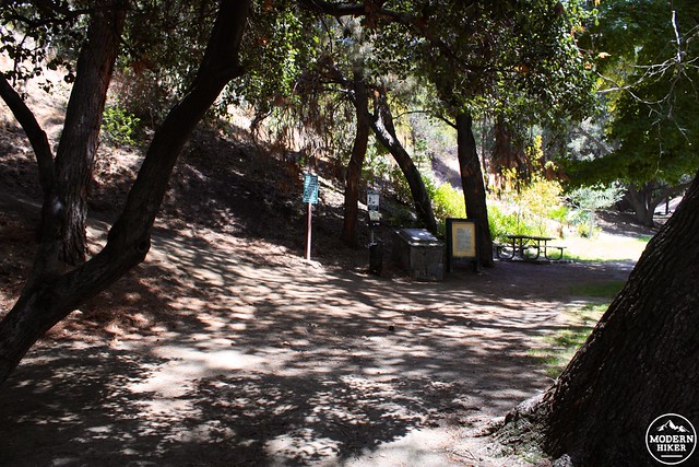
Instead, park at the large lot near the park’s entrance (you’ll have to drive past the gate on Harvard Road to get to it – if you enter the park, you’ll have to turn around). Stretch out and head into the park, passing some port-a-potties and a water fountain. Just past these buildings you’ll see a picnic bench and some trail info in the shade. This is the start of your hike – and also the last you’re going to see shade for a long, long time.
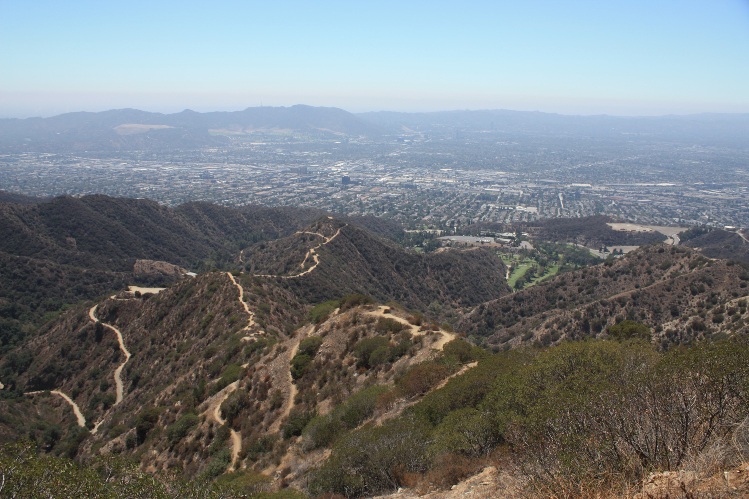
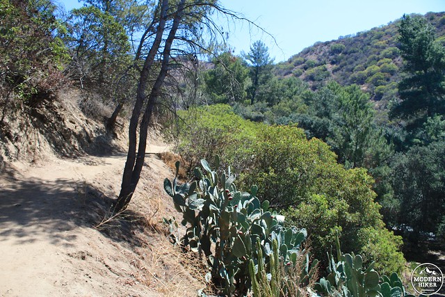
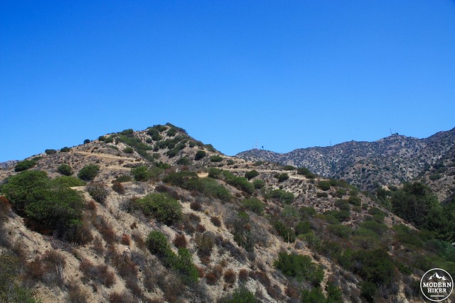
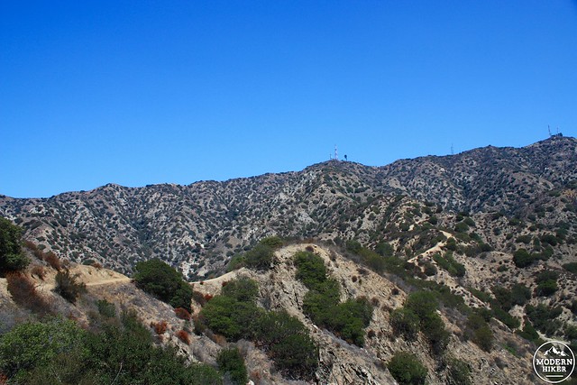
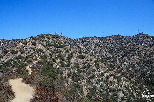
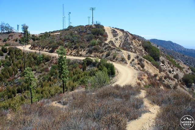
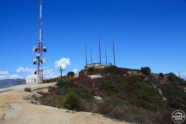
The trail wastes no time in making its way up the mountainside. You’ll gain about 300 feet in the first 0.4 miles before you hit a small plateau where another entry trail joins you. Most of the peaks in the Verdugos have been capped with communications towers, and you’ll be able to see these as you make your way up on the trail as well as some glimpses of the rest of the trail you’re going to be hiking on. Spoiler: it’s a lot of UP.
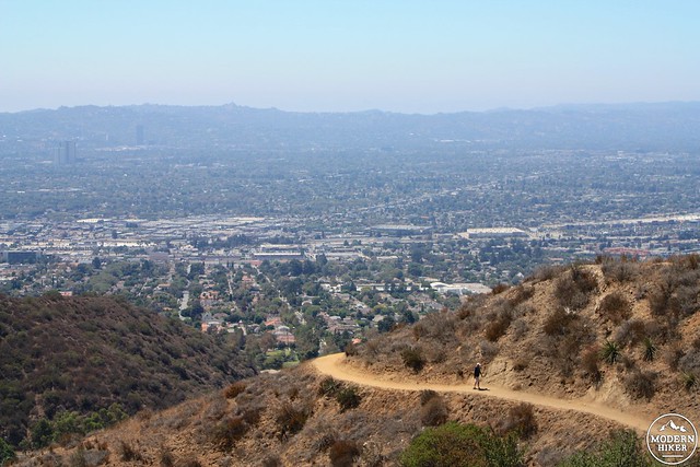
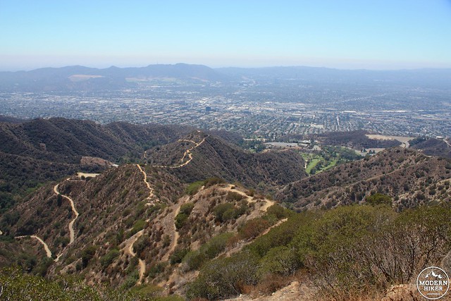
Because this trail makes such a quick and relentless elevation gain, the views open up really fast here. Even on the hot, hazy day when I hiked this route, I had some very nice views of Burbank and North Hollywood toward Griffith Park and was also able to spot downtown peeking out at me from behind the Verdugos.
The trail makes a few short, steep switchbacks to climb around an unnamed 1800′ hill before evening out on a narrow ridge again. You may note that some of these switchbacks seem a bit … tenuous. Don’t worry, you’ll get more chances to think that soon.
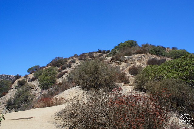
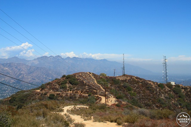
At the 0.8 mile mark, you’ll pass the final “shortcut” access trail and see a sign for the Vital Link Trail – a one-mile straight shot right up the side of the mountain. The trail starts out with more of those switchbacks and pretty much stays at that incline level until you reach the top of the mountain range.
Whereas other trails may have climbed up a canyon first at a gradual pace, then perhaps made sweeping switchbacks up a steep canyon wall to make its way to the top, the Vital Link Trail isn’t having any of that. Instead, the designers of this trail seem like they just pointed at one of the range’s long, narrow, crumbling ridges and said, “Put it there, contours be damned!”
You are about to climb 1066 feet in the next 0.86 miles and it’s not always going to be pretty. At times, the trail will just be a straight ascent up the ridge. Other times, you’ll get the occasional wooden stair. Or maybe you’ll just be on an impossibly tight switchback as you climb up. All the while, you’re going to be in full sun with only the occasional tiny shadow of a laurel bush to help you. If you’re hiking this in mid-day, I hope you brought your wicking layers – by the time I reached the top it looked like I had jumped into a pool.
You just hiked up that!
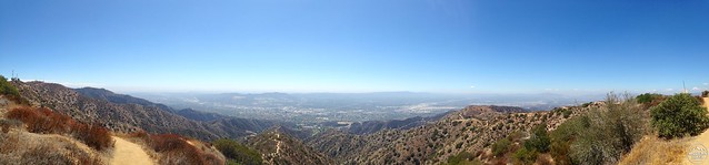
When you do finally reach the top of the trail, be sure to take in the incredible panorama before you. And also, drink lots of water.
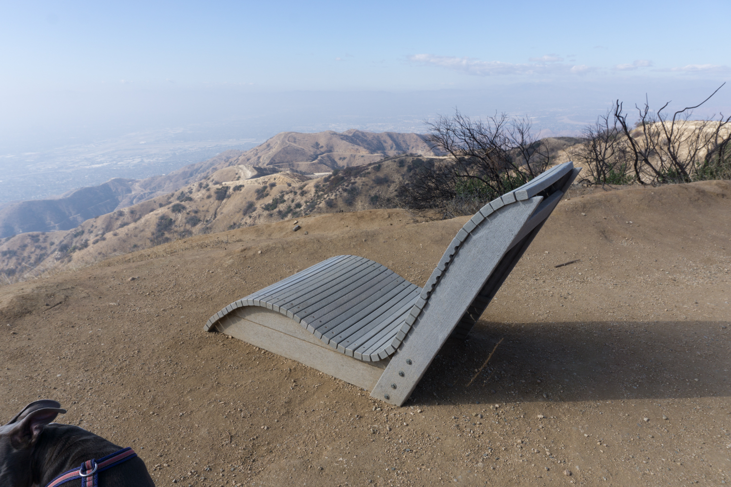
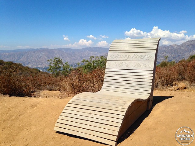
At the 1.7 mile mark, you’ll reach the end of the Vital Link Trail and a beautifully-designed lounge chair dedicated to the memory of Willie Meinn, which is the perfect place to take your boots off for a few minutes and soak in those incredible views.
If you were just looking for a workout, you could very easily turn around and call it a day – but if you’re interested in seeing more amazing views from the top of the Verdugos, press onward.
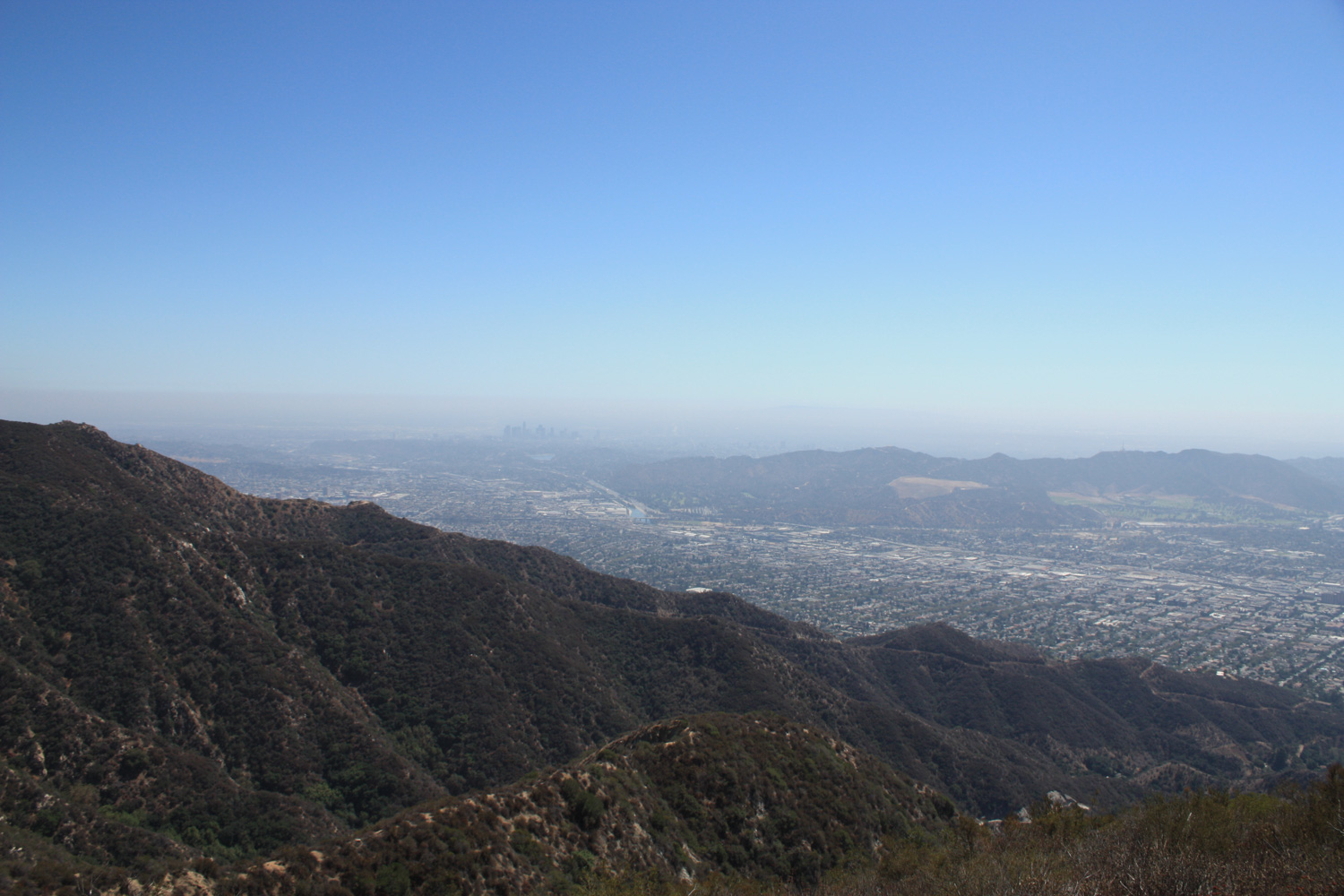
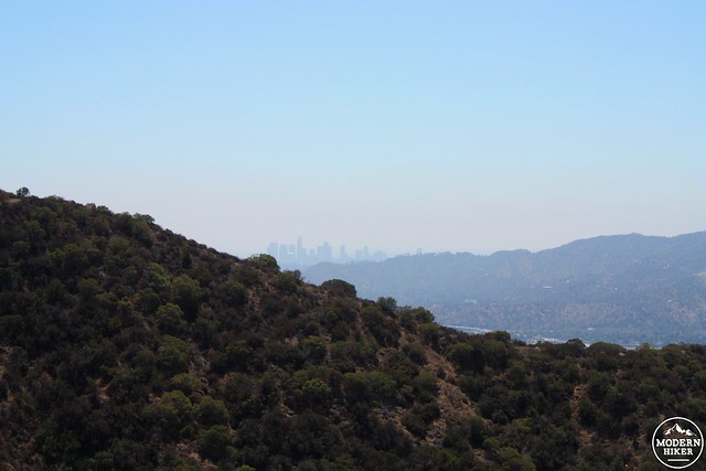
As I mentioned earlier, most of the peaks here have had communications equipment installed on them. The area isn’t necessarily a wilderness, but you’ll get nice cross-breezes from the summit plateau and there are some really stellar views of Southern California … especially on clear days. Even on this hazy day, I could see the entire Santa Monica Mountain range all the way to Sandstone Peak and Point Mugu – as well as Palos Verdes.
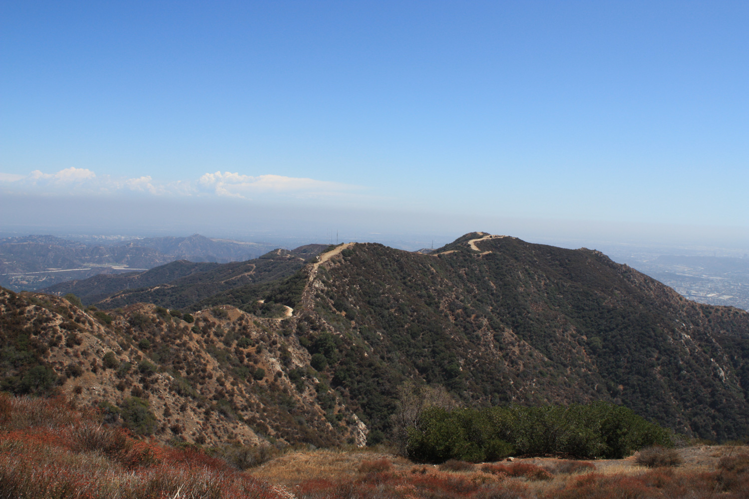
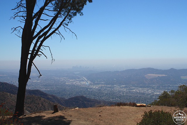
From the chair, the official route heads down the fire road to your left, then keeps right at the junction around the corner – but you can also keep trekking to the east along the summit ridge if you’d prefer. You’ll pass a small concrete structure of indeterminate purpose, catch a killer view of downtown, and then descend down a steep use-trail back to the road. You can use this technique to skip a little bit of distance on almost every turn on the summit plateau fire roads in the Verdugos, but they’ll often only save you a short bit of distance while adding extra incline. If you’re wiped out, stick to the road.
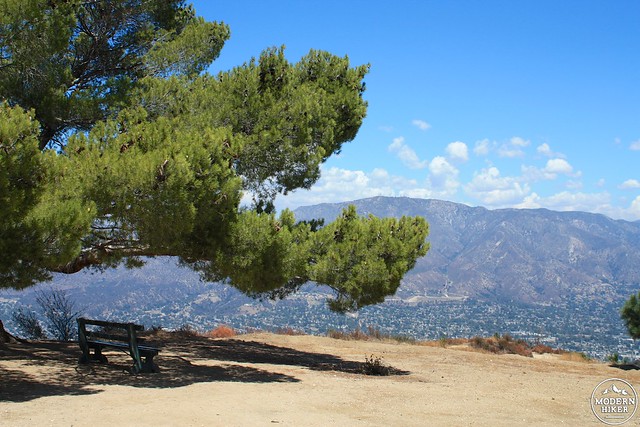
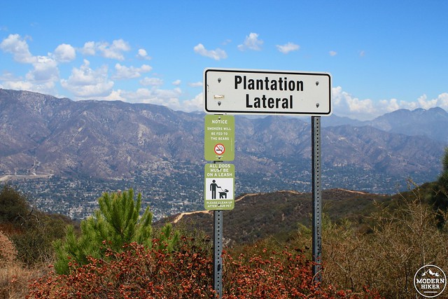
Continue until the 2 mile mark, when you’ll see a sign for a fire road heading north called Plantation Lateral. Head here for a very short side trip to a beautiful lone bench beneath an even more beautiful Scotch pine overlooking Mount Lukens to the north and the rest of the San Gabriels to the east.
If it’s been hot and sunny out, you will no doubt greatly enjoy this rare treat of shade. It’s a great spot for a quick snack or lunch, and you may find yourself reluctant to leave after you’ve spent some time here.
A bit further down the road from this bench, you’ll see the Fire Warden’s Grove – a small ring of eucalyptus trees planted after a wildfire that burned through the area in 1927. Ironic, since eucalyptus are highly flammable trees.
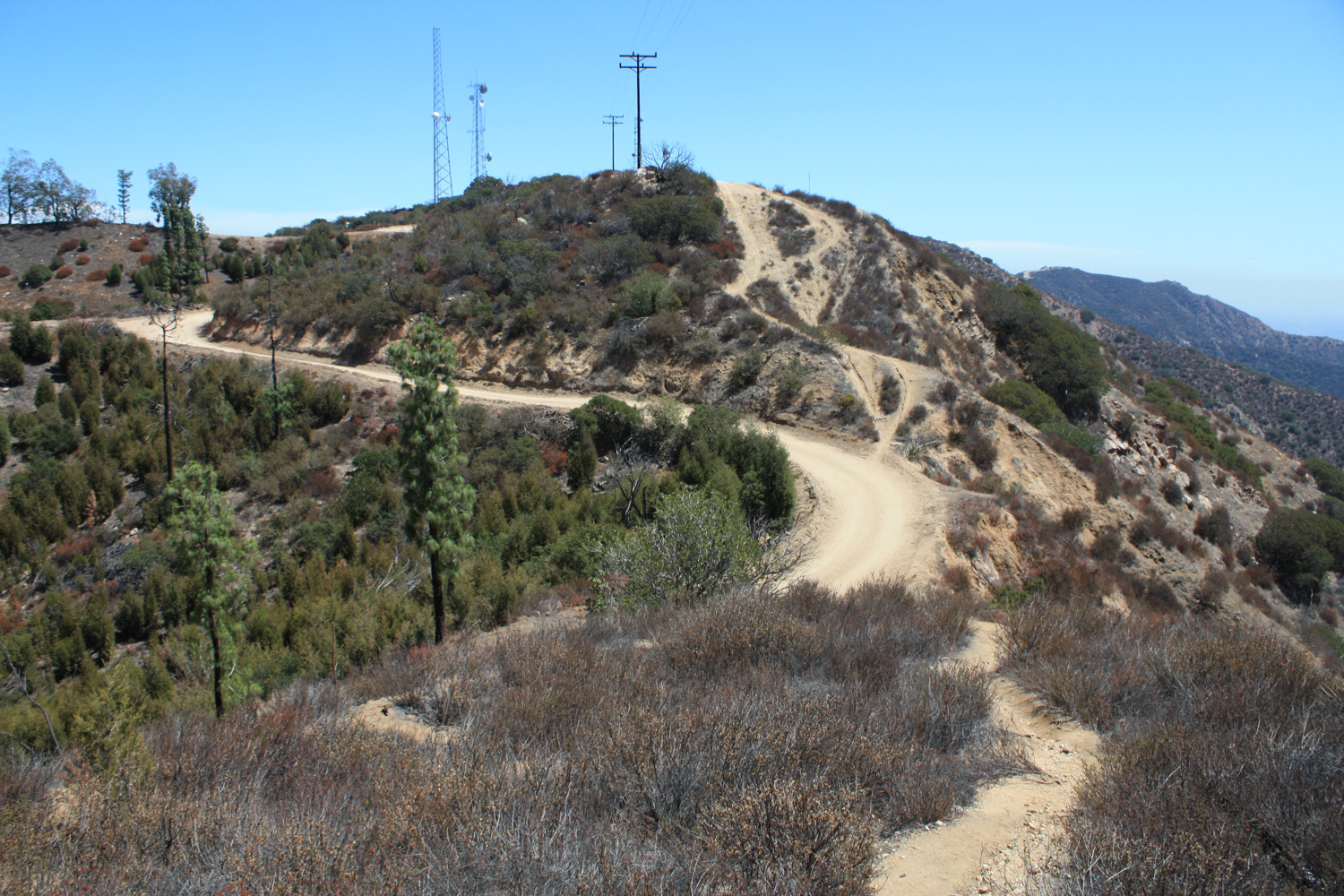
From here, return back to the fire road and head east for another half mile. At the junction with the Verdugo Motorway, stay to the right to continue another 0.2 miles between two communications structures. There is a thin asphalt-paved path leading to a circular structure that sits atop the informally named Verdugo Peak.
While there isn’t much at the summit, you will have more beautiful views of the region – as well as a nearly-complete look at the trail you just came up on.
looking east toward the San Gabriels
When you’re done soaking in the views, return back the way you came, making sure to note the city of Glendale’s awesome signs.
Seriously, whoever made those signs deserves some high-fives.
Note: In September, 2017, the La Tuna Fire tore through the northern Verdugos, scorching the landscape and damaging many trails. The Vital Link Trail was mostly spared, although the trail was kind of in need of some TLC before the fire and the flames and subsequent erosion hasn’t helped much.
Hiking this trail a year later, much of the sparse shade that was previously on the route is gone — although there are lots of signs of regrowth. Keen eyes will spot new growth on California buckwheats and California sagebrush. New black and white sage seedlings are hugging the rugged terrain, and almost all of the burned sugar bushes have sprouted vigorous new shoots, too.

Looking up at the Verdugos, November 2018

Sugar bush coming back to life
We should note, though, that while that spectacular Scotch pine at the end of the trail route here is still standing — along with many other nearby pines — their lower branches were singed badly from the fire. They’re still there, but they’ll need a little time to fill out to their former glory.

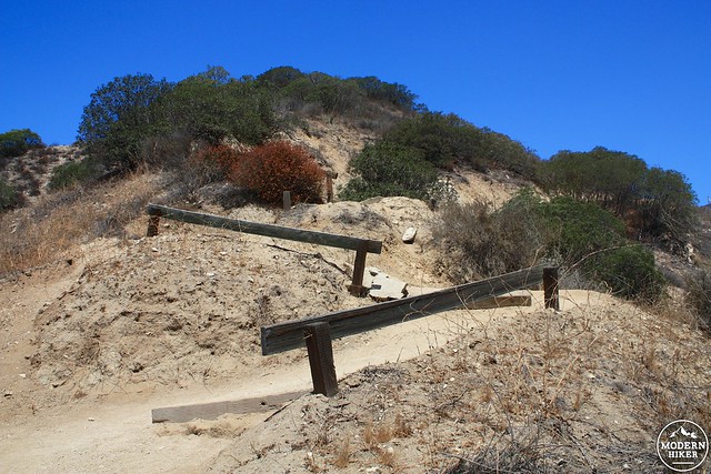
In all honesty, humans have done more damage to this trail than the fire did. Because the chaparral and scrub has been burned down, there are MANY more use-trails and switchback cuts now than there were before the fire — and the signs of increased erosion are plainly visible. We didn’t get much rain between 2017-2018, but it’s fairly easy to see what sections of trail would likely trigger park-closing slides given a larger rainstorm or two.

Don’t do this

or this
The trail is open to hikers and remains a wonderful hike — and one of the best workout trails in the Los Angeles area. But please do your part and stick to the established trail so we can ensure the park remains open!

The bench survived the La Tuna Canyon Fire
Tags: burbank, glendale, transit accessible, verdugo mountains, verudugo peak, vital link trail, wildwood canyon park