The Secret Canyon Trail traverses the length of the Pine Creek Wilderness south and slightly west of Pine Valley in the Cleveland National Forest. Despite being close to the city and easily accessed, much of the landscape within the wilderness is remote and accessible only via this long, point-to-point route. This route is conducive to backpacking, with three crossings of a fairly reliable seasonal creek and numerous flat spots for camping available to campers.

Pine Valley Creek Gorge
This 15.6 mile trail passes through the rugged, isolated gorge of Pine Valley Creek. At times, the trail follows a well-preserved flume grade once intended to shuttle water into a reservoir in Pine Valley. After crossing Pine Valley Creek, the trail enters Secret Canyon, which is one of the less accessible canyons in Cleveland National Forest. Beyond Secret Canyon, the trail terminates at a junction with the Espinosa Trail, which drops down into a popular watering hole at a junction with Pine Valley Creek and Horsethief Canyon.

Paintbrush
Folks looking to backpack will wish to obtain a backcountry camping permit from the Descanso District of Cleveland National Forest. You can download a copy of the permit from this page and email it to this email address. The Forest Service says to expect 4 business days for processing. You can head to this page for more information.

Horned Lizard
Also keep in mind that this is a shuttle hike, which means that you will have to either arrange pick-up or leave a car at the Horsethief Canyon Trailhead. This slightly convoluted transportation scheme provides the benefit of not having to double back, as the full out-and-back route would scrape a total of 32 miles. You also get to enjoy the luxury of not repeating any terrain; for all of the logistical hassles, shuttle hikes are a lot of fun for this very reason.

Secret Canyon Trail through Oak Woodland
One other factor to keep in mind is that the Secret Canyon Trail was once a corridor from migrant traffic traveling north from Mexico. The U.S. Border Patrol has shunted most of this traffic to the east, but migrants occasionally pass through. For safety reasons, group travel is preferred on this route. Even if you don’t cross paths with any migrants or drug traffickers, you may notice evidence of their passage.

Secret Canyon Trail before the Nello Irwin Bridge
Starting from the Pine Valley Creek trailhead just outside the town of Pine Valley, drop down a steep slope beneath oaks to find the path paralleling gurgling Pine Valley Creek. You’ll cross the creek at about 200 yards in, after which you will plunge into a grove of coast live oaks. Sadly, many of these coast live oaks have fallen victim to the gold-spotted oak borer. This introduced pest kills oak trees by eating through the cambrium between the wood and the bark. Local oaks have no defense against this bark beetle, and it has taken its heaviest toll in the areas adjacent to Mexico.

A pleasant stopping spot along Pine Valley Creek
The creek takes a bend to the left and the trail follows along with it. You’ll keep slightly above the banks of the creek as you approach the towering Nello Irwin Memorial Bridge that carries Interstate 8 across the gorge. Just before the bridge, you’ll find some side paths down to the creek. For people looking for a less ambitious dayhike, there are plenty of places to lounge and idyll around this sunny spot before turning back for a 3.2 mile total dayhike.

Flume Trail
If you opt to continue, you’ll pass beneath the bridge before crossing the creek for the first time. On the other side of the creek, you’ll begin to climb along a hillside to reach the grade of the old flume. In the past, the vegetation on this stretch of trail had a reputation for becoming overgrown, but recent trail maintenance efforts in the area have left the trail passable and in good condition.

San Diego Alligator Lizard
At 2.5 miles, you’ll join the flume, which will contour along the west rim of Pine Valley Creek Gorge for about 2.75 miles before dropping back down into the gorge. The flume grade, which stands upon hand-stacked rocks, remains remarkably well-preserved. The original engineers intended to use bridges to circumvent natural obstacles such as ravines or outcrops. Since the flume was never completed, there are a number of spots where you’ll leave the flume to navigate around one of these obstacles on the trail, thus punctuating the otherwise long, flat segments of the trail.

Creek Crossing after Nelson Canyon
About 6.9 miles in, the trail leaves the flume grade for good and drops down into Nelson Canyon. After dropping down to pass through a decimated grove of oak trees, the trail soon begins a switchbacking descent down to the bottom of Pine Valley Creek’s gorge. Once at the bottom, you’ll reach a sublime scene at the creek crossing where you can tank up on water, have lunch, and prepare for the climb back out of the gorge into nearby Secret Canyon. Campsites can be found nearby if this is your stopping point for the day.

Manzanita Forest
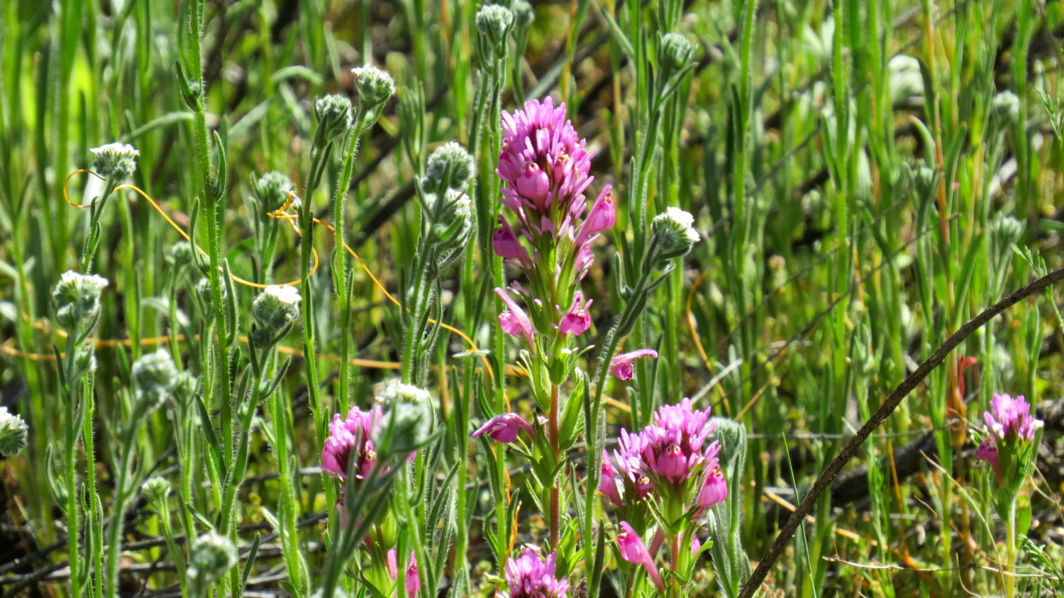
Beyond the creek, the trail begins a climb through an impressive climax forest of manzanita trees reaching 10-15 feet high. The trail tops out at a saddle at 10.5 miles and then begins to drop down into Secret Canyon. A seasonal creek trickles through Secret Canyon, nurturing groves of sycamores and a handful of cottonwoods. In the grassy areas alongside the creek’s rugged bed, Engelmann oaks provide cool patches of shade while owl’s clover, woolly blue curls, phacelia, and a host of other wild flowers add patches of color to bright spring-time green.

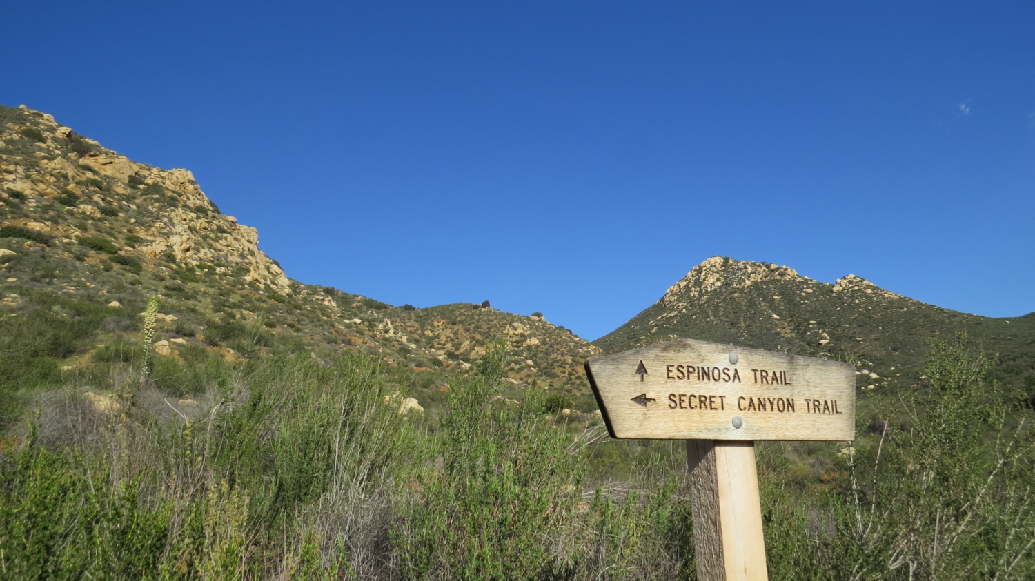
Espinosa Trail Junction
When the trail leaves Secret Canyon at 12 miles, it will contour along the east wall of Pine Valley Creek gorge until a junction with the Espinosa Trail. Pine Valley Creek trickles along in a tantalizing way about 100-200 feet below, but you still have .8 mile before you reach the next crossing. When you reach the Espinosa Trail junction, turn right and descend toward the creek.

Shallow Pool near the Confluence of Horsethief Canyon and Pine Valley Creek
When you reach the creek, you’ll be greeted with a sublime scene of water trickling (or gushing, depending on recent rainfall) over rocks into a large, shallow pool. As cottonwood and sycamore leaves rustle in the slightest breeze, you may find yourself dozing off atop one of the many boulders framing the pool. Closer investigation may reveal some Kumeyaay grinding stones (morteros and metates) in the rock left over from hundreds of years of acorn meal preparation. This lovely spot is definitely a highlight of the trip.

Horsethief Canyon
To conclude, return to the Espinosa Trail and turn right to begin the climb out of Horsethief Canyon. If you’re taking this as a long dayhike, you’ll want to be sure that you save plenty of energy for this last burst of climbing. You’ll gain 500’ of elevation in a little over a mile. The narrow Espinosa Trail terminates at unpaved Horsethief Canyon Road. Turn left here to follow it to the Horsethief Canyon Trailhead, where your pre-arranged shuttle will be waiting for you.
Tags: Backpacking, Cleveland National Forest, Descanso District, historic flume, Horsethief Canyon, Pine Creek, Pine Creek Wilderness, Pine Valley Creek, San Diego, Secret Canyon, Secret Canyon Trail