The Devil’s Garden Trail is the longest and most difficult maintained trail in Arches National Park – and it’s also one of the most fun. Once you get past the early sections you’ll be scrambling up and over long, narrow sandstone fins (future arches!), ducking under and crawling through existing arches, and trekking through ruggedly beautiful backcountry that few of the more casual tourists in Arches will ever get to see.
The trail begins at the end of Devil’s Garden Road, which is literally the end of the paved road in Arches National Park.
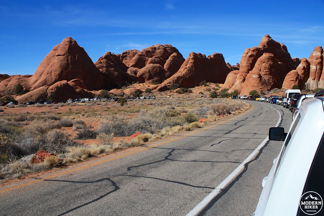
Because this trailhead is also near the Park’s one campground, this can sometimes be the busiest section of road even though it’s the farthest you can drive into the park without a 4WD vehicle. Even in the off-season, the trailhead parking can be a crowded affair.
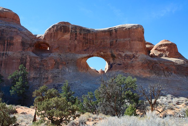
From the trailhead, hike north for 0.2 miles on the wide dirt path as it squeezes through two large sandstone fins, then take a right at the signed junction to get to the side trail to your first major formation – Tunnel Arch. At the 0.3 mile mark take another right at the signed junction to reach Tunnel Arch – which is actually a full arch through a particularly thick section of sandstone (hence the tunnel) as well as a nearby second arch.
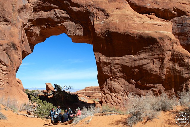
Backtrack to the main trail and continue straight at the junction to check out nearby Pine Tree Arch at the 0.6 mile mark. Pine Tree Arch is a smaller, stouter affair than Tunnel Arch and is named for the junipers that grow almost directly underneath the arch’s ceiling. You can walk directly through this arch or, as this group did, just have a little picnic there, too.
When you’ve had your fill, return 0.2 miles back to the main trail and take a right to continue heading into the Devil’s Garden.
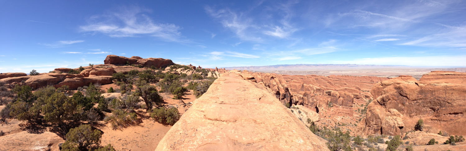
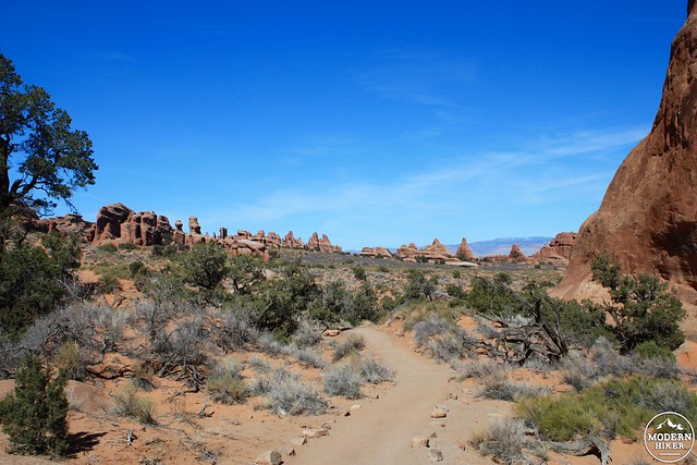
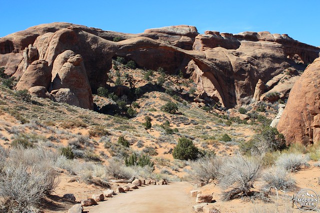
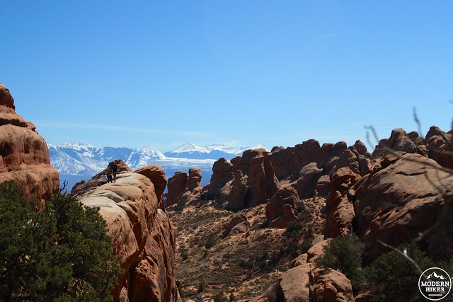
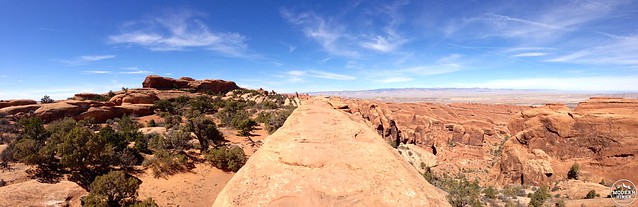
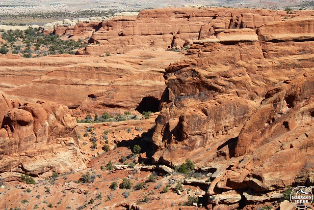
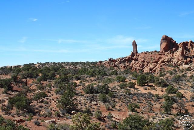
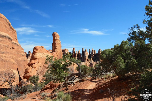
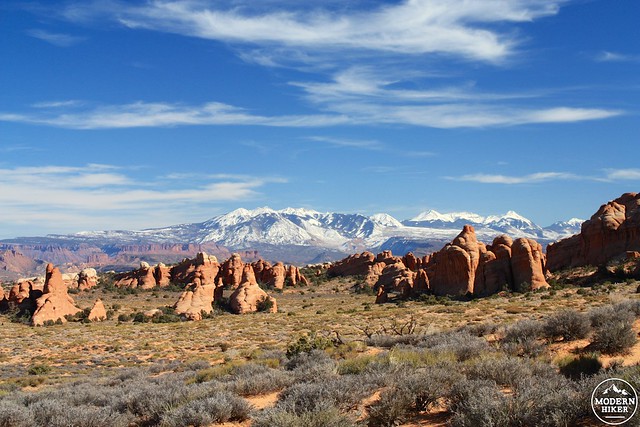
For the next half a mile, the trail maintains an easy-to-follow path heading toward the northwest. To your right the landscape is mostly flat, but to the left and straight ahead you’ll be able to see the strange angular rock formations you’ll be exploring the rest of the route. From this angle, many of them look like Bryce Canyon hoodoos, but they’re actually long, narrow sandstone fins. Most of the arch formations you’ve been seeing in the park so far are birthed from these stone slabs – as the softer dirt and sand near them weathers away, the exposed sandstone is eroded by wind, sand, and water. The arches themselves are constantly growing as they continue to be eroded until they eventually collapse – something that will be on display in just a short while.
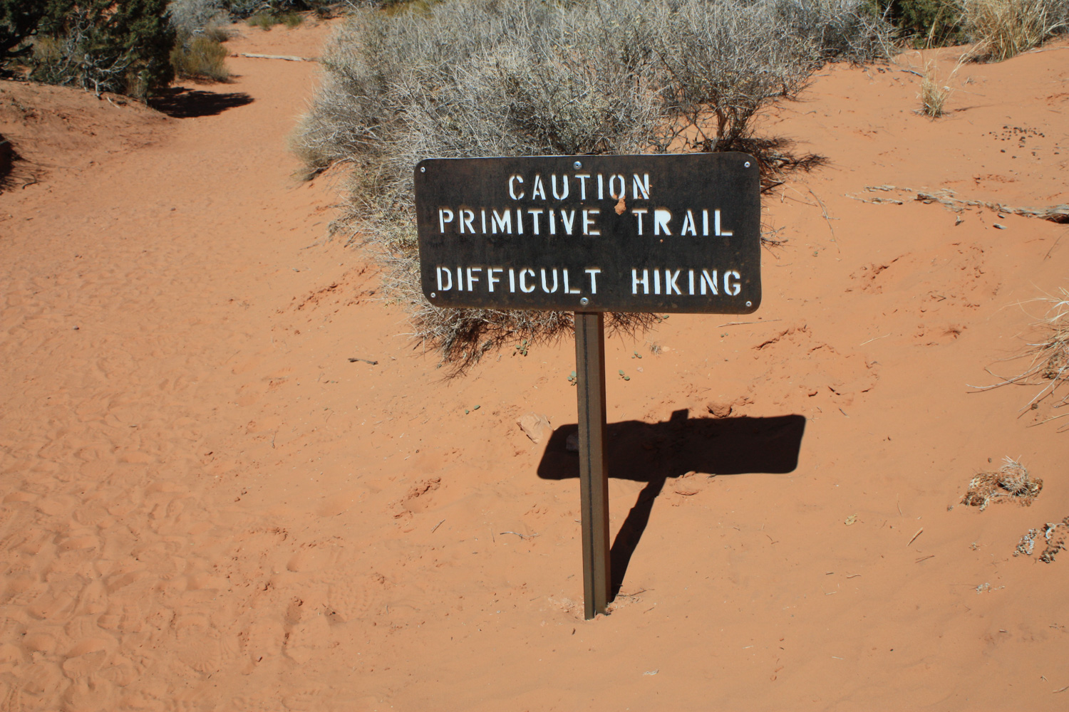
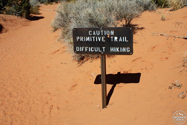
At the 1.3 mile mark, keep left to stay on the main trail. If you follow the full route described here, you’ll be coming back on the primitive trail that meets here.
In another tenth of a mile, you’ll see some of the results of that erosion.
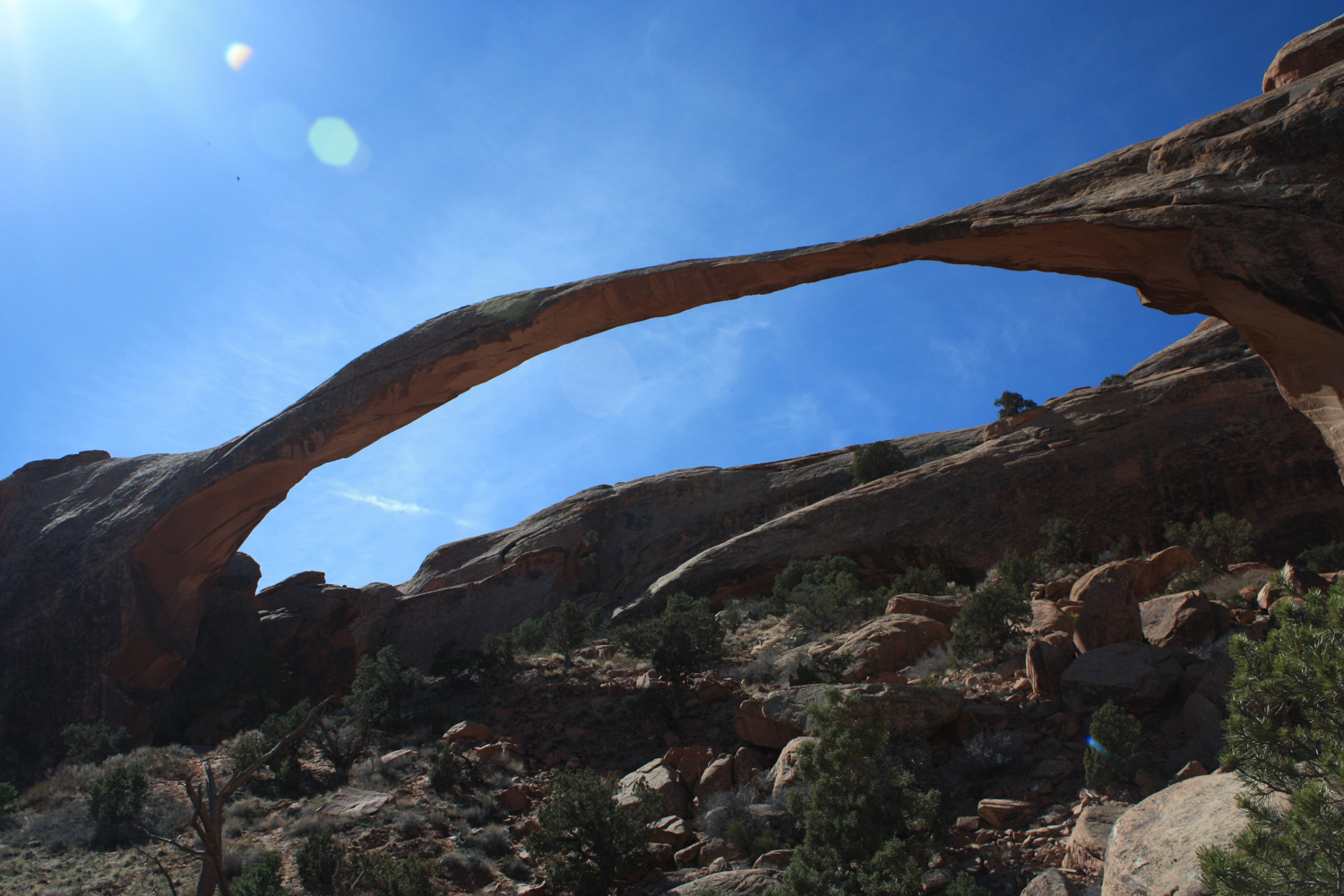
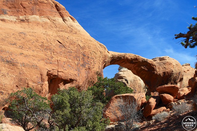
Nearby are the remains of Wall Arch – a 71 foot wide and 33 foot tall arch that collapsed on the evening of August 4th, 2008. Just past this is the still-impressive remaining structure of Landscape Arch. At 290.1 feet across, Landscape Arch is the longest arch in Arches National Park and is considered by some to be the longest arch formation in the world (Zion National Park’s Kolob Arch was thought to be longer until laser measurement gave the nod to Landscape by three feet in 2006; China’s Xianren Bridge was discovered in 2010 and bests both arches by quite a bit, spanning about 400 feet across – but it’s considered a natural bridge).
Landscape Arch
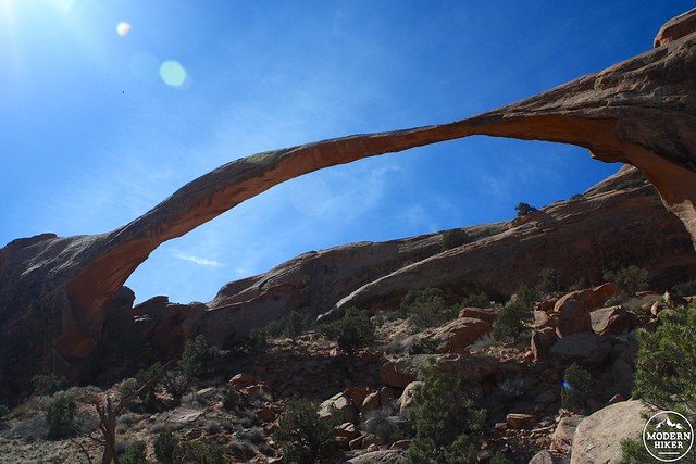
Landscape Arch has had its own recent run-ins with erosion. Since 1991, sandstone slabs 30, 47, and 70 feet long have fallen from the most narrow section of the arch. A trail used to lead hikers beneath the arch but it has since been closed for safety.
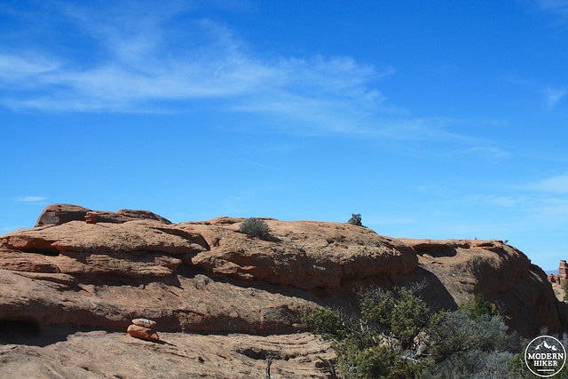
If you only wanted to see Landscape Arch, you can head back to the trailhead from here. But if you’re up for a bit more adventure, continue on – now, the trail leaves the ground and climbs up one of those long, thin sandstone fins. You’ll ascend about 250 feet in a quarter mile on this incredibly fun section of trail, which also gives you a very unique vantage point on the rest of the landscape.
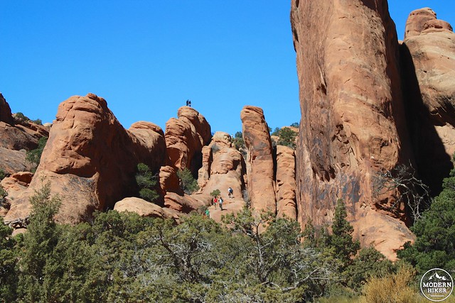
There are some very steep drop-offs along this section, so take your time and use extra caution.
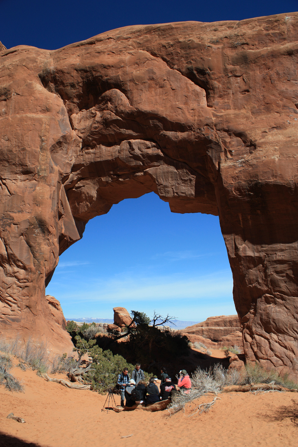
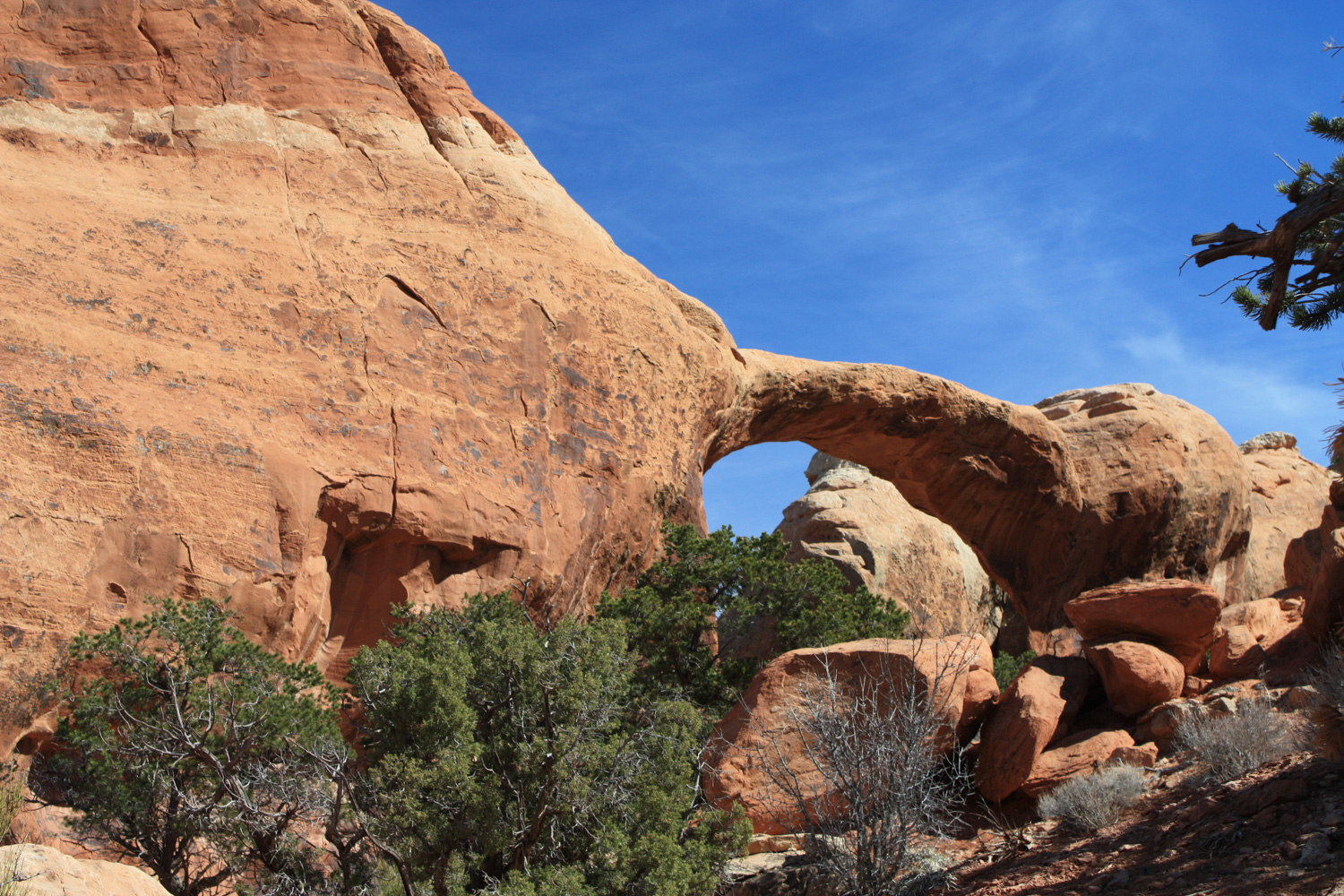
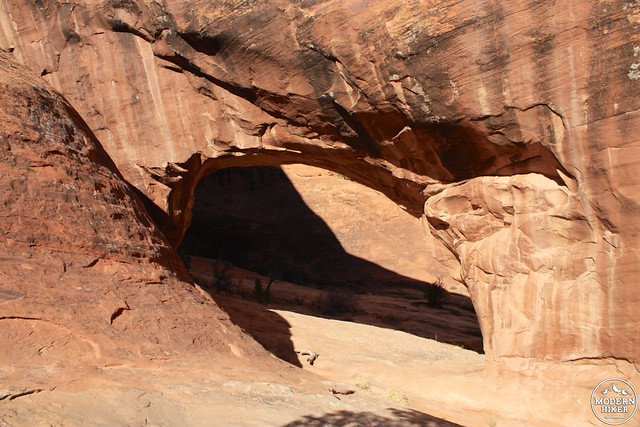
At the 1.8 mile mark, keep left at the three-way junction to head on two short side-trails to Partition and Navajo Arches. Now that you’re off the sandstone fins, you’ll instead be walking in their shadows as the trails hug the western sides of two parallel fins.
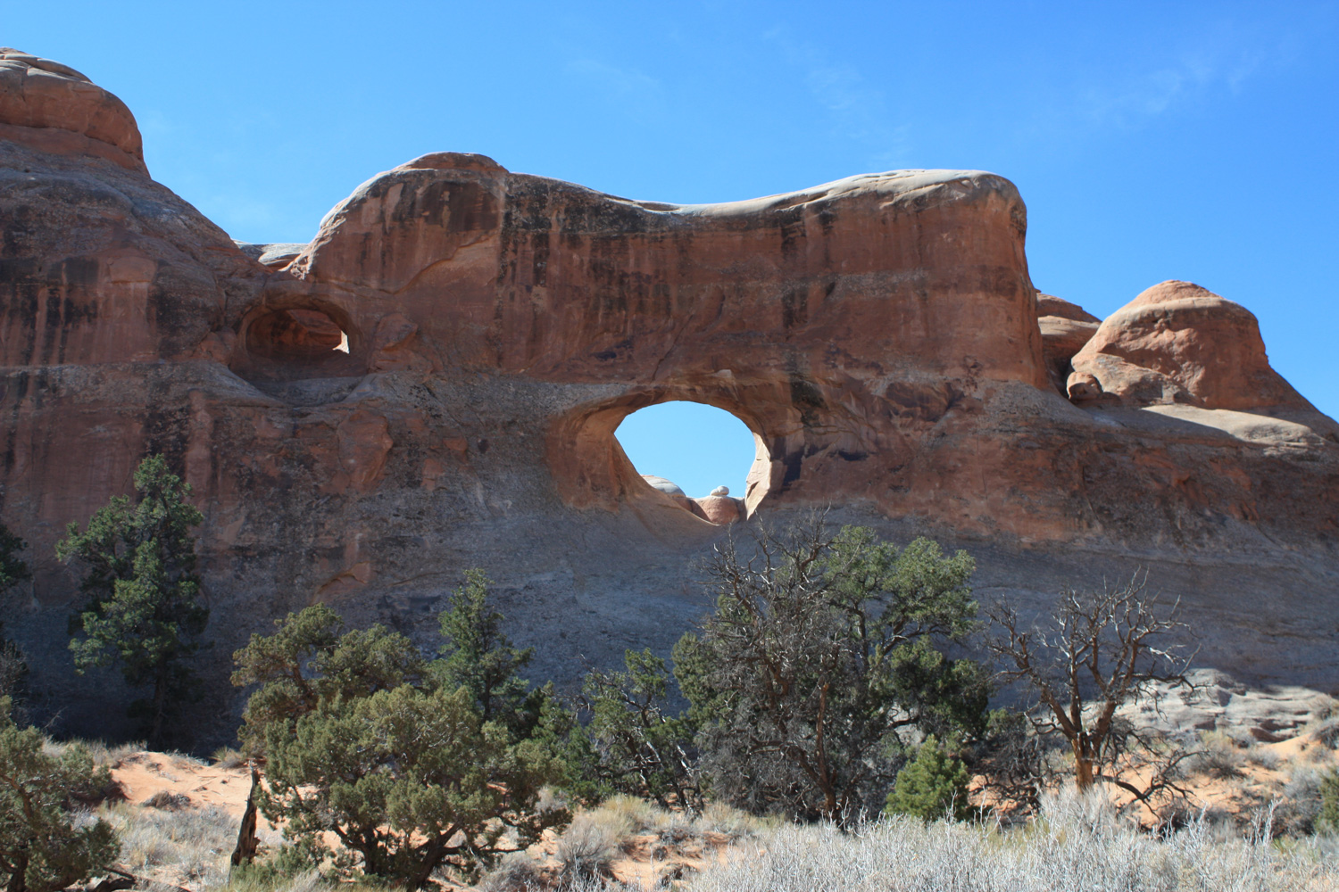
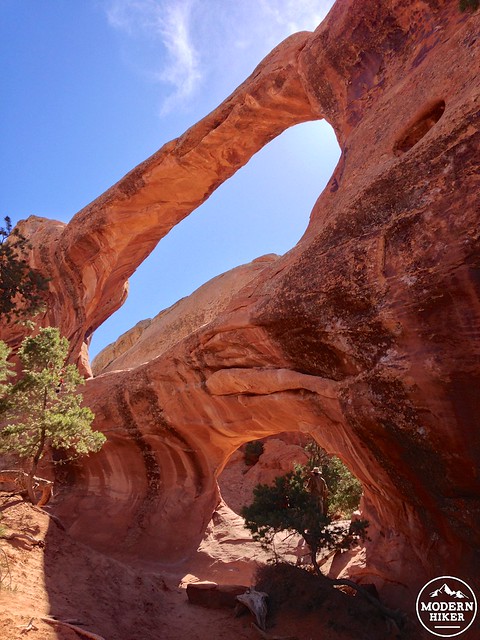
Visit the arches in any order you’d like – I chose to head to Navajo Arch first just because it was a bit farther away from the main trail, but they’re both worth checking out. Navajo is a low, angled arch that almost makes it seem like a cave at first, whereas Partition Arch – like the earlier Tunnel Arch – is a two-for-one deal with a view.
Navajo Arch
Directly beneath Navajo Arch
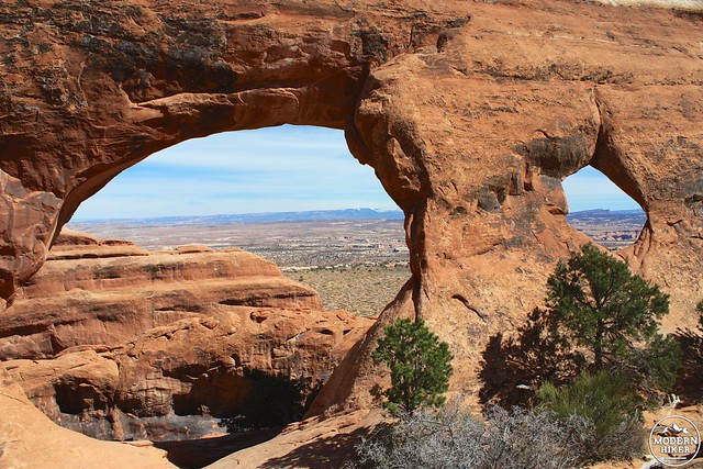
A postcard view through Partition Arch
After visiting both arches, return to the main trail and head left to continue deeper into the Devil’s Garden. For the next 0.4 miles, you’ll first be hiking on a faint dirt trail before hopping on top of another sandstone fin. This one’s not as narrow or as steep as the one at the start of the primitive trail, but there’s a decent drop-off on one side.
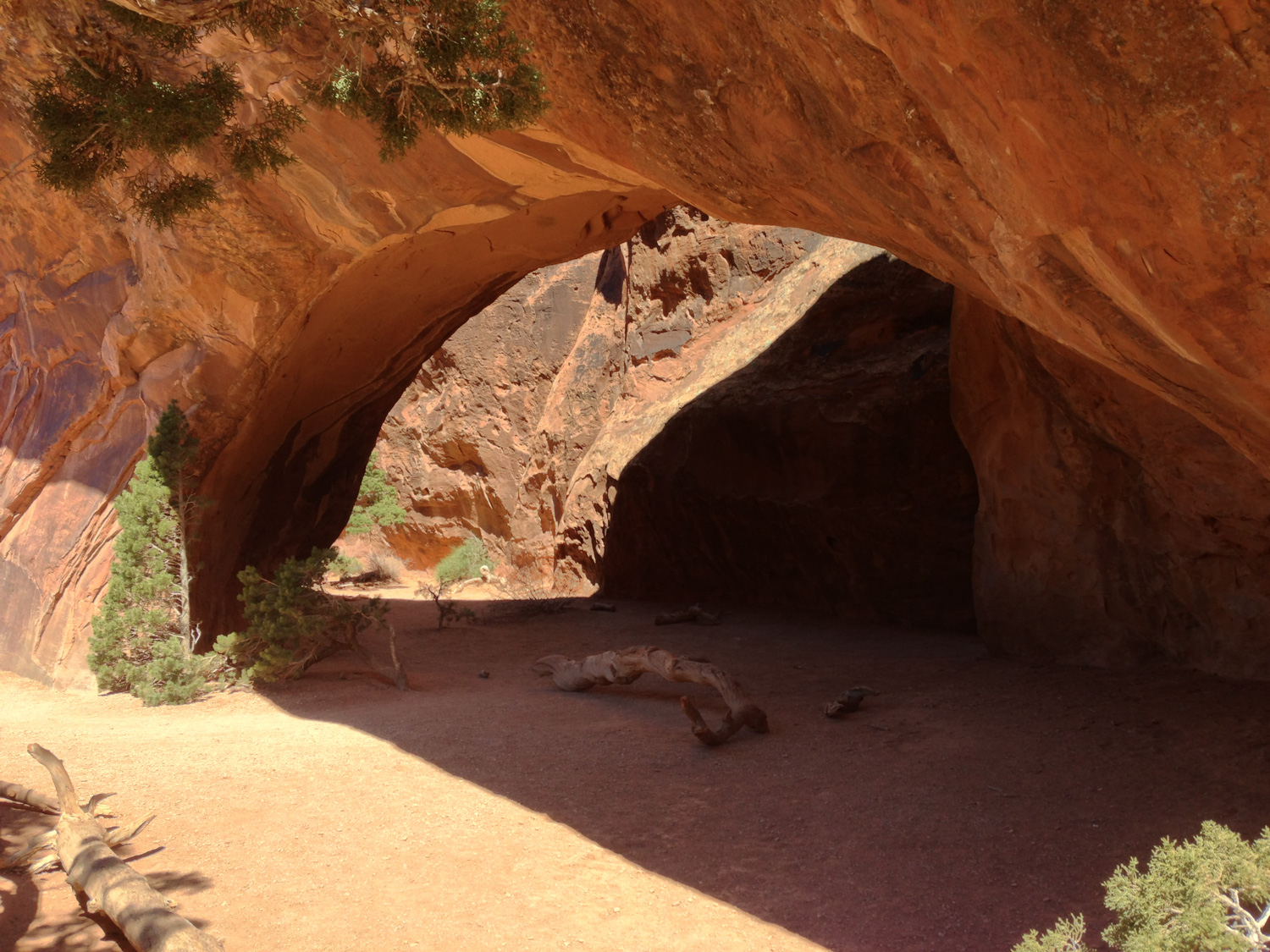
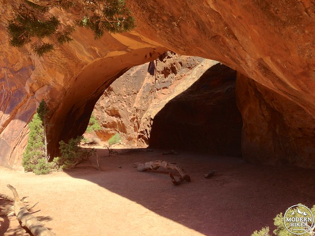
At the 3.1 mile mark, there’s a short spur trail to an overlook of Black Cave Arch (sometimes just called Black Arch on maps) which, as its name would suggest, has more of the appearance of a giant cave than an arch.
Follow the cairns and soak in the scenery of the fins as you continue hiking.

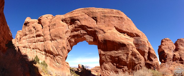
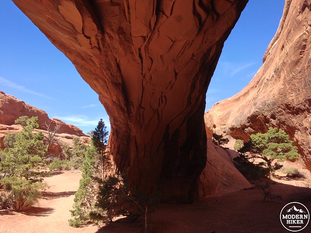
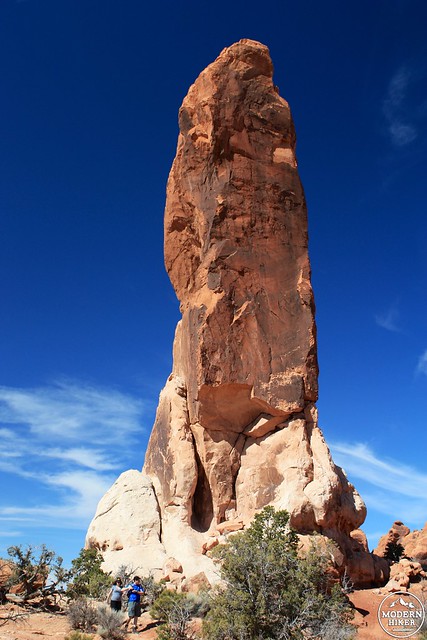
Just before the 3.5 mile mark, the trail makes a sharp turn to the southwest and drops down right in front of Double O Arch, a 150 foot tall sandstone column with two arches stacked on top of one another.
Just beyond Double O Arch is a half-mile side trail to Dark Angel – a 125 foot sandstone spire that’s a dramatic way to cap off the hike.
Keep to the left to head toward Dark Angel on a fairly straightforward use trail. You’ll be able to see the formation fairly quickly – as well as a very different view of Double O Arch from the back.
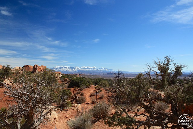
The Dark Angel stands prominently on its own and is very different than the arches and fins you’ve been hiking past so far. Not only is a great place to take a snack or lunch break, but it’s also a nice vantage point for soaking in views of the rest of the park’s quieter northern section. If you’re going to find privacy on Arches’ established trails, it’s probably going to be out here.
There are also some petroglyphs near the Dark Angel, although most maps don’t include them. If you should happen to stumble upon a small sign reading “You’ve found something unique, please preserve it,” then you’re in the right spot.
Backtrack to Double O Arch, this time keeping left at the junction to continue the Primitive Loop Trail.
Here, the trail heads slightly away from the rock formations and into a wash that runs through several fin formations. The trail drops in elevation as it follows the wash, and at the 4.83 mark there’s an option to squeeze between another set of fins on a short side trail to Private Arch – a small, very out-of-the-way formation.
Private Arch, hiding at the end of a use-trail
Return to the main trail and at the 5.4 mile mark it will leave the wash and turn southeast, once again between two large sandstone fins. From here on out, you’ll be keeping your eyes peeled for cairns and following the primitive trail back to the trailhead. At 5.75 miles there’s a little bit of scrambling down the side of a fin that will likely require the use of your hands but nothing that’s too difficult.
Just before the 6 mile mark, the trail enters another wash and trends toward the northeast – and at the 6.1 mile mark keep an eye out as the trail leaves the wash and turns south again (it’s pretty easy to space out and continue in the wash, so be aware!)
From here, follow the use trail back to the junction right before Landscape Arch and back to the trailhead – enjoying the unbelievable scenery along the way.


Tags: Black Cave Arch, Dark Angel, Devil's Garden, Double O Arch, geology, Landscape Arch, Navajo Arch, Partition Arch, petroglyphs, Pine Tree Arch, primitive trail, Private Arch, sandstone fin, Tunnel Arch, wall arch