UPDATE 2/6/2021: I hiked this on February 6th, 2021. The trail condition on Dripping Springs Trail is good. From the Dripping Springs/Palomar-Magee Trail Junction, the trail is in good condition up to about mile 8.5, at which point it becomes pretty brushy. There are numerous downed trees around 9 miles, and it remains sporadically brushy down to Crosley Saddle. Despite the overgrowth, the full loop is passable, provided you’re patient working your way over the downed trees.
The Agua Tibia Loop is one of three behemoth hikes in the Palomar District of Cleveland National Forest. The other two – Eagle Crag and High Point – occur nearby. Both Eagle Crag and Agua Tibia dip into the Agua Tibia Wilderness, which was the first and largest federal wilderness established in San Diego County. The full hike presented here is one of the most challenging and strenuous in San Diego. This write-up will provide three different options to enjoy this remote, rugged, and beautiful corner of the county.
Mt. San Jacinto
Agua Tibia Mountain occupies the northernmost block of the Palomar Mountain range. Agua Tibia is lower in elevation than the Palomar and Aguanga blocks, and it scrapes, but does not quite reach, 5,000’. The lower elevations ensure that this hike can be dangerously hot during the summer and should therefore be avoided out of season (from November to May). And unlike Palomar Mountain, the vegetation here is chaparral, with only a handful of Coulter pines and bigcone Douglas firs gracing the upper elevations.
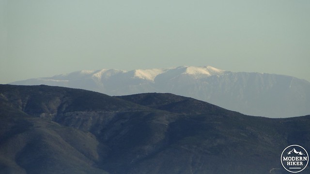
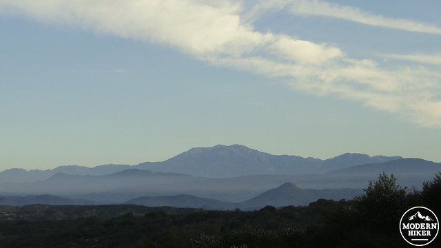
Mt. San Gorgonio
The three options for this hike include taking the Dripping Springs Trail alone, either as a day hike or as an out-and-back backcountry camping trip; second, stopping at the campsite at the end of the Dripping Springs Trail for overnight camping and then continuing around the summit on Palomar Magee Road while returning down the Wild Horse Trail for a two day hike; and, third, if you’re a real glutton for punishment, completing the entire hike in one very long, very sweaty day.
If you plan to camp, you will need to obtain a wilderness permit from Cleveland National Forest’s Palomar District in advance of your visit. To obtain the permit, fill out this online form, and email it to [email protected]. After that, you’ll be set up with a permit, enabling you to camp anywhere you like, so long as you choose a flat space with a durable, vegetation-free surface. Note that there is no reliable water on the route, so be sure to bring plenty of water – preferably two gallons worth if you’re hiking the entire loop.
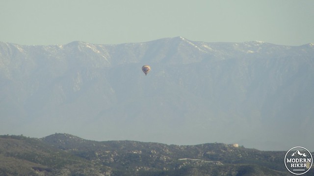
Hot air baloon
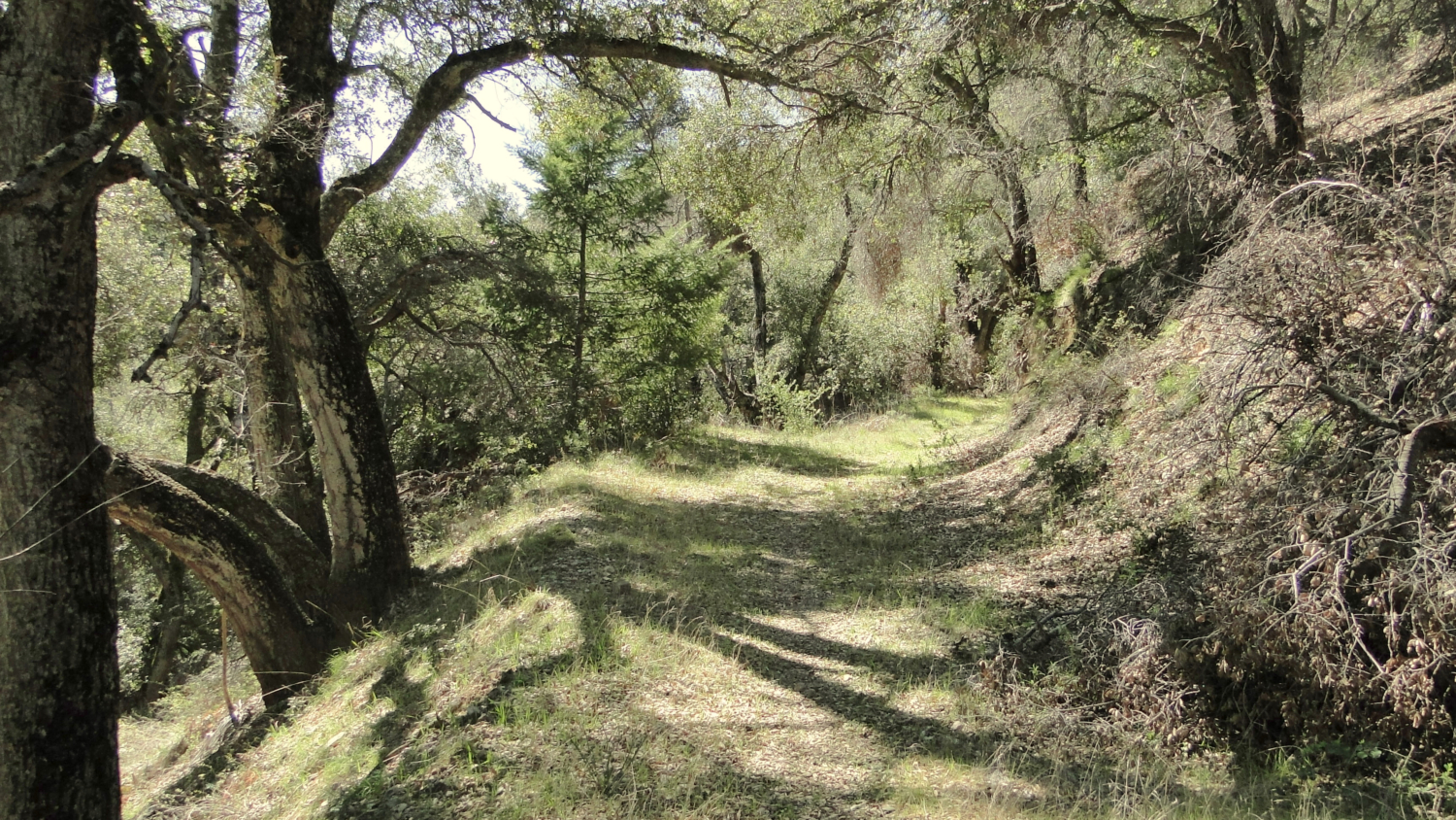
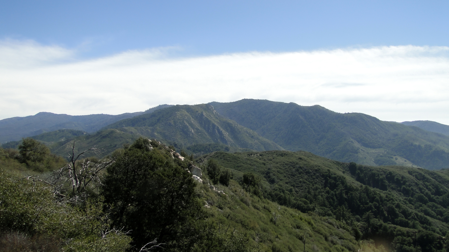
The Dripping Springs Trail starts out from the south end of Dripping Springs Campground. The trail quickly crosses the usually dry Arroyo Seco before climbing to a junction with the Wild Horse Trail. Remember this junction because in 18.5 miles, if you’re taking the loop, you will end up back at this spot. Following the junction, the trail will take you switchbacking up a hill on a steady, but reasonable grade. As you climb, be sure to look back frequently as excellent views of SoCal’s twin giants, Mt. San Gorgonio and Mt. San Jacinto, open up to the north above sun-baked Anza Valley and the city of Temecula. These views will be with you for the duration, and they are especially rewarding when the air is clear and both peaks are snow-bound.
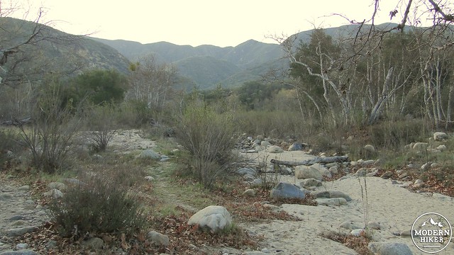
Arroyo Seco near the trailhead
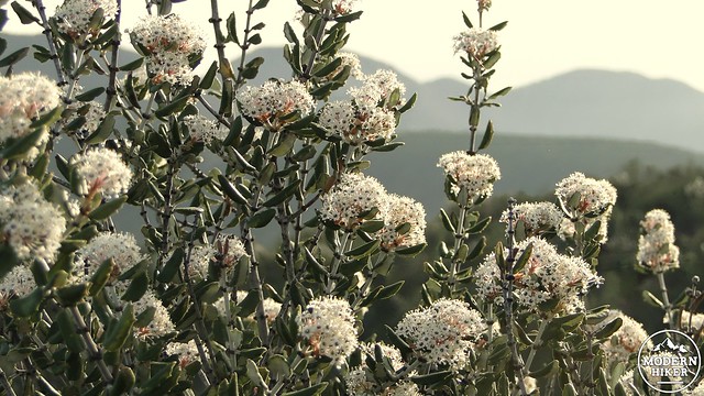
Ceanothus
Climbing commences at a reasonable pace over the next 6 miles before reaching the Agua Tibia Crest. During that time, you will dip into a flat-ish valley, where you will find the remains of some truly magnificent specimens of Manzanita and ribbonwood. These specimens had managed to grow to climax stage, which for Manzanita and ribbonwood takes on tree-like proportions, as a result of a lack of fire over nearly 100 years. However, the Vail Fire of 1989 roared through this area and incinerated the vegetation, leaving mostly skeletal remains of the old-growth trees and a few survivors in its wake.
Yerba Santa
As you climb out of the shallow valley, look to your southeast to see the summit block of Agua Tibia Mountain, bewhiskered with a sparse forest of bigcone Douglas fir and Coulter pines. Coulter pine, which has the largest and heaviest of all pine cones, will become more and more present as you begin climbing the next ridge toward the summit crest. This pine species grows in small clumps or individually among chaparral in the higher elevations. These sparse pines will provide some of the first shade since the very start of the trail. Don’t get too comfortable beneath them, though. Their massive, barbed pine cones have a reputation as “widow-makers.”
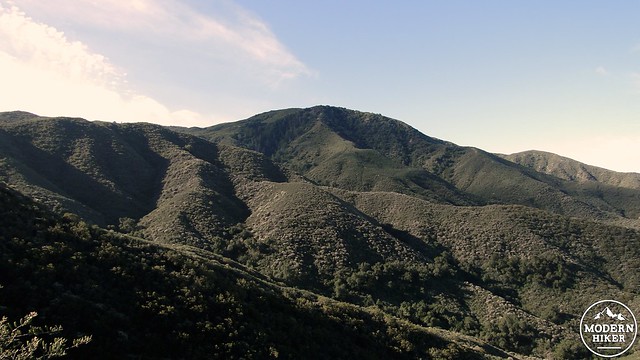
Agua Tibia Mountain
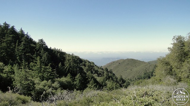
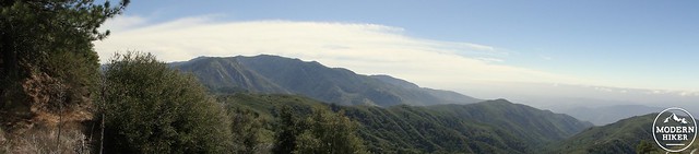
The ridge begins to flatten out and approach the summit. As it does, you will pass a few flat spots shaded beneath coast live oaks that will make excellent, albeit dry, campsites for the night.Not far beyond these campsites, you will come to a junction with Palomar Magee Road, which marks the end of the Dripping Springs Trail and the end of the line for more casual hikers. Even “casual” hikers will note that they have already hiked about 7 miles, gaining 3,200’ and will have another 7 miles and 3,200’ of descending to go. If this is as far as you’re interested in going, take some time to enjoy the view over North County (marine layer permitting) and north toward the Santa Ana and San Gabriel Mountains.
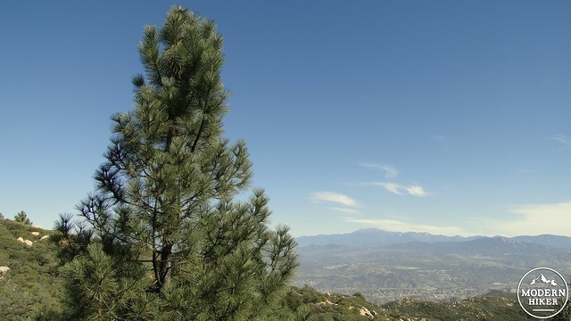
Coulter Pine
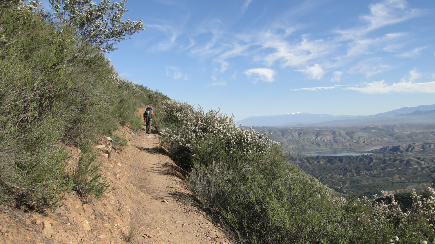
For those continuing on, bear left onto Palomar Magee Road. This “road” was once a much wider pathway allowing vehicles to traverse the Palomar Range’s crest from the observatory to Agua Tibia. Since the introduction of wilderness status, which prohibits mechanized vehicles of any kind, this trail has attained the proportions of a foot path, although the road bed is still in evidence. The next three miles are the highlight of this hike, as they pass around the west face of Agua Tibia, allowing excellent views toward the coast along with the densest thickets of trees. There are a few spots around here that could make good campsites, and the air here is cooler and more humid owing to the stronger marine influence from the ocean only 40 miles away. It’s not uncommon to observe this sea of clouds “splashing” up against this side of the mountain.
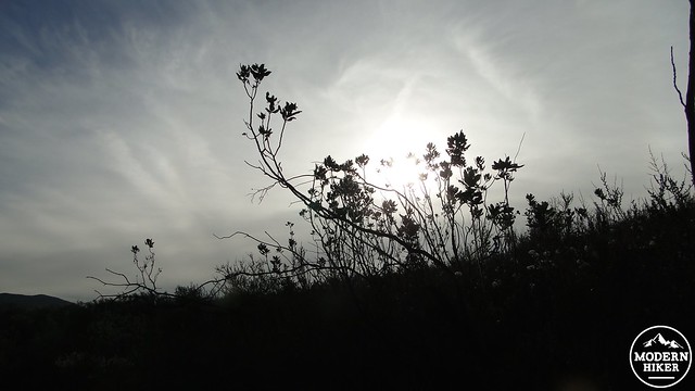
Looking west from the end of the Dripping Springs Trail
The trail will rise to a point where there’s a faint use trail to the summit. It’s easy to miss, and since the summit’s views aren’t much better than what you’ve already seen, there’s no major need to bag it unless you consider not bagging a peak to be a hike wasted. After reaching the trail’s high point around 4,700’, the trail will begin a long, gradual descent toward Crosley Saddle. Crosley Saddle is roughly the halfway point of this hike at 10 miles. This low point not only separates the Agua Tibia and Aguanga blocks of the range, but it also features a junction offering two separate destinations. If you continue straight on Palomar Magee, you will eventually arrive near Eagle Crag with the option of continuing on to beautiful Cutca Valley (16 miles away). The trail branching left is the Wild Horse Trail, which will eventually return you to the trailhead. It’s likely best to save Cutca Valley and Eagle Crag for another hike, which I feel is one of the most satisfying and spectacular in San Diego.
Looking south toward Eagle Crag
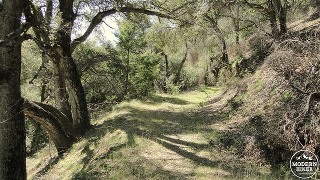
The 2007 Poomacha Fire burned through Crosley Saddle, incinerating most of the vegetation and giving way to a number of fire-following shrubs. Of these shrubs, the one to watch out for is Poodle Dog Bush, which causes a nasty allergic reaction similar to, but possibly worse than poison oak. Turn left onto the Wild Horse Trail at approximately 10 miles from the start, and begin a descent into a delightful canyon shaded by canyon live oaks. The shade here is thick, and this is the coolest and most comfortable section of the entire hike.
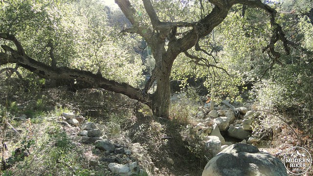
Around 11-12 miles the trees thin out and disappear as the ravine bottoms out. From here, it is a long, hot, sweaty, and somewhat monotonous return journey over undulating hills covered in chaparral. The more reliable upper reaches of Arroyo Seco Creek bubble tantalizingly close, but out of reach, just when you might want to dip your head in a cold bucket of water. Fortunately, numerous patches of riparian vegetation along the ravines that drain the slopes of the mountain, offering shade and possibly even running water if there’s been a lot of rain recently.
At 18.5 miles, the trail returns to the very first junction where the Dripping Springs Trail and Wild Horse Trail split. Turn right here, and follow the trail to the campground, and then continue through the campground to your car to wrap up the hike.
Tags: Agua Tibia Mountain, Agua Tibia Wilderness, Cleveland National Forest, Crosley Saddle, Dripping Springs Trail, Wild Horse Trail