A just-under 2 mile loop trail that explores some of the scenic highlights of northern Waterton Lakes National Park, this route takes you inside the beautifully color-contrasted Red Rock Canyon and to a lovely overlook of Blackiston Falls. This is a great introduction to this section of the park or a nice way to squeeze in some extra trail time in the neighborhood.
In the northern section of Waterton Lakes National Park, as far as you can drive on the Red Rock Parkway, the road ends and visitors have access to some spectacular scenery — and uncrowded backcountry — from a rather popular trailhead.
The Red Rock Parkway is, in and of itself, worth a trip. Known as a spectacularly scenic drive, this 8.7 mile paved road is popular with motorists and cyclists alike, and features numerous pull-off points that are great for wildlife viewing (we saw several black bears along the road on our trip!) as well as markers and plaques that can teach you about the area’s history — from First Nations buffalo hunting (similar to the technique used at Head-Smashed-In Buffalo Jump) to European oil exploration.
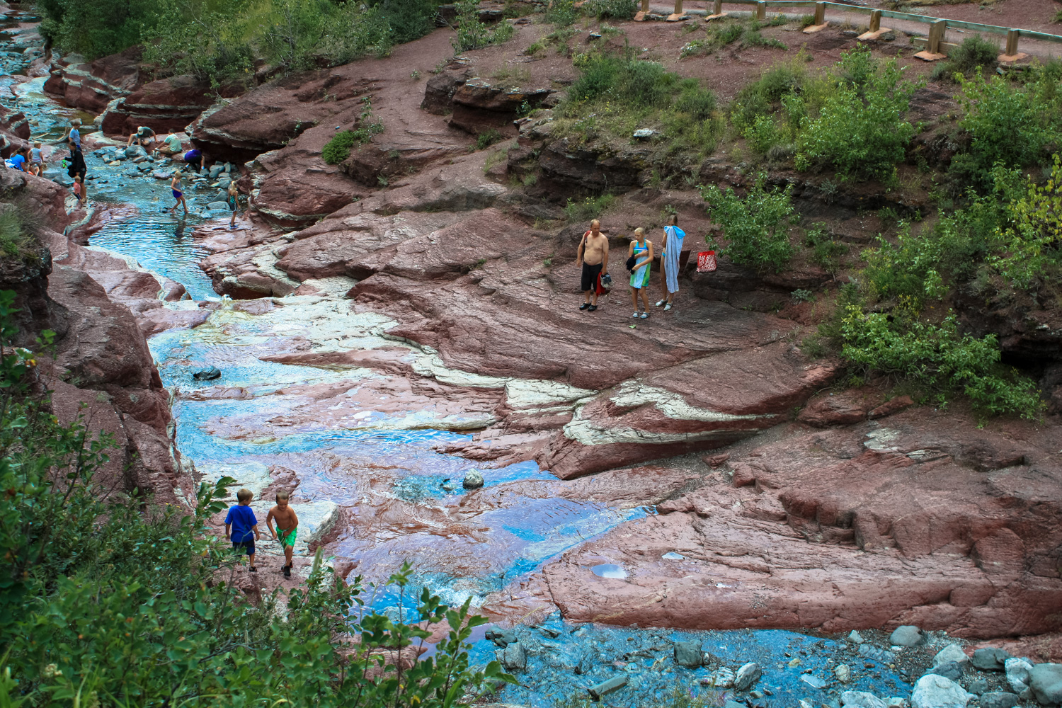
At the end of the road is a large parking and picnic area at Red Rock Canyon — a beautiful gorge cut into red rock by stunning blue glacial melt that is a remarkable change of scenery from the rest of the park’s picturesque lakes and alpine peaks.
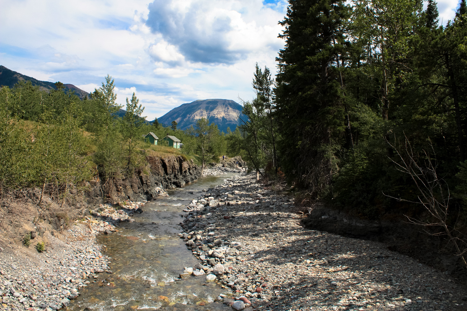
From the parking area, head southwest, ignoring the bridge that leads to the Snowshoe Trail. You’ll have some great views of Anderson Peak to the west, as well as the Bauerman Creek Valley. The moderate Snowshoe Trail leads west toward backcountry campsites at Goat Lake and below Mount Bauerman, but you’ll get a short view of the lower reaches of Red Rock Canyon to begin.


Lower Red Rock Canyon

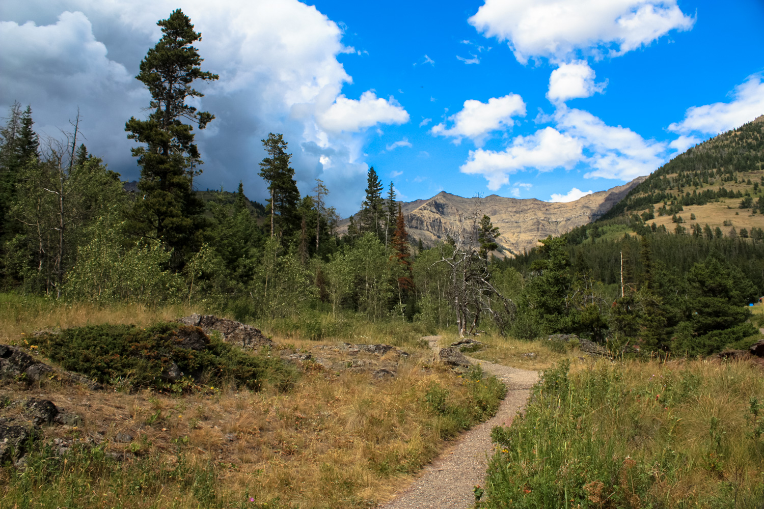
the gravel path heading toward Blackiston Falls
The sharp contrast between the brick-colored landscape of Red Rock Canyon and the electric blue water is striking here, but you’ll get a better view of this later.
The red rocks of Red Rock Canyon give way to the more traditional beige and gray as you get closer to Bauerman Creek. A boardwalk bridge crosses Red Rock Canyon, then Bauerman Creek. Almost immediately, you are plunged into a dense pine forest on a broad, shaded, gently-graded pathway.


Mount Blackiston, the tallest peak in Waterton Lakes National Park

The trail meanders pleasantly through the forest, breaking into a nice overlook of Lone Creek and Blackiston Falls at 0.6 mile.


Just past the viewpoint, a fenced-in path takes you to a viewpoint directly overlooking the waterfall’s cascade. Despite the fencing, this is still a beautiful place to take in the sounds and feelings of the roaring, misty river and you may want to linger here a bit.
When you’re done, backtrack to the trailhead and stay to the left at the bridge you crossed on the way in to remain on the western side of Red Rock Canyon.
Hiking along Red Rock Canyon in this direction really gives you a good sense of the erosion the creek is causing on the landscape. What begins as a broad, surface-level creek deepens and narrows into a towering gorge cut deep into the rock.


At 1.6 miles, the established trail reaches its northern limit. Here, you’ll cross the deep canyon on a short bridge, then return back on the opposite side.
If you’d like, you can walk inside the canyon itself. With a bathing suit and solid water shoes, you can get a totally unique perspective on this fascinating landscape — just be sure you check with the rangers for weather conditions before you venture inside. This is definitely not a place you want to get caught during a flash flood.
Tags: alberta, blakiston falls, canada, red rock canyon, waterton lakes national park