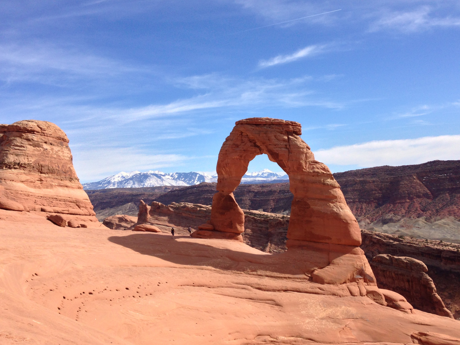
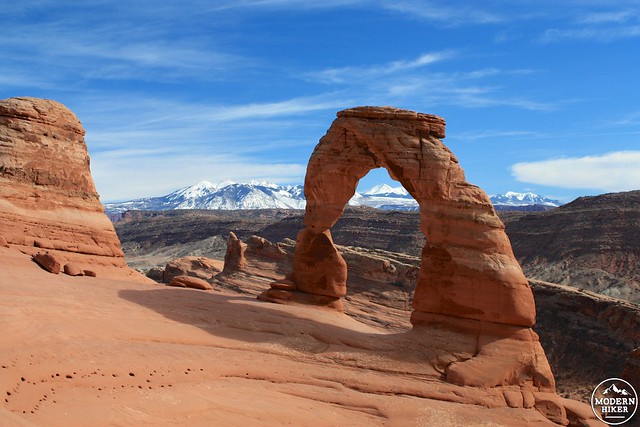
Delicate Arch is one of the most famous arch formations in the country, and the trail to it is one of the most popular routes in Arches National Park. The Arch is on Utah license plates and is one of the most enduring symbols of the American West – but its popularity should not dissuade you from hiking this trail. Not only is the 65 foot tall arch significantly more impressive in person, but the trail to reach it is one of the most well-designed trails I have had the pleasure of hiking.
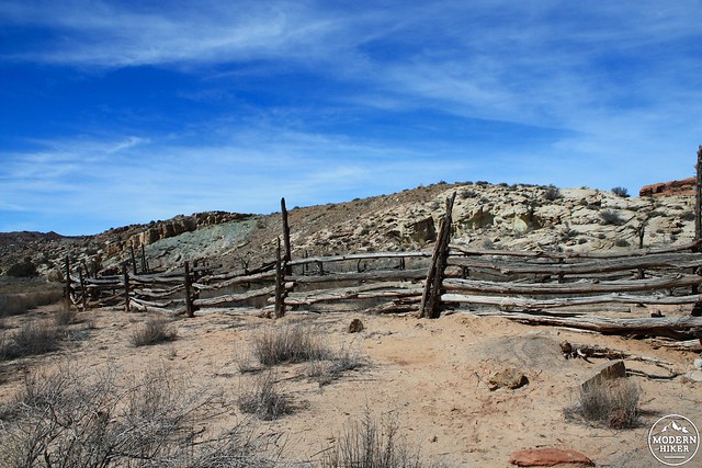
The trail begins at a large parking area near Wolfe Ranch. The historic ranch buildings are visible from the parking area and easily reached by a short side trail that departs from the Delicate Arch Trail itself. It’s definitely worth a visit – Civil War Veteran John Wesley Wolfe and his son moved here and built a one-room cabin near Salt Wash, where they raised cattle for about a decade. In 1906, Wolfe’s daughter and her family joined them – and demanded a new cabin be built with proper wood floors.
They lived in this spot for a few more years before packing up and returning to Ohio. The buildings are still in surprisingly good condition. You can view but not enter the cabin and store cellar and try to imagine what it was like to live here for so many years.
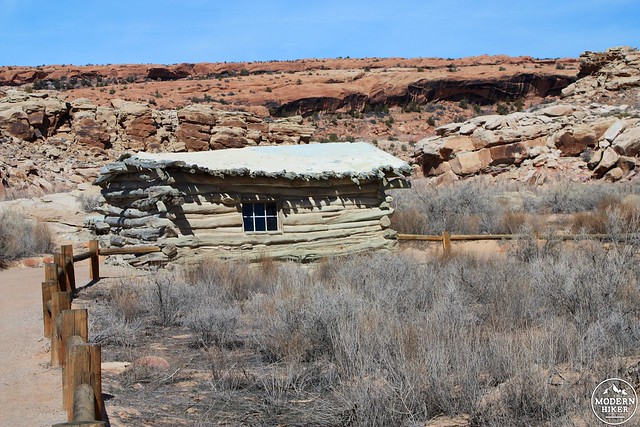
On some maps and park information, the cabin is called the Turnbow Cabin – named for a USGS geographer who was responsible for the first detailed maps of the area. Newer maps properly attribute the buildings to the Wolfe family.
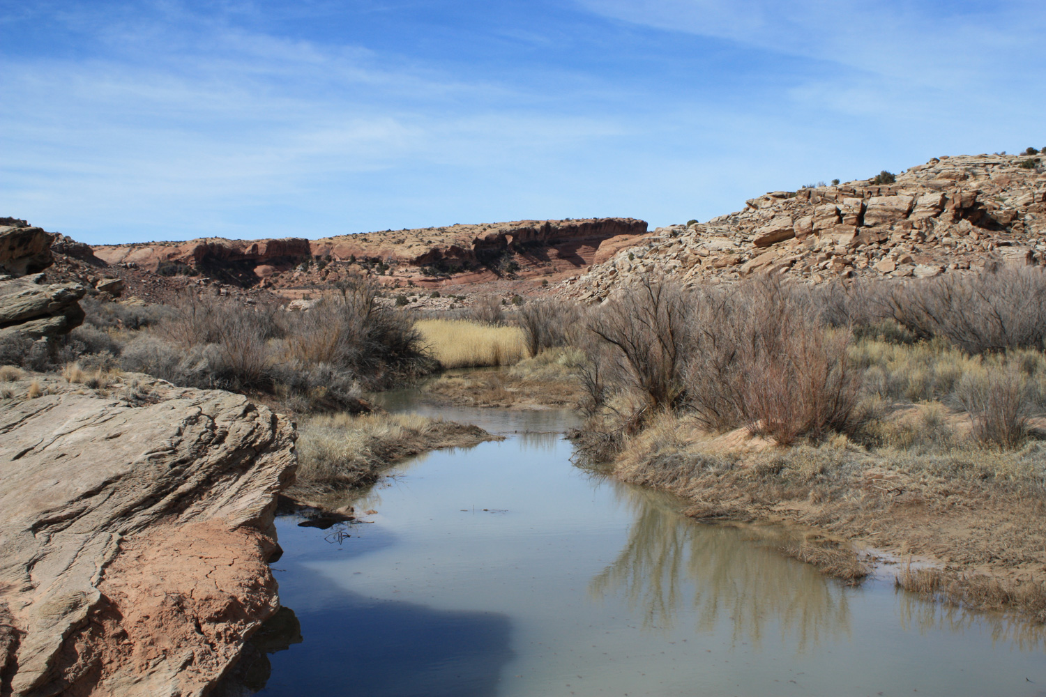
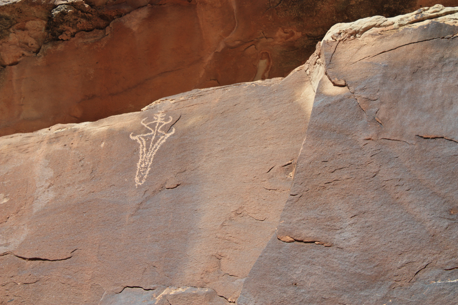
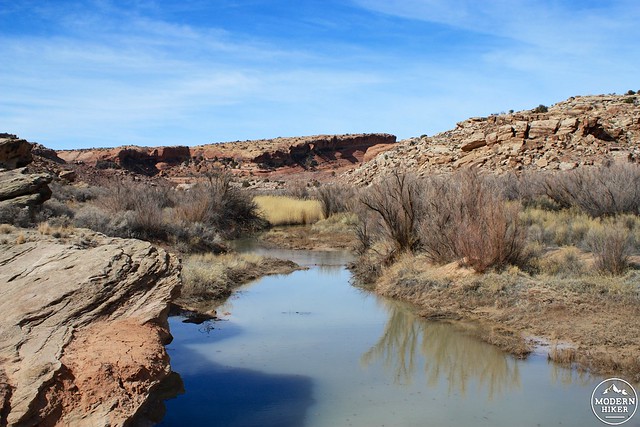
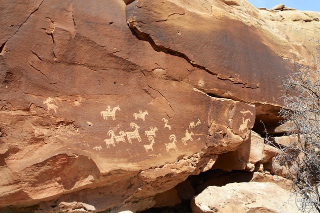
Across Salt Wash are a few Ute hunting pictographs in excellent condition. Cross the Wash on the bridge and take a left on the wide dirt path. At the 0.2 mile mark, you’ll reach the rock wall and be able to see the rock art fairly up-close.
It should go without saying, but don’t touch or mark the rock art or historic structures.

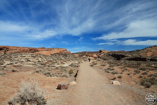
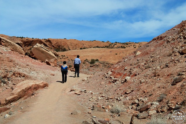
Follow the trail east along the rock wall for another tenth of a mile until it re-joins the main trail. Here, the route makes a short steep incline atop the rock wall, then turns east before leveling off and dropping back down to its previous elevation.
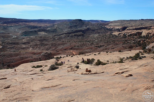
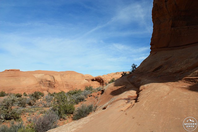
The landscape here is – for lack of a better word – stunning. The landscape here curves and bends its way through millions of years of differently-colored geologic history all on view at once. Add some clear blue skies for contrast and you’ll find it very difficult to put your camera down for more than a few minutes.
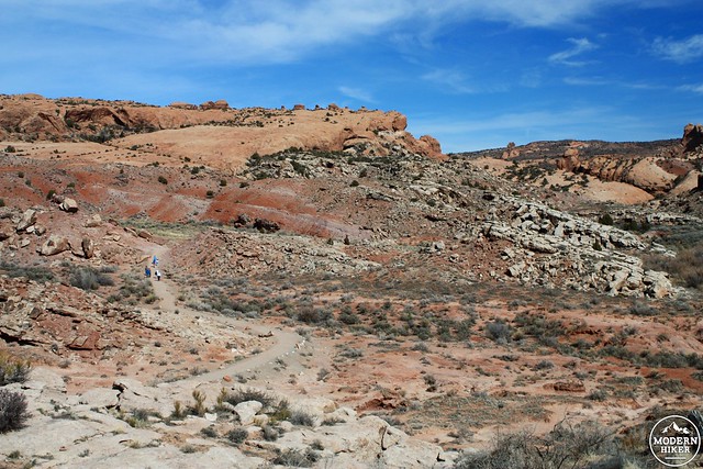
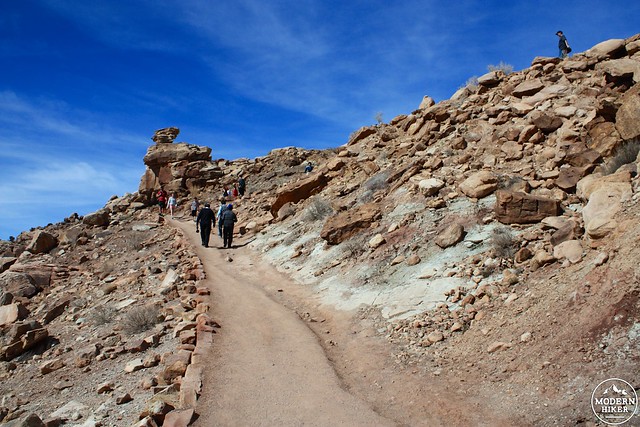
After dropping back down again, the trail climbs a short stone staircase and drops you off at the base of a long slickrock incline. From here, you’ll be keeping your eye out for rock cairns to mark the way, but if you ever get confused just remember: “Go up.”
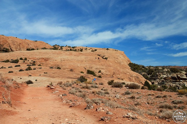
And while you’re gaining elevation, don’t forget to occasionally look back to take in the whole landscape of Arches.
Just before the 1.2 mile mark, continue following the cairns as they wind through a small grove of stunted junipers – after which you’ll meander through the stone in a narrow wash.
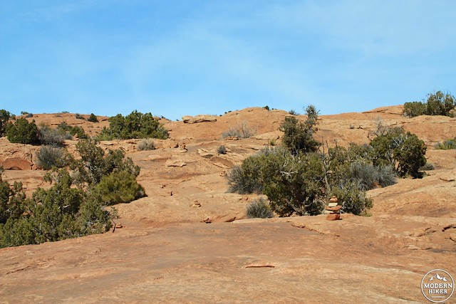
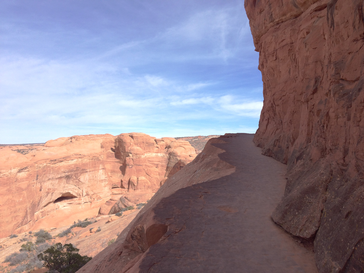
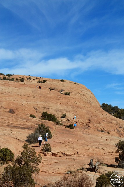
At this point, the trail travels on the north side of another long rock wall – this one much taller than the one at the start of the trail.
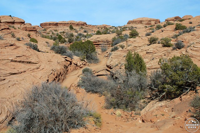
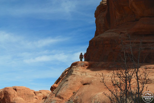
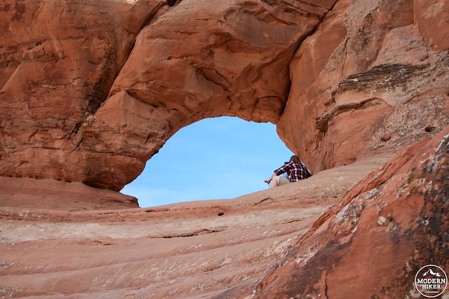
The route here is a little more defined – with stairways cut into the rock and the path defined to a narrow ridgeway that winds along the rock wall. As you hike here, be sure to pay attention to the shapes of the rocks around you – you may be able to spot some other arches, natural bridges, or the earliest beginnings of either of those on the other side of the small valley to your north.
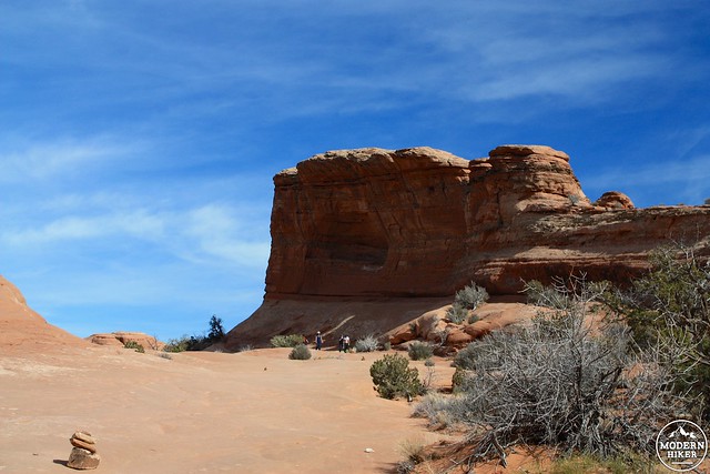
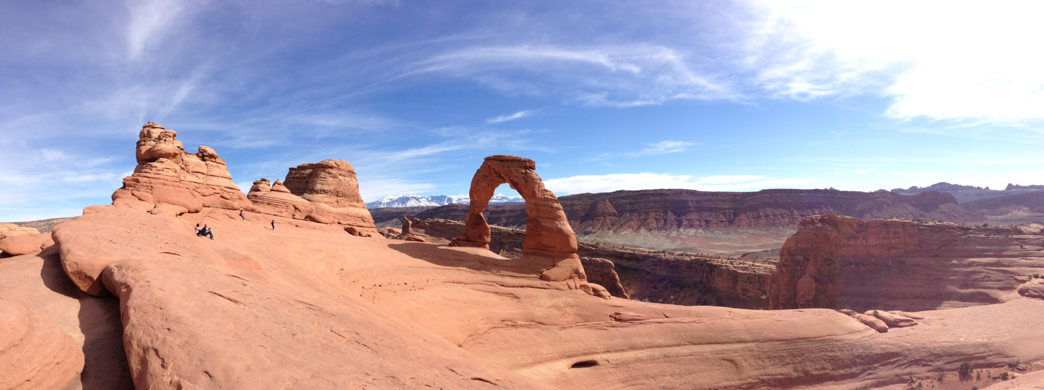
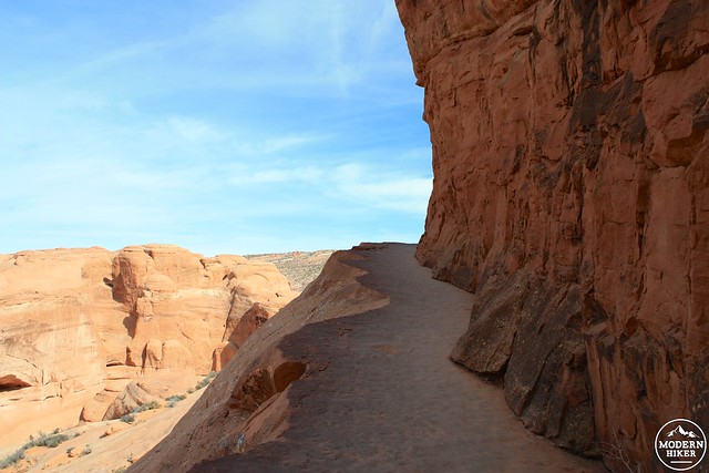
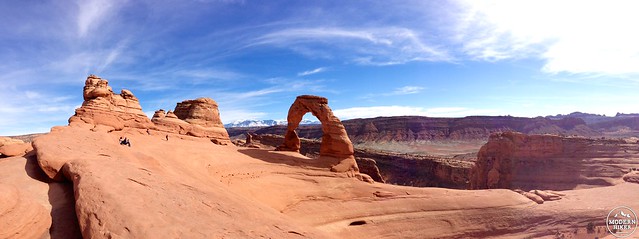
The trail narrows and hugs a steep ridge in the shadow of the rock wall and then – seemingly out of nowhere – the rock wall to your right drops away and reveals Delicate Arch to you, with the distant La Sal Mountains in the background.
The effect is so sudden and so shocking that seeing Delicate Arch hits you pretty hard. I definitely gasped when I turned that final corner – and I enjoyed the moment so much that I sat down nearby to watch other hikers’ expressions as they made the same discovery I did. Hiking conversations stopped dead in their tracks when people first laid their eyes on the Arch, replaced only with silence, slack jaws, and the occasional exclamation of wonder.
Don’t be surprised if the moment brings a tear or two to your eye.
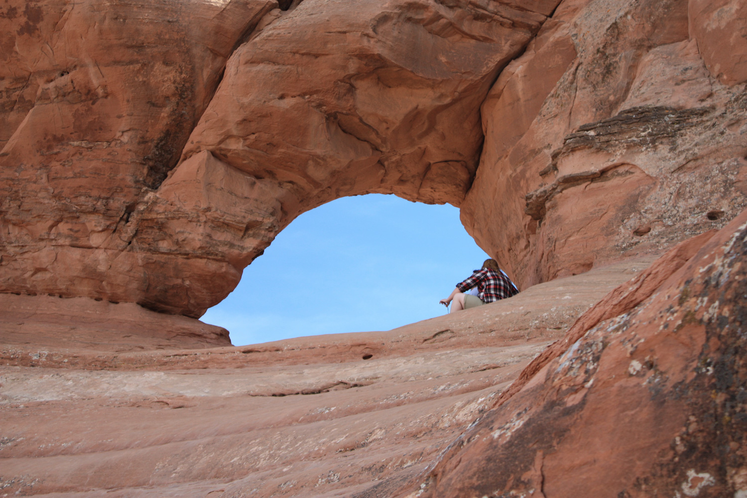
It is possible to walk up to the Arch itself, although climbing or scrambling any named arch inside Arches National Park is strictly prohibited.
I recommend going to see it up-close for yourself, or at the very least sitting back and enjoying others visit instead just for a taste of perspective. The Arch is a lot bigger than you’d think if all you’ve seen are photos and license plates.

Take as many photos as you’d like with the Arch, but make sure to leave some time to just sit in silence and appreciate this landscape’s tremendous and extremely temporary moment of beauty.
Return back the way you came.
Tags: arches national park, Delicate Arch, petroglyphs, pictographs, ruins, Turnbow Cabin, Wolfe's Ranch