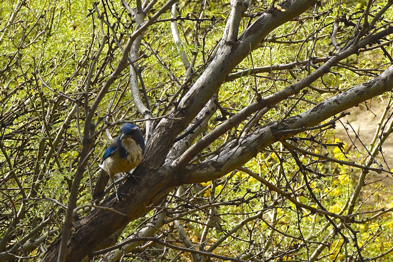
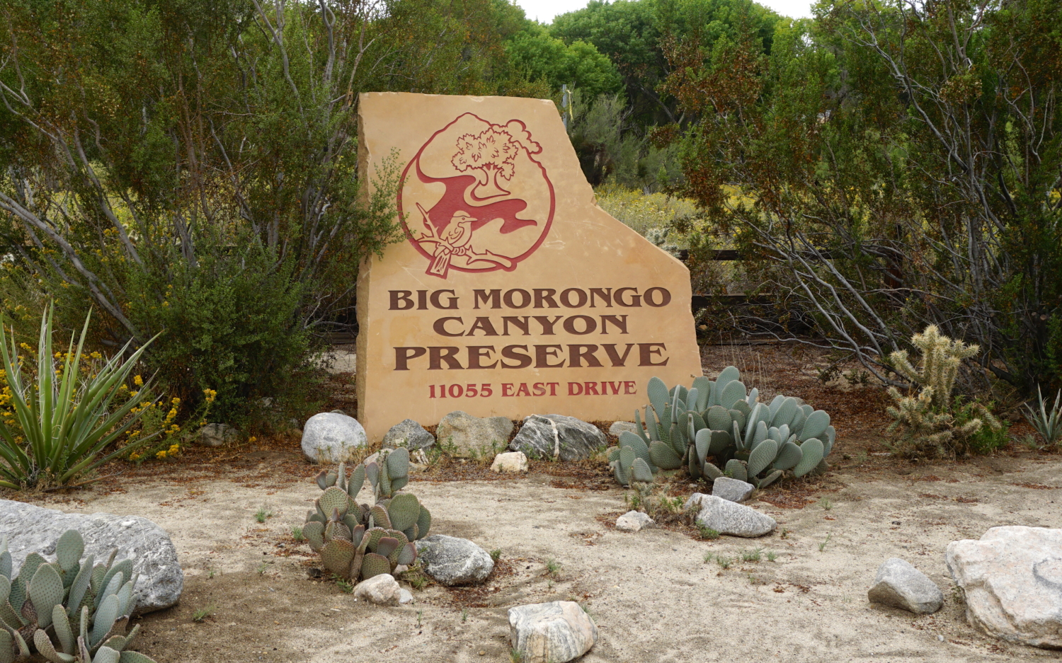
When most people envision the desert, the first word that springs to mind is probably “dry.” Not so at Big Morongo Canyon Preserve, a lush pocket of the brand new Sand To Snow National Monument tucked between the western edge of Joshua Tree National Park and the towns of Yucca Valley, Morongo Valley, and Desert Hot Springs. The canyon’s unique geographic makeup allows it to trap snowmelt from the nearby San Bernardino Mountains, creating a spring-fed wetland area that serves as an incredibly important travel corridor for wildlife. This is an especially popular stopover for migratory birds, so consider packing your binoculars and a camera to see if you can spot one of the 254 species listed in the Preserve’s birding list.
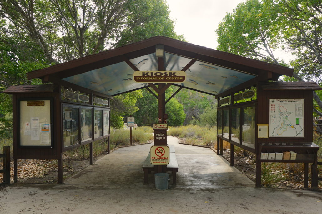
The Preserve’s trail system is small but dense, so our recommendation is to take a grand loop to enjoy a highlight reel of what makes this oasis so special. Begin at the Zeller Kiosk, located adjacent to a large parking area outfitted with picnic tables and bathrooms. Before you start hiking, spend a little bit of time here – pick up a simple map, snag some brochures about the Preserve’s history, and enjoy a multitude of displays about local fauna, medicinal plants, and the area’s indigenous Cahuilla and Serrano people, who used this area as a travel corridor between the diverse surrounds of the high Mojave Desert and the lower Colorado Desert.

When you’re ready to begin this counterclockwise loop, walk through the kiosk and head right (north) on a boardwalk that is part of the Marsh Trail. You’ll likely be accompanied by birdsong from the get-go, and even though busy Highway 62 is really not all that far away, a sense of peacefulness pervades the beautiful surroundings. Walk through tufts of yellow-blossomed alkali goldenbush and stands of Fremont’s cottonwoods, passing by the Preserve’s Natural Science and Education Center and a Butterfly Garden on your left, where you can hop off the trail to explore.

At 0.2 mile, reach an intersection on your right, where you’ll depart the Marsh Trail on a set of wooden stairs that mark your transition onto the Mesquite Trail. Walk for a few minutes, then make a right just shy of 0.4 mile to join the West Canyon Trail. There’s a short bit of uphill here, but the upside is that the higher you climb, the better the views down into the vibrant green watershed and north towards the Sawtooth Mountains near Pioneertown. As you’re walking through this area, you’ll notice remnants of the 2005 Paradise Fire, a 3,000-acre blaze that destroyed six homes.

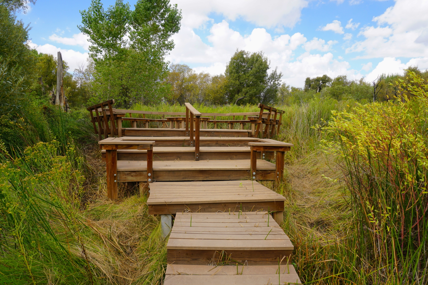
Once you reach the highpoint of this section, you’ll coast back down to the canyon floor to meet up with the Canyon Trail at 0.9 mile – this departs to the right to make a 9-mile round-trip detour, but you’ll veer left through an opening in a wooden fence to continue on the West Canyon Trail. Things suddenly become very green as you pass through a veritable tunnel of willows. Stay straight at a trail junction at 1.2 miles to cross a small boardwalk bridge and rejoin the Mesquite Trail. In just a moment, you’ll pass a side trail on your left that leads to the large George Helmkamp Deck, a worthy detour that puts you right in the middle of the marsh, surrounded by tall grasses, cattails, and water (or mud). Have a seat on one of the benches and plan to spend some time here relaxing; trust me when I say that on a beautiful day, it’ll be hard to pull yourself away from such serene surrounds!

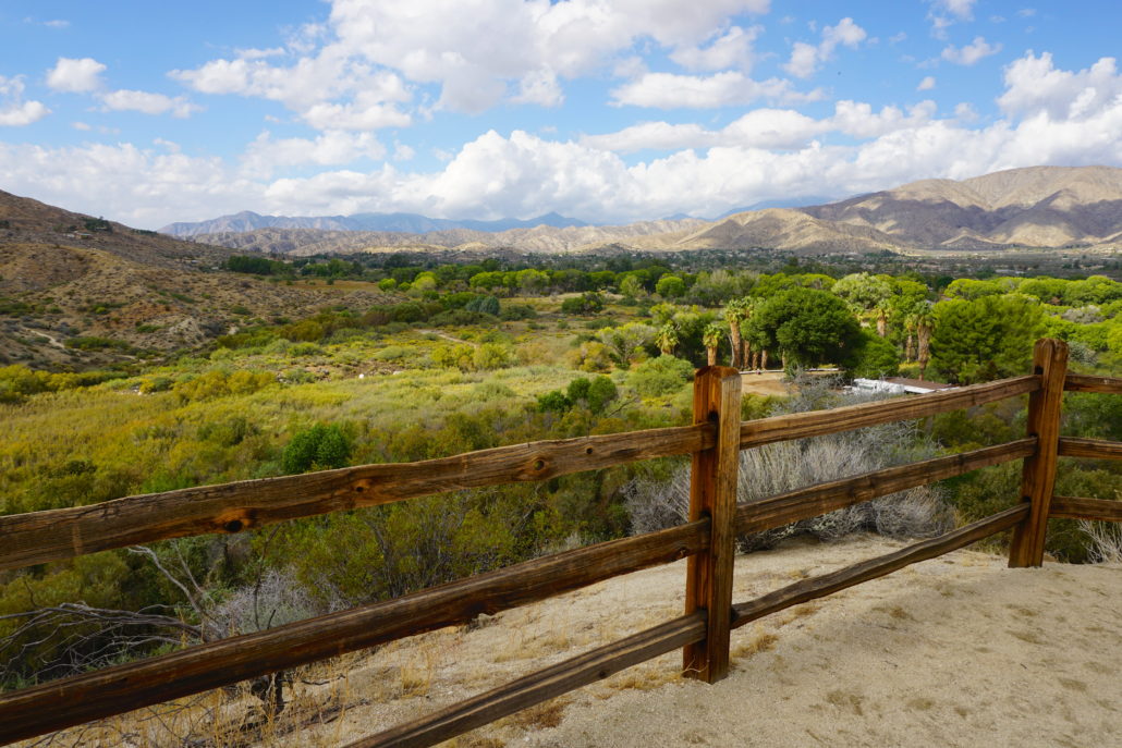
When you’ve dragged yourself back on trail, continue a tenth of a mile ahead to find another split in the trail – the left branch continues the Mesquite Trail towards the parking lot, but you’ll want to head straight to hop onto the Yucca Ridge Trail. As the name might suggest, you’ll head uphill for a short bit to reach an overlook at 1.4 miles that features stunning views down into the canyon and out to the Sawtooths. There’s a bench here, but you’ll also find a few more just ahead, right before heading back downhill. As you wiggle down, you’ll pass an assortment of desert plants, including cheesebrush, desert almond, Mormon tea, creosote, and cholla, many signed with small identification placards.
At 2 miles, you’ll once again reach the canyon floor, this time at a sandy trail junction with the Desert Willow Trail – choose the right branch to pop over the Currie Bridge, a small footbridge that might be covered with sand instead of hovering over water. The ground here might be soft, dry sand – or it might be moist and muddy, the latter offering the opportunity to look for animal tracks (pick up a tracking guide in the Zeller Kiosk at the beginning of your hike). Birds flit amongst the thick willows, which offer some of the only shade you might experience throughout the hike – a nice respite on a hot, sunny day.
Around 2.3 miles, you’ll rejoin the Marsh Trail and will see the end of your loop just ahead – the Zeller Kiosk, where you began your trip. If you’re not ready to leave quite yet, instead detour to the left to the Jess Sherrod Memorial Deck, where you can enjoy more wetland views and reflect on this magic oasis of water in the desert.
Tags: Big Morongo Canyon, Big Morongo Canyon Preserve, birding, birdwatching, colorado desert, desert, joshua tree, marsh, Mojave Desert, Morongo Valley, riparian, Sand to Snow National Monument, wetland