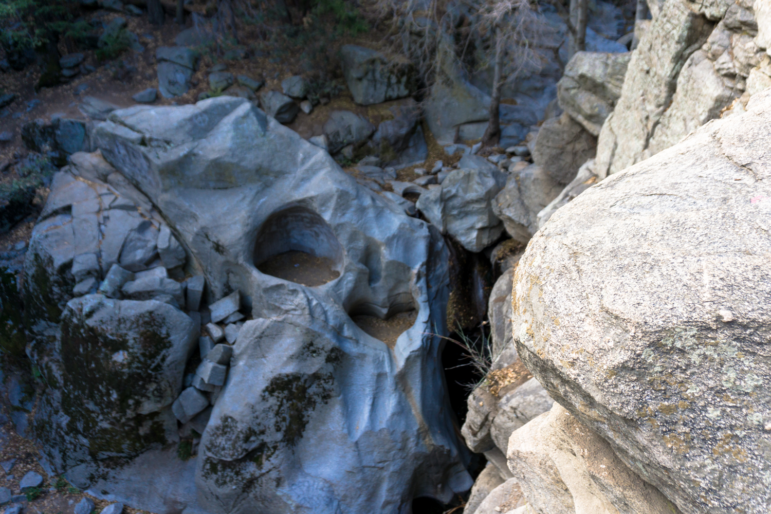
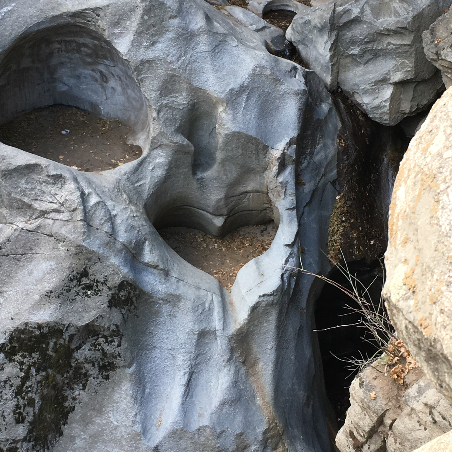
How long does love last? Well, if its symbolic form is etched into stone, the answer is — quite a long time.
This easy and popular route just outside of Crestline follows a well-worn path alongside a lovely riparian habitat hugging seasonal Seeley Creek to a waterfall where the slow forces of erosion have carved a nearly-perfect heart shape into the rock.
The trek begins at the end of the road near Camp Seeley — or at any place you can park on the way. The official trailhead parking is fairly limited, and even on a weekday morning these spots can fill up rather quickly. But even if you have to park somewhere along the CA-138, it’s not a long walk to get to the trail. Do be aware, though, that following periods of heavy rain the banks of Seeley Creek may swell to a dangerous level — either for your car driving over it to the trailhead or for your boots.
If you can’t snag a spot at the end of the road, the overflow lot will take you through the woods and around a swimming pool surrounded by a locked chain link fence.

The “official” trailhead parking will put you onto the trail just beyond this, so the spillover lot doesn’t add a ton of distance to your overall hike. Just a few minutes and you’ll be hiking through a dense pine forest in no time.

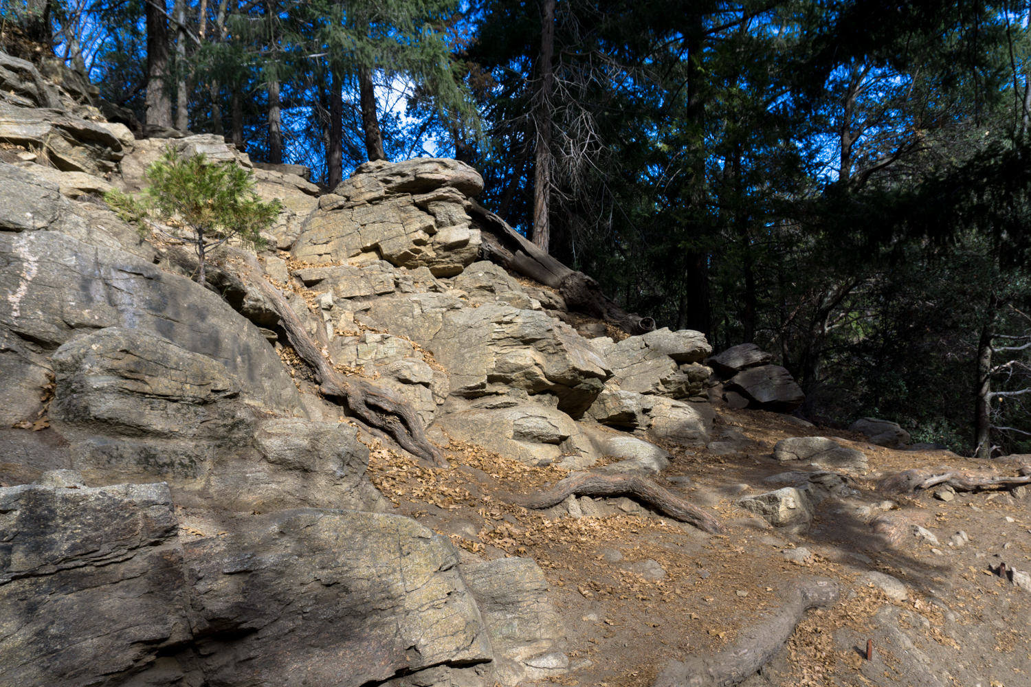
Just past the 0.25 mile mark, the trail begins to descend into the canyon.
It’s not a tough descent, but the trail is not as well-maintained as it used to be, so keep an eye out for tree roots and uneven, loose rock — especially if you’re hiking this trail with little ones.
Use trails spur off the main route and occasionally head down to the banks of the creek. The official trail stays above the water but feel free to extend your trip by popping down to the creek if you want to. Just know that to get to the viewpoint overlooking Heart Rock, you’ll have to eventually climb up and out of the creek.


Enjoy the scenery along the way: the dappled sunlight breaking through the pine trees and the sound of running water are pretty much omnipresent. If you’re hiking in the later months, you may also have the pleasure of some crisp mountain air and falling sycamore leaves to celebrate the autumn.
About 0.5 mile into the canyon, the hike trail bends to the east and leaves the banks of the creek to avoid some rough terrain near the water. Here, the trail rises slightly, then climbs a bit near some majestic old-growth native oak trees.

yowza!
Just past this oak, the trail sort of explodes into several different use-routes, without any clear indication of where you’re supposed to go to see the Heart Rock.
Don’t descend down the north side of the hill the oak tree is on — instead, look for a rocky, cliff-like area closer to Seeley Creek. Instead, turn to the right from the trail and carefully make your way down and to the edge of the rockside. From there, look toward the waterfall flowing from beneath a lodged boulder and right there — to the left — is the Heart Rock.

descending to the viewpoint


And there you go!
Feel free to explore and linger as long as you’d like — just remember that it’s uphill on the way back out.
Tags: crestline, geology, heart rock, San Bernardino National Forest