Elfin Forest Recreational Reserve showcases San Diego’s local habitat at its finest: acres of mature chaparral, oak woodlands, riparian woodlands, and coastal sage-scrub. The Olivenhain Reservoir, an interesting engineering accomplishment, is the scenic centerpiece of the reserve, and trails throughout the reserve showcase great views west and east.
Red Tape
Elfin Forest Recreational Reserve is unusual in that it’s a public recreation area managed by a municipal water company. For the average user, this translates to a handful of regulations and rules that differ from other regional and municipal land jurisdictions. The Olivenhain Water District is often very quick to close the reserve under adverse conditions, including rainfall, red flag conditions during Santa Ana season, and any other unusual circumstance. For example, they were one of the last open spaces to open during the COVID-19 crisis, even though other local jurisdictions had been open for weeks, or even months. Therefore, it’s a good idea to visit their website first to make sure the reserve is open for visitors.
The park also has variable hours, and it tends to open between 8:00 a.m. to 5:00 p.m. in the winter/fall, and from 8:00 a.m. to 7:00 p.m. during the summer. Again, check the website in advance before you visit so that you know what the hours are.
Finally, Elfin Forest has one of the more liberal leash policies for dogs. If you visit during the week, and if you wait until you get to the top of the Way-Up Trail, you can allow your dog to hike off-leash provided the dog is under your verbal control. Note that this isn’t a license to let your dog run wild; the reserve still expects your dog to be attentive to verbal commands while off-leash.

Safety
As mentioned above, Elfin Forest closes during adverse weather conditions, including rainfall and Santa Ana wind conditions. Escondido Creek, which the trail crosses very early on, swells with urban run-off from Escondido during rainy periods, which can flood the creek and cover trails. Santa Ana winds increase fire danger, and the reserve doesn’t take any chances when the north winds blow.
The primary dangers on this trail are heat, particularly between late April and early November, and rattlesnakes – also from April to November, but potentially any time of the year. If temperatures are over 85, you can expect this hot, exposed hike to be an uncomfortable, potentially dangerous experience. Get an early start if the forecast calls for heat. The trails are mostly wide enough that you can spot rattlesnakes, but some trails are narrow and brushy, which represents a slightly elevated risk of encounters.

History
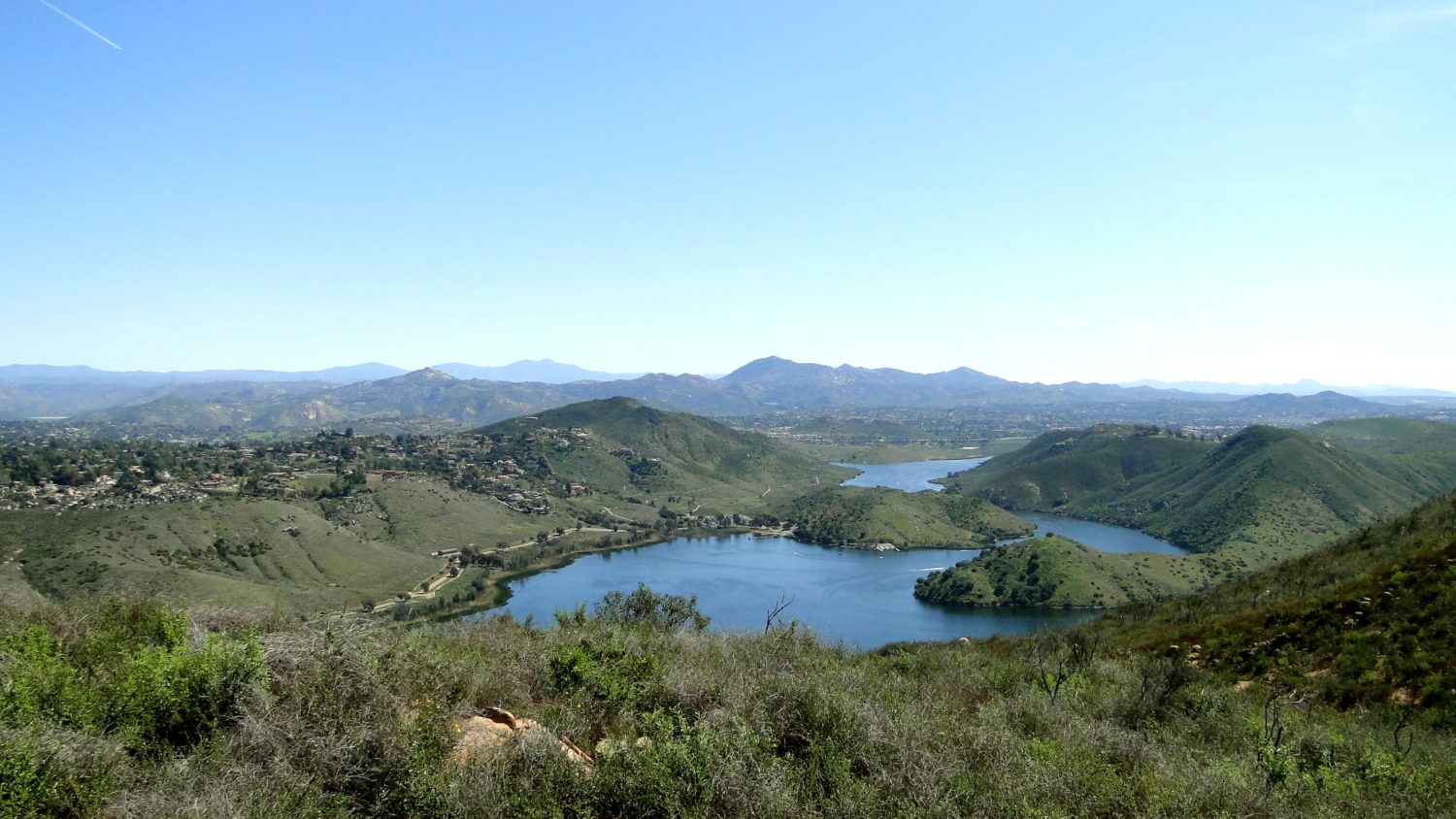
The rather unusual Olivenhain Reservoir is the primary historical feature at Elfin Forest. Completed in 2003, the reservoir provides water for the Olivenhain Municipal Water District (Carlsbad, Encinitas). Water gets pumped uphill from Lake Hodges and the Second San Diego Aqueduct; it is rather unusual to see such a large reservoir constructed high above any discernible water inflow.
Natural History of the Elfin Forest
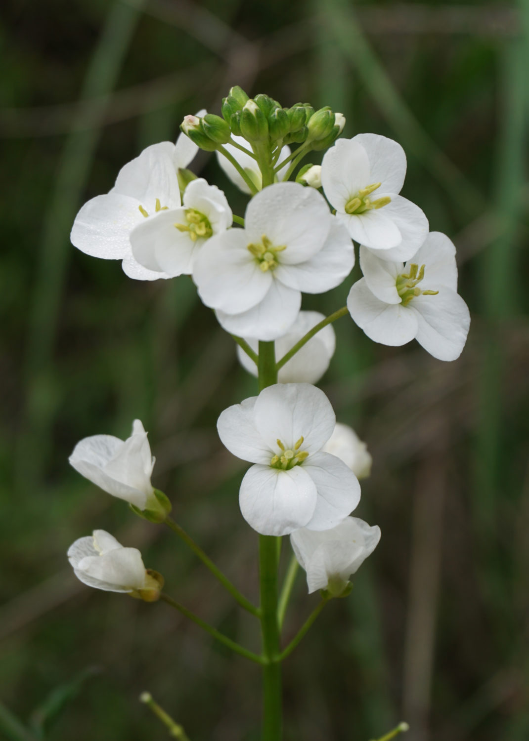
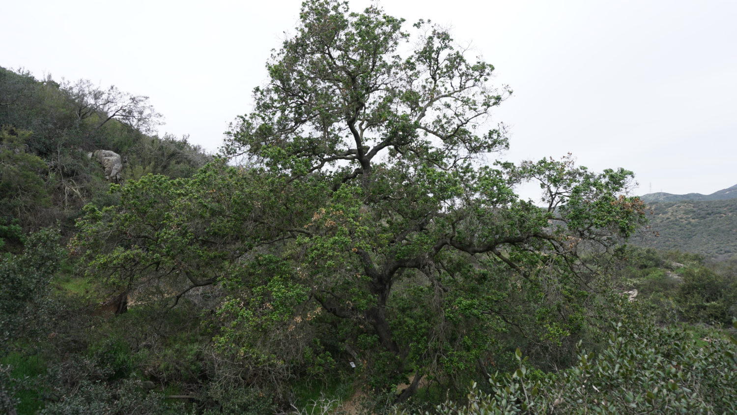
The term “Elfin Forest” refers to the mature chaparral growing throughout the reserve. Although most people don’t associate chaparral with trees, the actual biomass of chaparral in Southern California far exceeds biomass from tree species, making this plant community a crucial component of regional ecosystems. Along the various hike options described here, you will encounter numerous stands of chaparral, which is especially dense on the north-facing slopes ascended by the Way-Up Trail. Other microhabitats within the reserve include riparian zones around Escondido Creek, oak woodlands, and coastal sage-scrub communities.

Trail Maps:
Reserve Map
Botanical Trail Interpretive Guide
Elfin Forest Hike Description
This trail guide will give you multiple options for exploration that you can take separately or merge together. With each option, I give the distance, elevation gain, and approximate time required to complete the hike. All hikes originate from the same staging area located at the south end of the primary parking lot.

Option A: Creek Trail
Distance: 0.4 mile
Elevation Gained: Negligible
Time: 30 minutes
This short trail follows Escondido Creek west from the staging area for 0.2 mile to the banks of the creek. Technically, the trail continues on the other side of the creek, and it passes into the neighboring Los Cielos Preserve. Currently, the Los Cielos Preserve isn’t open for recreation, as they don’t have the infrastructure to accommodate hikers. They ask that people remain within Elfin Forest. This short segment is great for small children, and there’s a decent amount of shade along the way.

Option B: Botanical Loop
This short hike offers a taste of the Elfin Forest’s primary habitats accentuated by interpretive features that can help you learn a bit more about the various plants. This route also includes a pleasant stretch of hiking along Escondido Creek, although an unimproved crossing toward the end of the hike may be an unwelcome challenge for hikers seeking a more casual nature walk.
From the trailhead, follow the Way Up Trail across a causeway spanning Escondido Creek. The creek originates from the Lake Wohlford area in northeast Escondido, and along its path to the ocean at the San Elijo Lagoon, the creek collects urban run-off and some naturally occurring water from the city of Escondido. The water therefore should be treated with great caution, especially after a rainstorm, lest you come in contact with unknown contaminants. On the plus side, the continuous presence of water nourishes a picturesque riparian forest of willows, sycamores, and coast live oaks.
Once across the bridge, the Way Up Trail begins a moderate, occasionally strenuous incline along the north wall of Escondido Creek’s canyon. As you climb, look for a variety of species of chaparral, including mission manzanita, several varieties of ceonothus, sages, sagebrushes, toyons, lemonadeberry, and sumac. Wildflowers also grow along the trail beginning in February and often continuing throughout June. The trail is steep and rocky, and there are a few parts that may require a bit of extra focus.

At 0.4 mile and after 300 feet of climbing, the Botanical Trail splits from the Way Up Trail, leading away left past a stately coast live oak. Turn left to follow the Botanical Trail downhill; I have included a link to a PDF file that you can use as a reference to the various interpretive signs that inform about the local flora and fauna on the way down to Escondido Creek. The trail plunges back into the riparian zone along Escondido Creek at 0.9 mile, and it crosses Escondido Creek shortly afterward. This is an unimproved crossing, and you will need to carefully hop from rock to rock to get to the other side; trekking poles will help provide support and balance.
Once across the creek, turn left to complete a pleasant 0.1 mile stretch through riparian habitat back to the staging area.
Option C: Equine Incline Loop
Distance: 6 miles
Elevation Gain: 1400 Feet
Time: 3.5 hours
This undulating loop explores the western half of Elfin Forest’s rolling highlands, and it features some great views toward the coast, seasonal wildflowers, and nice views across Olivenhain Reservoir. There is a significant amount of up-and-down hiking in the middle, which may make the hike feel a bit more strenuous than the distance and elevation figures indicate.

From the staging area, join the Way Up Trail, crossing Escondido Creek along a concrete spillway. Beyond the crossing, the Way Up Trail begins a prolonged, switchbacking climb that gains 750 feet of elevation over the next 1.3 mile. Keep right at a junction with the Botanical Trail, and enjoy the emerging views northeast and east across Harmony Grove, Escondido, and beyond to the Palomar Mountains. Shade ramadas are placed at intervals to allow hikers to stop and rest, which comes in particularly handy on hot summer days.
At 1.3 miles, make a right turn onto the Mex-al Trail, which provides a meandering detour away from the wide Way Up Trail. The principle reason for this detour is that the Mex-al Trail has some nice views west, and single-track trail makes for more enjoyable hiking than fire road. At 1.5 miles, turn right again onto the Equine Incline Loop Trail, which commences a gentle descent through a drainage blessed with a seasonal creek that usually runs through the winter and spring months. Keep left at an easy-to-miss, unsigned junction with a trail accessing the Los Cielos Preserve at 2 miles; following it will lead you back down to the creek. Instead, follow the switchbacking trail on sunny, south-facing slope dominated by chamise and black sage to an easy creek crossing at 2.5 miles.

From the creek crossing, climbing resumes again after a long downhill respite. Regaining elevation that you’ve previously lost can be a bit of a psychological drag, but fortunately the views ahead across Elfin Forest and Carlsbad to the Pacific Ocean have some compensatory effect. The trail bends to the east at 2.9 miles and continues eastward along a ridge to the ridge’s apex at 3.5 miles. The apex is marked by a junction and a pair of shade ramadas. As this junction and shaded area lie beyond the halfway point and at the end of a long climb, this is a great spot to stop and rest before the return journey.
Once you’ve completed your break, turn right on the Manzanita Trail to descend to the service road traversing the northern shore of Olivenhain Reservoir. Upon reaching the road at 3.8 miles, turn left and follow the road northeast. The views of the lake are nice from the road, but the regularly spaced power lines do subtract something from the overall scenery. For the best views of the reservoir, turn right onto the Tykes Hike Trail at 4.3 miles. This gentle, semi-loop encircles a scrubby knoll, and it offers the best views of the reservoir unobstructed by power lines. The Tykes Hike comes to an end at another picnic area to the right at 4.5 miles. This picnic area marks the end of the Way Up Trail; upon reaching the picnic area, turn left to rejoin the Way Up Trail as it descends back to the trailhead.
Note that you can take a detour on the Botanical Trail on the return route if you want to enjoy the interpretive features and the riparian forest along the creek. This diversion adds 0.2 mile and negligible elevation gain to the remainder of the hike.
Option D: Lake Hodges Overlook
Distance: 6 miles
Elevation Gain: 1400 Feet
Time: 3.5 Hours
This final option explores the eastern half of Elfin Forest’s rolling plateau, with a culmination at the Lake Hodges Overlook. The overlook features the best views on the reserve, encompassing most of the eastern half of urban San Diego County, with a heavy emphasis on Lake Hodges down below.
As with the Equine Incline Loop, follow the Way Up Trail from the trailhead for 1.3 miles, gaining 750 feet. Instead of joining the Mex-al Trail, keep straight toward a picnic area at the end of the Way Up Trail and beyond the Ridgeline Maintenance Trail overlooking the Olivenhain Reservoir; this is a good place to rest if you’re tired from the climb. Return to the Ridgeline Maintenance Trail, and turn right.

After climbing to the route’s high point at 1.6 miles, turn right onto the Lake Hodges Overlook Trail. From this junction, the trail spends the next 1.4 mile undulating on its journey east and southeast to the overlook. Views across the Olivenhain Reservoir make for a pleasant companion as you climb, descend, climb, descend, etc. along the east rim of the reservoir’s sheltered valley. At 2.7 miles, a pair of side trails depart the main trail to wind and weave in parallel to the main trail; if you follow either one, add about a quarter mile of extra distance. It probably makes more sense to continue straight, as neither side trail takes you anywhere interesting.
Arrive at the overlook at 3 miles, and prepare to enjoy a lovely panorama spanning much of the eastern half of urban San Diego County. Directly below is the fjord-like Lake Hodges, which fills a significant section of the Del Dios Gorge. Beyond the cities of Escondido, Rancho Bernardo, and Poway, hikers may enjoy picking out the following landmarks: Mt. San Gorgonio, the Palomar Mountains, Woodson Mountain, Iron Mountain, Volcan Mountain, the Cuyamaca Mountains, Mission Trails Regional Park, and a whole host of other high points.

To complete this out-and-back route, retrace your steps back to the Way Up Trail, and follow the Way Up Trail back to the parking area. You can tack on the Botanical Loop Trail for an additional 0.2 mile of climbing with negligible elevation gain.
Tags: Elfin Forest, Equine Incline, Escondido, Escondido Creek, Lake Hodges Overlook, Olivenhaim Reservoir, San Marcos, Way Up Trail