Ansel Adams is famous for his high-contrast, black and white photographs of the granite domes and craggy spires of rock that make the Sierra Nevada famous. It is no wonder, then, that the wilderness area named after him is a picture-perfect example of his subject matter. The hike to Ediza Lake, tucked away deep inside the Ritter Range, traverses the best of it, passing through dense pine forests, roaring waterfalls, and perfectly blue alpine lakes.

This is an area that’s best savored as a 2-4 day weekend backpacking trip, and it’s worth noting that Ediza Lake can also be accessed from the south, via the John Muir Trail. Tack on a couple of other lakes in the region, and it’s easy to create a magical alpine lake and view-filled weekend adventure.
Most hikers will begin their day by parking near the Mammoth Main Lodge and nabbing a shuttle pass from the Mammoth Adventure Center ($8 for adults, $4 for children aged 3-15 as of July 2019). The shuttle is required for all day and overnight hikers arriving between the hours of 7am – 7pm to minimize traffic and human impact on the wilderness area. Hikers can wait for the shuttle (they run every 20 minutes or so) right outside the adventure center, near the playground.
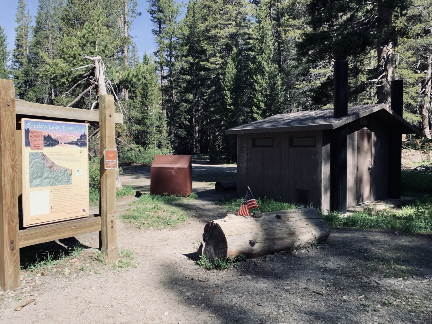
The shuttle ride itself is lovely, offering some seriously epic views of the Minarets to the west before passing through an old-growth pine forest. Hop off the shuttle at Agnew Meadows (stop number 1). From here, you’ll have to road walk NW for 0.2 miles before a large parking lot complete with vault toilets and trash cans signals the trailhead for Shadow Lake/The River Trail.

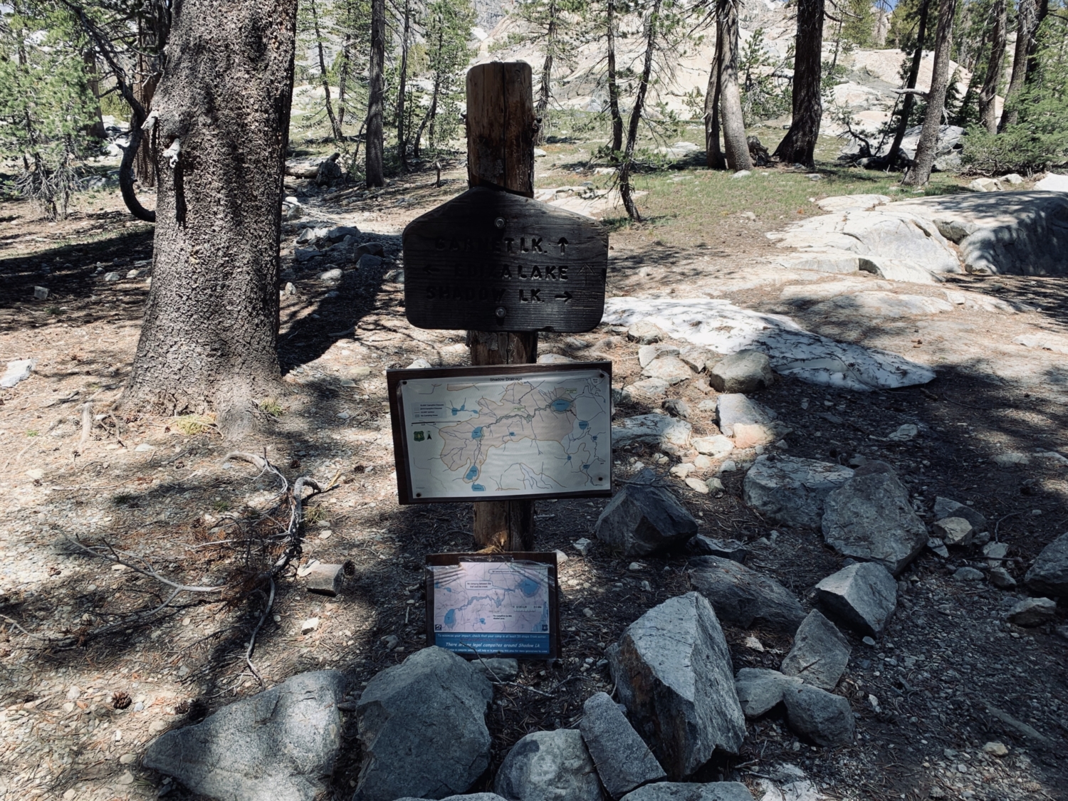
The first part of this hike follows the River Trail, before breaking away toward Shadow Lake and finally continuing on to Ediza Lake. Be sure to keep an eye out for wooden signs at trail junctions.
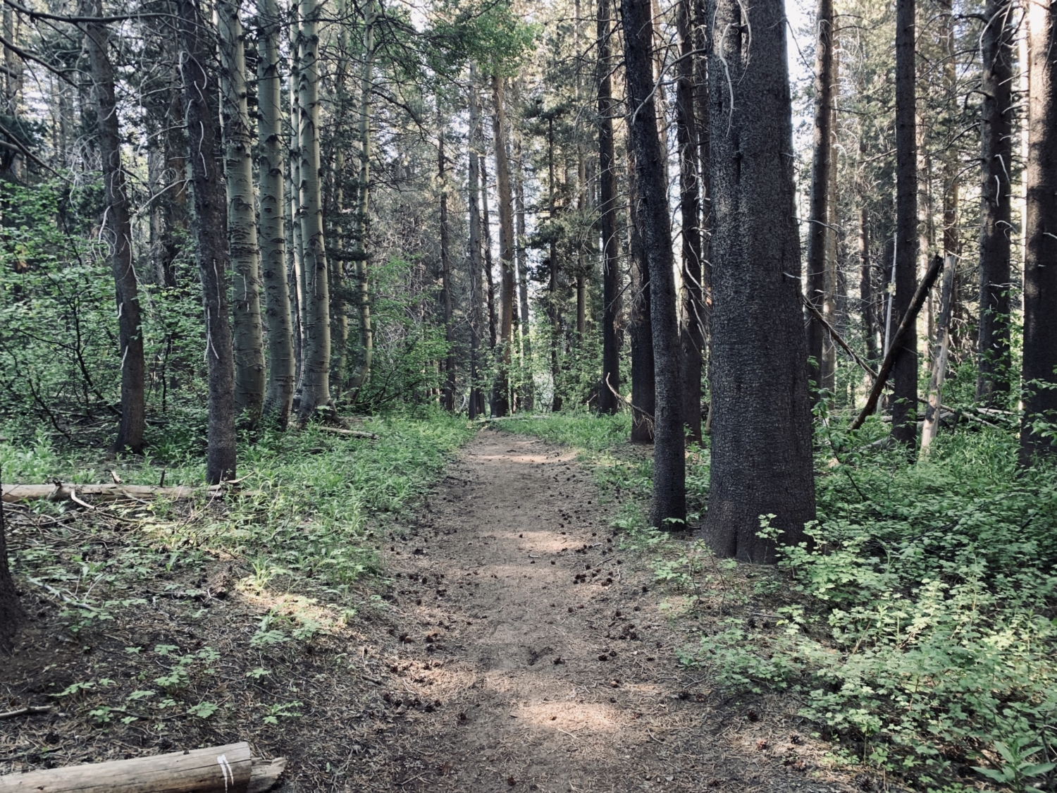
The River Trail starts off with amazing alpine meadow views right away. Be on the lookout for crimson wavy leaf paintbrush, purple splashes of lupine, and white pops of mountain whitethorn as you walk. The trail descends about 300 feet before flattening out and traversing a dense, shady forest. Bring bug spray – the mosquitoes here can be intense!

After passing the small but beautiful Olaine Lake, the trail will bend to the left and cross a large bridge over the Middle Fork of the San Joaquin River. From here, the trail begins its relentless, breathtaking climb.
The good news is that the views will only get better as you ascend, giving you plenty of incredible mountain vistas to distract from your inevitable leg burn. The next section of trail climbs almost 700 feet in just one mile, with amazing views of Mammoth Mountain to the south if you remember to turn and look back. Are you a gnarled tree lover? This stretch of trail has some of the most amazing, old Sierra junipers in the country.

Near the top of the first big climb, you’ll feel a welcome spray of mist from the towering Shadow Creek Falls, just a few feet from the edge of the trail itself. In just a few short steps, the trail will spit you out at the foot of the stunning Shadow Lake. This is a great spot for a snack or lunch break – soak in the views! You’ve earned them.
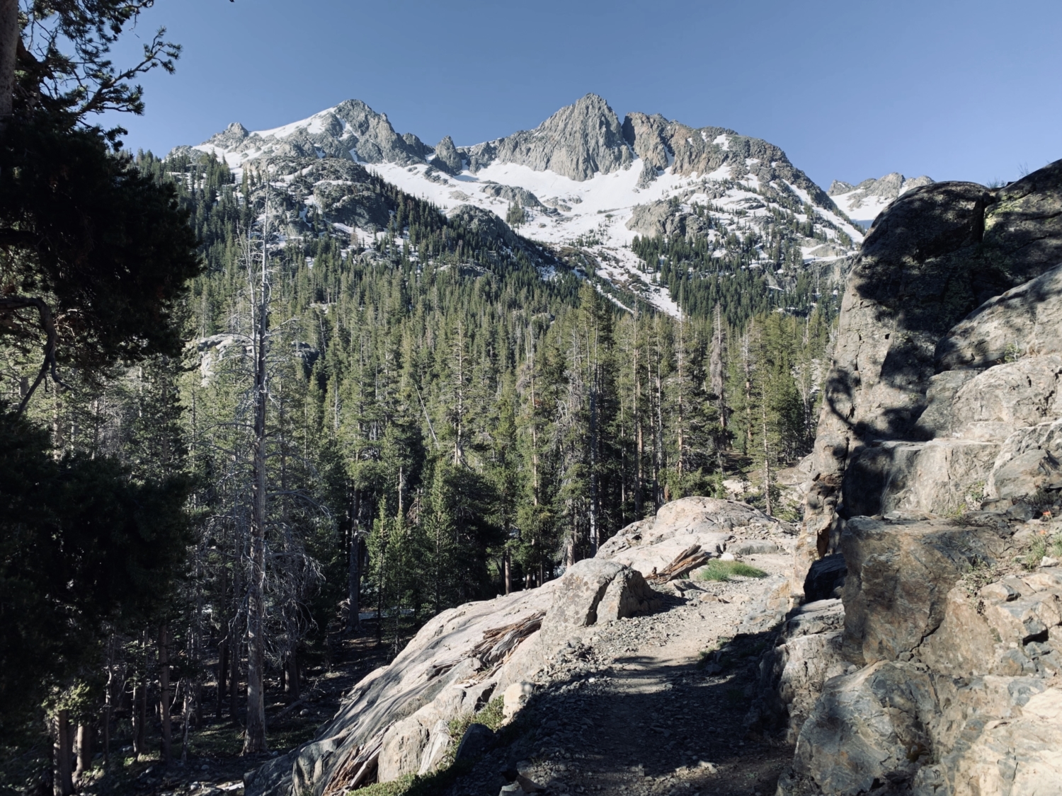
From here, the trail stays flat for nearly half a mile, bending around Shadow Lake before starting another big climb. If you look closely to the west of Shadow Lake, you’ll get your first views of the sharp spires of rock that make the Minaret Range so remarkable. On the west side of the lake, the trail will briefly join the John Muir Trail for 0.6 miles before a signed junction will point you towards the main attraction – Ediza Lake. Stay left at the junction.

This is where the views really begin to level-up. Over the next two miles, the trail climbs 300 feet, winding its way through rocky steps and tiny stream crossings, along the edge of Shadow Creek. The trail passes by brilliant green meadows, spiky fins of rock, and huge, gnarled pine trees before arriving at the immaculate alpine cirque that Ediza Lake calls home.
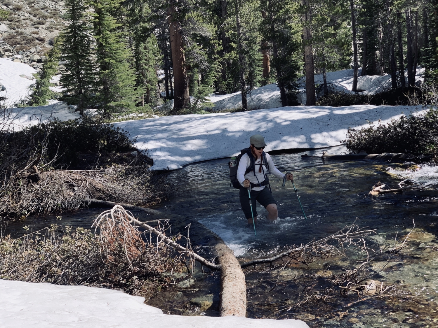
In late spring and early summer (depending on snowpack), there can be a very tricky stream crossing just before Ediza Lake. If snowpack is high, we recommend heading south, across the stream, 0.1 miles before the lake, and then approaching Ediza from the south edge of the rocky canyon.

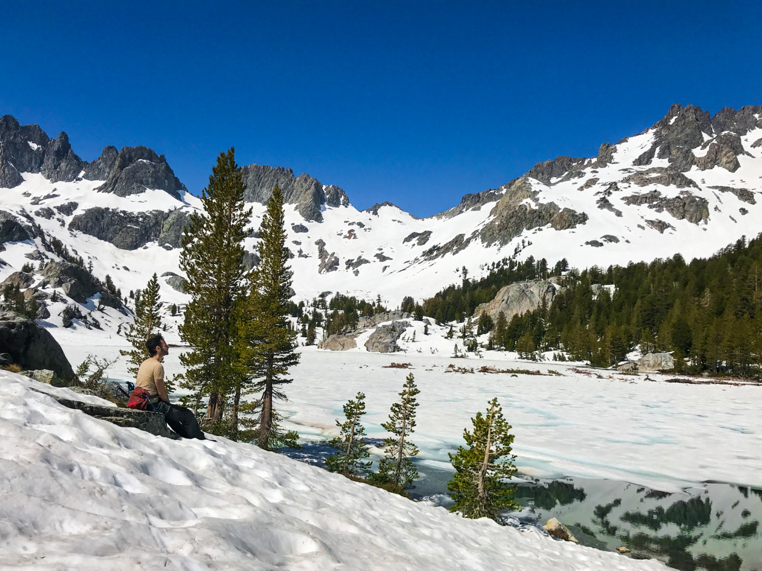
Once you arrive, the views are immediately commanding, with 13,150-foot Mt. Ritter dominating the skyline. Take a deep breath and enjoy the solitude that only these further-out lakes can bring, and maybe imagine this spot the way it was when John Muir and Ansel Adams roamed the area.
For those lucky enough to score a backcountry camping permit, continue around the lake’s shore. The best camping is on the south side where the shoreline is less steep. If you’re doing the trek as a dayhike, be sure to refill your water and take a well-deserved break here before beginning the long descent back the way you came.
The last shuttle leaves at 7pm, so when you’re ready, turn around and head back downhill the way you came, enjoying the majestic mountain views from the other direction, without the leg burn.
Tags: alpine lake, backcountry camping, backpacking trip, lakes, mammoth, Mammoth Lakes, River Trail, swimming holes, waterfalls, wildflowers