Edgewood Park and Natural Preserve in an adorable park in Redwood City famous for its spring wildflowers, the rare Bay checkerspot butterfly, and views of Mount Diablo and the San Francisco Bay. This loop hike takes you through the park’s shady oak woodlands up to the high point of the park, and then along serpentine grasslands with a focus on seeing wildflowers.

wildflowers in Edgewood Park
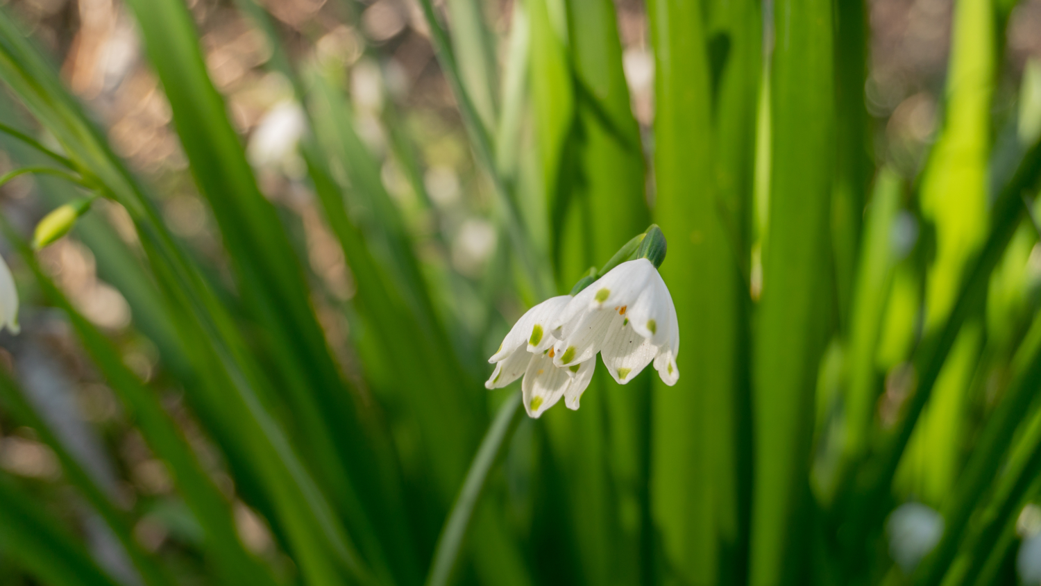
There are over 500 plant species at Edgewood Park—wow!—including 10 rare or endangered species. The timing of the wildflower blooms can vary each year, but early-mid spring is generally a good time of year to see the famous flower-filled meadows on the western side of the park. Even in winter you can find early-blooming flowers, too, like hound’s tongue and warrior’s plume. What else can you expect to see? I like this illustrated plant list by CalFlora, which you can conveniently sort by blooming month. This plant checklist for Edgewood Park on iNaturalist is also handy.
The land in Edgewood Park had been slated for development projects like a college and a golf course from the mid-1960s through the 1980s. Then in 1993, after careful documentation of the land’s species diversity and action by environmental groups, the San Mateo County Board of Supervisors declared it a Natural Preserve. That same year, a volunteer organization called Friends of Edgewood was created to “restore, preserve, and protect Edgewood’s natural resources.” On Friday mornings, you can see Weed Warriors out and about, Friends of Edgewood volunteers who remove invasive plants to keep the habitats and wildflowers in them healthy. FOE volunteers also lead free guided wildflower hikes from early March through early June at 10:00 a.m. on Saturdays and Sundays. Check their website, Facebook page and Instagram for news and updates.
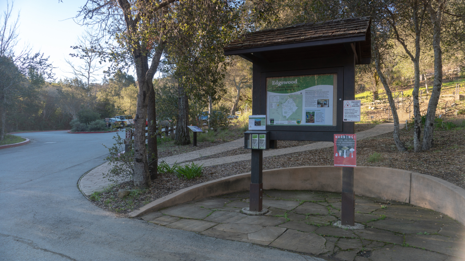
Start your hike at the kiosk in front of the Bill and Jean Lane Education Center. Grab a free brochure with a trail map and take a quick peak at the information posted. If you happen to visit on a Wednesday (9:30 a.m. – 12:30 p.m.) or the weekend (9:30 p.m. – 4:00 p.m.), you can stop in at the Ed Center to hear recorded stories with park founders, learn about special species in the park, and find out what is blooming. A wildflower garden in front of the Ed Center has a variety of flowers with accompanying signs.

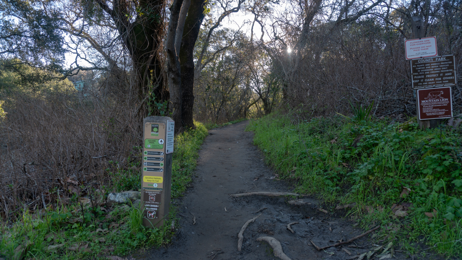
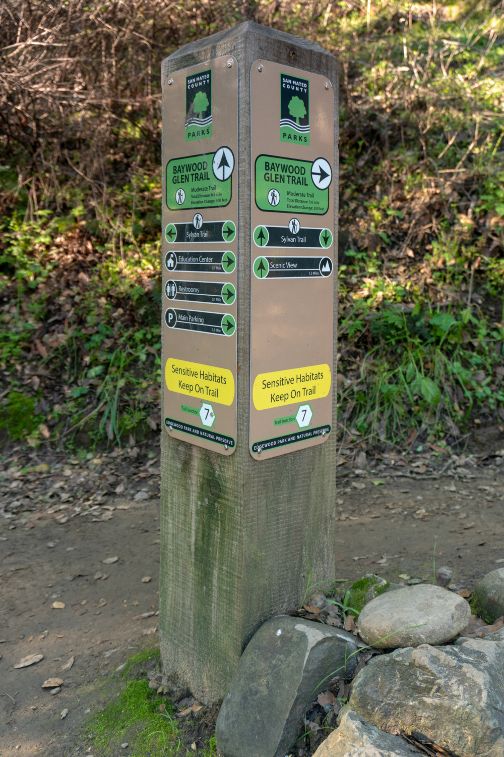
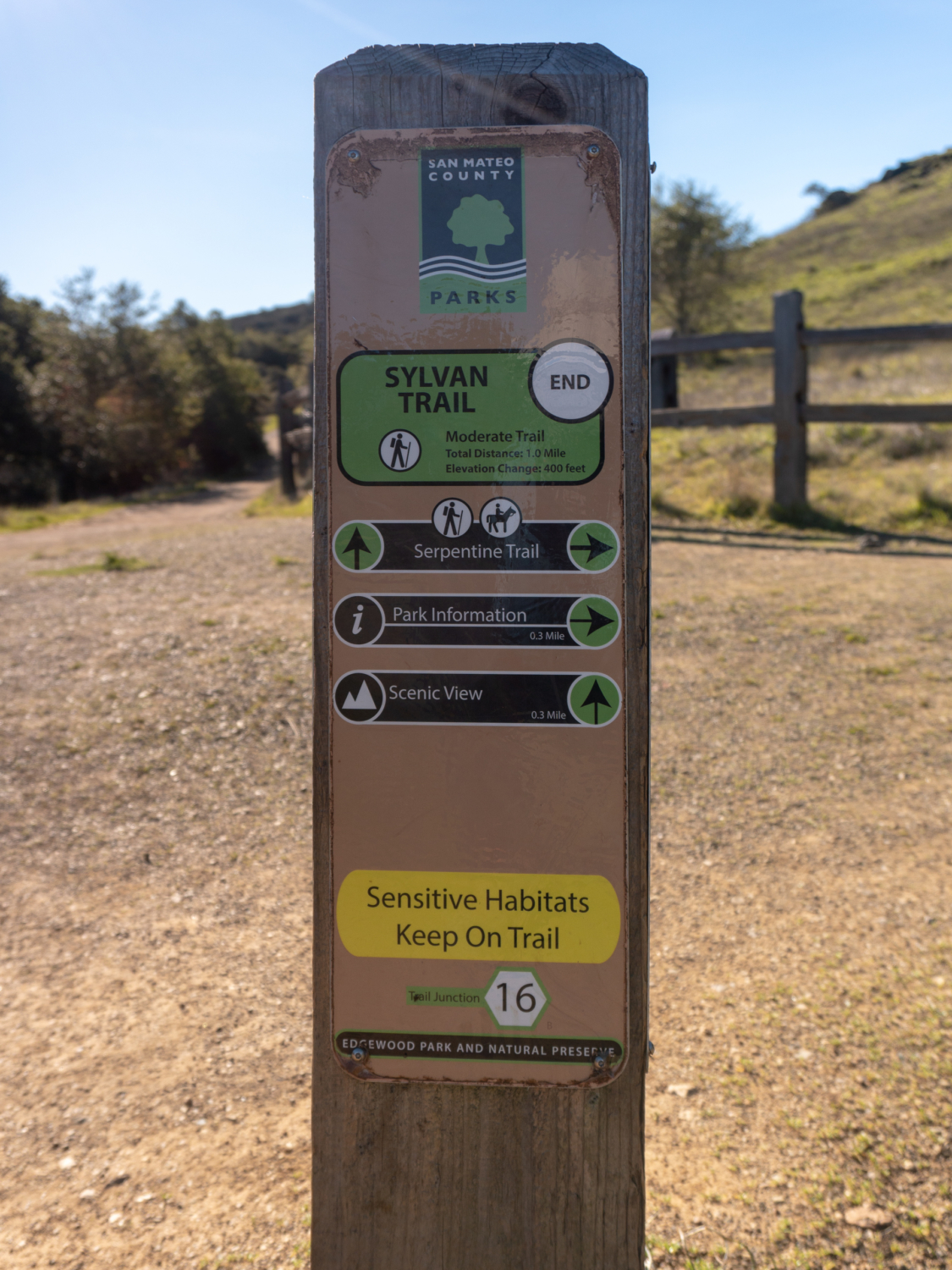
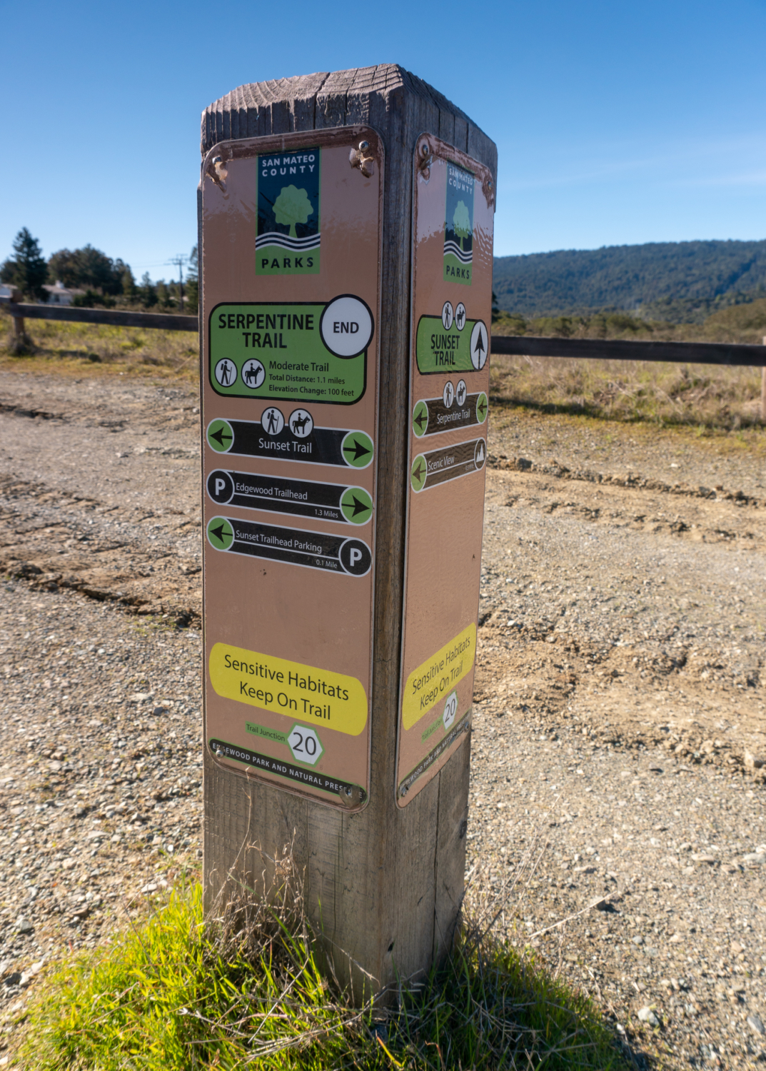
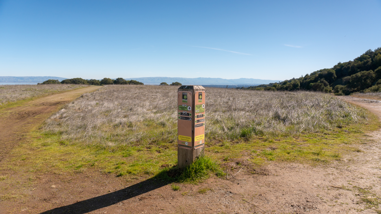
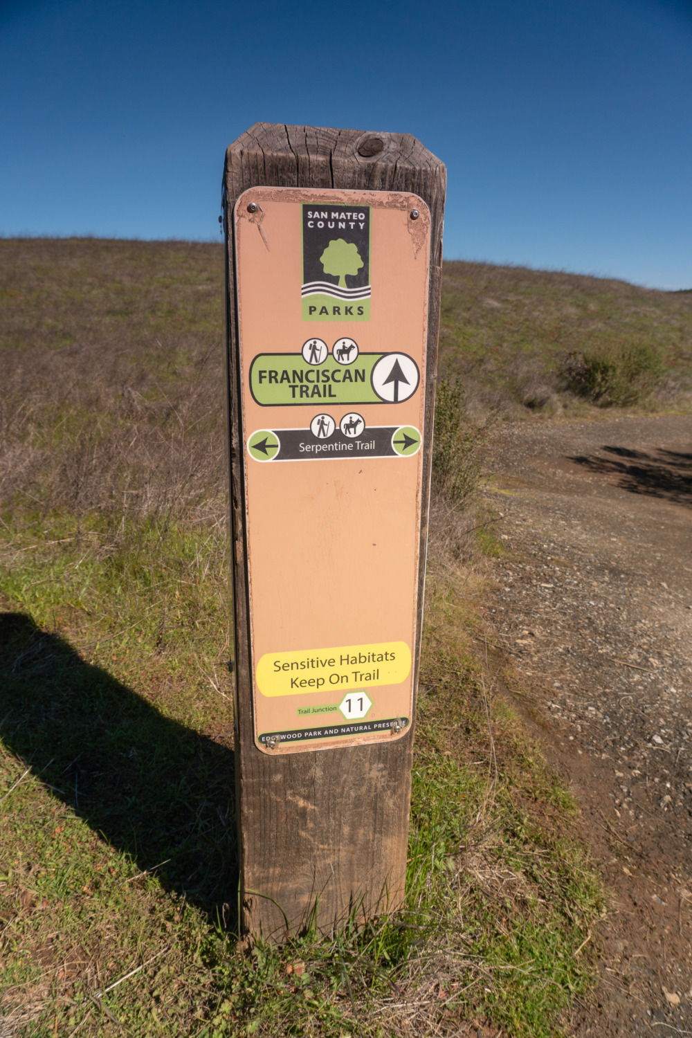
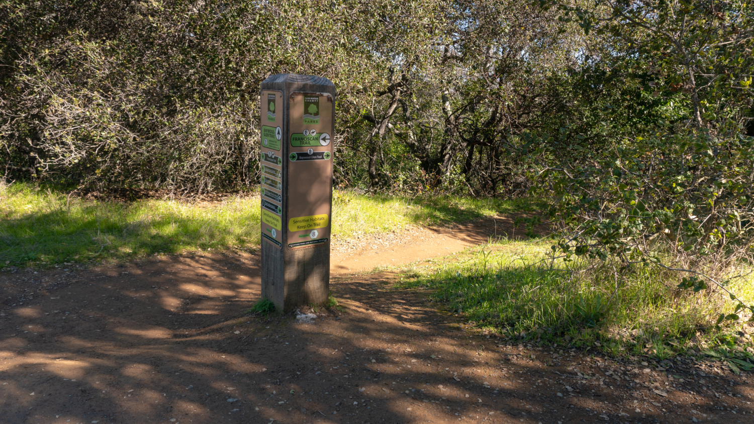
Head to the back of the parking lot, and bear right onto a narrow feeder trail next to a fence and residential driveway. Pick up the Sylvan Trail in 200 feet at junction 3. Numbered signposts like these are located at every trail junction in the park and are helpful for finding your way. Some junctions are close together and it can get confusing at times, so I would recommend carrying a map to get your bearings as you hike. A trail forking off the right here leads to restrooms and a picnic area.

Edgewood Park’s informative trail signs
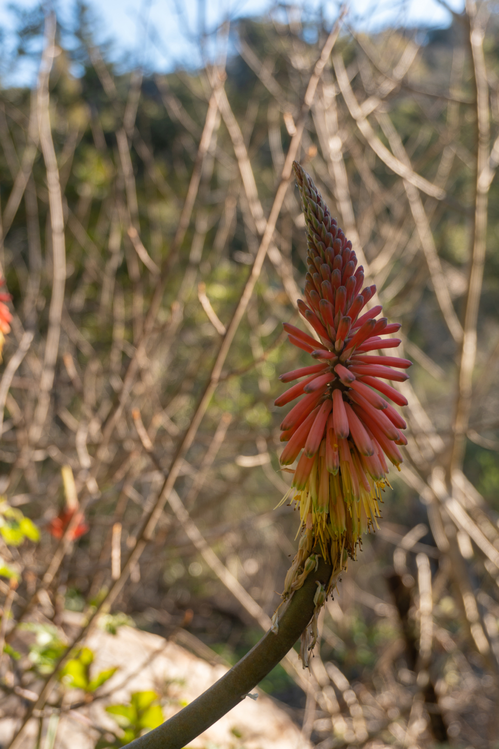
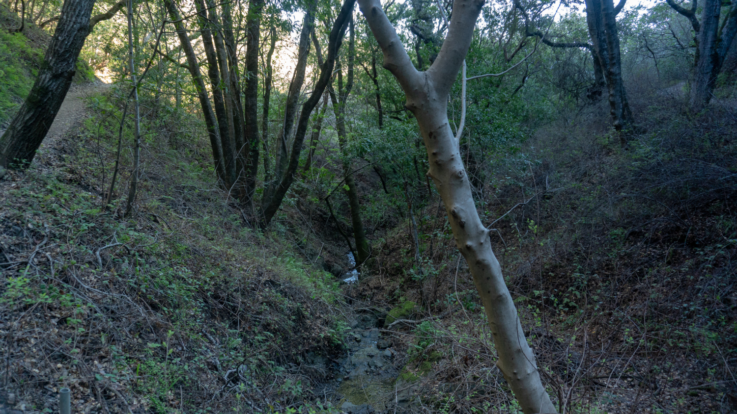
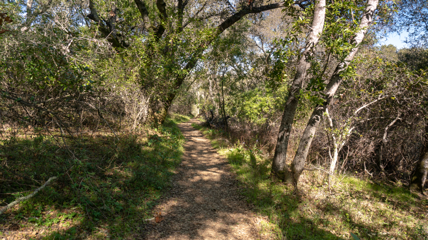
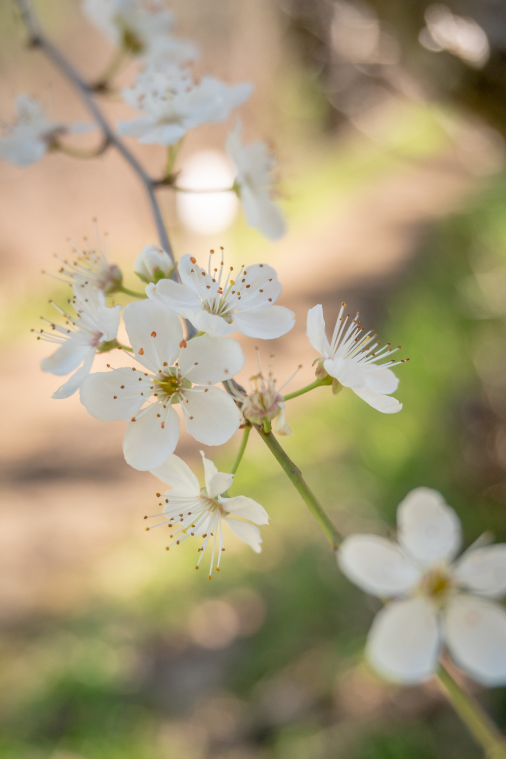
Hike south on the Sylvan Trail towards the Scenic View, entering a shady oak woodland with vines, ferns, coast live oak, pretty plum trees with their cherry blossom-like flowers, purple lupine, summer snowflower, and—yipes—lots of poison oak. A little grove of redhot poker grows along the trail too. Our hike will head southwest to the park’s 875-foot ridge and then descend into a clockwise loop (the 750 feet elevation gain is a cumulative count of all the hills climbed throughout the hike).

Pass the Baywood Glen Trail on your right, which you return on at the end of your hike. Up ahead is a shady riparian forest with a seasonal creek and lots of California bay and fan-like maidenhair fern. Climbing through the ravine, views begin opening up to the East Bay and Mount Diablo. You might even see black tailed deer feeding on grass and oak leaves. Feathery warrior’s plume sprout magenta tufts in winter.

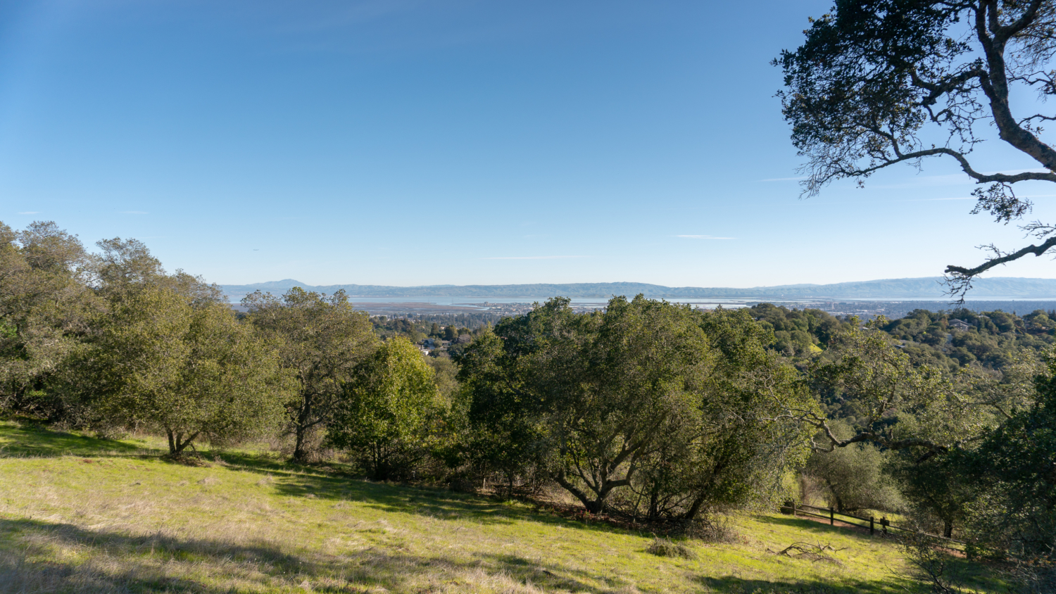
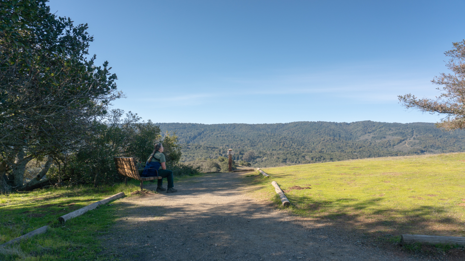
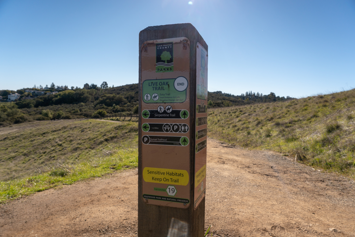
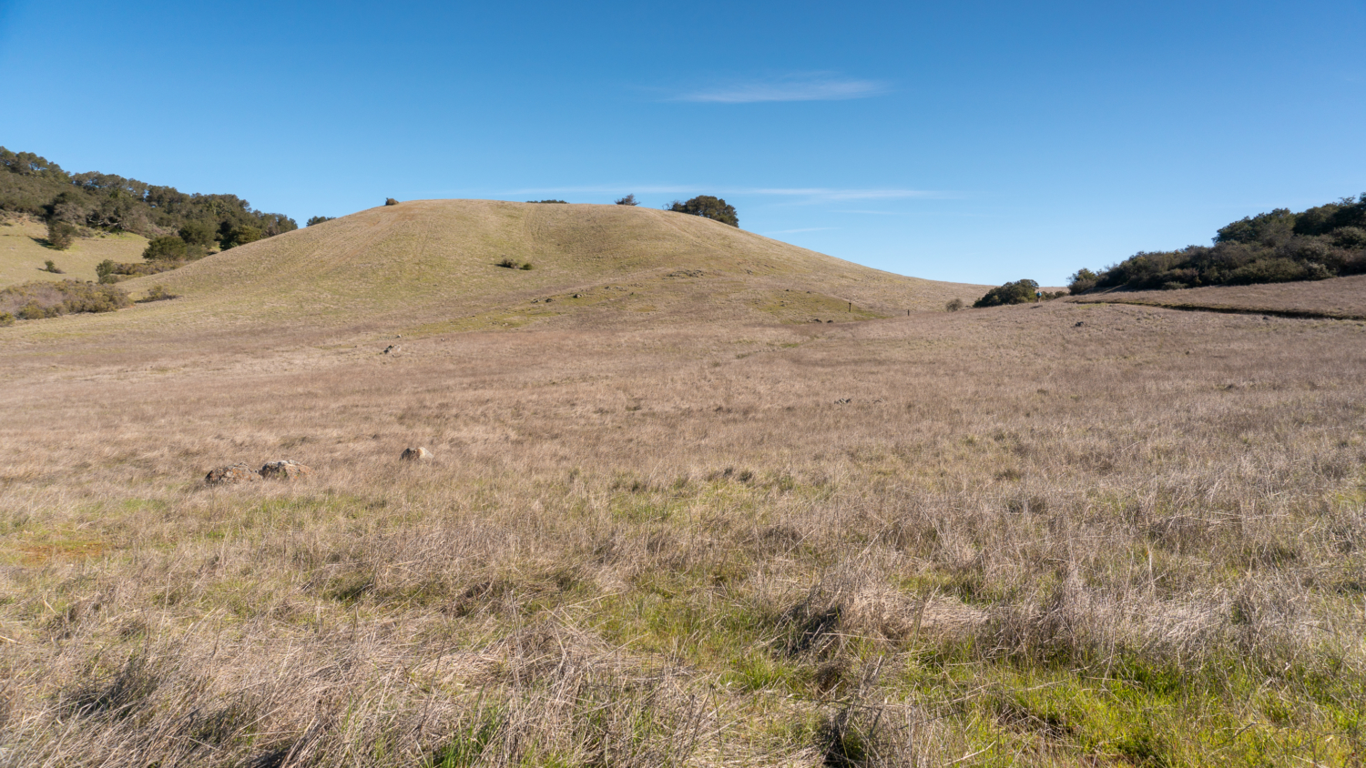
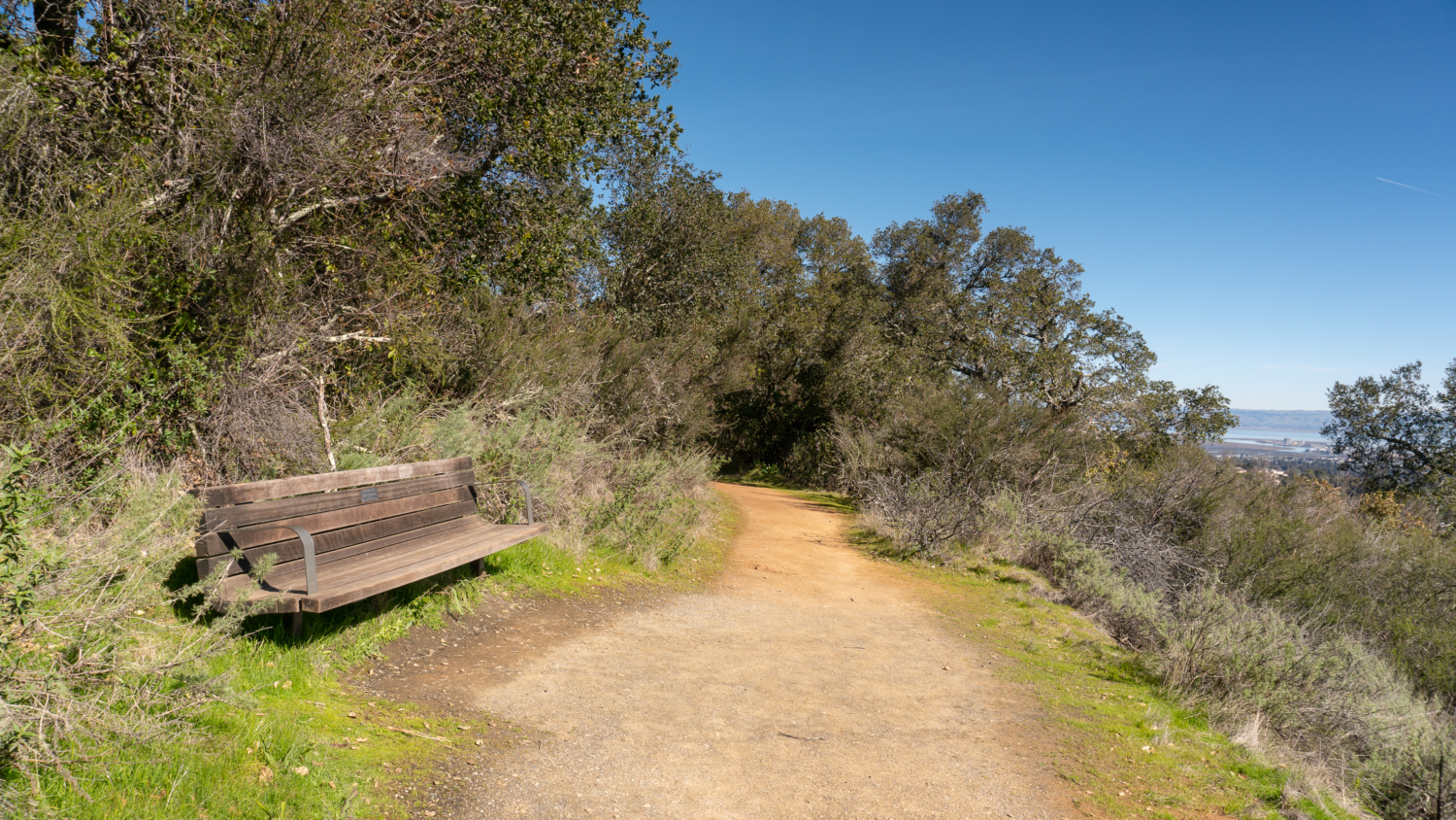
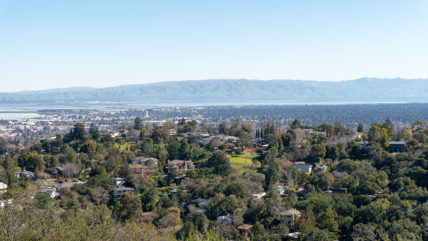
At the 1.0-mile mark, reach the end of the Sylvan Trail and bear left onto the Serpentine Trail towards the Scenic View. In just 0.2 miles, bear right onto the Live Oak Trail, continuing towards the Scenic View, also known as Inspiration Point. We will return to the Serpentine Trail at junction 19 to continue the loop, this is a short detour to the ridge to see a green-carpeted vista of Skyline Ridge to the west. A bench at Inspiration Point makes a good spot for a snack break and there are partial views east of Mount Diablo and the East Bay.


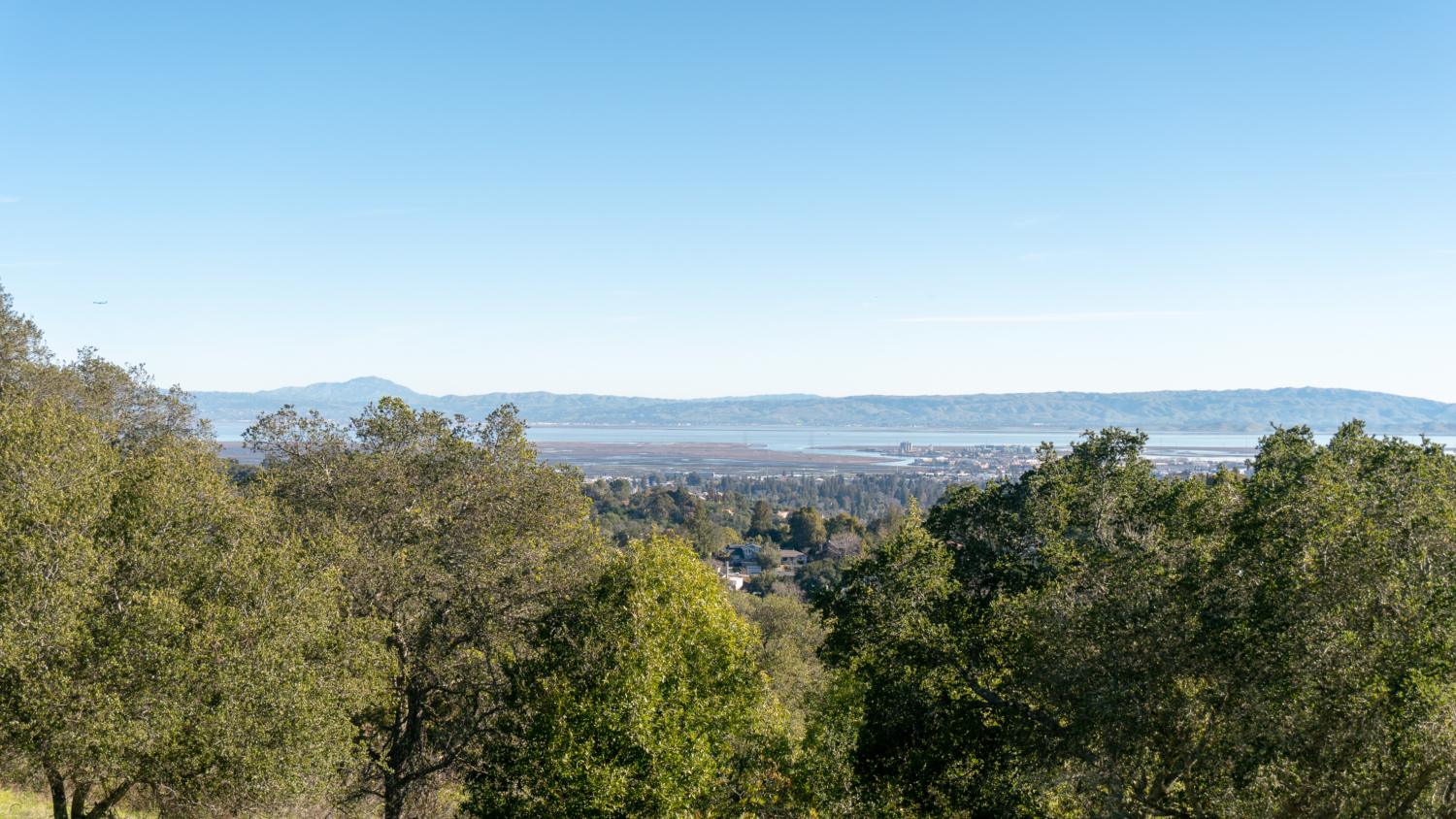
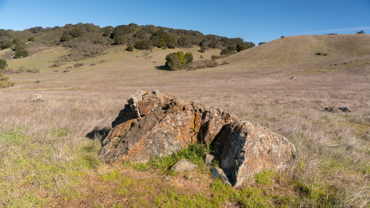
When ready, retrace your steps to the Serpentine Trail at junction 19, staying straight towards the Sunset Trailhead. As you descend from the ridge, the Diablo Range stretches from Mount Diablo to the northeast through the Sunol Wilderness and Mission Peak to the southeast. Serpentinite, a gray-green rock that formed when the oceanic plate subducted beneath the North American plate millions of years ago, creating the Franciscan complex, crops up here and there. It also happens to be California’s state rock.

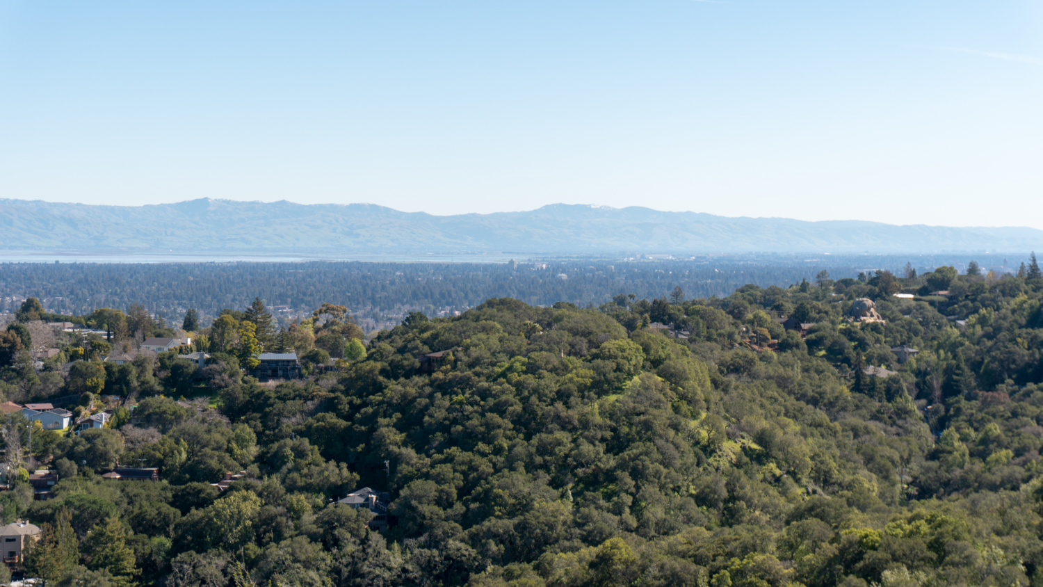
The views in Edgewood Park are sweeping and stunning

At the 1.8-mile mark, reach the end of the Serpentine Trail and turn right onto the Sunset Trail, heading northwest. These serpentine grasslands on the western side of the park are known for their sheets of spring wildflowers such as buttercup, clover, blue dicks, California poppy, and clarkia. You may see coyotes chasing deer through swaths of yellow goldfields, and western bluebirds swooping into nesting boxes.

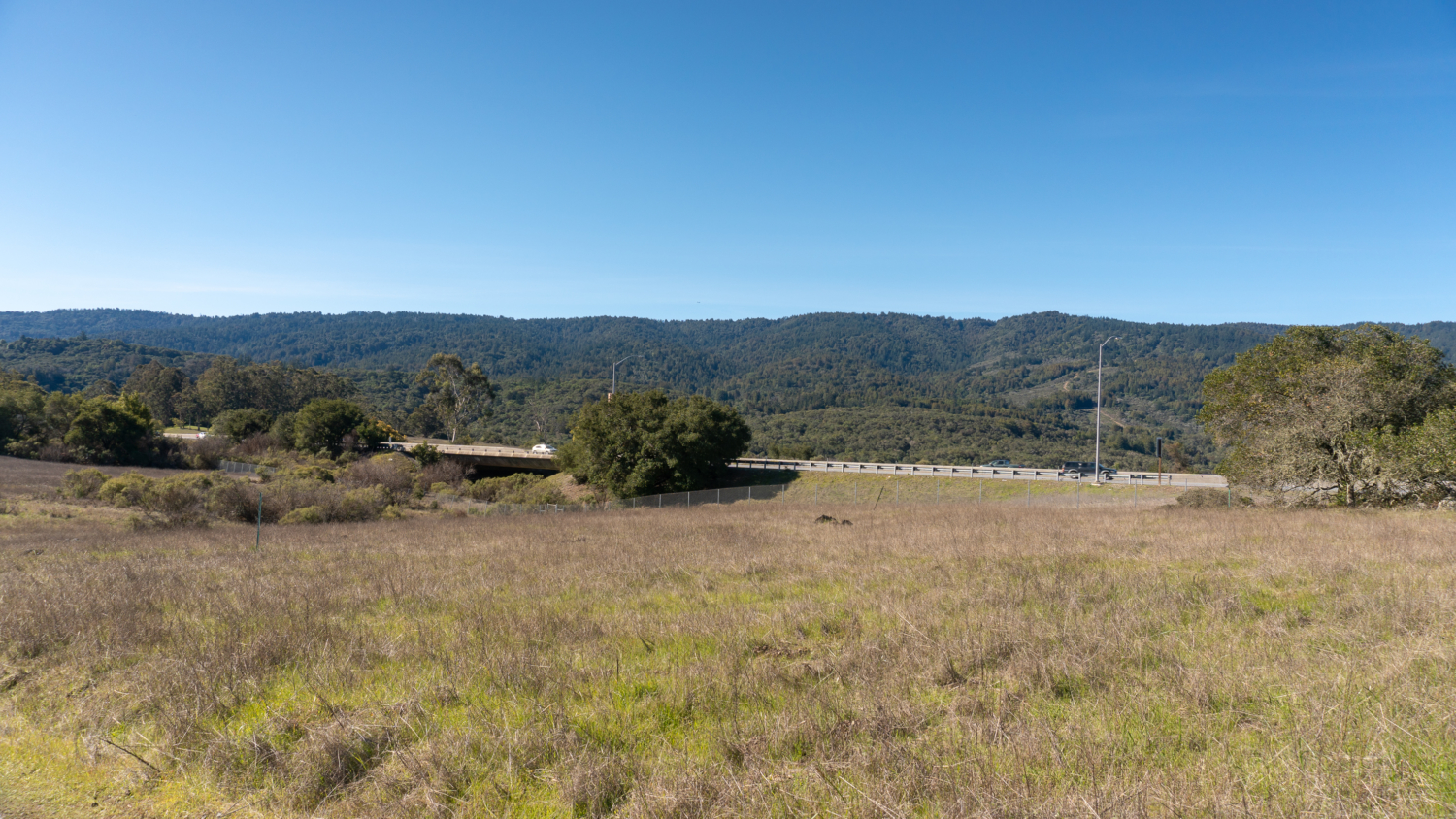
At the 2.5-mile mark, reach the end of the Sunset Trail, staying straight onto the Edgewood Trail. The urban reality of the park stares you in the face with clear views of I-280 and power lines. In 0.2 miles, turn right onto the Serpentine Trail, hiking east away from the I-280 traffic. The Serpentine Trail runs east west through the park. Earlier we were on the eastern side of it and now we are now on the western side of it. As you hike east, you are treated to more open grassland and another beautiful panorama of Mount Diablo, the East Bay, and the San Francisco Bay.

At the 3.1-mile mark, arrive at a 3-way junction. Straight ahead is the Serpentine Trail and to the far left and far right is the Franciscan Trail. Take the far left trail, heading northeast on the Franciscan Trail past more views of the East Bay peaks. A bench here is a nice place to pause one last time to enjoy the views of the Diablo Range and the southern tip of the bay. 
Past the bench at the 3.4 mile-mark, turn right onto Baywood Glen Trail towards the Education Center. Back in the shady oak woodland, zizag down the switchbacks among bush monkey-flower, hound’s tongue, warrior’s plume, and chamise. Reach a junction with the Sylvan trail at 4.0 miles, and then turn left to rejoin it. In 0.1 miles, you have returned to junction 3, the Y-junction to the restrooms and picnic area. Bear right to head down towards meadow and parking lot just beyond.

Notes:
- The main entrance to Edgewood Park and Natural Preserve is located at 10 Old Stage Coach Road, Redwood City, CA 94062.
- Park hours are 8:00 a.m. to sunset. Parking is free.
- The Bill and Jean Lane Education Center is generally open Wednesdays from 9:30 a.m. – 12:30 p.m. and Saturdays and Sundays from 9:30 a.m. – 4:00 p.m.
- Free trail maps are available here and at trailheads throughout the park.
- Restrooms are located at the Education Center and next to the picnic area near the Sylvan Trail.
- Picnic tables are first-come, first-served and fires are allowed in the park barbecue pits.
- Edgewood Park is very popular, especially when the spring wildflowers bloom. Parking can fill quickly at the main entrance. One strategy is to show up right when the park opens at 8:00, or wait until after 2:00 p.m. on the weekends when crowds have died down. You can also carpool, take public transit, and hike in from an alternate parking area.
- Alternative parking is available on the southwestern side of the park at the Edgewood Trailhead and the Clarkia Trailhead. It is a 0.6-mile hike northeast from both parking areas to the Sunset Trail.
- Dogs are not allowed in Edgewood Park and Natural Preserve. Dogs are allowed just across Edgewood Road in Pulgas Ridge Preserve, which has wildflowers too, including fetid adder’s tongue.
- Mountain bikes are not allowed on the trails in Edgewood Park.
Tags: california wildflowers, Redwood City, san francisco, San Francisco Bay Area, san mateo county, spring, wildflowers