Camelback Mountain is an iconic landscape located in Scottsdale, Arizona. From a distance, the mountain range looks like a camel laying down (hence the name), making it easily recognizable when gazing upon it from the surrounding mountains in Phoenix.

View of Camelback Mountain
Echo Canyon Trail on Camelback Mountain is one of the two trails that will lead you right to the top of the summit, which also happens to be the tallest peak in the Phoenix area. While standing on top of this epic peak there are amazing view of the city below and the surrounding mountains. It is a trail that you will never forget but it’s also one that commands respect.
Despite its short distance, Echo Canyon Trail is an expert level hike. Although warnings are posted at the trailhead, you will still see inexperienced hikers who have not yet learned their limits trying to push themselves to the summit. This results in a lot of hiking accidents, dehydration, search and rescue operations, and unfortunately — deaths. So, with that said, PLEASE EXERCISE CAUTION ON THIS TRAIL — start early, take lots of water, wear solid hiking boots, and have some desert hiking experience. You definitely don’t want this trail to be your first hike, OK?
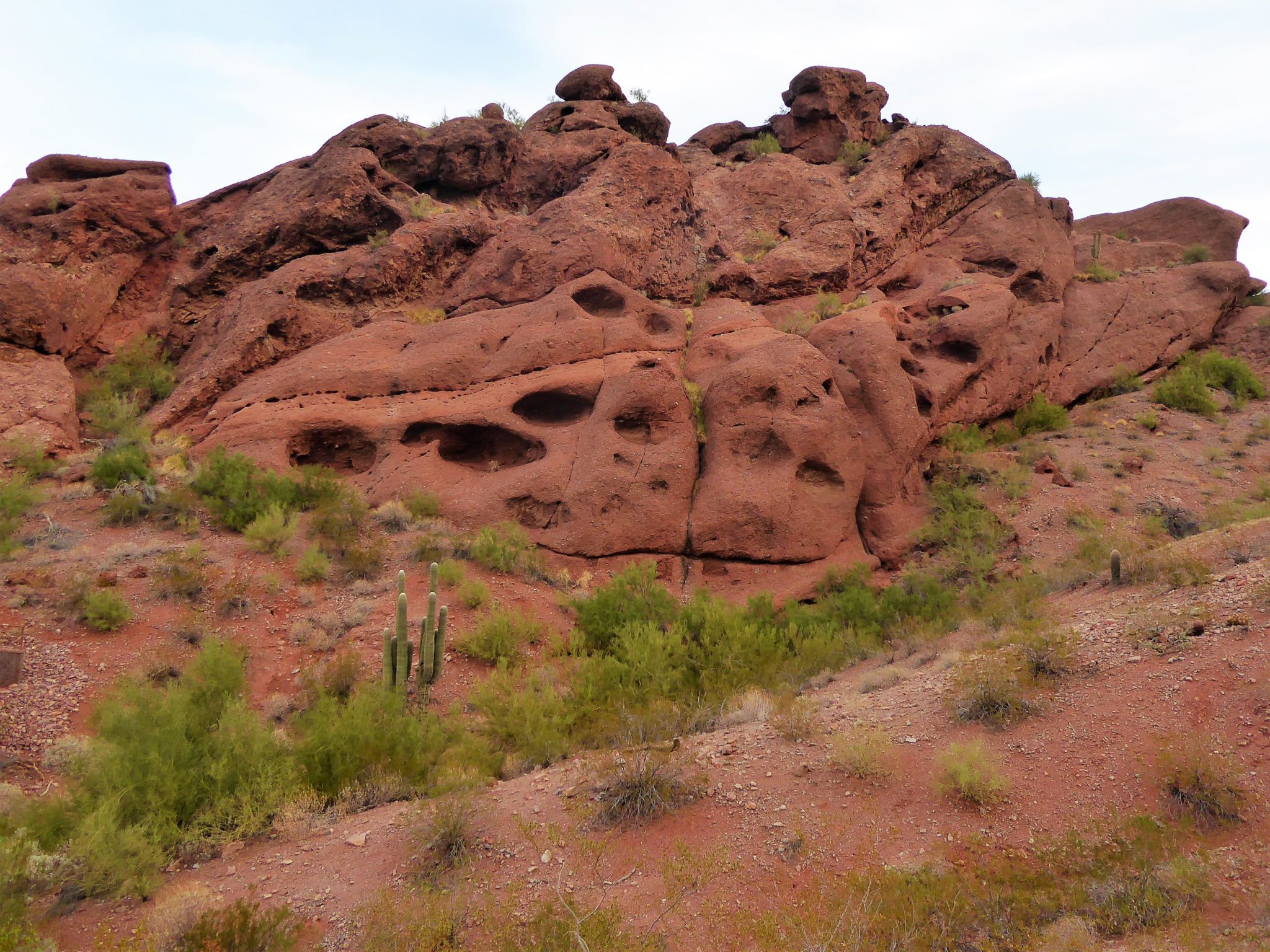
Echo Canyon begins as a wide dirt path with a quick incline up a few switchbacks that get your heart racing. This beginning portion of the mountain looks as if you are in an ocean aquarium. The surrounding mountains are porous like a sponge and some of the rocks have a bright green moss-like plant growing over them, making it look as if it’s algae. The mesquite trees in the washes also lend to this undersea mirage … There are a few lookouts where you can pull over to take a break or enjoy the view.

At around 0.4 mile the trail picks up with a set of wooden stairs. Soon after this, the route becomes so steep that there are metal railings anchored into the mountain to safely assist hikers in this potentially dicey situation.

At first, a metal pole will only on your left-hand side but soon after there will be a pole in the middle and then to the right. From my experience, the pole on your left (as you are going up) is the best pole to hang onto. There are carved out foot notches in the rock that will help your feet up. The other poles will not have these little notches, so it feels a little uncertain to walk on since it’s so steep and smooth you can easily slide on it, even with good gripping shoes.


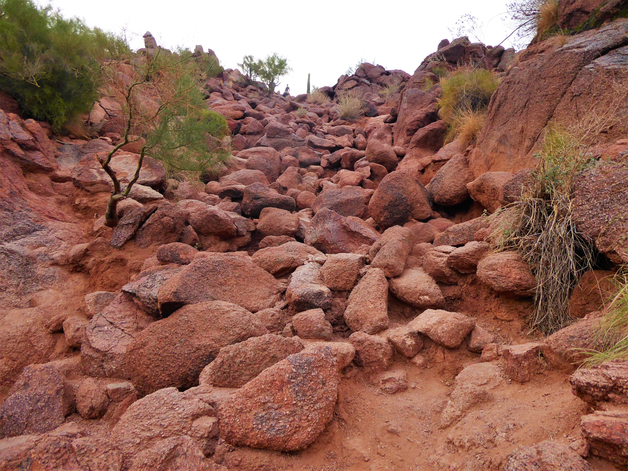
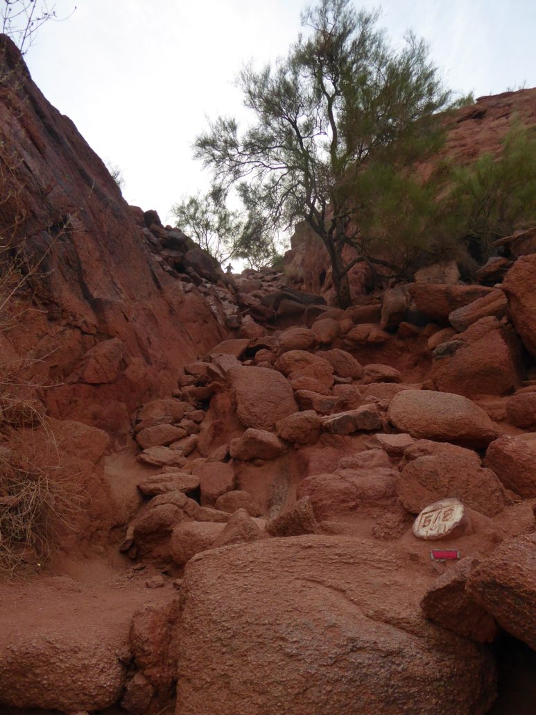
Once at the top of this steep section, you might think the tough part is over — but it’s only just begun! The trail now will require scrambling pretty much up all the way to the top. For this reason, you might want to consider bringing gloves along, although it isn’t completely necessary.
There are steep piles of bigger rocks that you will need to hike up. At times, it feels as if you’re back in that aquarium climbing up big pieces of gravel to get the relief of freedom up at the top.


On a few occasions the trail will flatten out, but it’s usually only brief moments until you are greeted by another big pile of rocks that requires scrambling. Echo Canyon Trail challenges your sense of resourcefulness. While there are trail markers, it’s still a scramble and therefore it’s up to you to figure out which direction up is safest for you.
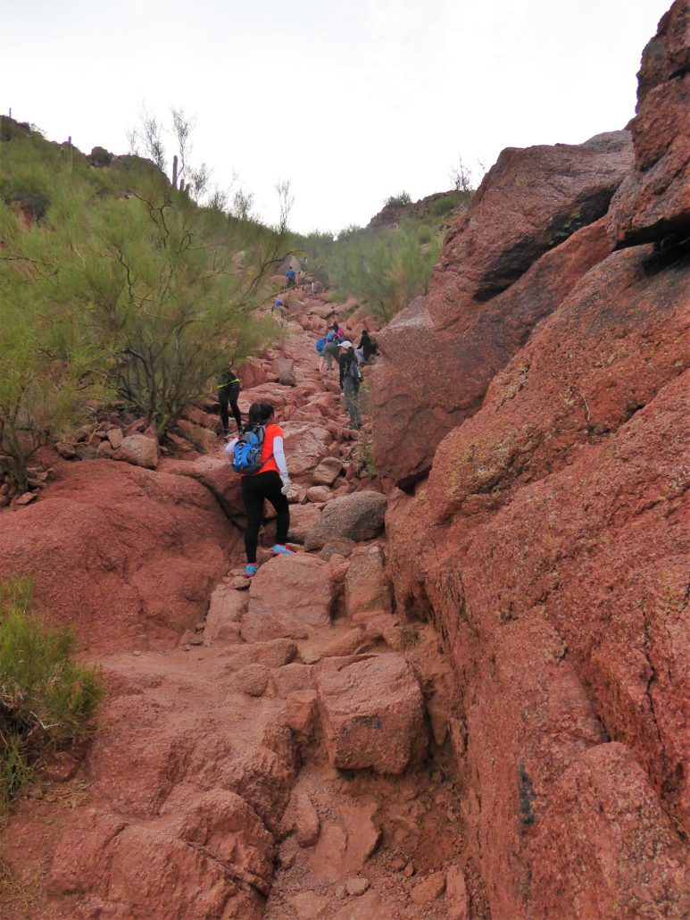
At 0.7 mile it may look like the trail veers to the right, but you actually want to stay in the middle section and walk up the smooth inclined rock. If you go to the right, it gets you off trail and toward the edge of the mountain which will require you to either backtrack, or make some dangerous maneuvers to climb back up onto the trail.
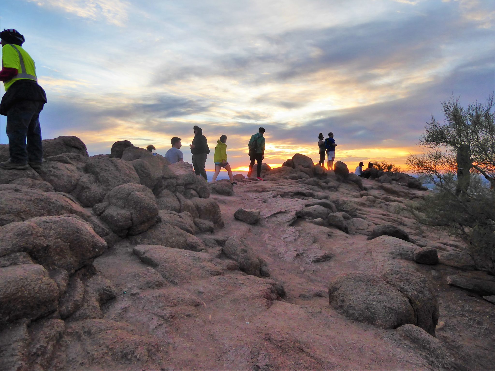
At around 1.1 mile you will be making your last ascent up to the very top of Camelback Mountain. A feeling of freedom and space will encompass you as you are surrounded by a 360-degree view of the entire city and the neighboring rolling mountains. Relax and take your time up at the top to enjoy the view you have worked so hard to see!

Top of Camelback


View of sunrise from Camelback
Notes:
The parking lot fills up quickly and the area around the trailhead doesn’t allow for many alternate parking options. You may need to wait for a spot to open or you can always park in a nearby business parking lot and either Uber/Lyft to the trailhead or bring a bike.
Tags: Arizona, AZ, Camelback, Camelback Mountain, hike, Hiking, nature, outdoors, peak, Phoenix, Scottsdale, summit, trail write-up