An out-and-back trail with two canyon routes and the option to continue on to Mission Peak. Rice Canyon trail follows a creek and ends with a vista of the canyon while East Canyon trail continues on to Mission Point which has views of the San Fernando Valley and connects with O’Melveny Park trails. You can choose to do both canyons or just one; this hike is a choose your own adventure kind of hike.

Parking lot and fee area

Beginning of the trail
The trail starts on a dirt road and travels away from the freeway for about 0.3-0.4 miles. At this point, you reach a fork in the road. You can choose here to go to Rice Canyon, which is about 1 mile in length, or choose to go to East Canyon, which will take you to Mission Point. We chose to do Rice Canyon first and then trek on to East Canyon.

Trail division between East Canyon and Rice Canyon Trails
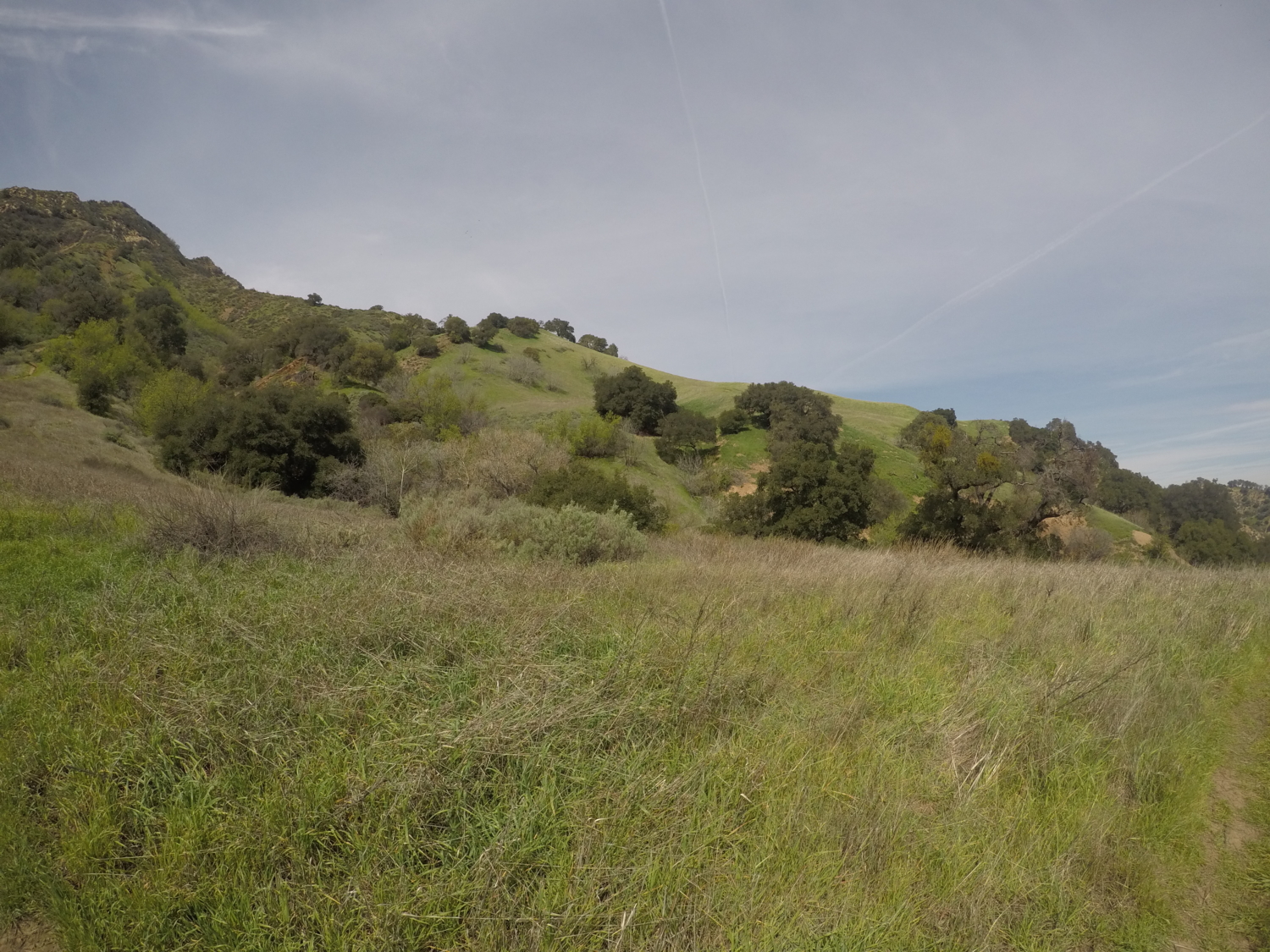
Rice Canyon trail travels along a creek bed that – after a good rainy season – will be flowing nicely. During the summer months, this creek bed is quite dry and the trail can get very hot as there is not much shade. The spring is the best time to enjoy the creek, see the green grassy hills and even enjoy the occasional sighting of our state flower the California poppy.
As you trek along this route, you may also start to notice the sounds of a nearby shooting range. The sounds become less apparent as you travel further into the canyon, so don’t worry if you’re not a huge fan of hiking in the sound-shadow of gunfire.

Rice Canyon
After meandering by the creek for about a mile, the trail veers right and gradually climbs the side of a hill. You will slowly gain some elevation and reach a grassy hillside at about 1.2 miles. The trail will travel up the hill a little ways and will offer some nice views of the canyon; however, it essentially dead-ends here. After you have enjoyed the green hills and canyon, travel back the way you came to the fork in the road to head towards East Canyon.

End of Rice Canyon Trail

East Canyon trail definitely shows the signs of the recent rains that have hit Southern California. There are several areas that are washed out and parts of the trail show where water carved its way through the dirt as it traveled down the hillsides. At about 0.1 miles after the fork, the trail splits. Go to the right and cross the stream as the original trail to the left has been washed out and would be difficult to pass. The stream crossing at the right will meet up with the original trail very quickly.
This section may be repaired in the future, but if we have a good rainy season you can reasonably expect the eroded areas to return again.

Stream crossing to the left of the fork. Don’t cross here!

Stream crossing towards the right side of the trail which is much easier to cross (view from the opposite side of the crossing)
After making it past this point, the trail is very easy to follow with little uncertainty as to where it leads. The trail gradually climbs and along the way you can see views of Santa Clarita to the north and some great vistas of the Santa Susana range to the West.

We steadily climbed up the trail and at about 2.25 miles up the trail (from the start of the East Canyon trail at the original fork) you reach an intersection of three trails. At this junction, keep towards the right. The trail going down to the left will take you down Weldon Canyon Mountainway and back down to The Old Road at a different trailhead (Newhall Pass Trailhead) than where you started.

Trail meets up with Weldon Canyon Mountainway
Travel 0.4 miles up the road and you will encounter a formidable fence that encloses a large area of private property. This fence will travel alongside you on your right should you continue on to Mission Peak.

Follow the sign to the left and go down the hill until you reach the next gate to the property. Without looking closely, this appears to be the end of the road. If you go all the way up to the gate however, you will see the trail to the left of the gate and that it continues closely alongside the fence.

Continue on this route and you will reach another gate barring your entrance to this expansive property (whatever this fence contains they sure do not want you anywhere near it). The fence has a sign for Mission Peak Trail, but the arrow points both ways. Go left and continue to keep the fence on your right hand side.

As you continue, the trail goes up and to the right alongside the fence, while to the left there is a gravel road. Take the trail on the right and you are on the last leg of the journey to Mission Peak.
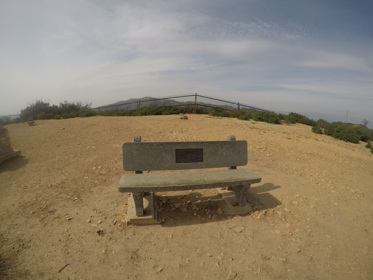
To the left, you can start to see views of the San Fernando Valley. The trail widens and starts to curve up a hillside. At the top of the hillside you have made it to your final destination. There is a plaque, a bench and several geomarkers (3 to be exact) as well as expansive views of the valley. On a clear day, you can see Mt Lukens to the East and Cahuenga Peak to the South. We logged 6.56 miles to reach the point; however, if you chose not to do Rice Canyon initially, it would take about 4.2 miles to reach Mission Point. Enjoy the views and then follow the trail through East Canyon back the way you came.

Final leg of the trail


View of O’Melveny Park from Mission Peak
Tags: dog-friendly, east canyon, Hiking, Los Angeles, Michael Antonovich Open Space Preserve, mission peak, mountain bike, Newhall, rice canyon, santa clarita, santa clarita valley, santa susana mountains, valencia