
Along Death Valley‘s most popular 15-mile stretch of tourist highway, Desolation Canyon maintains seclusion with a hard-packed trail through eroded volcanic landscape splashed with colorful minerals. The smooth span of road between Furnace Creek, the irrigated park hub, and Badwater Basin, the surreal briny salt flats representing the lowest point in North America (-282 feet below seal level), is the most popular driving tour of Death Valley. The Black Mountains here offer some of Death Valley’s greatest hits: the eroded badlands of Zabriskie Point, rough-hewn Golden Canyon, the muted greens and pinks of the Artist’s Formation, towering Natural Bridge. Thanks to a lack of major signage, it is surprisingly easy to find solitude at Desolation Canyon.

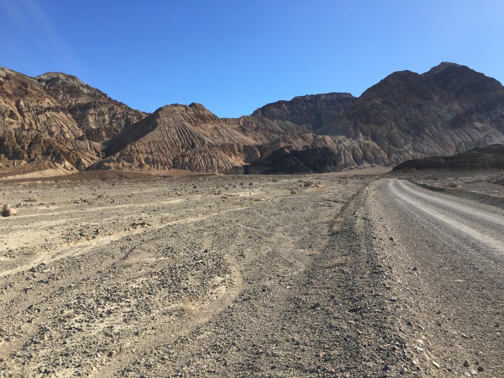
An unmarked, graded dirt road leads to Desolation Canyon.
From the small parking area at the end of the road, head east toward the wide canyon entrance in the side of the mountains. You will see two main openings–take the wide opening to the north and avoid the small opening to the south.

Desolation Canyon begins as a broad gulch but narrows down as the path goes gradually uphill, at points twisting into tight passages flanked by sheer canyon walls.

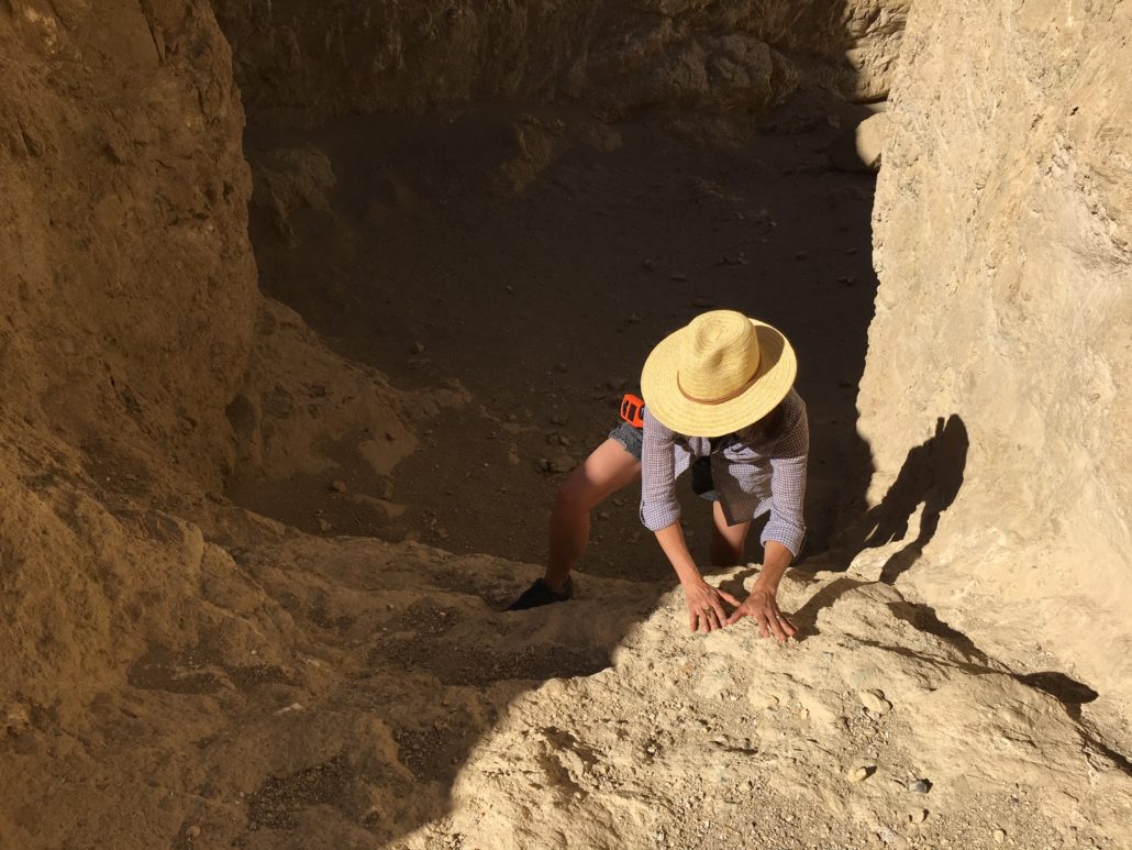
At 1 mile into the hike, you will encounter an 8-foot fall. There are good handholds and a gentle slant. You don’t need any particular expertise or gear to climb it. The angle of the picture below makes it look worse than it is. Still, proceed with caution. Going back down is more difficult. There is a shorter, 6-foot dry fall just beyond.
Desolation Canyon is part a network of passages carved out during periodic flooding. Several side canyons that offer tempting exploration that could make for a fun day of exploring. Major forks occur at 1.2 and 1.5 miles; stay right to remain in the main canyon. If you choose to explore the side canyons, the NPS advises that, since the canyon has been shaped by water, downhill is typically the way back to safety.

Desolation Canyon brings a lot of magical geologic elements into one place. It shares the sedimentary rocks of the nearby Artists Formation–volcanic minerals give the scoured hills and canyon walls splashes of muted color, blue-green, pink, gold.
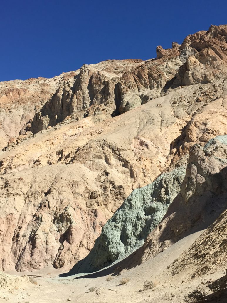
It is also clearly a child of the Black Mountains, with its eroded badlands, also found in Golden Canyon and Gower Gulch slightly north. The result is a scaled down yet amalgamated version of some of Death Valley’s most striking features. Also striking, the lack of vegetation, making you feel small as you walk across the blasted mud. Note: the hills may look indestructible, but they are fragile and easily eroded. Veering off the trail can scar the landscape for years.

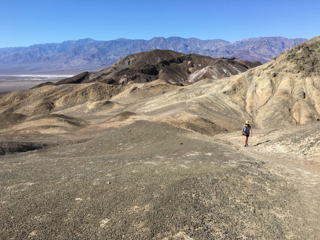
The trail ends at at a viewpoint looking across Death Valley in about 1.8 miles. Below, you can see the paved Artist’s Drive road snaking through the volcanic landscape.

Tags: artists drive, artists palette, badlands, badwater basin, black mountains, Death Valley, death valley national park, Furnace Creek, geology, golden canyon, zabriskie point