Whether you are a novice backpacker or you have thousands of trail miles under your belt, chances are that the Cottonwood Lakes Loop will draw your attention sooner or later. This 23.2 mile loop through classic High Sierra landscapes features lakes, streams, expansive vistas, plenty of great camping options, attainable summits, and some adventurous off-trail travel into adjacent glacial basins.

The loop described here straddles the northern edge of the Golden Trout Wilderness and the southern tip of the John Muir Wilderness and while passing between two major federal land-management jurisdictions, Inyo National Forest and Sequoia National Park. Like most areas where the National Park abuts the National Forest, your permit will cover you in both places. Day hikers in the Horseshoe Meadows area do not require a permit to visit, but all overnight users must obtain a permit in advance. Since the trailhead lies in Inyo National Forest, this is the agency from which you will want to obtain your permit. I include a link to Inyo National Forest’s Wilderness Permit application page, which is managed by Recreation.gov. Simply select the trailhead (Cottonwood Pass) and browse through the available dates until you find one you like.
-

Pacific Crest Trail Pano overlooking Big Whitney Meadows
This hike occurs almost entirely above 10,000′ of elevation and tops out just above 14,000′ at an option spur trip to Mt. Langley. Given that there is little time for acclimating if you drive up and start hiking, it will behoove you to spend a night at the Cottonwood Pass Campground that is set aside specifically for the purposes of acclimating. One night is not really enough to stave off all of the effects of altitude, but since you will probably be operating on a schedule, one night is better than nothing. Two nights and a shorter exploratory hike the day before you start this loop would be a better option.
-

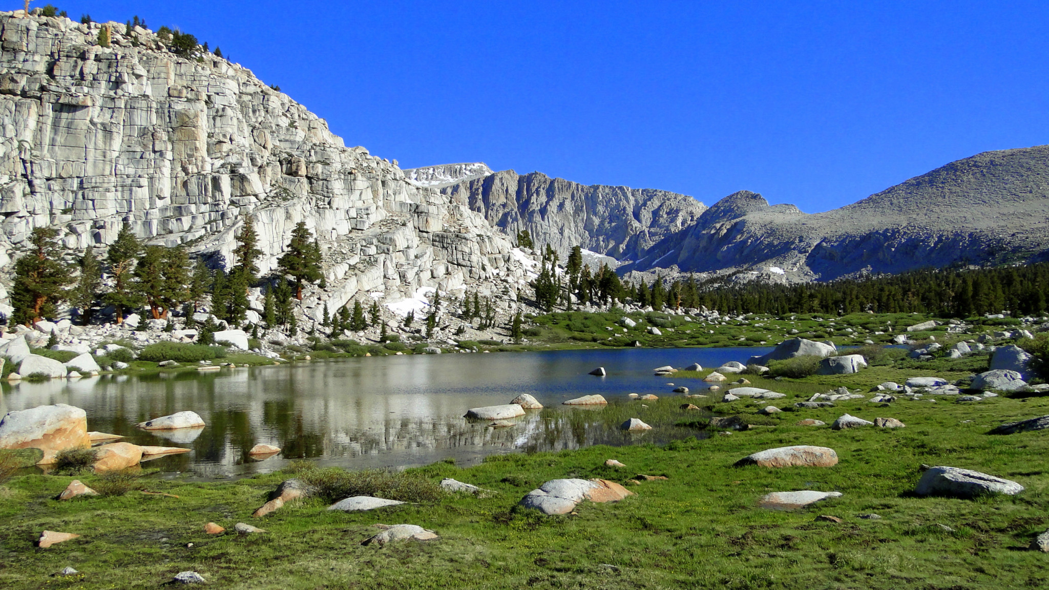
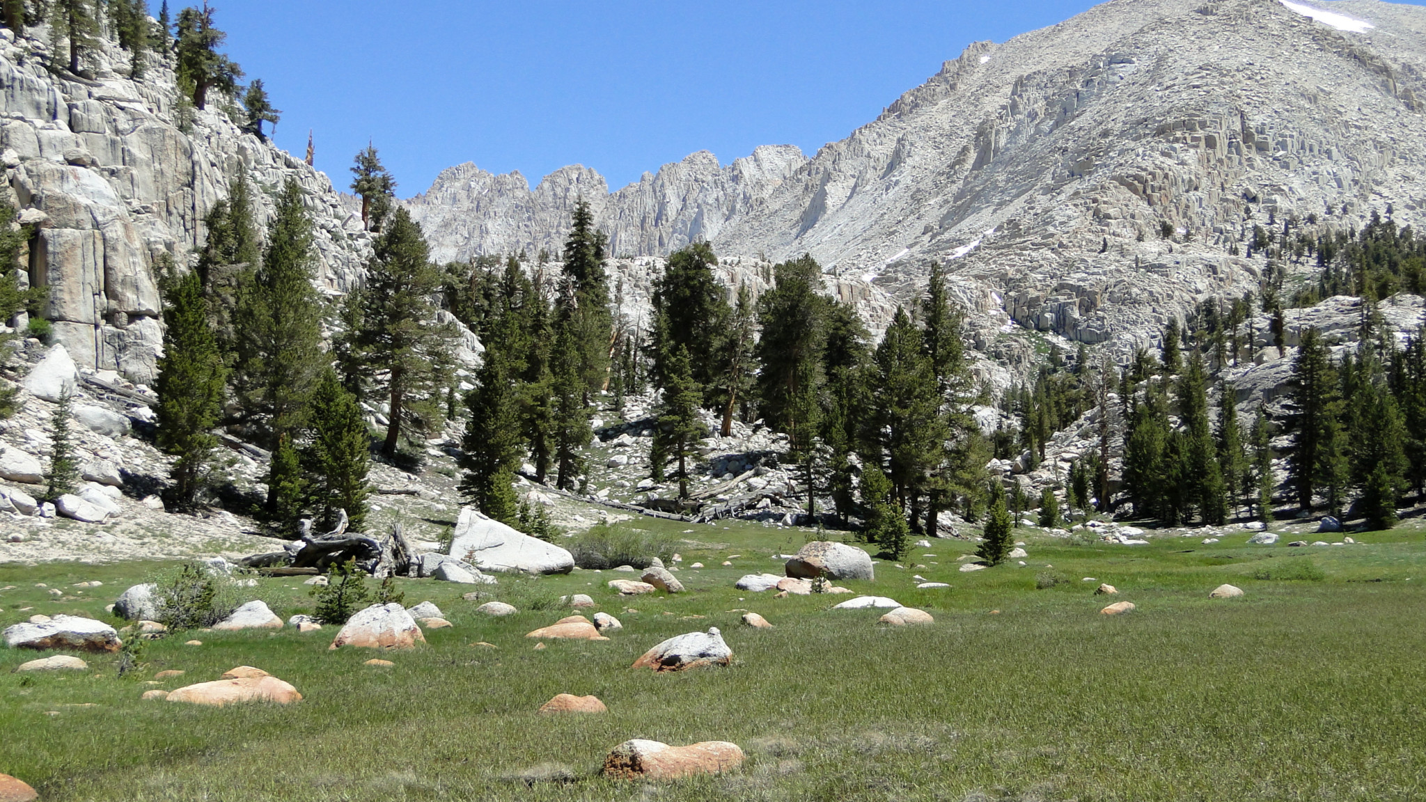
Cottonwood Lake #3
A few other precautions to bear in mind: Mosquitos can be a nightmare on this route given the large quantity of standing water around the streams, meadows, and lakes along the way. Come prepared for battle, and do not skimp on lines of defenses if you are hiking during the earlier parts of summer. The swarms usually die down with September’s cooler temperatures. Also, fishing is a powerful attraction for the lakes, and many people pack up here specifically to fish. If you wish to fish, bring your fishing license and check with the Eastern Sierra Interagency Visitor Center staff beforehand to brush up on regulations.
-

Horseshoe Meadow
This route departs and returns to the Cottonwood Pass Trailhead. I describe and recommend a clockwise route since Cottonwood Pass is a lot easier than New Army or Army Passes for the first day, and Chicken Spring Lake makes a fine destination for a first night. If you are a fast hiker, Soldier Lake works quite well. This is not to say that you cannot go counterclockwise if you are the sort that likes to do it your own way, but do not say I did not warn you when you are huffing and puffing your way up New Army Pass on day 2.
-

Cottonwood Pass Trail
Starting from the Horseshoe Meadow Trailhead, strike out west through the broad expanse of Horseshoe Meadow, which will sprawl out directly ahead and then on the left as you progress. Horseshoe Meadow is one of several vast meadows in the area occupying large basins gouged out by past glaciers. When water draining in from a number of hillside ravines reaches the flats, it disperses over a wide area, forming a marshy habitat that supports grasses, wildflowers, and blood sucking demon bugs. Horseshoe Meadow is the first such meadow you will encounter, with the even larger Big Whitney Meadow and Siberian Outpost Meadow on the other side of the Sierra Crest. This route does not bring you within reach of either of those meadows, but you could visit them via side trips provided your daily backpacking distance is modest enough to allow for extensive side travel. Keep in mind with your planning that the numerous options for side trips recommend less ambitious daily backpacking distances with several day hikes mixed in.
-

Descending from Cottonwood Pass
-

Chicken Spring Lake
Once atop Cottonwood Pass (3.6 miles), you arrive at a junction with the the Pacific Crest Trail (PCT) as well as a trail heading west toward Big Whitney Meadows. Choose the north-trending branch of the PCT and commence a gently ascending, short stretch over to the outlet of Chicken Spring Lake (4.4 miles). The lake invites plenty of exploration on its own, and the ridge just to the west provides an ideal perch to take in a sunset over the Great Western Divide. Day hikers can reach Chicken Spring Lake over the course of a moderately difficult hike, but this is about as far as most day hikers will want to go thanks to the elevation challenges.

Beyond Chicken Spring Lake, follow the PCT north as it loops around the west side of the Cirque Peak massif before crossing out of the Golden Trout Wilderness and into the John Muir Wilderness just east of Siberian Pass. Once over this divide, the vast Siberian Outpost meadow sprawls out to the west. The narrow basin leading to Army and New Army Pass appears to your right as you veer north off of the PCT toward Soldier Lakes.
-

Soldier Lake
Whether you only plan to stop for a short while or for the night, Soldier Lake (9.6 miles) is an essential destination on this route that I have factored into the overall distance. You should not miss this beautiful spot. The best camping can be found on a small peninsula sandwiched between the creek and a marshy meadow to the east. A bear box lies along the trail adjacent to the meadow just south of the lake.
-

Approaching Miter Basin
If you have a lot of time to kill while at Soldier Lake, or if you want to set aside an entire day for some rugged off-trail exploration into a stunning lake basin, backtrack south from Soldier Lake and turn right along a trail paralleling Rock Creek that travels west. Soon thereafter, make another right up the Rock Creek drainage to approach Miter Basin. Several stunning alpine lakes ringed by some of the highest peaks on the Sierra Crest invites a full day of exploration. Since I don’t include this in the GPS track, you will want to make sure you enter the basin armed with a topographic map, a compass, and the knowledge of how to use them. No trails penetrate the basin, which will daunt hikers unaccustomed to cross-country travel.
-

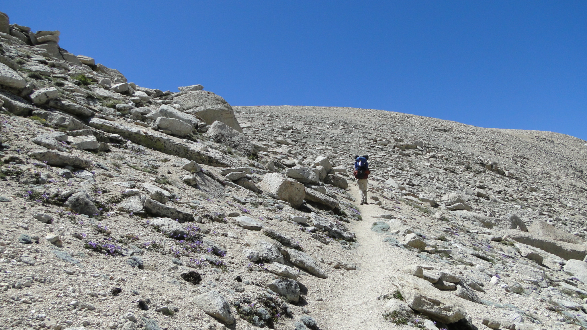
The approach to New Army Pass
By the time you are done at Soldier Lake or Miter Basin (usually day 2 or 3), you should be well enough acclimated to handle the climb up to New Army Pass and beyond to Mt. Langley, Cirque Peak, or, if you are really gung ho, both. After backtracking south from Soldier Lake and turning left into the glacial basin leading to the pass, you will climb above the tree line past numerous springs, seeps, and small meadows that form the headwaters of a tributary to Rock Creek. At first, the climbing is pretty gradual, but the trail becomes steeper after making a hard bend to the right. From here, climb toward the saddle where the Old Army Pass Trail (12.6 miles) reaches the Sierra Crest from the Cottonwood Lakes.
-

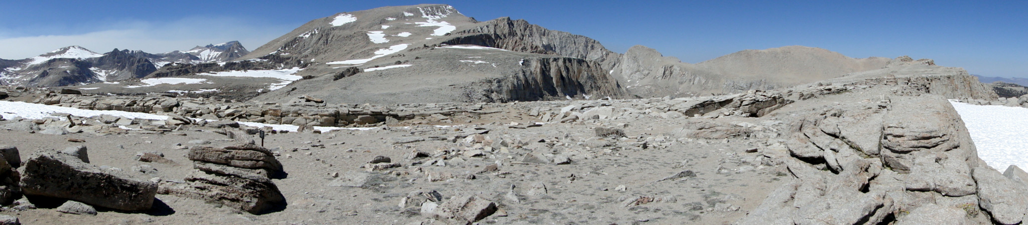
Cottonwood Lakes #4 and 5 from Old Army Pass
As tempting as Old Army Pass may look on the topos, you will want to avoid it in favor of New Army Pass (13.6 miles), even though the newer pass requires you to climb another 700′ from the saddle. If you are tempted to shortcut directly to the Cottonwood Lakes, keep in mind that Old Army’s trail descends on a north-facing slope that is known to hold its snow well into the summer. Unless you’re prepared with snow and ice gear, this would be a dangerous way to drop out of the saddle.
-

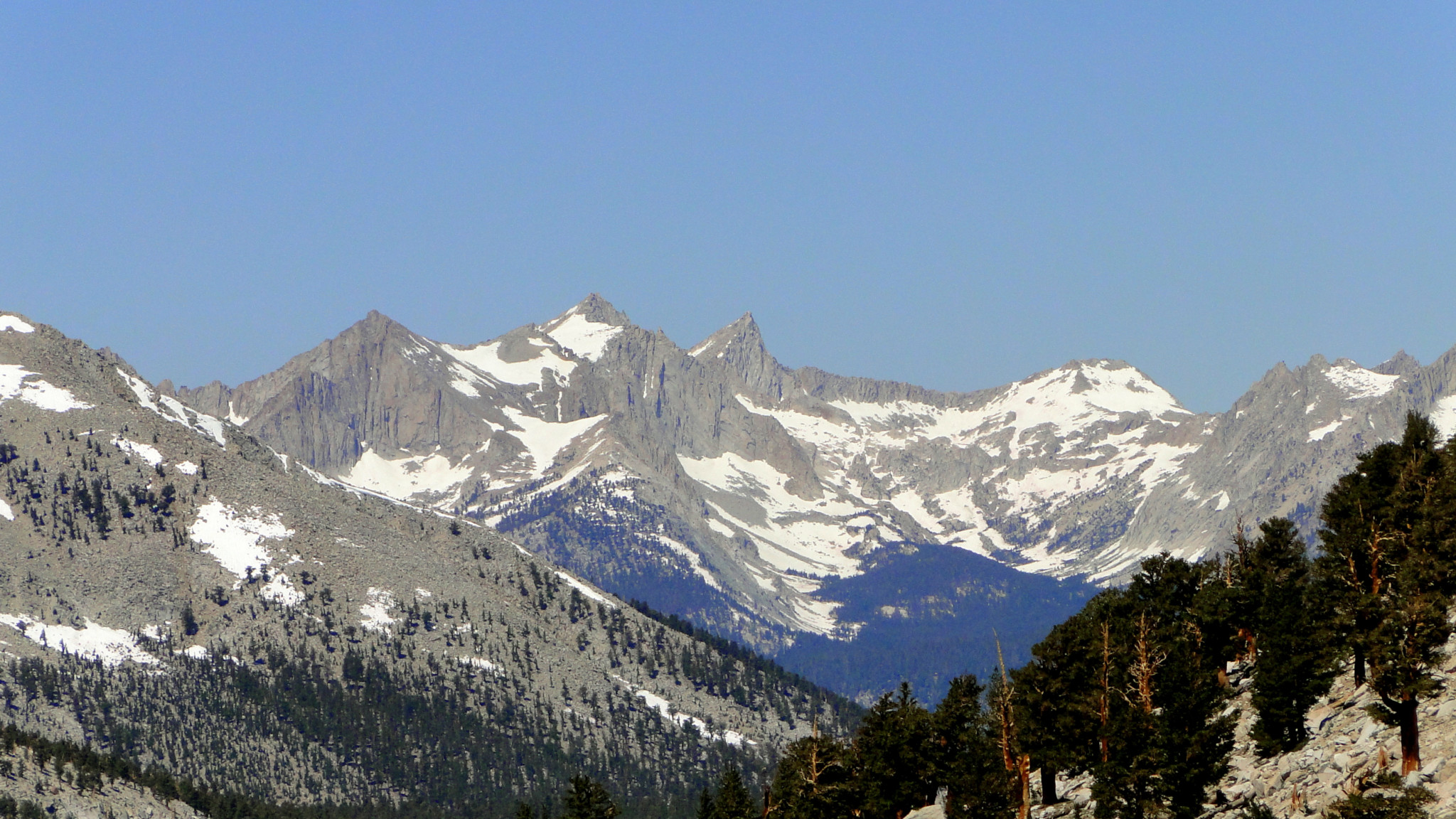
The approach to Mt. Langley from Old Army Pass
For the summit ascent of Mt. Langley – one of the “easy” California 14ers, which adds on nearly 5 miles to the route, turn north at the saddle and follow an informal path marked by cairns. The initial climb is moderate, but the final climb up to the summit block is very steep. Coupled with the high elevation, this final climb will easily take you 2-3 times longer than you expect. Views from the summit are absolutely magnificent, rivaling even those found on Mt. Whitney. In fact, if you are unable to obtain permits for Mt. Whitney, or if the permit process is a major turn-off for you, the ascent to Langley is a fine substitution. Again, I don’t include this on the GPS track, so I recommend you make use of your topo and compass to find your way.
-

High Lake
After dropping down from New Army Pass along sweeping switchbacks, you pass High Lake (14.8 miles) nestled to the left in a picturesque basin before taking a wide arc around a moraine before dropping down along the shores of Long Lake (15.7 miles). Long Lake is a fine option for camping if you are opting for shorter days or if you spent the better part of the day up on Langley.
-

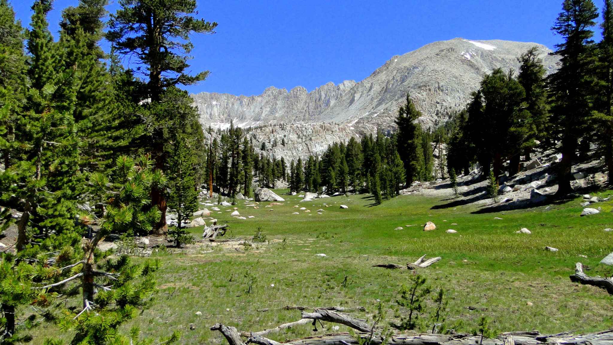
Cottonwood Lake #4
If you are still early on in your day, proceed to the Cottonwood Lakes, which may well be where the rangers put you for your night’s camping when you get your permit. The five Cottonwood Lakes are only part of the numerous lakes that occupy this cluster of glacial basins, and every single one of those lakes are beautiful. A looping trail splits away from the main Cottonwood Lakes Trail just past Long Lake (16.4 miles), and it will lead you north through the Cottonwood Lakes in this order: Lake 2, Lake 3, Lake 4, Lake 5, and then back to Lake 1 after crossing a soggy meadow. There is abundant camping to be found on the banks of Lakes 3-5 and on the ridge separating the unnumbered lake and Lake 3. Additional camping can be found south from here at the South Fork and Cirque Lakes.
-

Cottonwood Lake #1
To conclude your trip, follow Cottonwood Creek all the way back to the trailhead, first heading east and then south as the creek makes a wide arc. The trail will actually lead you to the Cottonwood Lakes Trailhead, which is separate and slightly north from where you parked your car at the Cottonwood Pass Trailhead. A connecting trail branches off on the right at 20.9 trail, and it will lead you south back to the Cottonwood Pass Trail. Once back to the Cottonwood Pass Trail, turn left to return to the trailhead and your vehicle.
Tags: Army Pass, Big Whitney Meadows, Chicken Spring Lake, Cottonwood Lakes, Cottonwood pass, Horseshoe Meadows, Inyo National Forest, John Muir Wilderness, Miter Basin, Mt Langley, New Army Pass, Pacific Crest Trail, Siberian Pass, Soldier Lake