Located approximately 30 miles north of San Francisco, Point Reyes National Seashore is a staple for any outdoor enthusiast, both to bay area locals and visitors alike. Despite its relatively close proximity to a major city and its location within Marin County, Point Reyes immediately feels like a different world. Tucked away on the beautiful California coast among breathtaking foggy beaches and green forests of moss, ferns and countless bird species, it is truly a spectacular place to visit for a short (or long) backpacking trip. That is to say: This is an absolute gem in the National Park system, and should be a must-see for all backpacking enthusiasts, especially for those who want something accessible from a major metropolitan area.
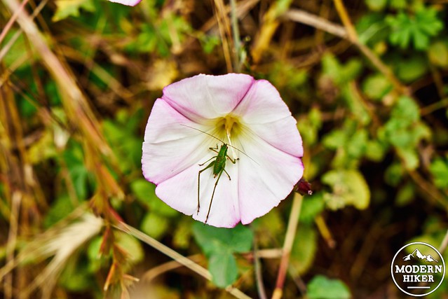
A little about Point Reyes, and what makes it unique. An often overlooked and fun piece of trivia: Point Reyes is in fact geologically separated from the rest of Marin Country AND almost ALL of the continental United States. The well-known San Andreas Fault forms a rift zone, resulting in a unique peninsula formation riding on a completely different tectonic plate than that of mainland California (how cool is that?). As a result, Point Reyes National Seashore contains different soils and plant life compared to those found just to the east, producing several interesting and unique environments. In fact, it’s the ONLY known home to the rare and endangered Sonoma Spineflower.
Are you convinced yet? Great, on to the backpacking trip.
Point Reyes is home to numerous trails, forming a relatively dense network of routes and points of interest. The route described in this write-up travels through several mini-environments within Point Reyes, and at approximately 22 miles, is best done as a 1-2 night backpacking trip. While the route can be be done as one mega day-hike or just with a single night out and back to either of the trail camps, this route gives plenty of time for exploration and sight-seeing, especially for those new to backpacking who aren’t ready for 10+ mile days.
First, a word of caution: As this is northern California, I strongly suggest that adventurers to our beautiful coast become well acquainted with two plants, poison oak and stinging nettle. Don’t touch these, because they will either cause a bad rash to appear 1-5 days later (or within even less time), or in the case of Nettle, hurt you with tiny stinging hairs. There are some spots on the trail where, after a few recent big rain events over the 2014-2015 winter, there has been some significant growth along the edges. However, they are avoidable, as long as you’re paying attention. Additionally, always give your hands and ankles a good wash in the evening with cold water (and maybe a little camp soap, away from water sources) to remove any oils from poison oak. And the best advice anyone can give when hiking on the coast: wear pants!
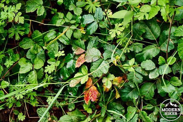
Poison Oak. Notice the red, as well as the leaves in groups of 3!
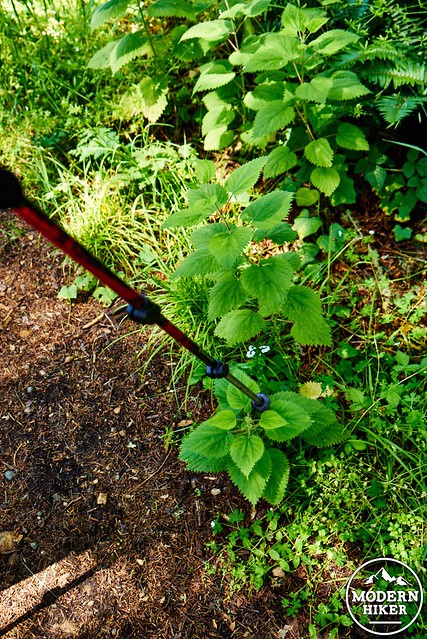
Nettle. Avoid the stem especially, which upon close inspection, are covered in tiny horrible stinging hairs.
With that out of the way, onward to the write-up.
Day 1: 6.15 miles
The trail starts at the Bear Valley Visitor Center, a relatively new and impressive building housing a small gift shop as well as educational exhibits. Permits can be obtained from the camping registration desk in the visitor center. This is also where you pick up your pre-reserved permits, or can speak to someone about getting a walk-up spot if any are available (again, for weekends, I strongly recommend reservations). Notably: The gift shop sells the Tom Harrison Point Reyes Map
for roughly $11, which is worth picking up. While the person at the camping desk will give you a smaller paper map covering the area, the mileages on the Tom Harrison map are slightly more accurate.
After parking in the parking lot across from the visitor center, the trail begins at the end of the road within view at the Bear Valley Trailhead.
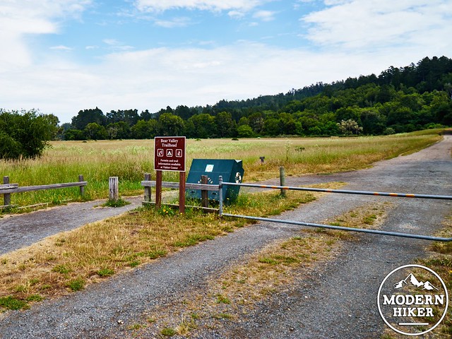
For the first .2 miles, the trail is a wide and gentle dirt fire road traveling through a dry meadow of grass and oaks. Your first turn will come at the junction of the Bear Valley trail (fire road) and the Wittenberg Trail, which breaks off to the right and heads upward.
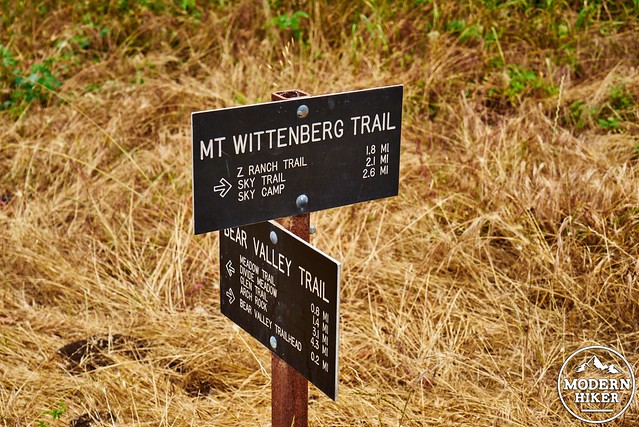
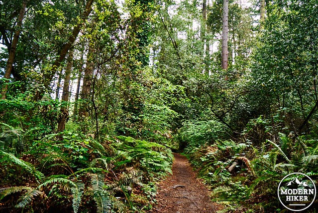
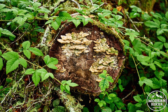
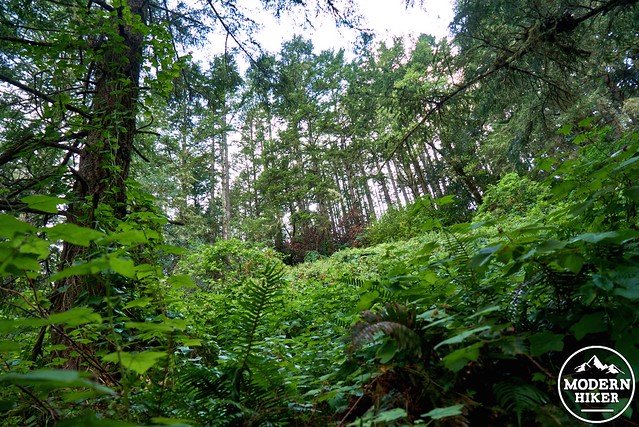
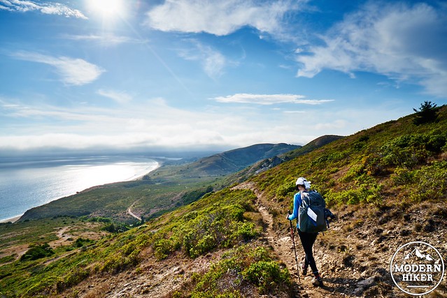
Steadily heading uphill for the next 1.8 miles, the Wittenberg Trail travels roughly 1,100 feet up through beautiful green and lush coastal forest. Ferns, moss, and mushrooms are abundant (as well as points where the poison oak has begun to encroach at the edges of the trail). The humidity here is markedly different from the rest of the trail, as you reach the high point of the entire three day trip at about 1277 feet.
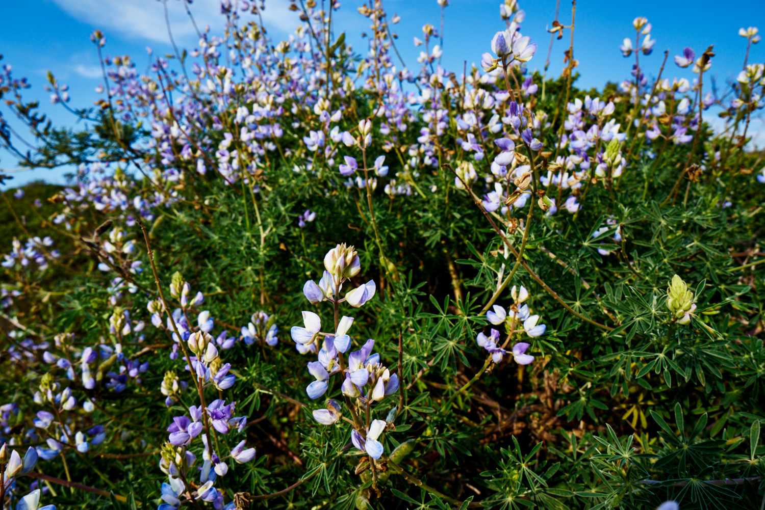
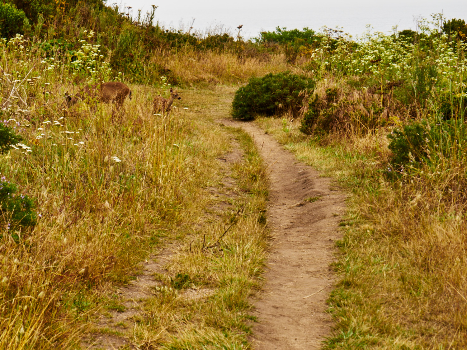
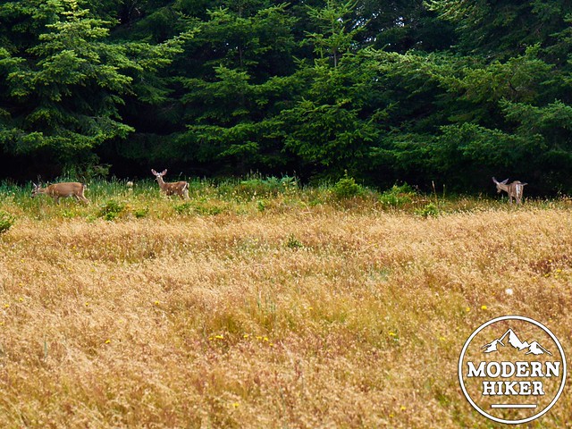
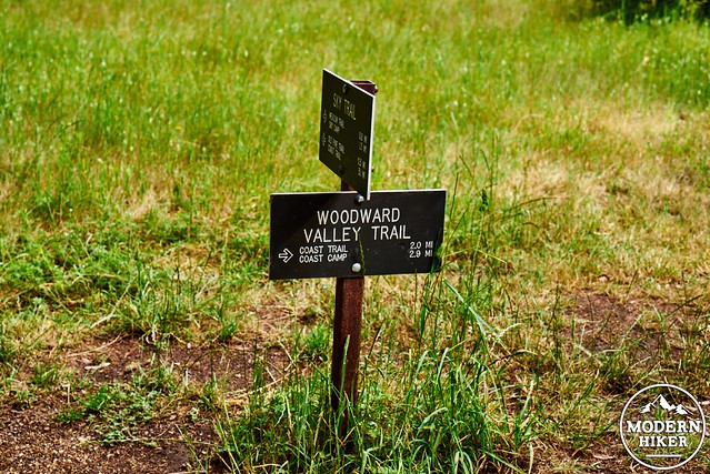
After 1.8 miles, the trail reaches a junction with the Z Ranch Trail. Follow the sign for the Meadow Trail, which is .4 miles. At this point, the trail levels out, traveling through a mix of forest and beautiful meadows which at times of the year are home to wildflowers and (probably) deer.
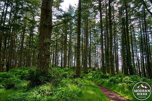
Eventually, you reach the junction of the Meadow Trail and the Sky Trail .4 miles later. Our next destination is the Woodward Valley Trail, which is reached after a gorgeous .8 mile trek along the Sky Trail, arguably one of the most iconic (and well maintained) trails in the entire park. This section gradually heads downhill along a ridge, with all of the today’s major climbing already completed. Pass through spectacular forests with occasional views of the ocean and the hills to the east.
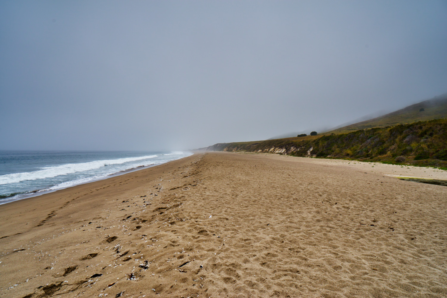
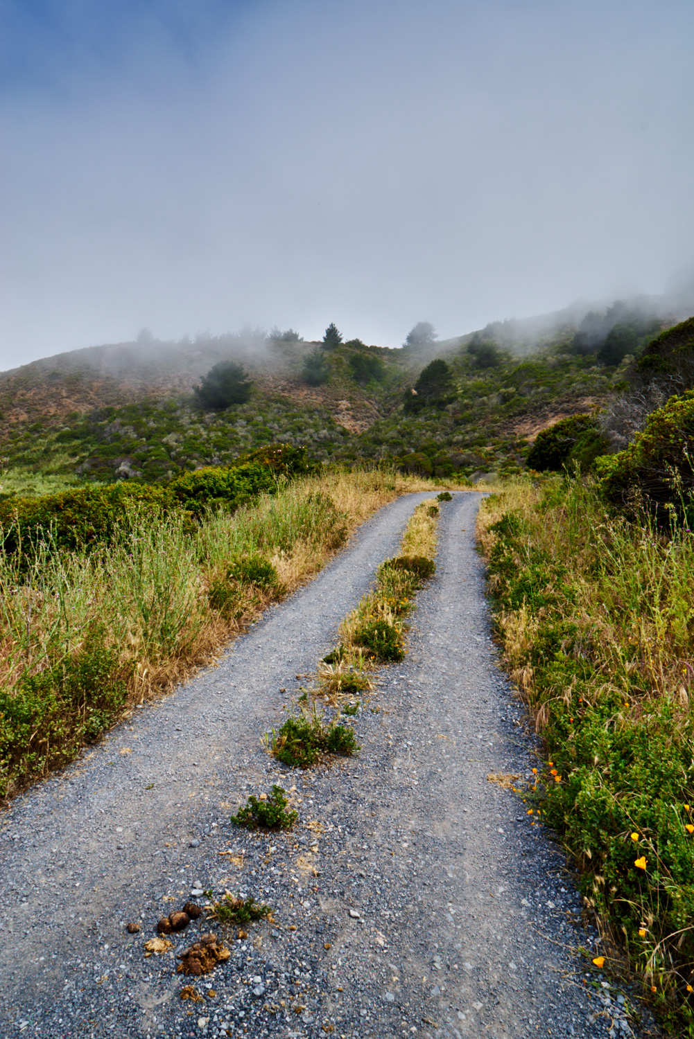
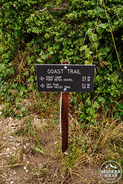
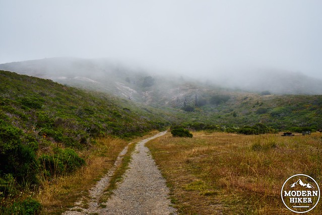
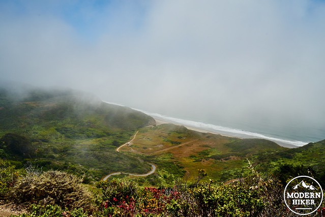
At the junction with the Woodward Valley Trail, head to the right towards Coast Camp and the Coast Trail. This trails steadily turns towards the water, heading downhill towards the coast and your final destination for the night. It is relatively well maintained in most sections, with a few areas of overgrowth, which is nonetheless still easy to navigate. Eventually, the trail emerges from the wooded hillside and travels along bare hills with low coastal shrubs and grass, allowing for expansive views to the west and north.
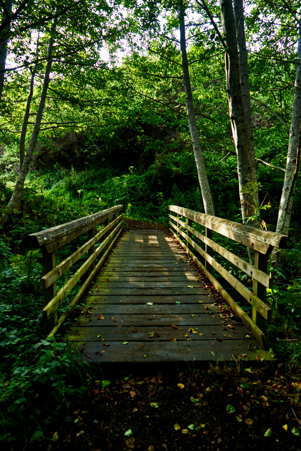
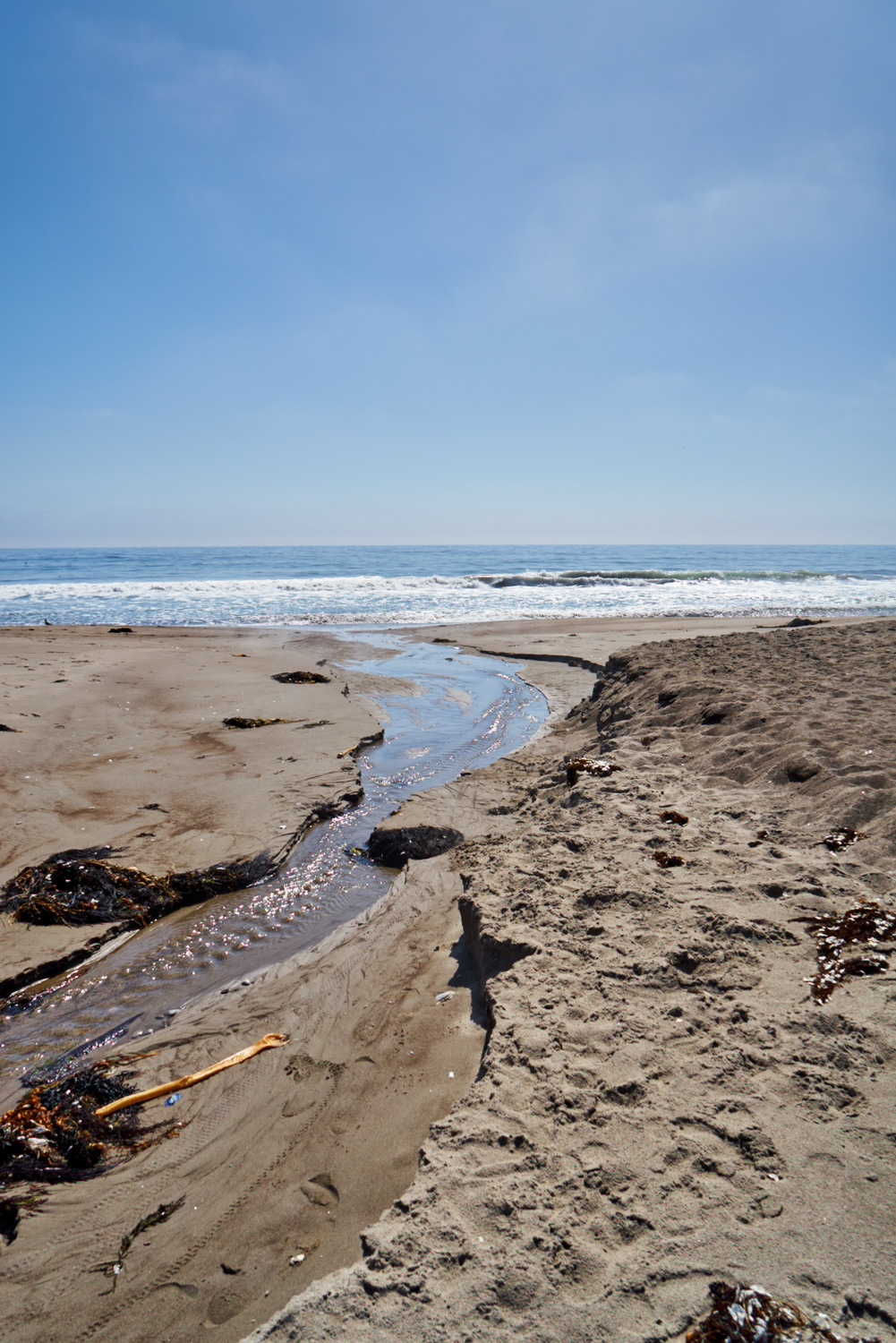
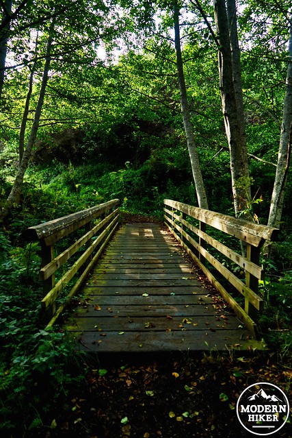
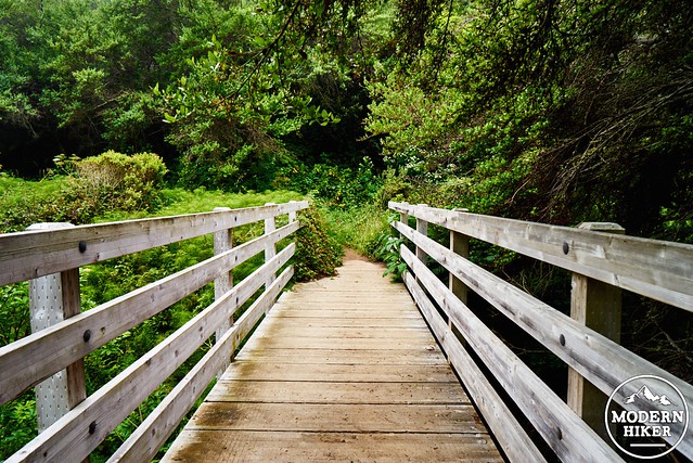
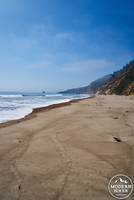
After 2 miles, you reach the final junction of the day, turning north on the Coast Trail for a beautiful and easy .9 miles to Coast Camp. Crossing a creek over a wooden bridge, you eventually see the camp below as you drop down into a small valley.
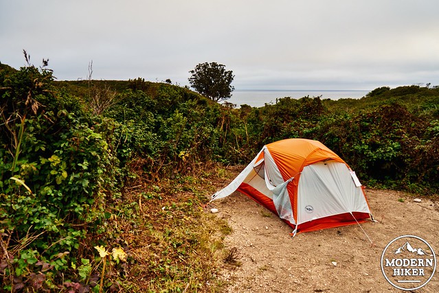
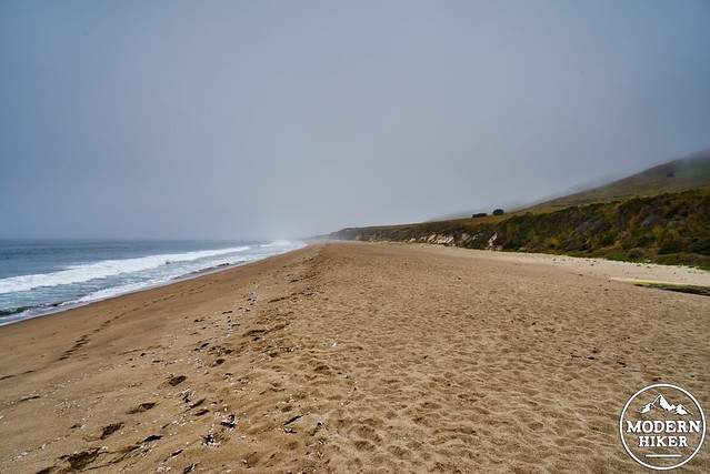
Note: It can be a bit confusing to find sites here. You’ll first walk into the area with the group sites. The smaller individual sites (1-7) are further along and to the right if you just follow the trail a bit further (there is a sign). Downhill from the sites, there is a noticeable trail heading to the beach.
Day 2: 8.5 Miles
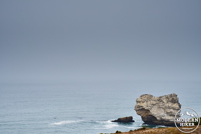
On day two, you will be traveling almost entirely along the spectacular Coast Trail. Starting at camp, travel back the way you came for .9 miles, again passing over the bridge towards the junction with the Woodward Valley Trail. Once there, continue along the Coast Trail for another 3.4 miles towards the Sky Trail/Bear Valley Trails. Of the total mileage for day 2, the first 4 miles are relatively flat and easy going, alternating between well a well traveled and wide trail through shrubby grasslands and green gullies packed with plant life seeking water. This entire section of the trail features great ocean views, with occasional glimpses of sea bird colonies living on rocky crags off the coast.
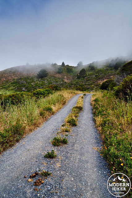
At roughly 5 miles, and following the junction with the Bear Valley Trail, the Coastal Trail will begin to climb up a large ridge, with a total elevation gain of about 800 feet. Passing through stands of pine and grassy meadows, the trail eventually levels out for a short period of time, before heading back down towards sea level and Wildcat Camp, your destination. The last 2 miles of the day travel steadily downward, passing through several sections of dense vegetation. However, as mentioned, the trail is easy to follow even through these areas. Eventually, you will see Wildcat camp from above, and wind your way down to find your campsite.
Again, the sites are not so easy to find, especially with the tall plant-life in the meadow. However, the individual sites are more towards the water (away from the bathrooms). Again, there is a very noticeable trail heading to the beach on the south side of the camp.
Wildcat Camp is home to countless bird species. We enjoyed watching the quail run through our camp, and the occasional glimpse of tiny yellow birds.

Day 3: 6.5 Miles
The final day of this route leaves Wildcat Camp and heads back towards the starting point at Bear Valley. The first .7 miles retrace your steps from the previous day, again taking you to the Coast Trail junction.
This time, keep heading straight for another .5 miles, until you read the sign for the Glen Trail, which will head to the left. Take this turnoff. The trail will quickly begin to descend, having reached its highpoint for the day. You’ll travel through green forest thick (in sections) with Nettle (which, as you know, you should never touch), alternating between sunny meadows and trail layered with soft pine needles. After another .5 miles, you will stay on the Glen Trail (rather than going towards Glen Camp via the Glen Camp Loop, but if you do don’t worry. You’ll still reach the Bear Valley Trail, but it will be slightly longer). At this point, follow the signs for the Bear Valley Trail, which you will reach at a big noticeable junction after 1 mile. At this point, you have an easy and enjoyable 3 mile walk back to the parking lot, following a wide fire road that also acts as a bike and horse route. At various points, the road follows a lush green stream surrounded by multiple types of ferns and wildflowers.
Eventually, you’ll reach your starting trailhead, the visitors center, and bathrooms.
Additional logistics and consideration:
Water: Each backcountry campground has readily available potable water, which can be obtained from pipes near the bathrooms (easy to find). However, it’s always a good idea here to bring lightweight backup water treatment (we brought a small set of Aquamira drops)
Rain: Especially during the winter (and when we’re not in a huge drought), Northern California can get very rainy. It’s very important to check the weather before your adventure.
Ticks: This is California, so be mindful and check for ticks!
Arch Rock: The Coast Trail visits the popular Arch Rock. However, this is currently closed, due to a recent collapse (and death). Respect the signs.
Tags: Backpacking, california, Camping, Hiking, Marin County, National Park Service, Point Reyes, Point Reyes National Seashore, Trail Write-Ups, wildflowers