Alamere Falls is a coastal waterfall at the southwestern end of Point Reyes National Seashore. It is one of two tide falls—a waterfall that flows directly into the ocean—near San Francisco. The other is insta-famous McWay Falls. There is some controversy regarding the route to get to Alamere Falls, which I will get into below. Regardless, this leg-stretcher features coastal views, wildflowers, freshwater lakes, an ocean-side campground, and an inimitable waterfall that belongs on your waterfall hike bucket list.

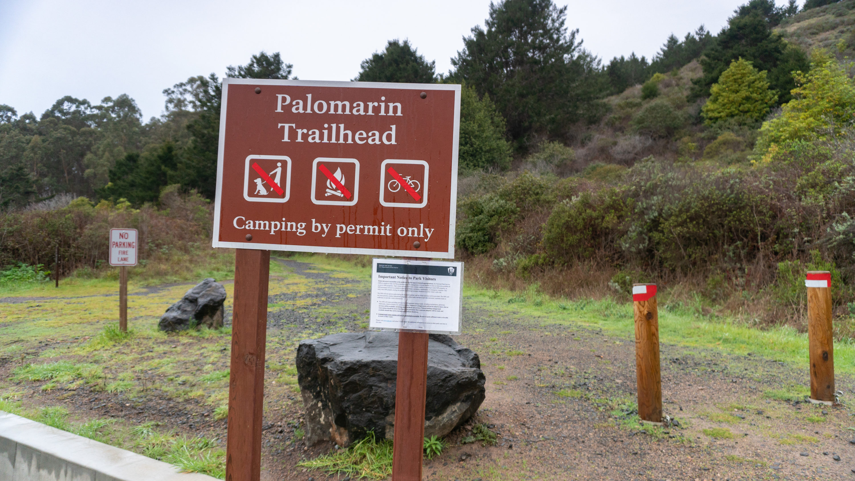
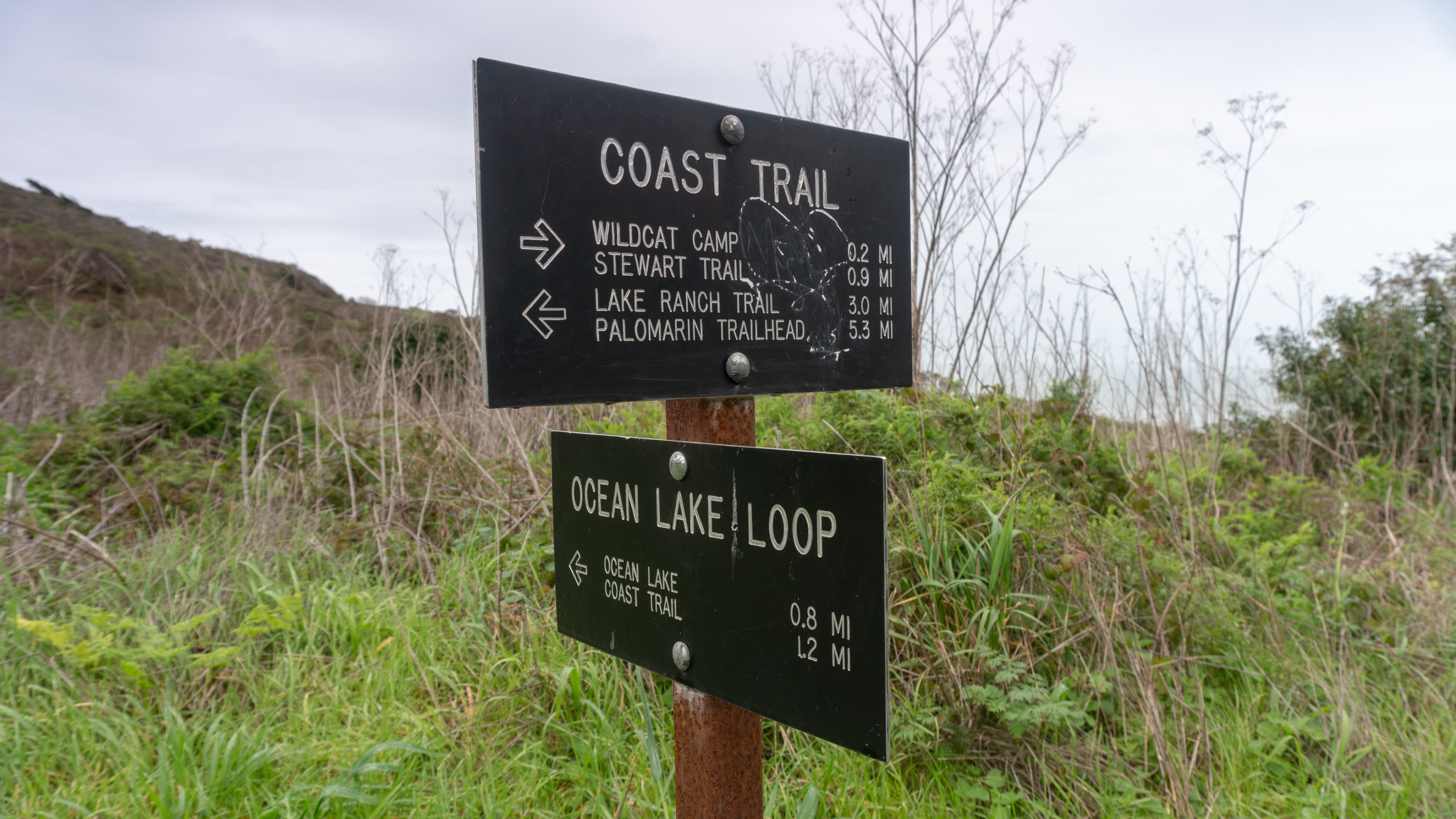
This trail description for Alamere Falls begins at the Palomarin Trailhead at the end of Mesa Road in Bolinas. Palomarin is one of three major trailheads for Alamere Falls: The others are Bear Valley (14.6 miles roundtrip) and Five Brooks (14.8 miles roundtrip). The Palomarin route is the shortest of the three, which may explain its popularity.

This brings us to the controversy. You may see Alamere Falls advertised as an 8.4-mile hike online and in guidebooks. The 8.4-mile route is a shortcut on an unmaintained trail that some have dubbed the “Alamere Falls Trail.” It involves scrambling down a deeply rutted and eroded cliff next to Alamere Falls. Park rangers at Point Reyes National Seashore discourage this route because it erodes the cliffs, may damage plants, and because it is dangerous.

Here is the full statement on Point Reyes National Seashore’s webpage for Alamere Falls:
Please take note! Many social media posts, websites, and older (and some newer) guide books reference an “Alamere Falls Trail” (also sometimes referred to as a “shortcut to the falls”). The “Alamere Falls Trail” is NOT a maintained trail, and poses many hazards to off-trail hikers—crumbling and eroding cliffs, massive poison oak, ticks, and no cell phone service. Visitors who use this unmaintained trail may endanger themselves and rescuers, and inadvertently cause resource damage, such as trampling plants, which may lead to the death of the trampled plants. On an almost weekly basis, visitors get hurt scrambling down the heavily rutted route leading to the top of the falls or sliding down the crumbly cliff-face to get to the beach, sometimes requiring search and rescue teams to be mobilized. The National Park Service strongly advises visitors against using this unmaintained route.
Okay, so now that we know what’s what, let’s do it. Begin your hike at the Palomarin Trailhead, heading northwest on the Coast Trail towards Wildcat Camp. The trail is moderately wide. It rolls along the undulating coastline beside eucalyptus, California blackberry, and coffee berry at first, and then opening up to bluff side ocean views. Briny ocean air flows from crashing tides up over the bluffs into the radiating needles and mouse-tail cones of Douglas fir. Vines, wildflowers, and shrubs form thickets beside the route; it is a denser forest than you would expect for a coastal hike. Although the high point of the hike is 563 feet, the trail gains 200 feet here and and loses 75 feet there throughout the hike, adding up to 1950 feet of cumulative gain that takes into account all the hills climbed on the way to Alamere Falls and back.


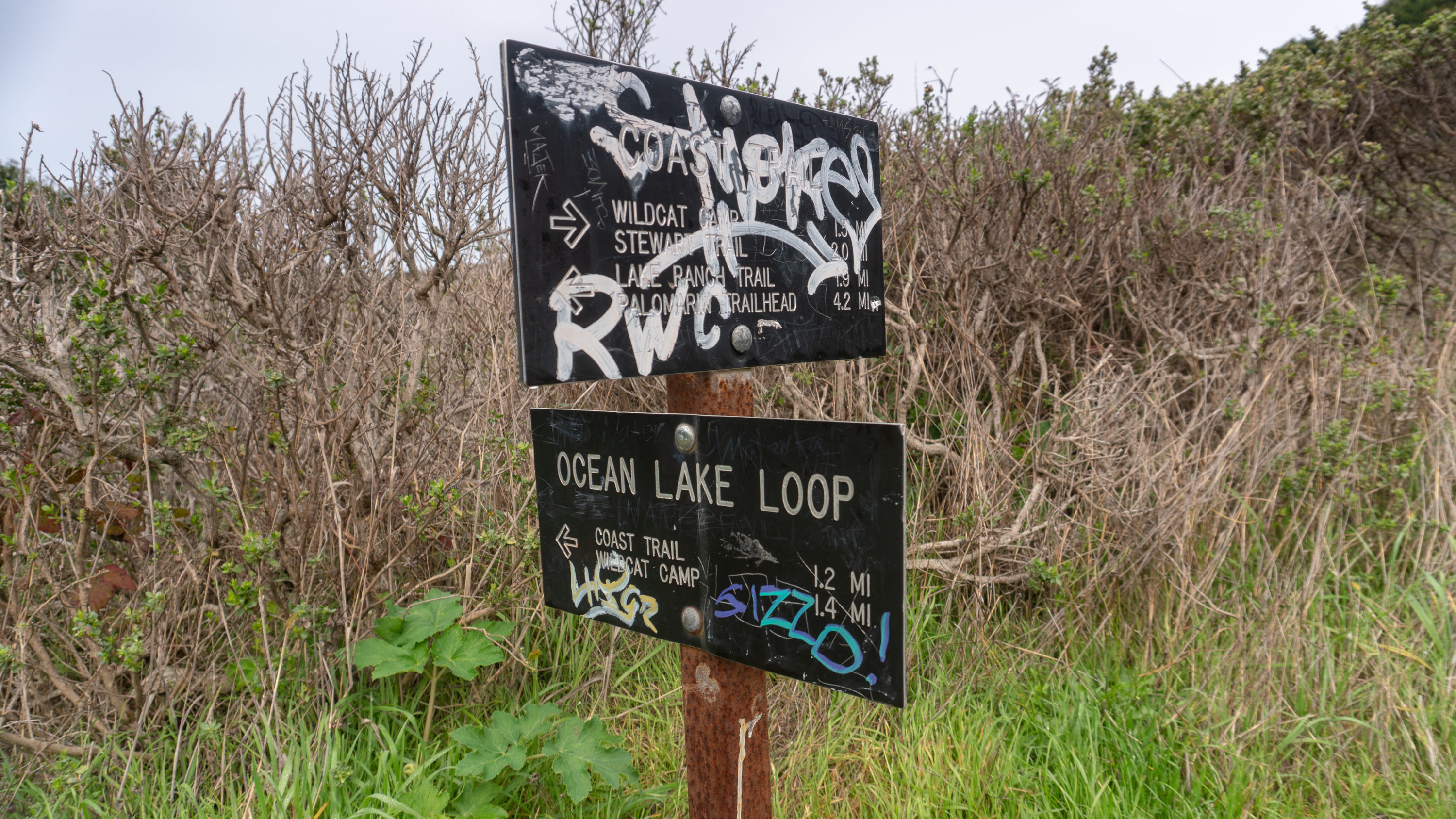
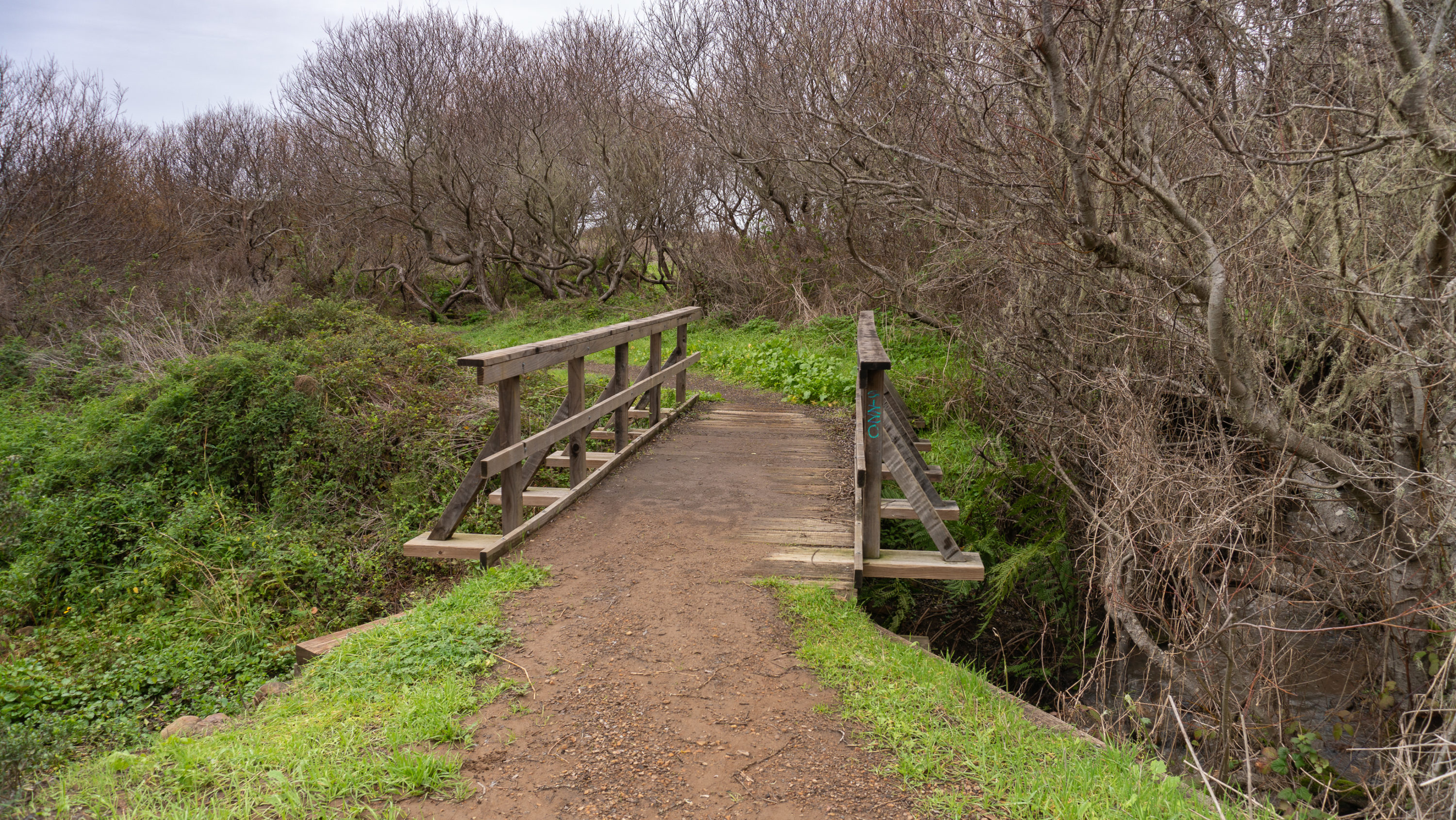
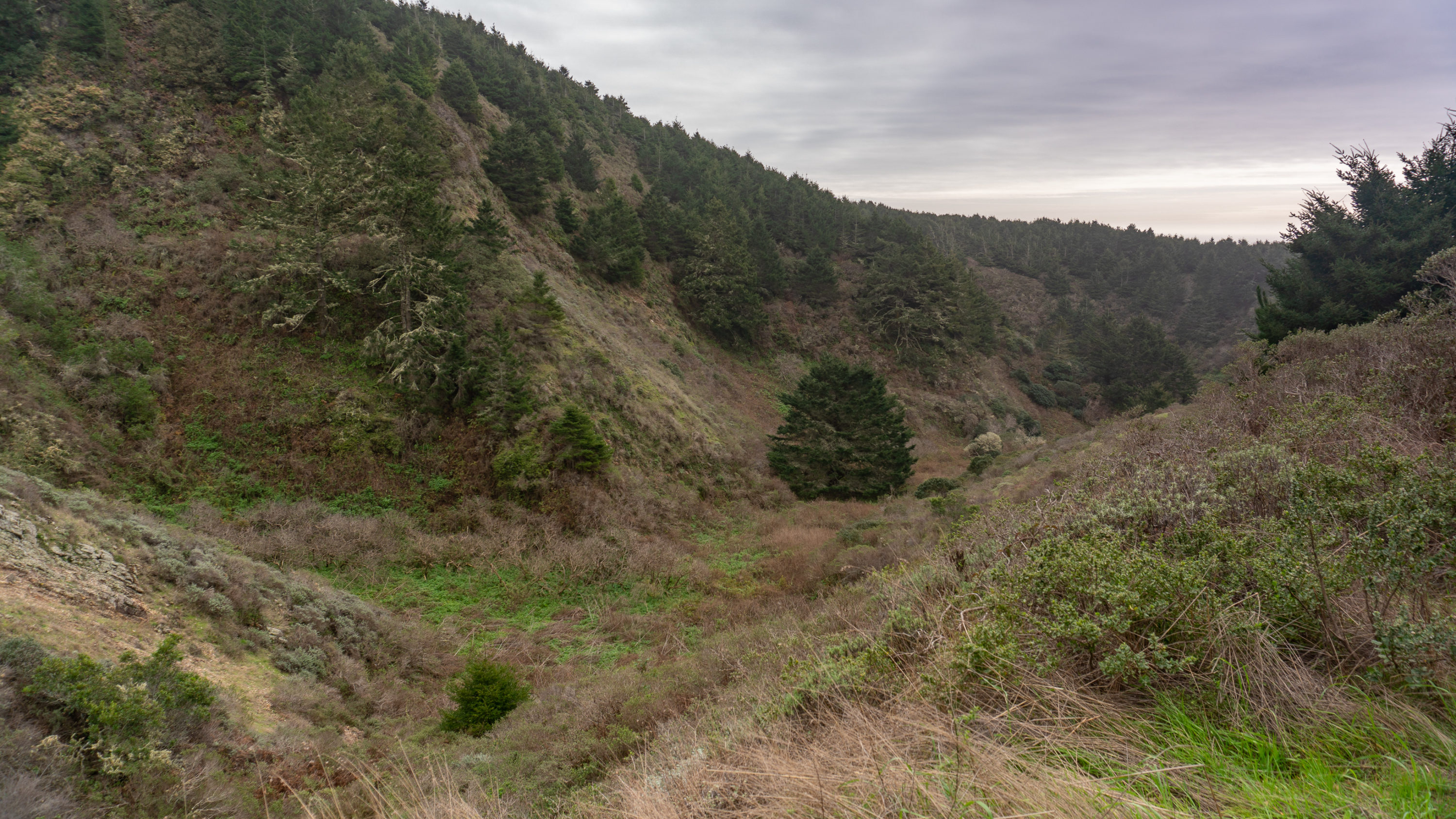
The Coast Trail and Alamere Falls lie within the Phillip Burton Wilderness, encompassing over 32,000 acres of land that covers roughly 47% of Point Reyes National Seashore. Phillip Burton was a congressional representative from California who served in the U.S. House of Representatives from 1964 to 1983. He is credited with the creation of the Golden Gate National Recreation Area. This wilderness was originally called Point Reyes Wilderness, but was renamed the Phillip Burton Wilderness in his honor on July 19, 1985 after he passed away. Typically, a wilderness designation means that motorized and mechanical devices like boats and bicycles are banned in order to preserve the pristine and “untrammeled” nature of the wilderness. Sadly, as you will see along this hike, it has not prevented folks from spraying graffiti on signs, wooden bridges, and rocks along the trail.

At the 1.2-mile mark, the trail turns inland away from the ocean. You are still out in the open air, surrounded by bramble, Douglas iris, bush lupine, and wild sweetpea.


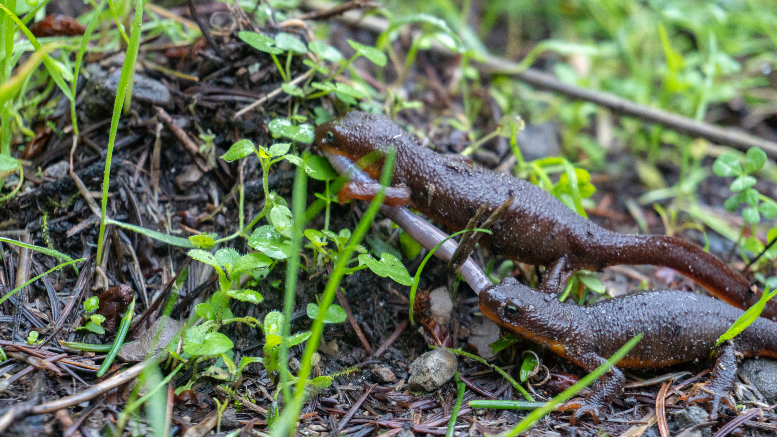
Reach the Lake Ranch Trail junction at the 2.3 mile-mark, staying straight on the Coast Trail towards Wildcat Camp. At 563 feet, the hike trends downhill from here, although still gains elevation in spots. Rough-skinned newts toddle along with pin wheeling legs that rock their bodies back and forth like a seesaw, their orange undersides not quite reaching their eyes.


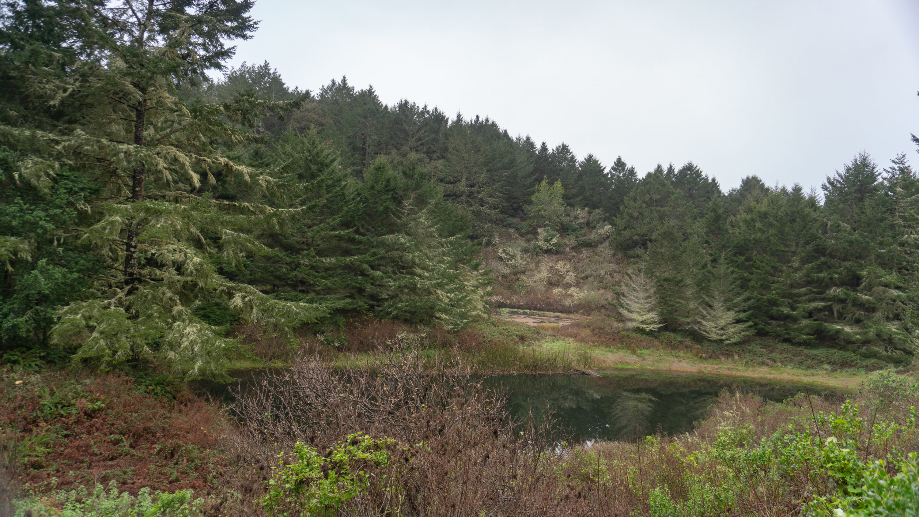
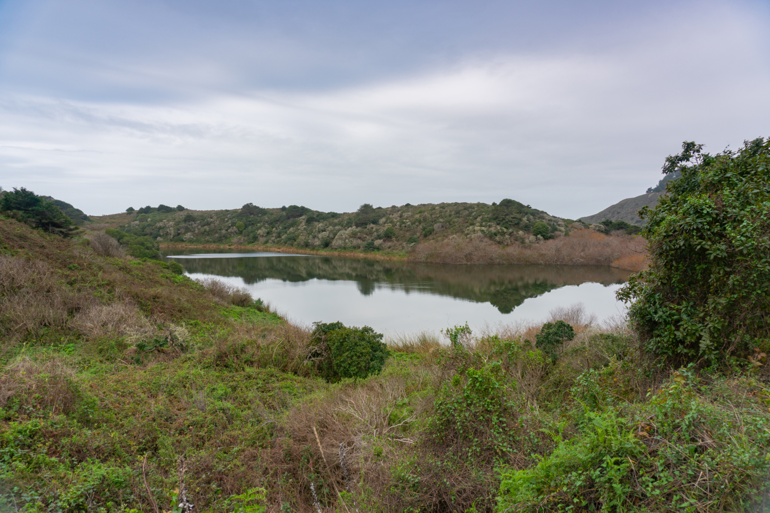
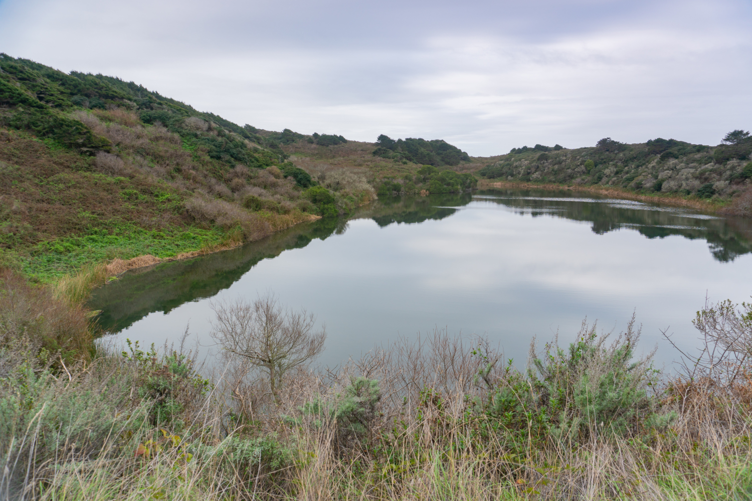
The next 1.3 miles pass through a Douglas fir and alder forest, with glimpses of ponds and freshwater lakes. Bass Lake, at the 2.8-mile mark, is a large lake with an evergreen forest reflected on its glassy surface. It is a popular day hike from the Palomarin Trailhead for swimming and picnicking. An unmaintained spur on the northwestern corner leads to a small meadow and primitive lake access.

Crystal Lake, northwest of Bass Lake, is not visible from the trail. There was an unmaintained trail to the lake in the past; however, today it is heavily overgrown and marked with a graffiti stained sign that says the trail is closed. Along this stretch, oodles of mushrooms cover the damp earth floor in winter. Best to leave them be; species are difficult to tell apart and can be poisonous.

Pelican Lake, a large pleasant lake surrounded by tall dunes, is next, coming into view at the 3.6-mile mark. Though there is not an official trail to the lake, an overgrown and unmaintained trail nearby leads to an overlook of Double Point. Past Pelican Lake, a wooden bridge offers safe passage over Alamere Creek, the water source for Alamere Falls.


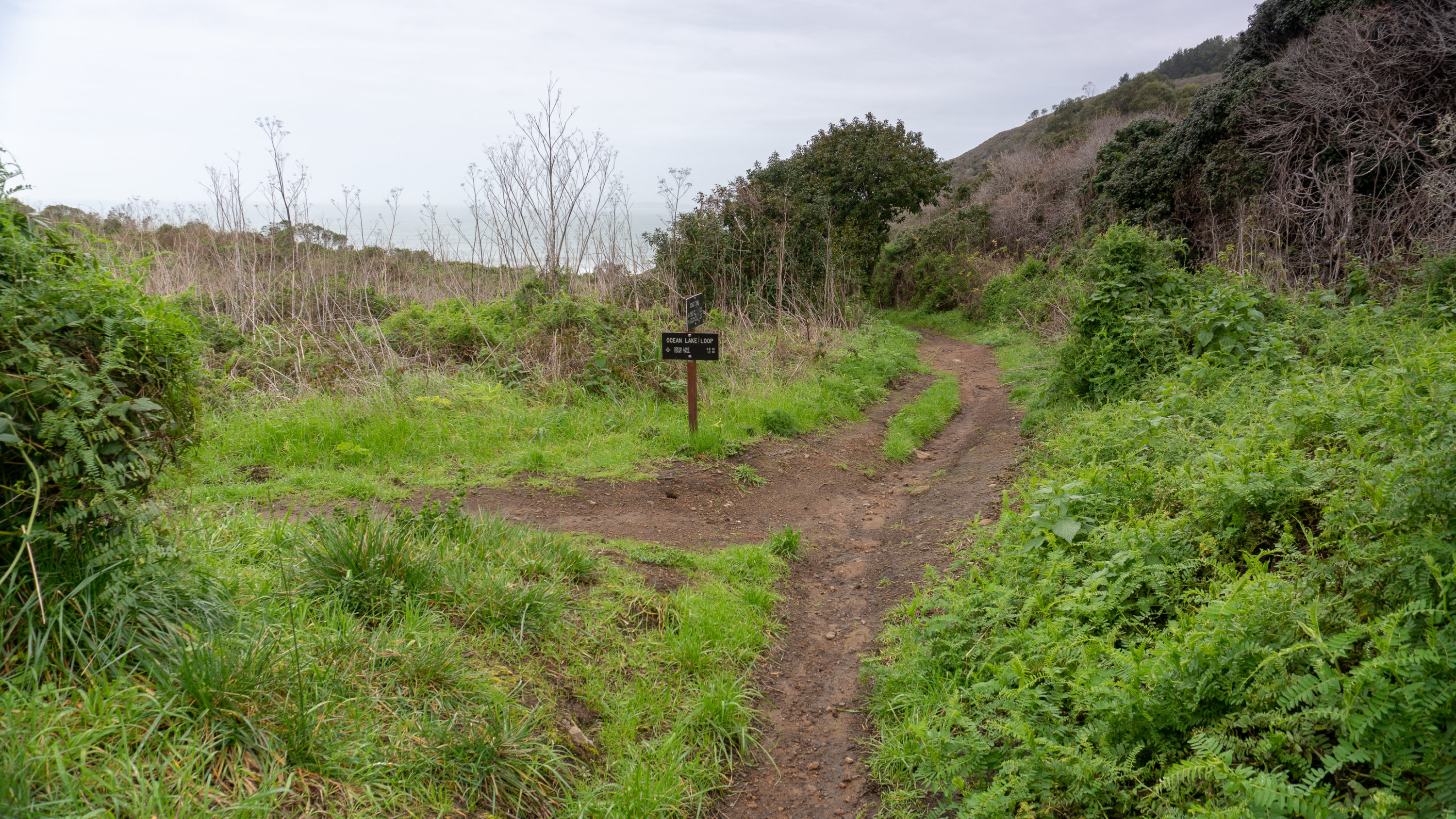
At 4.2 miles, reach the Ocean Lake Loop junction. You can bear left or right; the trails sync up in 1.2 miles. You have views of the ocean and Alamere Falls on the lefthand (western) trail, but it is always nice to do a loop. I would recommend bearing right towards Old Out Road for now and saving the views on the western trail for your return from the falls. (Although I couldn’t blame you for doing the out-and-back on just the western trail 🙂 Both routes gain a couple hundred feet in elevation before dropping down to Wildcat Campground and Wildcat Beach.


Bearing right, take the eastern trail on the Ocean Lake Loop toward Old Out Road. The trail narrows into a grassy single-track. Climb 0.75 miles to Old Out Road junction, after which the trail mercifully descends to the beach with a view of Wildcat Lake on your left.


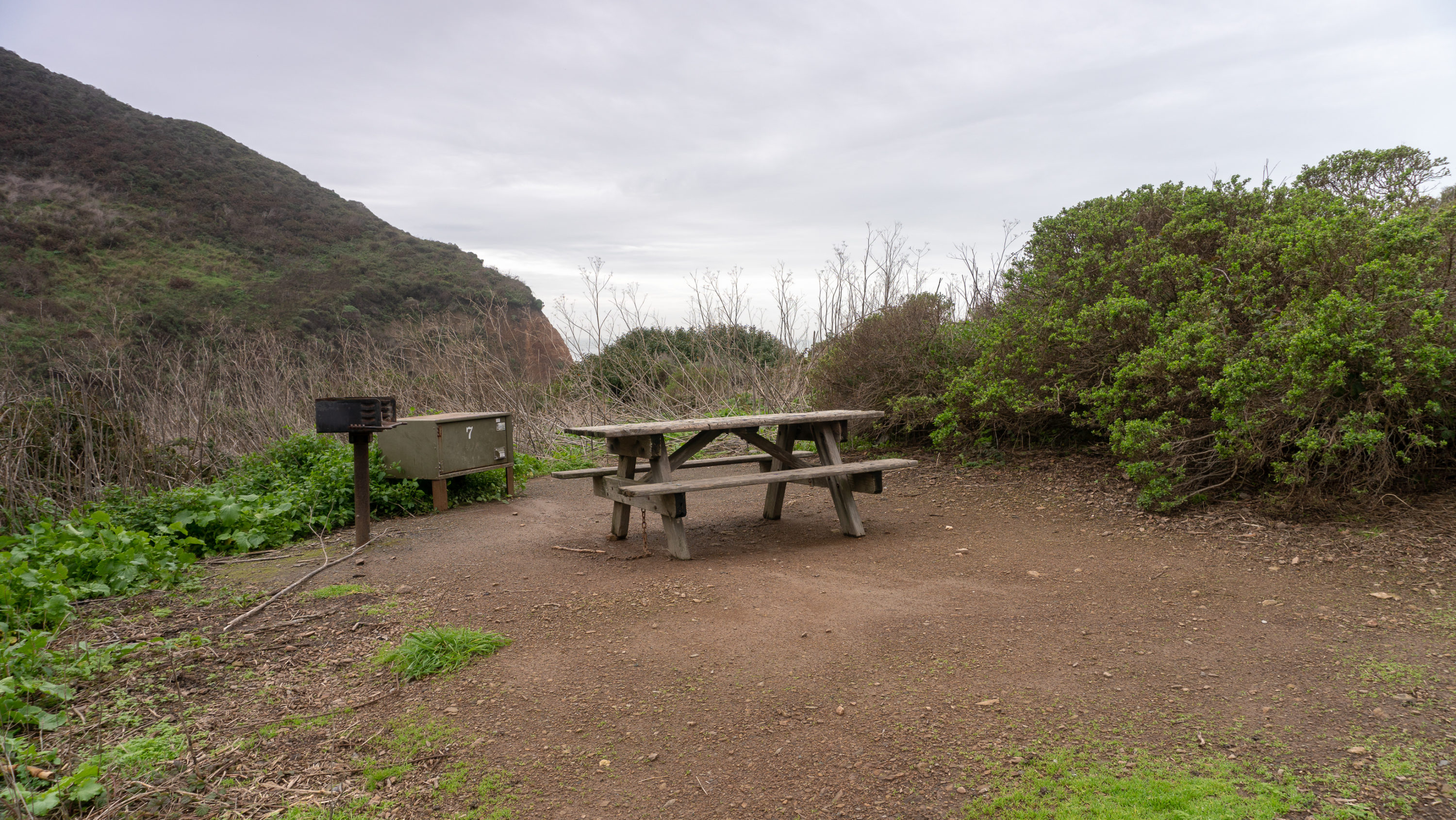
Stay straight at the end the Ocean Lake Loop, descending to Wildcat Campground at the 5.6-mile mark. Wildcat Campground has eight reservable sites and is a great savior for hiking Alamere Falls, given the need to hike the beach at low tide. Staying overnight can help you just be there when the tide is at its lowest so that you can make the hike to the falls safely and back. It’s also a nice option for breaking up the hike, or making it part of a backpacking loop on the Coast Trail.


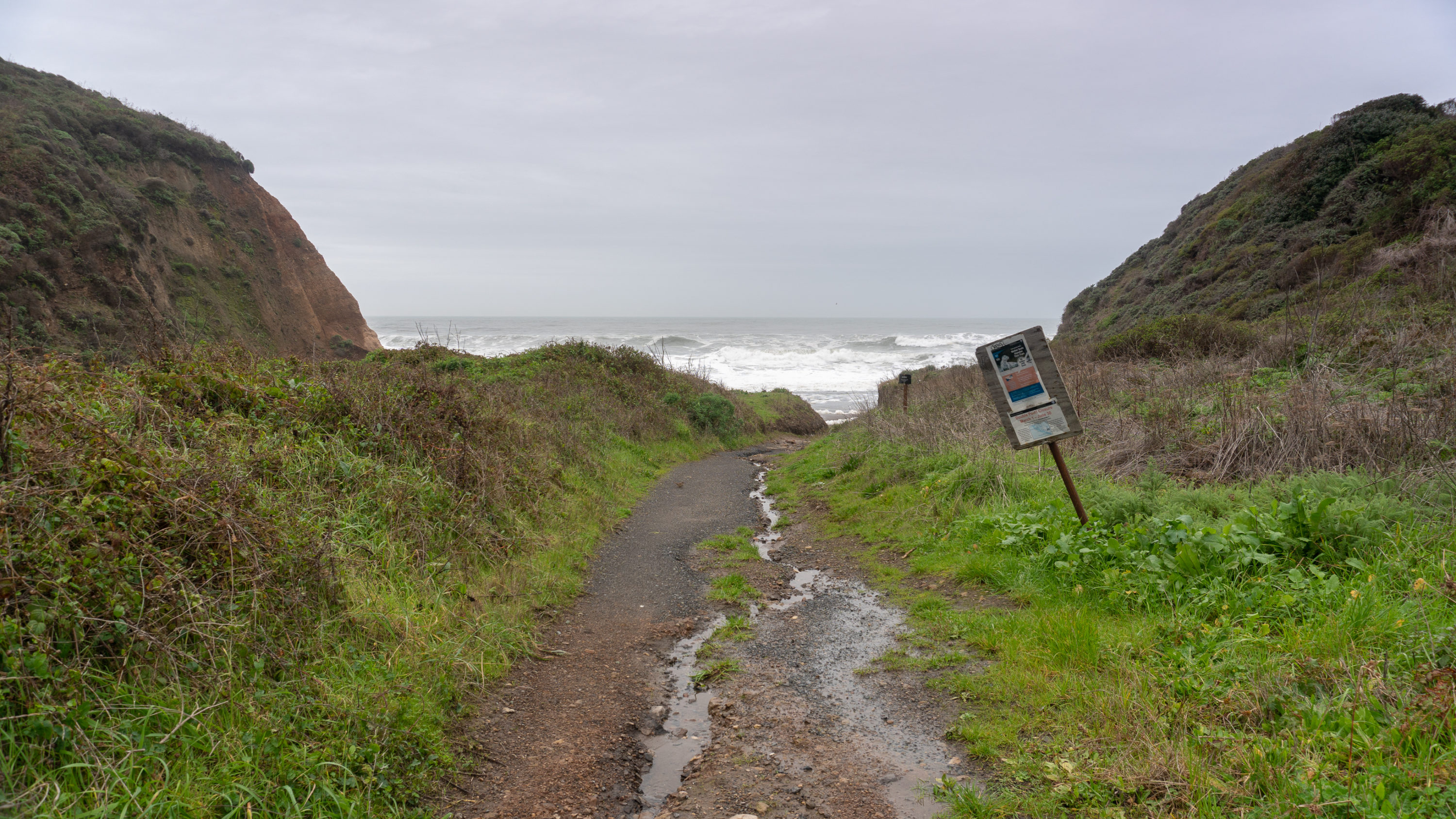
Turn left at Wildcat Campground towards the ocean, descending 0.1 miles to Wildcat Beach. Take off your boots and revel in the cool water and exfoliating sand on your feet: a relief after the long approach. Turn left to cross over a stream flowing into the ocean and hike 1.2 miles south to Alamere Falls. Craggy bluffs cut sharply against the pounding surf. In just a quarter mile, you will be able to spot the falls in the distance.


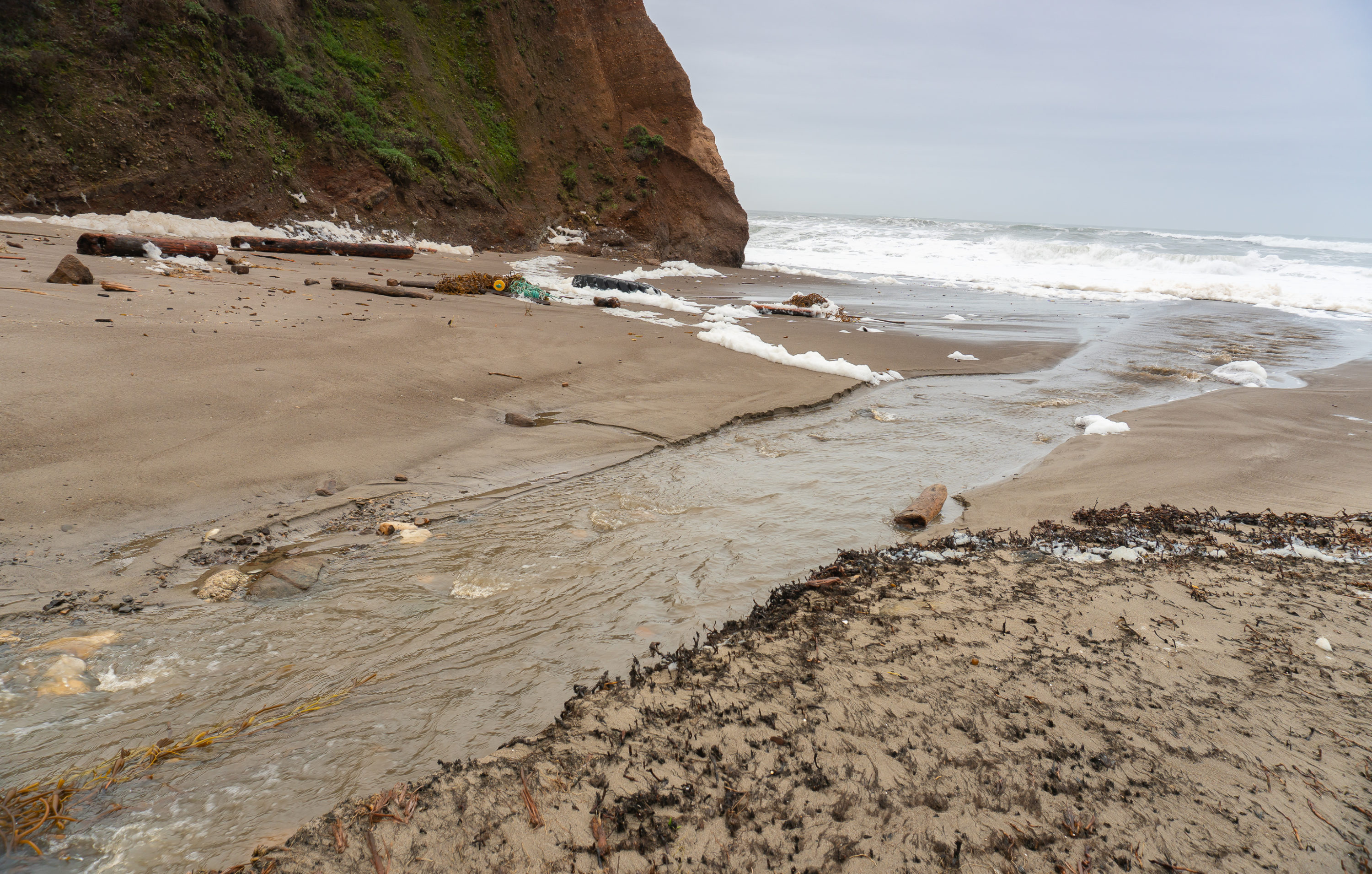
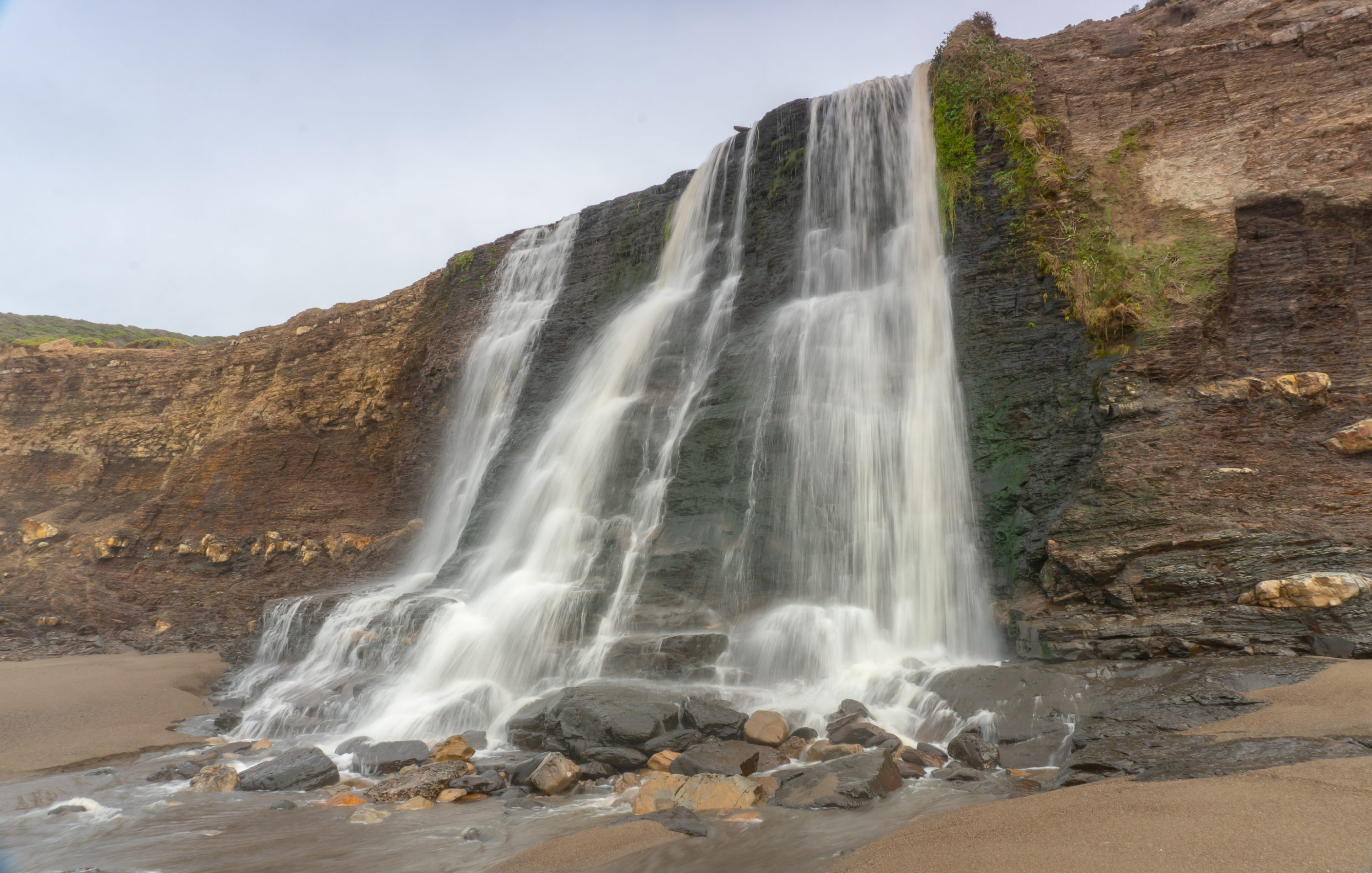
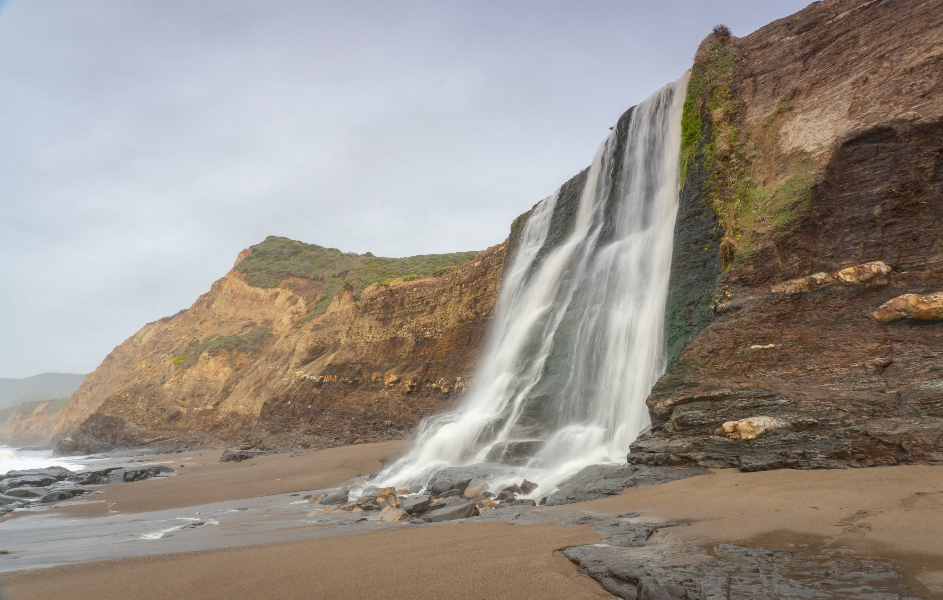
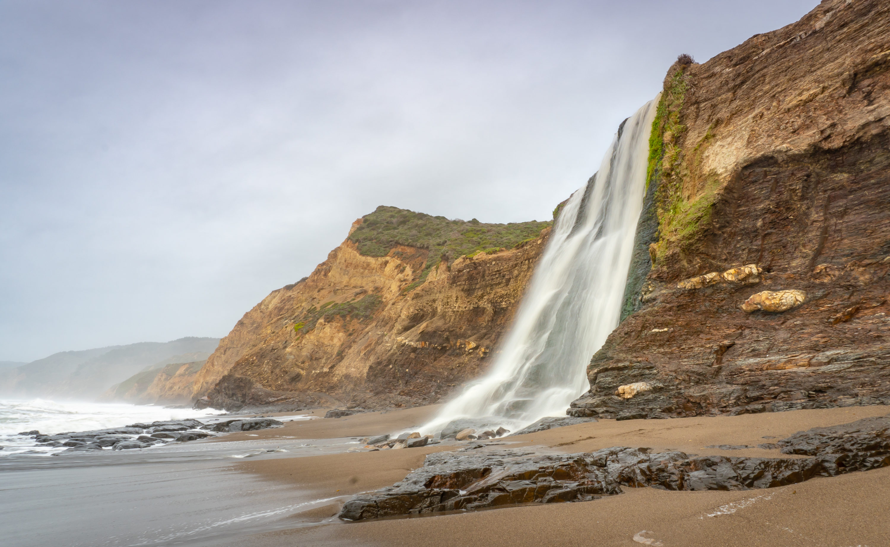
At the 6.9-mile mark, arrive at Alamere Falls. The 40-foot tall waterfall drops like a curtain from Alamere Creek above, hugging shale rock and etching patterns in the sand. Unlike McWay Falls, the other tide fall that is day-trip distance from San Francisco, you can hike to the base of this waterfall and see it up close. It is mystical and satisfying, a one-of-a-kind of hike you feel a tiny bit awed to have achieved.


When ready, retrace your steps on the Coast Trail to the Ocean Loop junction. This time, bear right to take the western side of the loop—the side closest to the ocean. Alamere Falls is visible from a stunning viewpoint overlooking the Pacific. A bench here is too tempting to pass up: Sit for a moment and take a rewarding look at the falls you just reached. After your communion with the ocean, continue southeast to close the Ocean Lake Loop, heading back to the Palomarin Trailhead on the Coast Trail.


Notes:
- Dogs are not allowed with the exception of federally recognized service dogs.
- Mountain bikes are not allowed on the Coast Trail from the Palomarin Trailhead; they are allowed on the Stewart Trail from the Five Brooks Trailhead.
- Point Reyes National Seashore is open daily from sunrise to midnight.
- A map of the route is available here on the Point Reyes National Seashore The Tom Harrison map for Point Reyes National Seashore has detailed information about the trail too.
- There are no fees to enter or park in Point Reyes National Seashore.
- Restrooms are available at the Palomarin Trailhead and at Wildcat Campground.
- Check the tide for Wildcat Beach before you go. Waves obscure the beach at high tide, making the beach walk treacherous and unsafe. Time your hike for low tide to give yourself time to reach the falls and head back.
Tags: beach, beach access, california, Coast Trail, forest, National Park Service, nature, outdoors, Phillip Burton Wilderness, Point Reyes National Seashore, san francisco, Waterfall, waterfall hikes, wildflowers