Sequoia National Park’s Giant Forest comprises an area of about 1,800 acres and features many of the park’s main attractions, including Sherman Tree, Congress Trail, Crescent Meadow, and Moro Rock. Add to this about 3.8 miles of trail leading to Tokopah Falls, and the attractions most visitors to Sequoia National Park see can be contained within about 2,200 or so acres. However, Sequoia National Park contains a whopping 404,063 acres of terrain within its boundaries, which means that much of the park remains unexplored and unseen by the casual visitor.
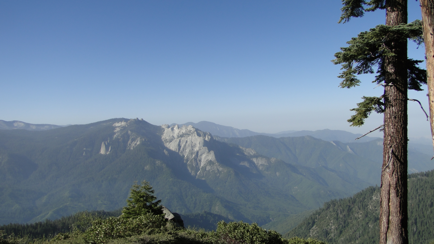
Mt. Silliman and Silliman Crest from the summit
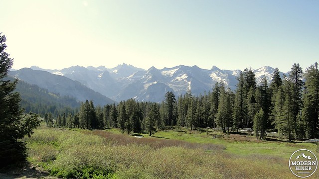
84% of Sequoia is designated wilderness and therefore not accessible to automobile. Although some of the 404,063 acres is contained within the chaparral/woodland environment of the foothills and within mixed-conifer forests on the western slopes, most of the park’s lands consist of epic high country terrain full of glacially carved peaks, valleys, and tarns, pristine lakes, and stunning views. Not only does Sequoia contain the world’s largest trees, it also contains the lower-48’s tallest mountain (Mt. Whitney), one of its deepest canyons, two major watersheds, and too many lakes to count.
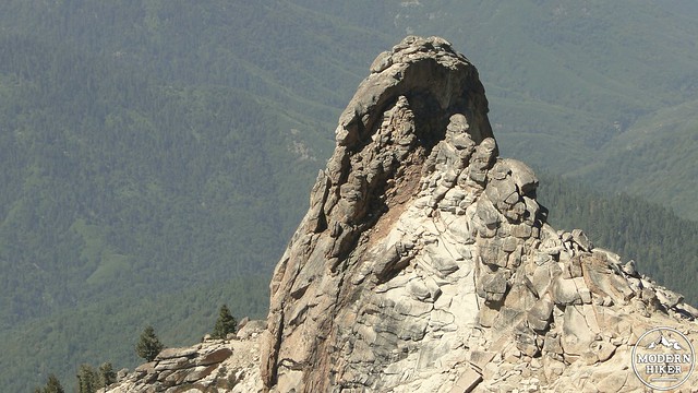
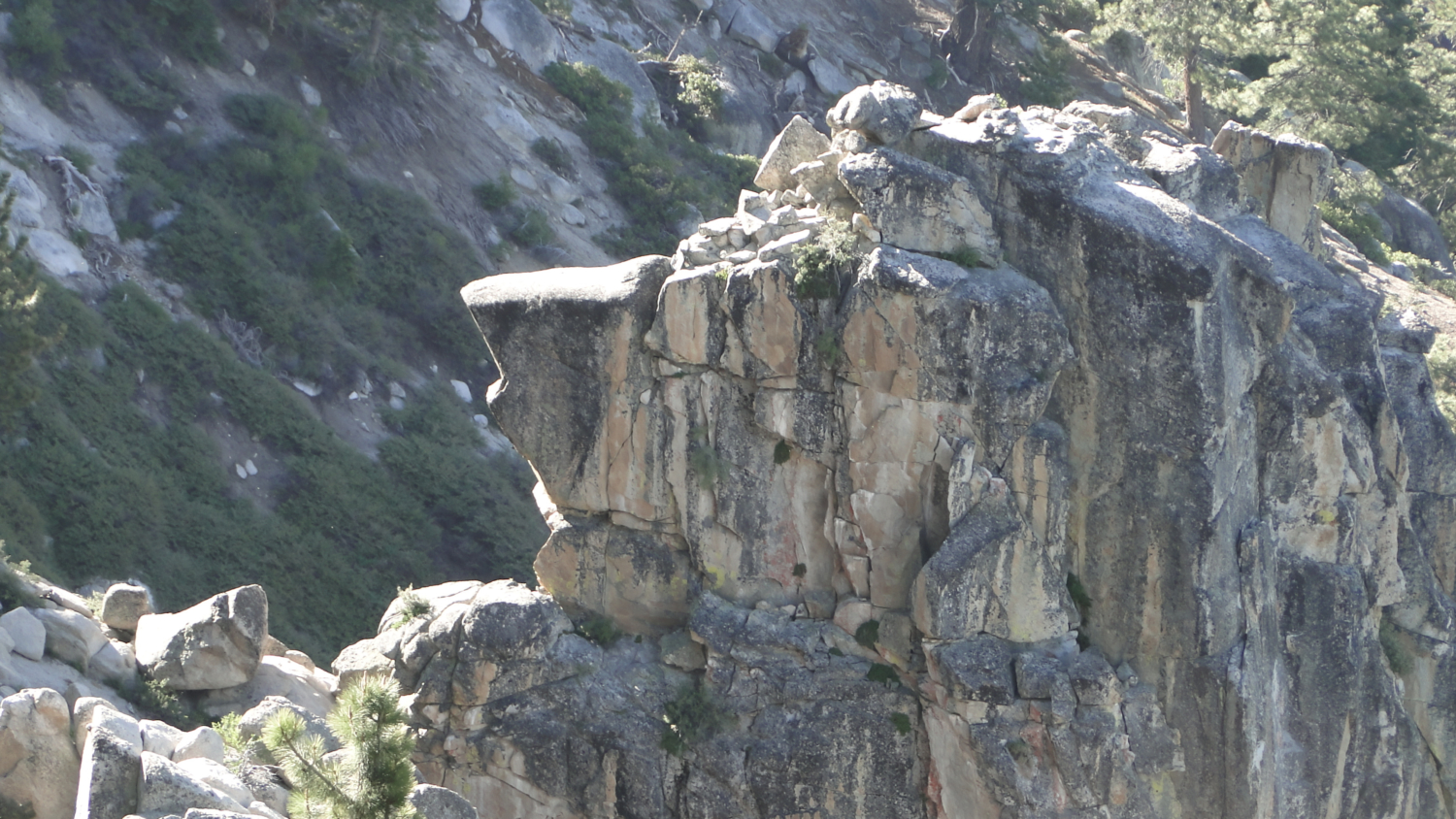
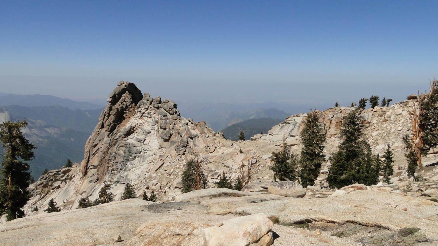
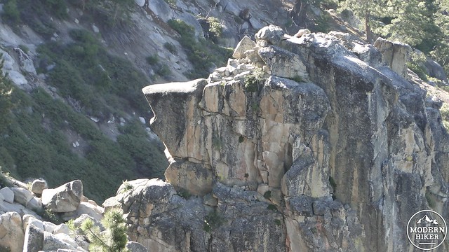
Tharps Rock
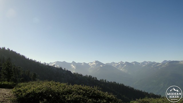
The tip (and a lot more) of this figurative high country iceberg can be observed from the summit of Alta Peak. Alta Peak, which gets its name from the Spanish word for “High,” stands at 11,200’. Alta is an apt name, even though nearby regional peaks tend to dwarf it. Comparisons aside, Alta Peak pokes its head over the treeline, reaching high enough to offer an expansive view of about half of the park. This long ridge of 12,000+ peaks divides the Kaweah watershed from the Kern watershed while also forming a spectacular backdrop of alpine wilderness.
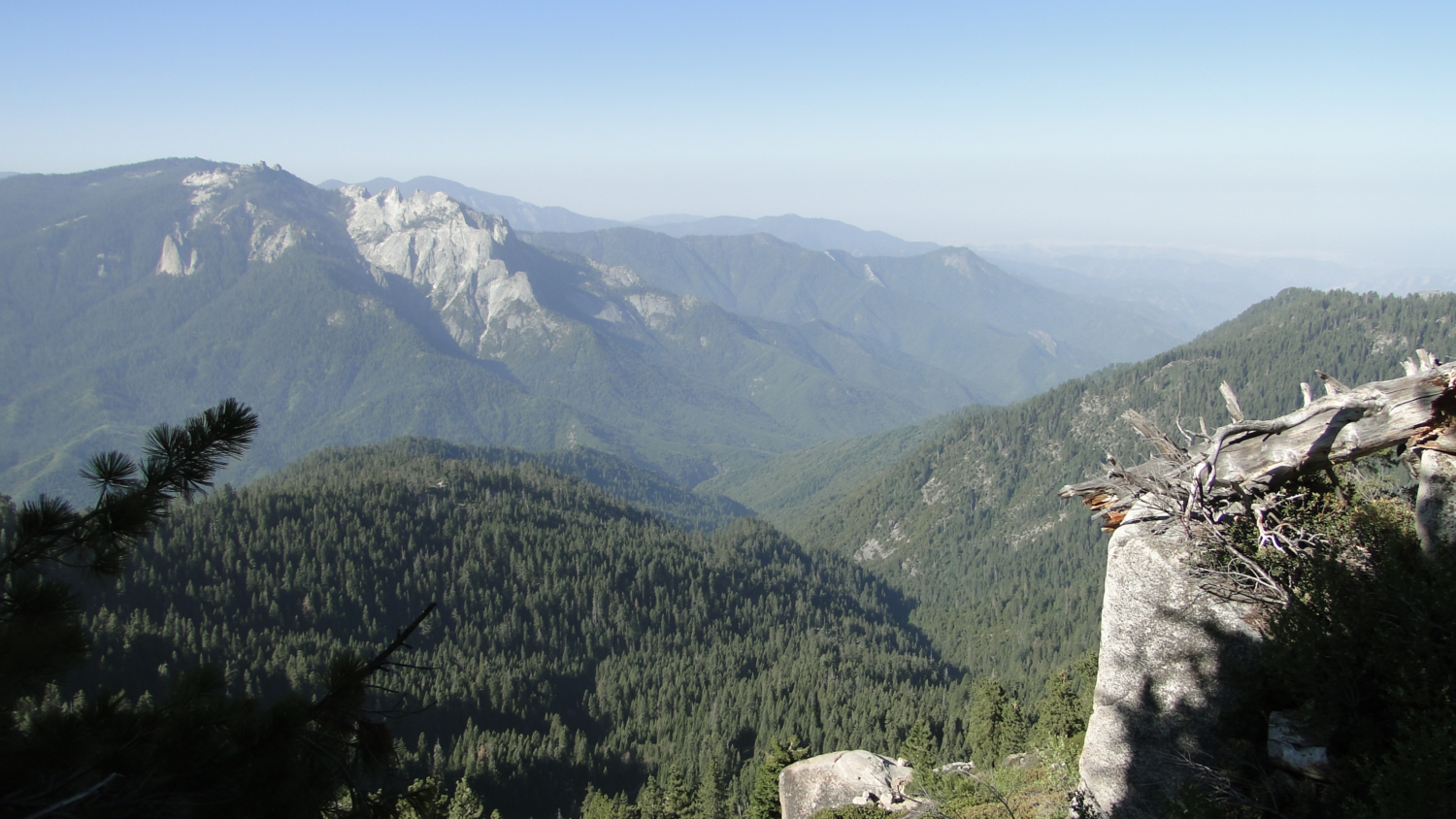
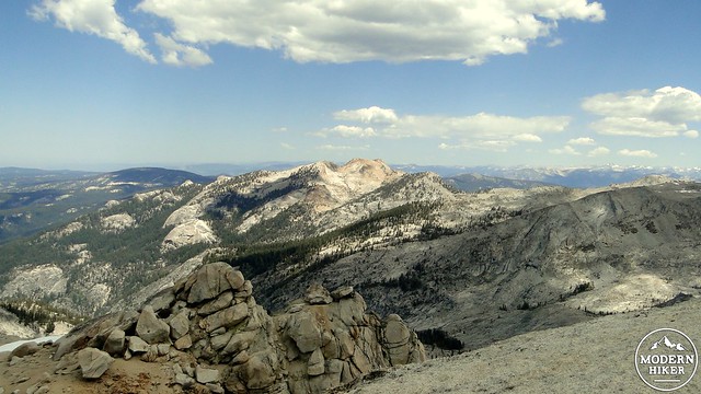
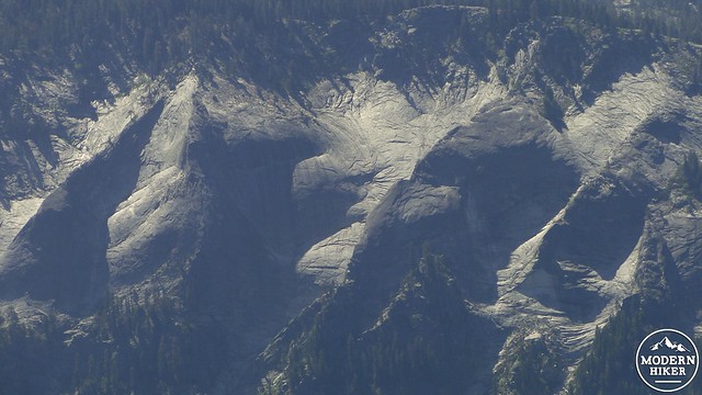
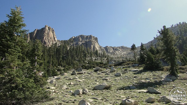
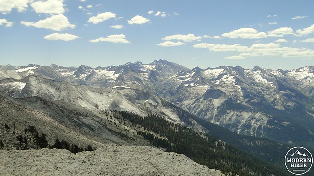
The Great Western Divide
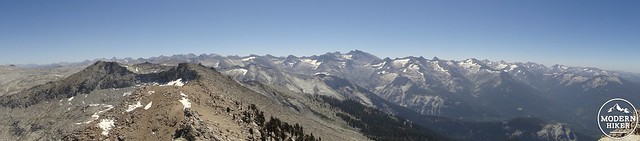
Alta Peak is one of only two spots above 11,000’ accessible from roads in the Giant Forest area. The rest of Sequoia’s high country is only accessible via day hike from either the eastern side of the range at Whitney Portal or New Army Pass, or from the eastern portion of Mineral King Valley. Due to its geographic position, Alta Peak offers commanding views that encompass the entirety of the western side of the park, including most of Mineral King. To the east, the Great Western Divide stands like an army of rocky sentinels guarding the bulk of the Sierran high country. Just beyond a gap in the Divide, one can see the summit of Mt. Whitney, where it’s even possible to pick out the summit hut. To the north, much of Kings Canyon’s front country is visible. And immediately to the south lies the deep and gaping Kaweah Canyon dropping over 9,000 feet to its base at the park’s Ash Mountain headquarters.
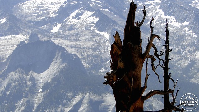
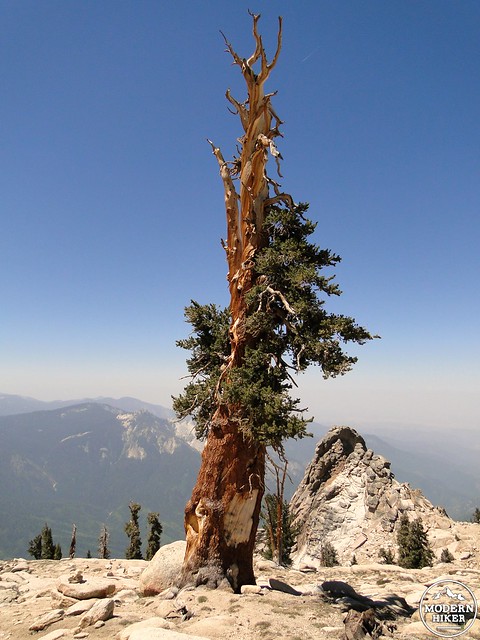
Pine snag set against the Divide
Foxtail pines before the summit approach
This is a long, demanding hike that many people take as an overnight backpacking trip. There are three options for backpacking, including Panther Gap, Mehrten Meadow, and Alta Meadow. Backcountry permits can be obtained in advance by faxing a request to Sequoia’s backcountry permit office and then picking up the reserved permit at either the Ash Mountain or Lodgepole backcountry offices. Sequoia-Kings Canyon National Parks have recently revamped their permit system. Instead of the old “spend the day waiting for your fax to go through” system, the new 3-step process requires you to fill out the application and then email it to the park. After that, you receive a confirmation email indicating that you have the reservation. After that, you go to a government pay site to pay for the permit. Remember that the permit reservation is insufficient as a permit. You will still need to pick up your permit from the Mineral King Ranger Station either on the day before your hike or the day of your hike. This handy webpage allows you to see what kind of availability remains at each of Sequoia-Kings Canyon’s trailheads.
Glaciated ridges along the Divide
Red fir forest
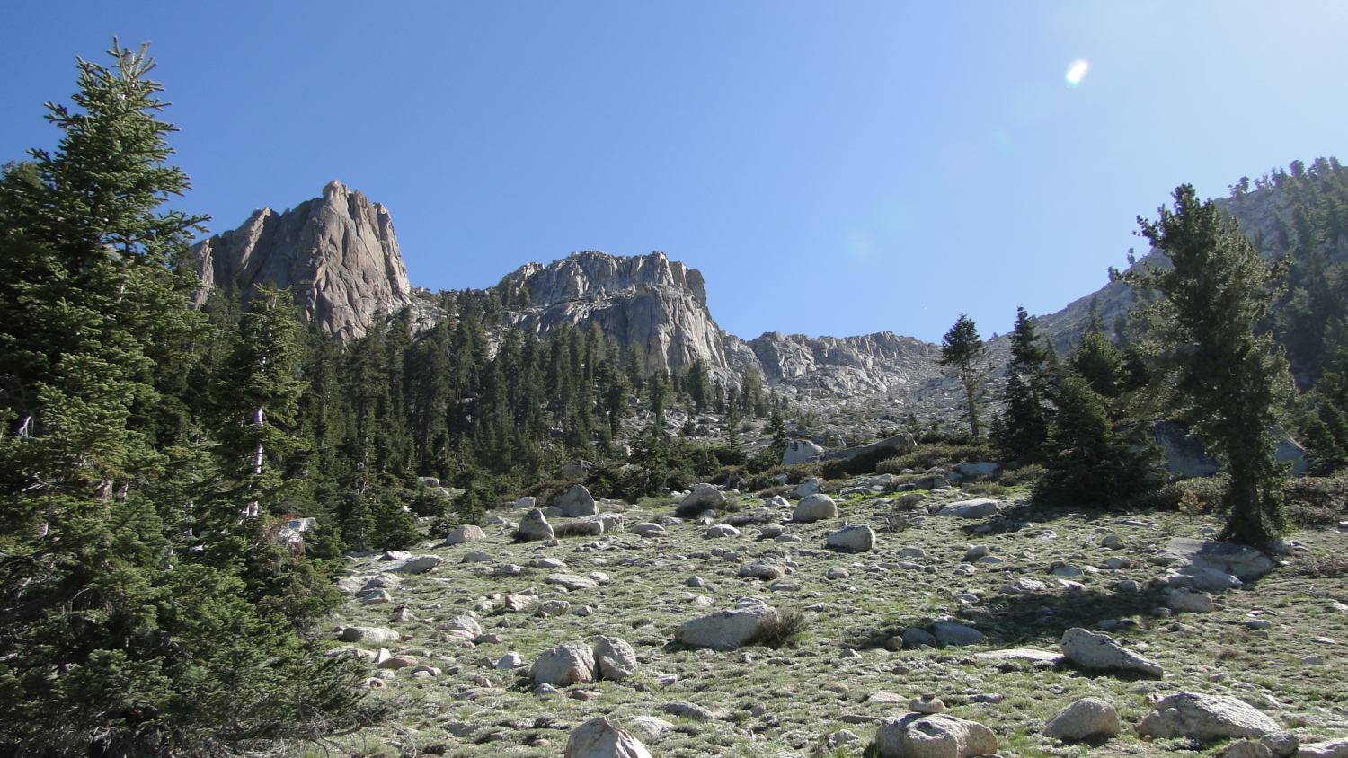
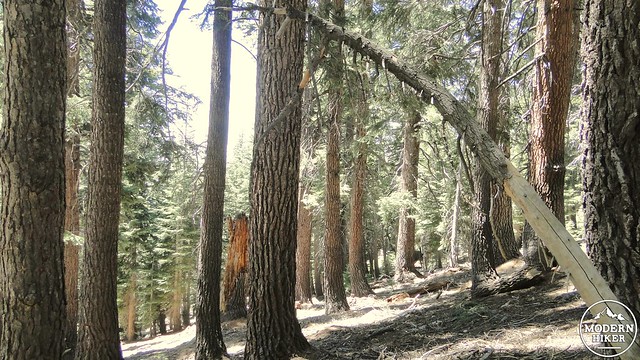
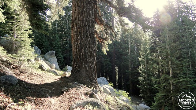
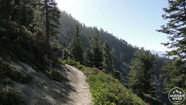
To access the trail, start from the Wolverton Parking lot at the combined trailhead for Alta Peak and the Lakes Trail. After climbing up a short connector trail, you will quickly junction with the trail leading back to Lodgepole to the left. Turn right, which will lead to a junction with the Lakes Trail. You’re now walking through a thick forest comprised mainly of red fir, with a few white firs, sugar pines, and jeffrey pines thrown in. Along the right hand side of the trail is a narrow ravine through which runs Wolverton Creek. At various points, the creek slows down and becomes a narrow meadow. Keep your eyes peeled here as this is the most likely place to spot bears and deer.
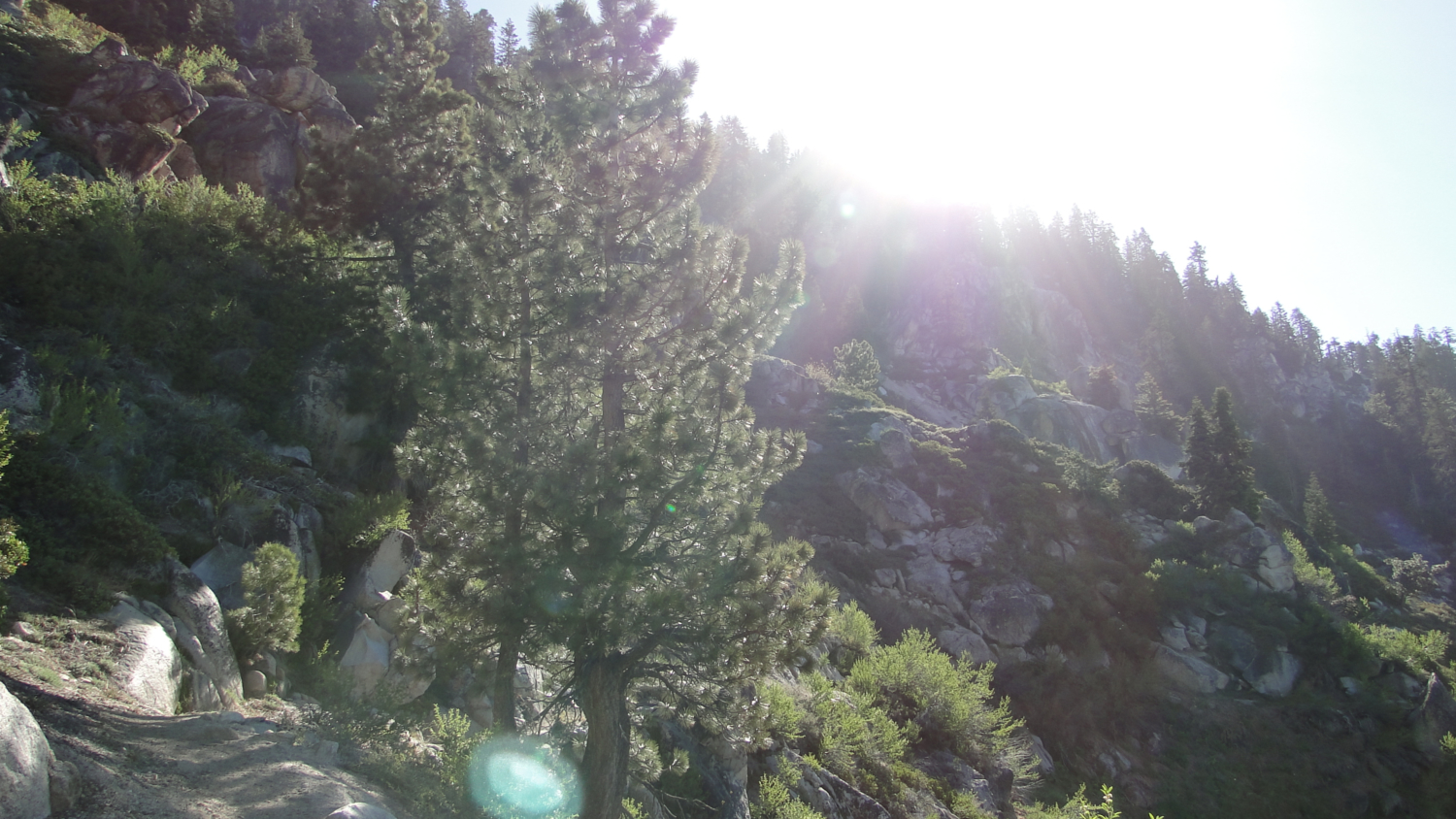
A sunny break in the forest
The trail will climb gently for a few miles before coming to a junction with the Lakes Trail veering off to the left. Stick to the right, which indicates Panther Gap and Alta Peak. As the trail continues to climb, lodgepole pines will replace the sugar and Jeffreys, but the red fir will become even more dominant and omnipresent. This tree, with its deeply-furrowed purple bark and bottle-brush needles becomes truly massive in the right conditions, and it is the one of the largest of all the true fir species.
View east from Panther Gap
Continuing on, you will see a number of open meadows created by spring-fed streams trickling down the slope on your left. Crossing these streams is an easy affair unless done in periods of peak run-off, in which case a few of them might present a challenge. Soon, the trail will come to a thinner and dryer portion of the forest. The trail will take a few steep switchbacks before you come huffing and puffing upon an open space revealing views south over Kaweah Canyon and the Castle Rocks formation. This is Panther Gap, where this trail junctions with the Alta Trail that runs between the Giant Forest Museum and the summit of Alta Peak. Panther Gap offers dry camping, including some stunning views. However, there are not a lot of spots and water access is better at Mehrten Meadow.
Sunnier south slope
Hook a left onto the Alta Trail and resume your climbing. You’ll get a welcome respite from the sometimes oppressively dense red fir forest as you walk along a south-facing slope covered mainly in chaparral and the occasional Jeffrey pine or white fir. You may notice a large outcropping that looks a lot like a grizzly bear’s head. Continuing on, the trail will wind around more dry slope before plunging back into the red fir forest and continuing on until coming to a small meadow with a few hospitable campsites on its north end. Mehrten Meadow is not the loveliest spot for backpacking, but it is the most convenient to the summit and is probably the most popular spot given its combined access to water and to the trailhead.
Grizzly bear or lion?
After passing Mehrten Meadow, there’s just a little bit more climbing left until getting to the junction between Alta Meadow and Alta Peak. While most day hikers will probably want to omit Alta Meadow, I’m including it here since it is a worthy destination in its own right as well as a very desirable place to set up camp. The trail over to Alta Meadow bears off on the right before immediately crossing a creek and then undulating gently toward the Meadow. This .9 mile stretch of trail gains and loses a little bit of elevation, but the work is a lot easier than what came before and what will follow if you make an attempt on the peak. After crossing a low rise just past another stream, a large, sloping meadow fringed by firs and pines emerges before you with the Great Western Divide looming behind it. This is an inspired spot, and it’s a great place to stop and break before turning back to tackle the peak. From here, return back to the junction and prepare to get your butt kicked.
Alta Meadow
The summit climb to Alta Peak is a beast. If you look at the elevation profile, you’ll see that the uphill grade increases dramatically. Furthermore, the next 2,000 feet of the climb will take place above 9,300’, which is where a lot of people really start feeling the altitude. To reiterate, this section of the hike is really hard, and if you’ve had enough, you may wish to stick with the meadow. However, if you are in the mood for some punishment, you may begin following the trail. This trail will eventually cross the same creek you crossed to get to Alta Meadow before plunging back into the red fir forest.
Junction for the peak and meadow trails. The hard part is yet to come
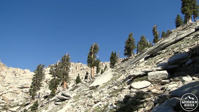
Your reward for this relentlessly steep grade is that the vegetation finally makes the transition into the alpine scenes so common on the east side of the range. Western white pines emerge and co-mingle with the rapidly diminishing red firs, and after a switchback turning left around one of these massive Western white pines and past a bend to the right, you will see the first of the foxtail pines. The foxtail pine is a relic species that is closely related to the ancient bristlecone pine but had diverged following the uplift of the Sierra Nevada range and the creation of the Owens Valley. Bristlecones grow east of Owens Valley in the White Mountains, where they attain ages as old as 5,000 years and grow more slowly due to less precipitation. The foxtail is generally younger, but larger, and it is an exceptionally attractive, albeit gnarled and twisted tree.
A particularly flamboyant foxtail pine
Soon, the foxtails will peter out altogether, and there’s little more than a few hardy ground plants and a whole lot of granite. As you make your slow and deliberate way, you will eventually come to eye level and surpass a large rock formation known as Tharps Rock, which was named after the first European to take up residence in Giant Forest. Tharps Rock is way up there, but it’s not as way up as the peak, which is now visible from your vantage. This large rock pile looks pretty close, but you still have several hundred feet of slow, laborious, short-winded, dead-legged climbing before you can sit on it. Isn’t hiking the best?
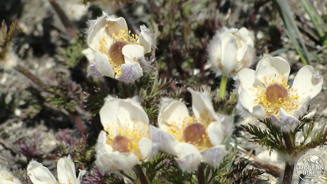
Alpine flowers
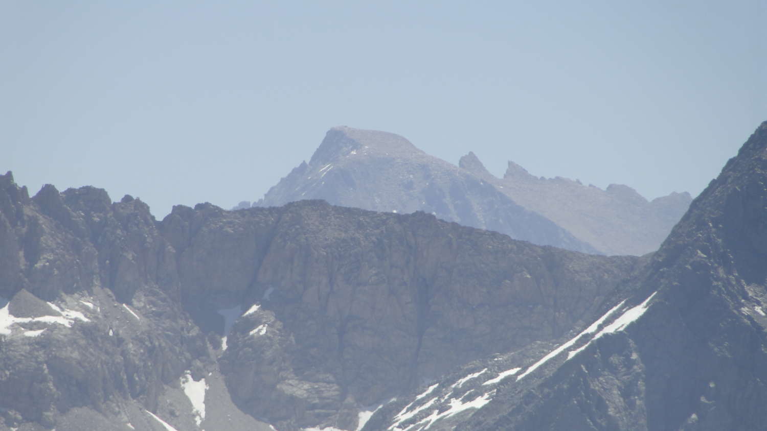
After you’ve made it to the base of the rock pile, make the cautious scramble to the top and prepare to be stunned by the commanding and spectacular view now before you. The Great Western Divide seen from this close is less an imposing ridge of peaks and more of an intricately carved masterpiece of geology, fluted with glacial canyons and fins with razor sharp summits gracing the highest points. Below to the south are Alta Meadow and Kaweah Canyon with the peaks of Mineral King just beyond Timber Gap on the other side of the canyon. Mt. Whitney is visible just past the Great Western Divide. The jagged wilderness of the Kings County High Country lay to the north, while the smoggy San Joaquin Valley lays still and silent off in the distance. From here, tiny Moro Rock juts out from the Giant Forest plateau looking insignificant from 5,000 feet up. I know I’ve only seen a minute sliver of the wonders of California, but the view from Alta Peak is as good as any view I’ve ever seen here, excepting Mt. Whitney.
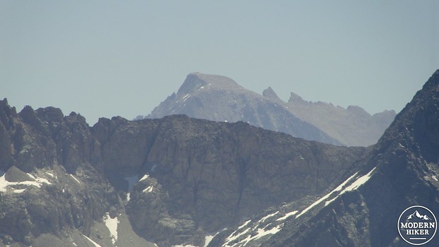
Mt. Whitney peaking over the Divide
However, there’s still a bit more. After coming down from the peak, I recommend climbing up (very carefully) onto one of the rock piles marking the mountain’s northern escarpment. From here, you can pear down into the Lakes basin and into upper Tokopah Valley. Four lakes sparkle below you, while a huge glacially-carved granite wilderness stretches out for many miles. Should you be tempted to see these lakes up close, you may enjoy the Lakes Trail, which Modern Hiker hopes to cover at its earliest convenience. The Lakes Trail also offers great backpacking options, and many people include Alta Peak and the Lakes Trail into a two-night trip encompassing both destinations.
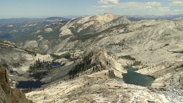
From left to right, Emerald, Aster, and Pear Lakes. Heather Lake is obscurred by a ridge
From the peak, it’s a simple but exhausting matter of retracing your steps pass the Alta Meadow Junction, past Mehrten Meadow, past the Grizzly Bear rock, and then to Panther Gap. Hook a right on the trail to Wolverton and hoof it back down to the parking lot. This is long, wearying hiking, especially after exerting so much energy on the summit push, but it is mostly shaded and still pleasant enough. Still, I won’t deny that it’s a great relief to emerge from the forest with your car in sight, where you can kick off your shoes and head back to Lodgepole for a well-earned raid on the ice cream section inside the general store.
Great Western Divide from the summit
Tags: Alta Meadow, Alta Peak, Alta Trail, Great Western Divide, Mehrten Meadow, Panther Gap, Sequoia National Park, Wolverton