A beautiful, isolated, and rugged river canyon in the Los Padres National Forest. Lots of river crossings, swimming holes, fascinating geology, and opportunities for off-trail adventuring.
WARNING: This area is involved in a lengthy and particularly nasty land battle with a private owner. From mid 2010 onward, hikers have been harassed by the landowner near the trailhead, and it appears hikers’ vehicles are being broken into with increasing frequency – which may or may not be related to the land ownership issue. Hikers and backpackers are encouraged to exercise caution, avoid leaving valuables in their cars, and keep up on their insurance payments until the situation can be resolved.
Things could have gone bad on this trip. Really bad.
There are a set of unofficial ‘rules’ for hiking – essential equipment, planning, backups, etc. This is what happens when you ignore all of them.
My friend Will and I spent a tidy sum of cash on backpacking equipment for our last wilderness adventure in the San Bernardinos. That particular trail had a sizable elevation gain, and did a number on our regular hiking speed and the achiness of our legs. So when Will proposed the relatively flat trail into Matilija Creek as a second trip, I was all for it.
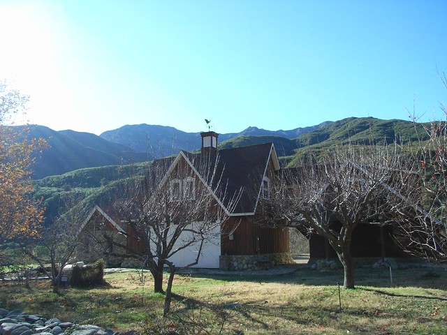
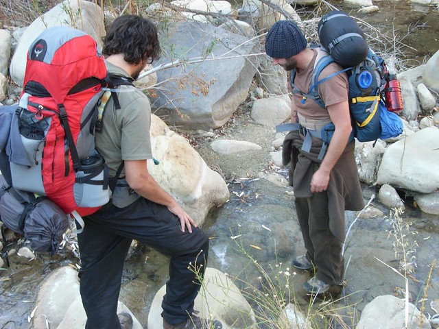
Early Sunday morning, Will, Nick and I took a long drive up the 101 to Ojai, stopping to pick up some last minute food supplies before venturing into the Los Padres National Forest. Winding our way down Matilija Road, we passed several isolated cabins and an inviting-looking dam-built lake before parking at the trailhead and waiting for our fellow backpackers – Glen and Liz – to arrive.

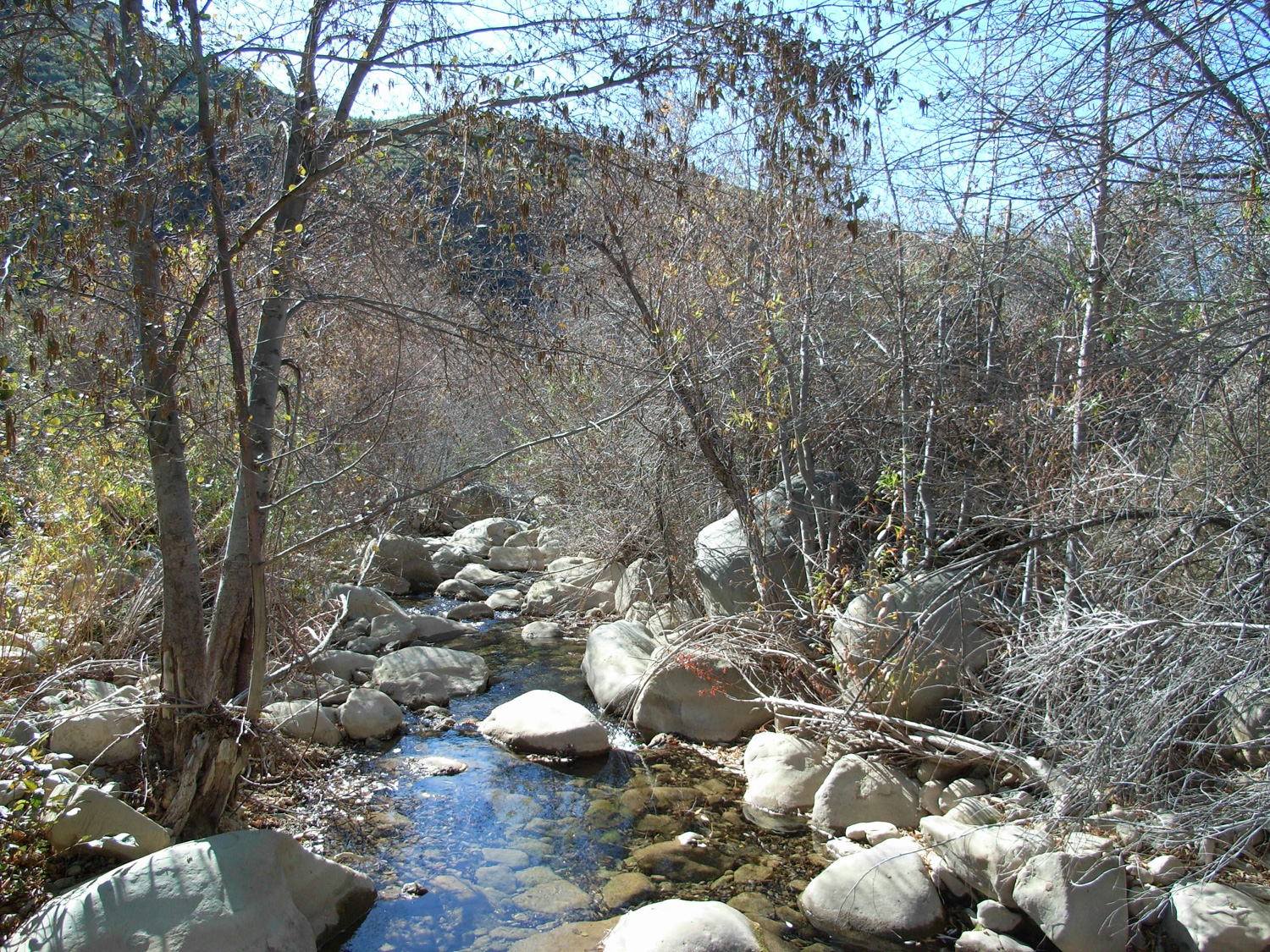
The trail was in great condition, and despite a few cans near the beginning of the trail, was surprisingly trash free. Many of the trails in the Angeles National Forest with quick and easy access – like Switzer Falls or the beginning parts of Icehouse Canyon – are littered with trash, empty water bottles, and needless graffiti. I’m guessing the fact that you have to hike in for a good mile and a half before you get to anything vandalizable has something to do with this area’s pristine nature. Good thing those damn kids are so lazy, what with their XBoxes and YouTubes and all. The hike in was fantastic. Even though there are multiple river crossings, none of them were especially difficult. And we were doing them with heavy, bulky packs on. If you were just checking out the area for a day-hike, you’d have no problem at all. And if you happened to be on the hike during the summer, when, say, there wasn’t any ice around, you might be tempted to voluntarily lose your footing and take a plunge in one of the dozens of deep swimming holes that lined the creek.
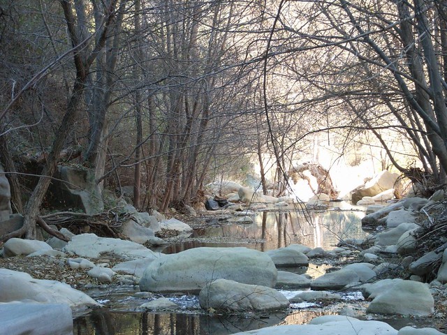
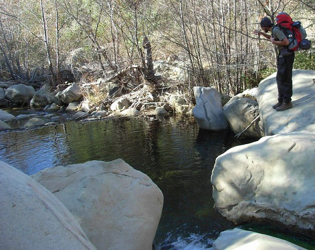
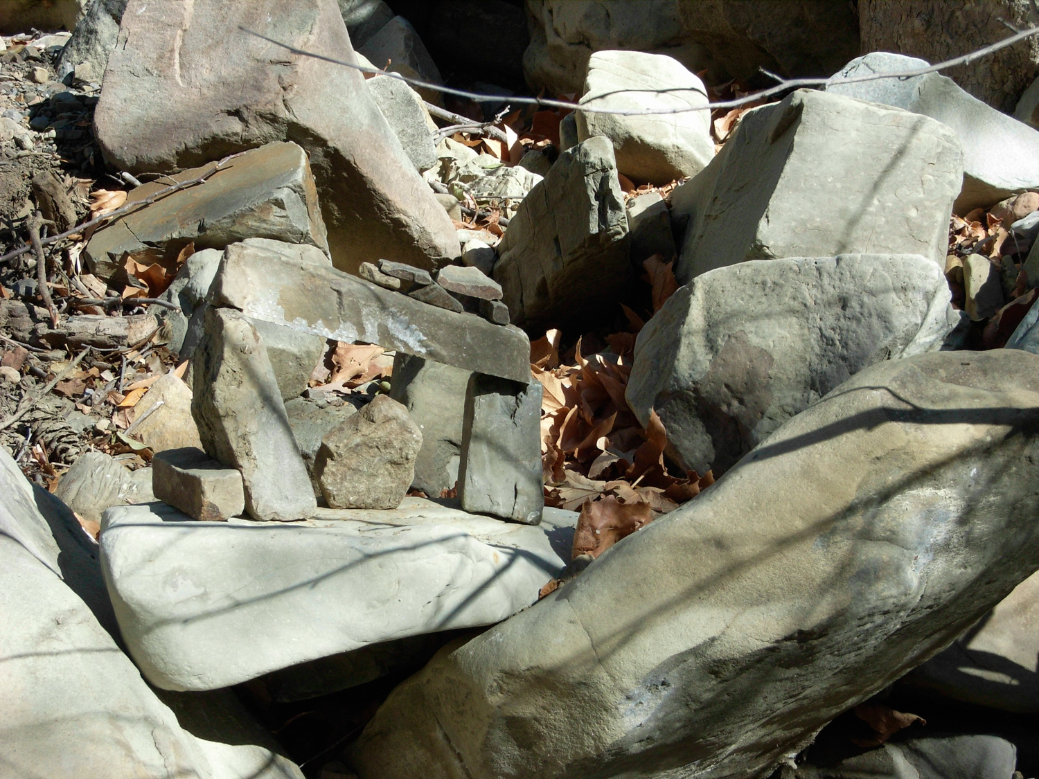
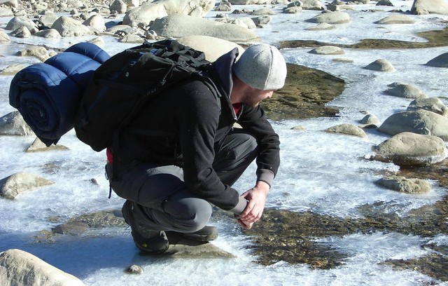
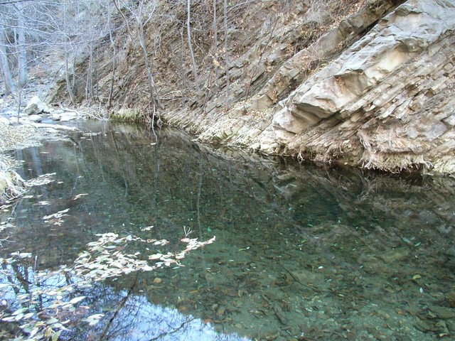
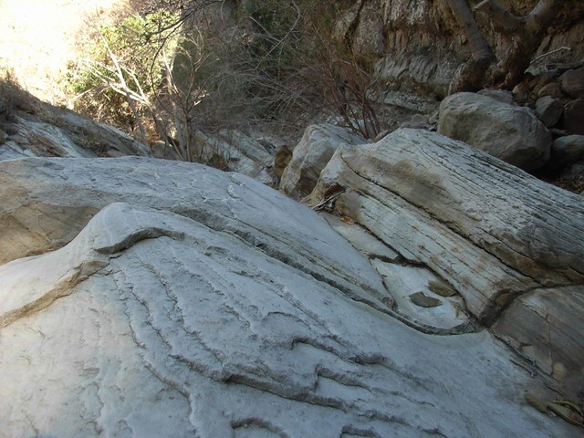
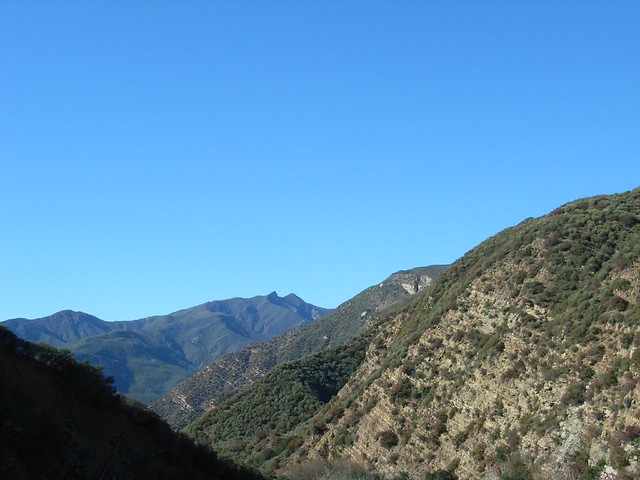
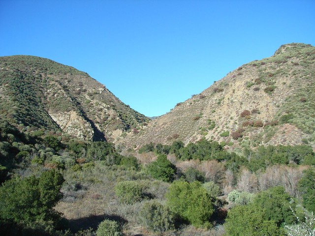
As the canyon walls closed in tighter around us, the trail brought us closer to exposed sides of the mountains.When I go on hikes, I’m always interested in checking out the geology and geography of the area. What had to happen to make this canyon look the way it does? How long did it take? What kinds of unimaginable forces were at work?Matilija Creek has a great mix of tectonic action and erosion. On exposed walls, you can very clearly see the sedimentary layers bent and twisted into impossible angles, while along the creek you can see the power of rushing water smoothing and polishing rocks into stone waves.
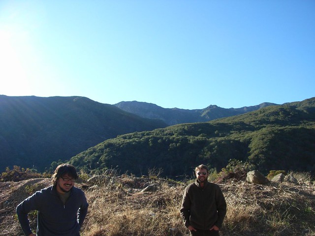
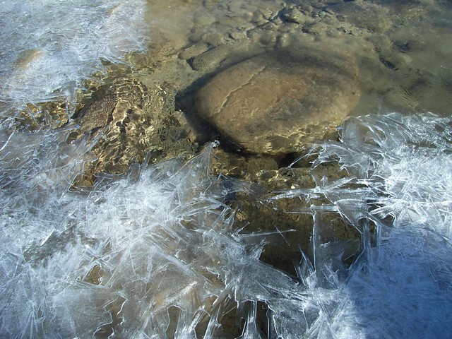
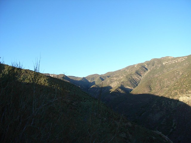
Past the first trail campsite, we found a shaded area of the creek that had frozen completely solid. And of course, we couldn’t resist the chance to walk on it. ‘Cause come on – when you live in Los Angeles County, you have to seize that opportunity when it presents itself.Further on, the trail left the creek bank and slowly ascended along one of the canyon walls. As we got higher up, the great expanse of the canyon to the south unfolded before us, with a great backdrop of Los Padres peaks.
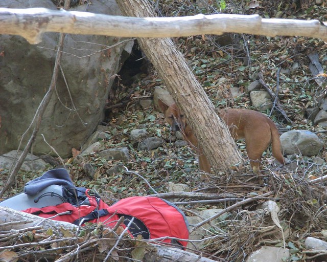
It was around this time, while walking through a nondescript area of sycamore trees, when we heard a rustling noise in the leaves ahead of us. Dingo sprung into action and leapt forward at the noise, and the next thing I remember is someone yelling “skunk!” Dingo, never having encountered a skunk before, ignored the protests of her hiking companions and attacked, managing to pick it up and shake it around for a second. The skunk settled back down on the ground and turned its business end toward Dingo, and as she went in for a second strike, she got the business.And she got it good.
Nick ran in and pulled Dingo away before either animal could retaliate. The skunk ran back off to the woods, and Dingo sneezed and threw up as we made a beeline for the creek.
Most of my experiences with skunks have been very, very passive. I’d smell one as roadkill, off in the distant woods or farms near my house, or on my dog after he’d gotten too curious in our backyard. “That’s not too bad,” I’d say to myself. “I don’t see what the big deal is.”
Let me tell you, an up-and-close skunk spray is one of the foulest smells you will ever experience. It is thick and pungent, and you can taste it if you try to breathe through your mouth.
Gross.
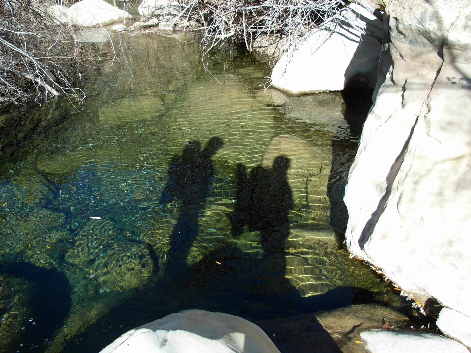
Lucky for us, after Will washed Dingo in the spring and Nick found some sage to rub into her fur, she didn’t smell that bad. The pack she wore, though, still had the lingering odor for the rest of the trip. On her part, I think Dingo was a bit confused as to what happened to her, and why everyone was so reluctant to be near her for a while.
As we all figured we’d just do a little bit of boulder hopping and slight off-trail wilderness peeping, none of us took the things you’re supposed to take with you when you’re hiking. No water. No gloves. No food. No maps. No flashlights.
Bad, bad idea.
But for now, it was two in the afternoon, and we weren’t going to be out long. I grabbed my camera and GPS for posterity, and we hopped along the river for a while. Eventually, we came to a field with a large, jagged slab of sedimentary rock sticking out along a ridge. We all sat on the edge and surveyed the sylvan scene before us.
Liz and I were bringing up the rear, and I’ll admit I seriously considered turning around more than a handful of times.
I don’t mind bushwhacking, and off-trail exploring can be a hell of a lot of fun … if you have a general idea of the area you’re in. I was the only one who had a map, and the one I had only barely showed the Matilija Creek area on its edge. So we had no idea where we were going, and I had no reference memory or visual landmarks to fall back on.
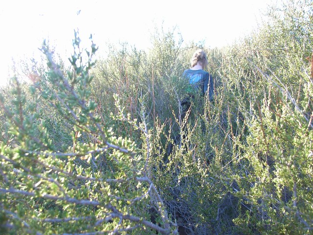
Also – when we could stand up and walk – the brush was unbelievably thick. We’re talking literal walls of green, and the paths we took were often made by closing our eyes, putting our hands in front of our faces, and just pushing through the brush. Here, Liz demonstrates:
Eventually we reached a long, clear slope of loose rock and ‘dirt-skiied’ our way down. This, I’ll admit, was actually really fun. We stood up on two legs and basically just pushed down on the dirt. Down we went – smoothly and with lots of control. I called it “Skiing I Can Do.”
“But despite these speedy descending aids, it was still dusk before we got to the small canyon. As the sun sank completely out of sight, we were left in the dark, maneuvering through unexplored territory. Feet slipped on ice. Hands grasped at broken branches for support, sending their owners’ tumbling to the floor. Misstepped legs were soaked in icy creek water. Thorns were everywhere. And Dingo was still missing.
We eventually made it back to the main creek, but were still plagued with the same problems. The stars blanketed the night sky above us, but the thick tree canopy kept all helpful light irritatingly out of reach. We fell into the creek, slipped on rocks, broke branches and crashed into brush. Eventually, we got so desperate that Liz offered her scarf up as a torch so we could at least have a little bit of light. It helped for a while, but soon even that was gone.
Dingo did find her way back to us, though. Smart, smart dog.
Surprisingly we all remained calm, although later on in the night we all admitted to various degrees of internal panic. We weren’t sure if we would even see the camp from the creek, but my GPS still had enough juice to tell us we were getting close. And after what seemed like forever, we saw a pair of flashlight beams coming from downstream.
A couple had arrived at our camp after we left and set up their tent. They were going to go to sleep, but were worried when night fell and we hadn’t come back. They apparently heard us stomping through the wilderness and turned their lights toward us when we got within full earshot.
It was like a lighthouse in the middle of the forest – an unbelievably welcome sight for our quintet of weary travelers.
I can’t imagine what we must have looked like to that couple, emerging from the wilderness bruised, beaten, scratched, and wet. They must have thought we were idiots.
At that point, I honestly wouldn’t argue.
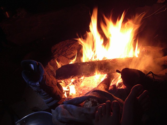
We all stuffed ourselves and went to bed. I’d bought myself a new silk sleeping bag liner on sale before I left, so getting to bed was nice and easy this time. No cold, no shivering, and with the bonus of getting to pretend I was sleeping in luxurious silk sheets. Plus, I had my tent window toward the sparkling canopy of wilderness stars, and our tents were right next to mother nature’s greatest sleeping aid – the babbling brook.
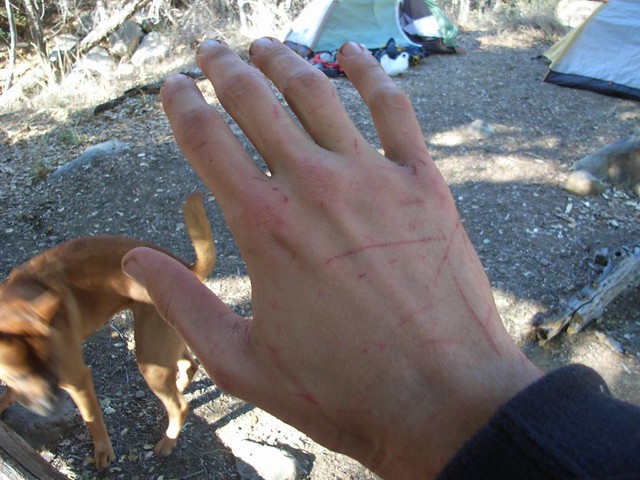
The next morning, I got the first look at my hands, which didn’t hurt too bad, but got pretty unpleasant whenever I had to put pressure on them. In the morning sun, I could see why:
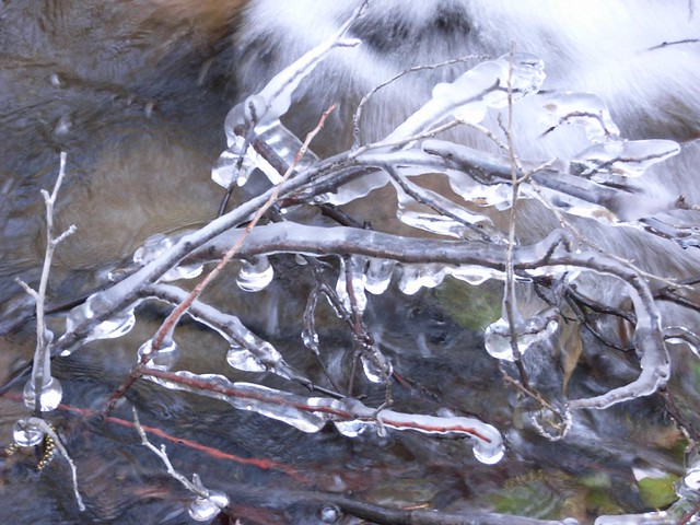
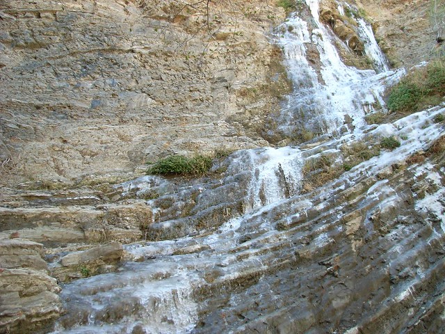
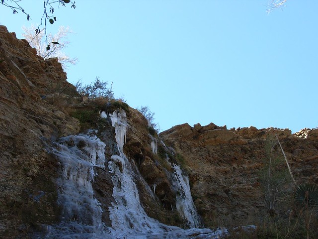
It was a pleasantly uneventful hike up to the next campsite. The trail got pretty narrow and hugged the edges of sharp drop-offs. I don’t know how well we would have fared had we decided to camp up there. But we did pass by an amazing frozen waterfall – the water still running beneath a thick coat of ice. It was one of the more surreal things I’d seen on the trail, and definitely one of the most entrancing.
After a quick pack-up and hike-out, we emerged intact. Bruised, beaten, slightly bloody, but wiser and confident in our abilities to get out of getting lost. And I, personally confident that I want to stay exclusively on-trail for a little while.
Tags: Backpacking, hikes, Hiking, Los Padres National Forest, Matilija Creek, Trail Write-Ups